Block
From the record
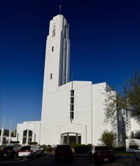
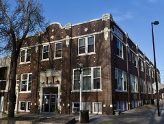
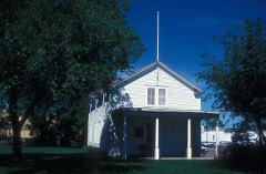
29 National Register listings published here.
Sources: the National Register database, National Park Service
47 topographic sheets cover 28 settlements here, and 29 properties are on the National Register of Historic Places.
29 National Register listings published here.
Sources: the National Register database, National Park Service
Every property in this county listed on the National Register of Historic Places, with the year it was listed and the federal nomination document.
Every wildfire the federal occurrence database records inside this county: 143 of them, burning about 16,770 acres. 7 started naturally and 4 were recorded as arson. Each settlement page carries the fires within five miles of it.
| Reported cause | Fires |
|---|---|
| Missing data/not specified/undetermined | 49 |
| Debris and open burning | 30 |
| Equipment and vehicle use | 21 |
| Recreation and ceremony | 11 |
| Natural | 7 |
| Power generation/transmission/distribution | 6 |
| Fireworks | 6 |
| Smoking | 5 |
| Arson/incendiarism | 4 |
| Railroad operations and maintenance | 3 |
| Misuse of fire by a minor | 1 |
The five largest, by the area the report gives. One of them was set deliberately.
| Date | Cause | Size | Reported by | Name on the report |
|---|---|---|---|---|
| 9 April 2003 | Recreation and ceremony | 6,000 acres | Long Lake National Wildlife Refuge | MCCLEAN BOTTOMS |
| 17 March 2012 | Recreation and ceremony | 4,045 acres | North Dakota State Forest Service | 93RD ST NE |
| 1 May 2005 | Arson/incendiarism | 1,280 acres | Long Lake National Wildlife Refuge | KIMBALL BOTTOMS FIRE |
| 12 March 2012 | Missing data/not specified/undetermined | 1,000 acres | North Dakota State Forest Service | RIFLE RANGE |
| 16 March 2008 | Missing data/not specified/undetermined | 700 acres | North Dakota State Forest Service | KIDDER COUNTY LINE |
| 14 May 2008 | Debris and open burning | 657 acres | Long Lake National Wildlife Refuge | LONG LAKE 1 |
| 24 August 2004 | Natural | 450 acres | North Dakota State Forest Service | DESERT |
| 6 June 2002 | Recreation and ceremony | 384 acres | Long Lake National Wildlife Refuge | BISRURAL 1 |
Every settlement page carries the fires within five miles of it - see the settlement index below.
The NOAA Storm Events Database holds 681 reports for this county, causing 3 deaths, 46 injuries and about $321,157,730 in recorded property damage. Each settlement page carries the reports that name it.
| Kind of event | Reports |
|---|---|
| Hail | 324 |
| Thunderstorm Wind | 232 |
| Tornado | 57 |
| Flash Flood | 22 |
| Funnel Cloud | 15 |
| Heavy Rain | 12 |
| Flood | 10 |
| Lightning | 6 |
| Wildfire | 2 |
| Winter Weather | 1 |
The most serious of them, by death, then injury, then recorded damage. The accounts are quoted exactly as the forecast office filed them.
| When | Event | Place named | Harm | What the report says |
|---|---|---|---|---|
| July 1952 | Tornado (F4) | not stated | 1 killed, 25 hurt, $250,000 | no account filed |
| November 1997 | Winter Weather | Mc Kenzie | 1 killed, 12 hurt, $20,000 | Freezing drizzle fell across parts of South Central North Dakota most of the afternoon. The deceased was driving a pickup eastbound on I-94 when he lost control of the vehicle and crossed them median hitting a suburban head on. All 8 people in the suburban suffered minor injuries. The deceased's wife was also injured. Within a 6 mile stretch of I-94 that included this accident, there were 2 other accidents all within 10 minutes of each other resulting in 3 minor injuries. Traffic speeds were reported to be around 20 mph during the time of the accidents. |
| July 1996 | Heavy Rain | Bismarck | 1 killed | no account filed |
| August 2024 | Lightning | Sterling | 3 hurt, $1,000 | A NWS meteorologist interviewed one of the victims. Three teenage males were goose hunting when thunderstorms approached their area. They packed up their equipment and were walking to their pickup truck close by when all three were struck by lighting. The victims were knocked down, and when they were able to get up they continued their return to the pickup truck and drove to a hospital emergency room in Bismarck. One victim suffered a small brain bleed and reduced hearing. The second victim suffered a large cut in his hand along with a flash burn to his eyes. The third victim suffered tingling sensations in his right foot along with a headache. All the victims recovered from their injuries. The goose blinds they were carrying were severely damaged in the incident. |
| November 2000 | Tornado (F1) | Bismarck | 2 hurt | Tornado touched down near highway 83 in north Bismarck and traveled in a west..northwest direction. Forty two homes sustained minor to moderate damage and injuring two people. |
| June 2025 | Thunderstorm Wind | (Bis)Bismarck Muni A | 1 hurt, $5,000,000 | Straight line winds pushed through the Copper Ridge subdivision south of Lincoln, and caused extensive damage. Several home were severely damaged, with large sections of shingles blown off roofs, some roof sheathing blown off, blown in garage doors, extensive siding damage, and removed decking. Several detached garage and smaller shop buildings experienced similar damage, with one experiencing its side wall being blown out. A large shop building was completely destroyed with the damage blowing across the road into the neighbors property. One injury occurred when a male was outdoors chasing his sunglasses that were blown away in the wind when an airborne rafter struck him in the shin causing a severe leg injury. Winds from this event were estimated at 110 mph. |
| July 1952 | Tornado (F4) | not stated | 1 hurt, $250,000 | no account filed |
| April 2003 | Wildfire | Bismarck | 1 hurt | no account filed |
| September 1986 | Thunderstorm Wind | not stated | 1 hurt | no account filed |
| June 2001 | Hail | (Bis)Bismarck Muni A | $113,000,000 | no account filed |
| July 2005 | Hail | Bismarck | $93,000,000 | Nickel size to tennis ball size hail combined with 70 mph winds caused extensive and widespread damage in Bismarck. The larger hail fell on the north side of the city where most of the damage occurred. Numerous homes and vehicles damaged. There was damage to siding and roofs, and windows were broken. Property damage estimates were provided by the North Dakota Insurance Commissioner. |
| June 2016 | Hail | Bismarck | $50,000,000 | A severe thunderstorm struck northern portions of the city of Bismarck around 4:30 AM CDT. Large hail combined with strong wind gusts to cause substantial damage. The largest hail with a diameter of 3.25 inches fell near Legacy High School. Winds of 75 mph combined with large hail to cause a swath of substantial damage from along Divide Avenue in north Bismarck to approximately five miles north of the city of Bismarck. Siding, roofs, and windows were damaged on homes. Multiple car dealerships sustained hail damage, which included the largest dealership in the city. |
| June 2011 | Flood | Wilton | $20,000,000 | See the event episode narrative for details. |
| July 2024 | Hail | Bismarck | $10,000,000 | A slow moving thunderstorm developed to the south of Mandan and rapidly strengthened as it moved into Burleigh County. The storm then gradually moved to the east-southeast passing over Lincoln. This storm caused extensive damage to developments to the south of Bismarck and throughout the Lincoln area. Most locations initially experienced hail ranging from one to two inches in diameter, but as the storm approached Lincoln hail increased to baseball size. In addition, one mile to the south of Lincoln a hailstone was measured at 4.5 inches in diameter. |
| August 2024 | Flash Flood | Bismarck | $8,000,000 | Torrential downpours with between two and five inches of rain moved through the Bismarck area as a very slow moving thunderstorm passed over. Storm sewer and drainage systems in the city were overwhelmed by the intense rain rates. Many downtown businesses took on water, resulting in damaged inventory along with business losses due to inaccessibility and time taken to recover. One of the primary medical centers in the downtown area had water pouring in from two side streets that damaged an MRI machine. The city of Bismarck government services also suffered significant damage. Many homes and apartment complexes sustained water damage, particularly in basements. |
| May 1996 | Thunderstorm Wind | Bismarck | $3,200,000 | no account filed |
| July 2024 | Hail | Baldwin | $2,000,000 | The severe thunderstorm that passed over the Harmon Lake area in Morton County moved into Burleigh County, and produced a swath of ping pong ball to tennis ball size hail as it passed to the north of the city of Bismarck. This storm caused extensive damage to roofs and vehicles. |
| June 1999 | Thunderstorm Wind | Bismarck | $2,000,000 | Widespread damage to buildings, downed power lines, uprooted trees, street flooding and water damage to homes. |
| July 2022 | Hail | Bismarck | $1,200,000 | This was the first of two storms that produced severe hail over the Bismarck and Lincoln areas of Burleigh County. Initially, quarter to ping pong ball size hail fell just to the northwest of Bismarck, but hail size increased as the storm moved through the city. Many roofs and vehicles were damaged, along with recreational vehicles at dealerships. |
| June 2015 | Thunderstorm Wind | (Bis)Bismarck Muni A | $1,000,000 | Trees and power poles were extensively damaged, especially just east and north of the downtown area. Power outages lasted three days in some areas. A roof was torn off a building along Broadway Avenue. A small plane flipped over on the north side of the Bismarck Municipal Airport. |
| June 2009 | Flash Flood | Wilton | $1,000,000 | Thunderstorms with heavy rainfall continuously redeveloped in eastern Morton County and trained through Burleigh County for several hours during the evening of the 15th. Rainfall reports ranged from three to six inches in Bismarck, to 10.2 inches seven miles east of Bismarck. Flash flooding resulted from the heavy rainfall in Bismarck and points east, including water one to two feet deep flowing over Interstate 94 near Sterling at the peak of the event. Many homes had water in their basements. City streets in Bismarck were flooded and vehicles had water damage.||The heavy rainfall also resulted in a flood warning for Apple Creek, which quickly rose to major flood stage by the morning of the 16th. |
| July 2008 | Hail | (Bis)Bismarck Muni A | $800,000 | A severe thunderstorm brought a large swath of very large hail through the north side of Bismarck early Saturday evening. Hail reports ranged from golf ball size to baseball size, along with multiple reports of hail damage to vehicles and homes. The hail swath width is estimated to have ranged from two to four miles, with the largest hail reports contained within a quarter of a mile swath width. |
| April 2009 | Flood | Wilton | $558,000 | Heavy overland flooding and flooding along Apple Creek resulted in damage to 19 homes and numerous state, county, and local roads. |
| March 2009 | Flood | Wilton | $530,000 | Ice jams on the Missouri River caused river water to flood parts of south Bismarck and southeast Burleigh County, around Fox Island, including about 15 homes. Apple Creek also flooded. Overland flooding damaged county and township roads. Flooding continued into April. |
| June 2025 | Hail | Baldwin | $500,000 | Multiple homes had roofing damage at The Ranch subdivision north of Bismarck. |
| June 2025 | Hail | Baldwin | $500,000 | Multiple homes suffered roof and siding damage in the Heritage Reserve subdivision north of Bismarck. |
| September 2025 | Flash Flood | (Bis)Bismarck Muni A | $500,000 | Approximately two to three inches of rain fell in a short period of time, leading to flash flooding. The most notable flash flooding occurred in the Bismarck area. Many vehicles were stalled due to floodwaters along State Street south of the North Dakota State Capitol Building, and along Bismarck Expressway. Both the 7th and 9th Street underpasses were flooded. Drainages over various parts of the city were flowing at or above capacity. |
| May 2023 | Hail | Bismarck | $500,000 | A supercell thunderstorm over Mandan, Morton County, moved into Bismarck, Burleigh County. Initially, the storm continued to produce golf ball size hail near Bismarck State College, but hail size decreased to around one-inch in diameter as it moved through the city. Vehicles and homes were damaged, mainly on the western side of Bismarck. |
| June 1994 | Thunderstorm Wind | Wilton and Baldwin ar | $500,000 | Nine 80 foot power line towers were blown over from Wilton and southeast of Wilton. Trees were uprooted and buildings destroyed at a farm near Baldwin. |
| July 2022 | Hail | Bismarck | $400,000 | This is the second of two storms that moved through the Bismarck and Lincoln areas. Additional damage to roofs and vehicles occurred with this storm. |
| August 2019 | Hail | Bismarck | $400,000 | A thunderstorm moved through Bismarck producing hail up to two inches in diameter, damaging many roofs and gutters. |
| May 2010 | Thunderstorm Wind | Arena | $400,000 | A farmstead two miles east of Arena sustained heavy damage from severe thunderstorm straight line winds. One outbuilding was destroyed, a television antenna was blown down, roof damage was sustained to the home and another outbuilding, and several trees had damage. The severity of the damage was indicative of winds up to 90 miles per hour. |
| June 2015 | Thunderstorm Wind | (Bis)Bismarck Muni A | $350,000 | Very strong thunderstorm winds were reported near the city of Lincoln. A camper rolled out of a yard. A stack of large hay bales collapsed. Garage doors buckled. Trees were uprooted and others snapped and there was a lot of damage to outside lawn furniture and children's play sets. Power lines were downed. |
| August 2024 | Thunderstorm Wind | Sterling | $300,000 | Straight line winds caused significant damage in and to the south of Sterling. On the south side of Sterling, a large grain bin in an elevator complex was dislodged and blew to the east-southeast. South of this location, a large sunflower field was significantly damaged with many parts of the field flattened. Along Highway 83, fifteen power poles were broken or significantly damaged on both sides of the highway. |
| August 2022 | Flash Flood | Bismarck | $250,000 | Flash flooding occurred primarily in and around the city of Bismarck. Vehicles were stranded in flood waters to the south of the North Dakota State Capitol Grounds, and in the 7th Street underpass. Storm sewers were overwhelmed, with manhole covers being pushed off and flood waters escaping. |
| July 2019 | Thunderstorm Wind | Regan | $250,000 | Straight line winds severely damaged five large steel grain bins at a farm site. A separate hopper-style bin was rolled into a field. In addition, half of the roof on a new pole barn shop was torn off with insulation blown out. Crops in the area were also severely damaged. |
| June 2016 | Thunderstorm Wind | Bismarck | $250,000 | Multiple trees were reported down in the Hoge Island area north of Bismarck with this storm. This caused substantial damage to many homes. Boat damage also occurred. |
| July 2011 | Thunderstorm Wind | Moffit | $250,000 | Double poled wood transmission lines were snapped in half. A heavy ranch sign with three foot long concrete anchors was ripped out of the ground. A camper was flipped off of the highway and tossed over a tree row 25 yards from the road. |
| June 2007 | Flash Flood | Driscoll | $250,000 | Very heavy rain of 2.50 inches fell in 30 minutes time 7 miles south of Driscoll. A total of 4.50 inches of rain was measured 2 miles northeast of Driscoll. Water was reportedly standing everywhere and water covered roads including in the city of Driscoll. Several roads were washed out. Water was up to 4 inches deep in some homes basements in Driscoll. |
| July 1981 | Tornado (F3) | not stated | $250,000 | no account filed |
| June 1956 | Tornado (F2) | not stated | $250,000 | no account filed |
| May 2010 | Thunderstorm Wind | Driscoll | $200,000 | A farmstead one mile west of Driscoll sustained damage to two outbuildings. Tree damage was evident from just north of Driscoll, northward to Arena. A farmstead five miles south of Arena had one outbuilding damaged. The damage was indicative of severe thunderstorm straight line winds up to 85 miles per hour. |
| July 2011 | Lightning | Bismarck | $190,000 | A lightning strike to a rural north Bismarck home caused a fire that destroyed the home several hours later. |
| July 2014 | Thunderstorm Wind | (Bis)Bismarck Muni A | $175,000 | Severe thunderstorm winds estimated at 75 miles per hour resulted in extensive damage across the Kimball Bottoms Recreation Area south of Bismarck. Several large cottonwood trees were snapped. Four vehicles where heavily damaged when the trees fell on them, and one camper trailer was crushed. No injuries occurred. |
| June 2020 | Thunderstorm Wind | Driscoll | $150,000 | Two barns along with a pole structure building were destroyed. |
| July 2018 | Thunderstorm Wind | Moffit | $150,000 | Many large trees were uprooted. Power lines were down, and multiple buildings were heavily damaged. |
| July 2011 | Hail | (Bis)Bismarck Muni A | $150,000 | About a dozen homes in Falconer Estates subdivision had roof and gutter damage from the large hail. |
| June 2025 | Thunderstorm Wind | Baldwin | $100,000 | A large pole barn was mostly destroyed with posts from the pole barn pulled out of the ground, but the equipment sustained minimal damage. |
| June 2021 | Flash Flood | Moffit | $100,000 | Over five inches of rain was estimated to have fallen over far southeast Burleigh County. This heavy rain damaged roads and culverts. |
| July 2021 | Thunderstorm Wind | Sterling | $100,000 | Several semi-trailers were turned over by thunderstorm wind gusts near Sterling. |
| September 2016 | Thunderstorm Wind | Wilton | $100,000 | Five power poles were broken near mile marker 5 on Highway 36 east of Wilton. A blade was also blown off a wind turbine in the area. Several large ponderosa pine trees were blown down at a church site near mile marker 6. |
| August 2011 | Flash Flood | Baldwin | $100,000 | Flooded roads were reported throughout Bismarck with water as much as two feet deep on streets. Water was running over curbs and through yards. Ditches in rural north Bismarck were full to overflowing and threatening homes. Two to three inches of rain fell on Bismarck. Rain at the airport measured 2.48 inches. |
| June 2013 | Flash Flood | Bismarck | $90,000 | Torrential rain, an inch in ten minutes reported from south Bismarck, fell across Bismarck late in the evening of June 22nd. Numerous reports of flash flooding were received from across the city, including the intersection of Washington and Divide, 26th and Rosser, and at points along Bismarck Expressway including at Washington. These intersections had the worst flooding with up to a foot of water flowing across the road, over the curb, and in some cases into homes and businesses. Underpasses were flooded with several feet of water, and one road was closed due to fast flowing deep water. Vehicles were stalled at various locations in the city. |
| June 2025 | Tornado (EF1) | Baldwin | $75,000 | This is the first of two tornadoes that occurred to the north of Bismarck. The tornado developed just north of a residence, and slowly moved to the south-southeast. As it moved through the residence lot, the tornado caused significant roof damage to an outbuilding and toppled a covered trailer. In addition, a few softwood and hardwood trees were snapped or uprooted. As the tornado moved south over 110th Avenue Northwest, it snapped several large branches off a large cottonwood tree in the south ditch. The tornado then continued to move south before dissipating. Based on the damage done this tornado was rated EF-1, and from that wind speeds were estimated to be around 95 mph. |
| September 2016 | Thunderstorm Wind | Wing | $75,000 | A barn was destroyed, and a roof was damaged on another building. |
| June 1999 | Tornado (F1) | Driscoll | $75,000 | no account filed |
| September 2023 | Thunderstorm Wind | Bismarck | $60,000 | Several tree branches, along with a few trees, were knocked down in and around the Bismarck area. Two vehicles were totaled as a tree fell on them at Skyway Park Village. |
| November 2000 | Tornado (F2) | Bismarck | $55,000 | Tornado touched down in a sparsely developed area in open country along highway 1804. The tornado skipped in a west..northwest direction. One home was heavily damaged. Several bales of hay were destroyed. The tornado crossed the Missouri River into Morton county. |
| July 2019 | Flash Flood | Bismarck | $50,000 | Heavy rain occurred in Bismarck, with up to two inches of rain falling in parts of the city in 30 minutes. Water was flowing over curbs in many locations, and in parts of south Bismarck buildings in lower lying areas took on water in their basements. Two feet of rushing water through some streets caused dangerous driving conditions. |
| July 2011 | Flash Flood | Bismarck | $50,000 | Multiple reports were received from across Bismarck of water up to 18 inches deep flowing over roads. Mainly the flash flooding was in low lying and poor drainage areas of the city. In some cases water washed up to the foundation of homes and into window wells. Rain amounts were around two inches. |
The Survey's mineral resources record lists 8 workings inside this county. 7 still produce and 1 is closed or unrecorded. Each settlement page carries the workings within five miles of it.
| Commodity | Workings |
|---|---|
| Sand and Gravel, Construction | 8 |
The least common of them first, because a county's hundredth gravel pit says nothing its first ten did not.
| Where | Site | Commodity | Status | Recorded |
|---|---|---|---|---|
| Adams East Pit | Sand and Gravel, Construction | Producer | ||
| Adams West Pit | Sand and Gravel, Construction | Producer | ||
| Airport Pit | Sand and Gravel, Construction | Producer | ||
| Bismarck State Pit | Sand and Gravel, Construction | Producer | ||
| Dakota Plant | Sand and Gravel, Construction | Producer | ||
| Getz Pit & Plant | Sand and Gravel, Construction | Producer | ||
| Hot Plant Site Falconer | Sand and Gravel, Construction | Producer | ||
| Macdonald S. Pit & Plant | Sand and Gravel, Construction | Past Producer |
Named settlements recorded in the Geographic Names Information System, each with the topographic sheets covering it. Villages, hamlets and abandoned places alike. Each is shown with the nearest named watercourse or landform and the survey quadrangle it falls on.
Burnt Creek-Riverview unorganized territory · 58503 · Burnt Butte quadrangle
9 sheets, 1907 to 1979
Burnt Creek-Riverview unorganized territory · 58503 · Harmon quadrangle
10 sheets, 1907 to 1979