 Block
Killdeer, North Dakota
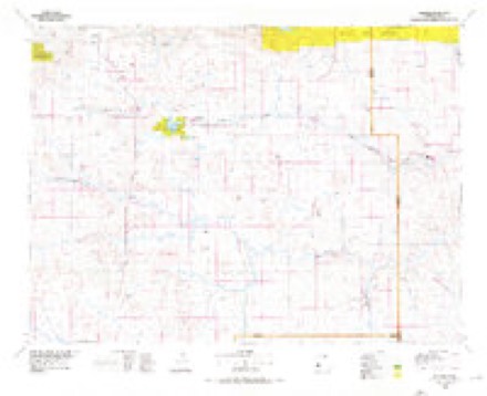
7 topographic sheets cover this place, the earliest surveyed in 1953 and the latest in 1974. It stands in Killdeer City. It lies in ZIP code area 58640. It stands on Gumbo Creek. The Survey maps it on the Killdeer quadrangle.
Topographic sheets covering this place
5 surveys from 7 printed sheetsMatched by testing this settlement's coordinate against the published boundary of every sheet in the United States Geological Survey's historical collection. Each opens the scanned sheet at the Survey.
- 1953 USGS Watford City quadrangle1:250000, 3 printings
- 1957 USGS Watford City quadrangle1:250000
- 1967 USGS Watford City quadrangle1:250000
- 1974 USGS Killdeer quadrangle1:24000
- 1974 USGS Killdeer quadrangle1:100000
Fires near this place
1 since 1993Regional context, not property-specific evidence. The federal wildfire occurrence database lists 1 fire within 5 miles of Killdeer in 1993, burning under an acre in total. None started naturally. None was recorded as arson. Distance is straight-line from the map coordinates, so a fire counted here may appear on a neighbouring settlement's page as well.
| Reported cause | Fires |
|---|---|
| Equipment and vehicle use | 1 |
The most recent of them, most recent first, with the day each was reported and the service that recorded it.
| Date | Cause | Size | Reported by | Name on the report |
|---|---|---|---|---|
| 25 August 1993 | Equipment and vehicle use | under an acre | Audubon National Wildlife Refuge | LAKE ILO |
Settlements close enough to share some of these fires:
Storms near this place
60 of 72 shownRegional context, not property-specific evidence. The National Weather Service names Killdeer in 72 storm reports between 1995 and 2024: 42 hail, 17 thunderstorm wind, 7 flood, 3 tornado. The reports record 2 injuries. Each account below is quoted exactly as the forecast office filed it, from the NOAA Storm Events Database, and each date opens the federal record of that event.
| When | Event | Place named | Harm | What the report says |
|---|---|---|---|---|
| July 2016 | Hail | Killdeer | 2 hurt, $20,000,000 | A slow moving supercell resulted in an extended period of very large hail and damaging wind gusts in and around the city of Killdeer. Hail up to 3.25 inches in diameter completely covered the ground in many locations. The hail combined with wind gusts of 75 mph to cause extreme damage to buildings, trees, and vehicles in the city. At the Killdeer nursing home windows were broken out and four rooms were damaged to the point where they were not habitable. Two residents sustained minor injuries. The first was injured (direct injury) when they were struck by broken flying glass. The other person was injured (direct injury) as they were evacuating their living area due to broken windows and fell on a wet floor as rain and hail were pouring in. Every field light at the new football stadium was destroyed, and every bus at the school was significantly damaged. Significant damage occurred to vehicles including those at a dealership. |
| August 2014 | Flood | Killdeer | $1,700,000 | Upwards of 10.50 inches of rain in parts of Dunn County led to very significant overland flooding. There was also flooding along the Knife River and its tributaries. There was significant damage to roads and crops. A county emergency declaration was issued. |
| April 2023 | Flood | Killdeer | $540,000 | Flooding from snow melt runoff caused significant damages to county infrastructure. |
| June 2018 | Tornado (EF2) | Killdeer | $175,000 | This was the second of two tornadoes in Dunn County this day. The earlier tornado hit nothing and so was rated EF0. This second tornado was rated EF2. It initially struck a mobile home shortly after it touched down, completely destroying the structure. Based on that damage the tornado at this location was EF2. From that EF2 rating the winds were estimated at 125 mph. No one was home at the time so there were no injuries or deaths at this location. The tornado then proceeded generally northward to a farmstead, where a stock trailer was flipped, a truck was pushed 200 yards through a fence, and an old out-building was completely destroyed. At the farm the damage corresponded to EF1. There were no injuries or deaths as all on the farm reached safety before the tornado struck. The tornado then continued to the north until it dissipated. The overall tornado rating is EF2. |
| July 2013 | Thunderstorm Wind | Killdeer | $175,000 | There were multiple reports of up to eight inch in diameter trees snapped around Killdeer. A hanger at the Killdeer airport was destroyed, with several planes damaged or destroyed. |
| June 2010 | Thunderstorm Wind | Killdeer | $70,000 | Trees and power lines were reported down from the intense thunderstorm winds. In addition, a roof was partially torn off of the Buckskin Bar and Grill and an exterior sign was blown off of another building in Killdeer. Damage was also sustained to other buildings, along with two lightning related fires. |
| March 2009 | Flood | Killdeer | $70,000 | Overland flooding damaged state, county and township roads. The Knife River was also in flood. No homes were flooded. |
| May 2011 | Flood | Killdeer | $50,000 | See the event episode narrative for details. |
| July 2016 | Hail | Killdeer | $30,000 | no account filed |
| July 2012 | Hail | Killdeer | $25,000 | The large hail dented cars and damaged shingles on a home. |
| June 2016 | Hail | Killdeer | $20,000 | no account filed |
| July 2012 | Hail | Killdeer | $15,000 | The very large hail damaged a patrol car. |
| June 2015 | Thunderstorm Wind | Killdeer | $10,000 | Several large trees were downed. |
| August 2023 | Thunderstorm Wind | Killdeer | - | Thunderstorm wind gusts were estimated by the public. |
| June 2018 | Tornado (EF0) | Killdeer | - | This was the first of two tornadoes in Dunn County this day. This tornado remained in an open field. No damage occurred and so it was rated EF0. A second tornado in Dunn County later this day was rated EF2. |
| June 2015 | Tornado (EF0) | Killdeer | - | This was a brief tornado in an open field. There was no damage and no structures were impacted, so the rating is EF0. |
| June 2015 | Thunderstorm Wind | Killdeer | - | A power outage was reported with the strong wind gusts. |
| March 2015 | Thunderstorm Wind | Killdeer | - | The National Weather Service received no reports of damage. |
| August 2013 | Thunderstorm Wind | Killdeer | - | Heavy rain accompanied the strong winds. |
| August 2013 | Thunderstorm Wind | Killdeer | - | Pea size hail and heavy rain accompanied the strong winds. |
| June 2011 | Flood | Killdeer | - | See the event episode narrative for details. |
| July 2011 | Flood | Killdeer | - | See the event episode narrative for details. |
| August 2011 | Flood | Killdeer | - | See the event episode narrative for details. |
| July 2009 | Thunderstorm Wind | Killdeer | - | A trained spotter reported an estimated severe thunderstorm wind gust of 60 mph. |
| August 2008 | Hail | Killdeer | - | No damage was reported with the large hail. |
| July 2005 | Hail | Killdeer | - | Reported by a NWS cooperative observer. |
| August 2002 | Flash Flood | Killdeer | - | Several county roads washed out. |
| July 2001 | Thunderstorm Wind | Killdeer | - | Reports of tree damage. |
| August 1995 | Thunderstorm Wind | Killdeer | - | Several trees blown over as well as a roof on an apartment building blown off. Numerous fences were blown down and several barn doors destroyed east of town. Reports of rainfall vary from 1.0 inch to 2.5 inches. |
| July 2024 | Funnel Cloud | Killdeer | - | no account filed |
| July 2024 | Hail | Killdeer | - | no account filed |
| July 2024 | Hail | Killdeer | - | no account filed |
| July 2024 | Hail | Killdeer | - | no account filed |
| July 2024 | Hail | Killdeer | - | no account filed |
| July 2023 | Hail | Killdeer | - | no account filed |
| August 2023 | Hail | Killdeer | - | no account filed |
| August 2023 | Hail | Killdeer | - | no account filed |
| June 2020 | Thunderstorm Wind | Killdeer | - | no account filed |
| June 2020 | Hail | Killdeer | - | no account filed |
| August 2019 | Hail | Killdeer | - | no account filed |
| August 2019 | Hail | Killdeer | - | no account filed |
| August 2019 | Hail | Killdeer | - | no account filed |
| June 2018 | Hail | Killdeer | - | no account filed |
| June 2017 | Hail | Killdeer | - | no account filed |
| August 2016 | Hail | Killdeer | - | no account filed |
| July 2016 | Hail | Killdeer | - | no account filed |
| June 2015 | Funnel Cloud | Killdeer | - | no account filed |
| July 2015 | Hail | Killdeer | - | no account filed |
| September 2014 | Hail | Killdeer | - | no account filed |
| May 2014 | Hail | Killdeer | - | no account filed |
| July 2013 | Hail | Killdeer | - | no account filed |
| July 2013 | Hail | Killdeer | - | no account filed |
| July 2011 | Thunderstorm Wind | Killdeer | - | no account filed |
| August 2010 | Hail | Killdeer | - | no account filed |
| June 2009 | Hail | Killdeer | - | no account filed |
| June 2009 | Hail | Killdeer | - | no account filed |
| May 2008 | Hail | Killdeer | - | no account filed |
| August 2007 | Hail | Killdeer | - | no account filed |
| June 2007 | Hail | Killdeer | - | no account filed |
| July 2005 | Hail | Killdeer | - | no account filed |
Nearest settlements
The eight closest, with where each one stands in the county. Distances are straight-line, computed from the Geographic Names Information System coordinates.
| Map | Place | Distance | Sheets |
|---|---|---|---|
| Dunn Center | 7.2 miles | 7 | |
| Medicine Hole | 8.8 miles | 7 | |
| Oakdale | 9.1 miles | 7 | |
| Manning | 9.8 miles | 7 | |
| Fayette | 12.6 miles | 7 | |
| Emerson | 14.4 miles | 7 | |
| Werner | 15.8 miles | 7 | |
| Halliday | 22.2 miles | 7 |
Provenance
This settlement is recorded in the Geographic Names Information System as feature 1029739. The sheet list is computed by point-in-boundary test against the United States Geological Survey's historical topographic inventory. Both are works of the United States government and carry no copyright under 17 U.S.C. 105.
Wildfire. Short, Karen C. 2022. Spatial wildfire occurrence data for the United States, 1992-2020 [FPA_FOD_20221014]. 6th Edition. Fort Collins, CO: Forest Service Research Data Archive. https://doi.org/10.2737/RDS-2013-0009.6 Collected with United States Government funding and usable without additional permissions or fees.
Storms. NOAA National Centers for Environmental Information, Storm Events Database https://www.ncei.noaa.gov/stormevents/ A work of the United States government, no copyright under 17 U.S.C. 105. Narratives are quoted verbatim from the National Weather Service report and are not edited or summarised.