 Block
Litchville, North Dakota
10 topographic sheets cover this place, the earliest surveyed in 1897 and the latest in 1986. It stands in Litchville City. It lies in ZIP code area 58461. The Survey maps it on the Litchville quadrangle. 169 people lived here at the 2020 count. It stands 1,470 feet above sea level.
Population over time
2 figuresLitchville fell from 172 to 169 between 2010 and 2020. These are the recorded population figures Wikidata holds for this place, reached through the Geographic Names Information System number this page is keyed on rather than by name, so they belong to this place and not to another of the same name. Most are census counts, but not all are: an early figure may be a founding or settlement estimate, and an estimate published within five years of a census is left out. The change column is computed, and is left blank where more than 20 years separate a figure from the one before it, because a gap that long is not a change between two counts.
| Year | People | Change |
|---|---|---|
| 2010 | 172 | |
| 2020 | 169 | -3 (-2%) |
Topographic sheets covering this place
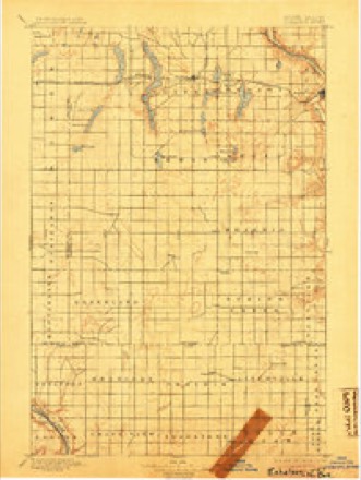
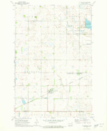
5 surveys from 10 printed sheetsMatched by testing this settlement's coordinate against the published boundary of every sheet in the United States Geological Survey's historical collection. Each opens the scanned sheet at the Survey.
- 1897 USGS Eckelson quadrangle1:125000, 3 printings
- 1953 USGS Jamestown quadrangle1:250000, 3 printings
- 1956 USGS Jamestown quadrangle1:250000
- 1970 USGS Litchville quadrangle1:24000
- 1986 USGS Jamestown quadrangle1:100000, 2 printings
Storms near this place
54 since 1995Regional context, not property-specific evidence. The National Weather Service names Litchville in 54 storm reports between 1995 and 2024: 40 hail, 6 tornado, 6 thunderstorm wind, 1 lightning. No death or injury is recorded in these reports. Each account below is quoted exactly as the forecast office filed it, from the NOAA Storm Events Database, and each date opens the federal record of that event.
| When | Event | Place named | Harm | What the report says |
|---|---|---|---|---|
| July 2004 | Tornado (F4) | Litchville | $1,700,000 | The tornado tracked south for about 4 miles along 97th avenue southeast, then turned to the southeast and tracked about 6 more miles before it crossed into LaMoure county about 2 miles north-northwest of Marion. One abandoned farmstead 10 miles west-northwest of Litchville was nearly swept clean of its buildings. Eight to nine buildings and 5 to 6 metal grain bins were swept away. At an occupied farmstead about 9 miles west of Litchville, the most damage was reported. The family was out baling hay at the time and were not hurt. The equipment they used to bale hay (three tractors and a baler) were the only things left unscathed by the tornado. Two houses, 5 outbuildings, a cattle barn, and miscellaneous farm equipment were all leveled. Machinery and debris were scattered across the yard and in the nearby pond and fields. A new pickup truck was demolished and sheet metal and metal support beams were wrapped around trees and vehicles. About 35 cows were killed, 20 grain bins were demolished, and a semi truck was overturned. The last F4 tornado in eastern North Dakota occurred on June 6, 1999, near Mountain, ND. |
| August 1997 | Lightning | Litchville | $60,000 | Lightning struck the roof of a house, quickly igniting the second story of the house. The upstairs level was destroyed, with the rest of the house sustaining smoke and water damage. |
| September 2017 | Tornado (EF1) | Litchville | $30,000 | The tornado peeled shingles and roofing off of homes at two farmsteads roughly a mile apart, and snapped or uprooted several box-elder and spruce trees at both farmsteads. Branch scatter through a shelterbelt located midway between the farms suggested a possible secondary vortex. Peak winds were estimated at 110 mph. |
| July 1999 | Tornado (F0) | Litchville | $10,000 | Two homes were damaged by a tornado northwest of Litchville. One home had quite a few shingles blown off. The second home had part of its roof torn off. Several rafters and a third of the shingles were blown off. Most of the insulation in the attic was sucked out. |
| August 1999 | Tornado (F1) | Litchville | $5,000 | The tornado began south and west of Litchville, travelling mostly through open country before it crossed briefly into Lamoure county. It then crossed into Ransom county, where it dissipated north of Lisbon. |
| September 2002 | Thunderstorm Wind | Litchville | $500 | Tree branches were snapped off in the wind. |
| June 2024 | Hail | Litchville | - | Broadcast Media relays report of quarter sized hail in Litchville, ND. |
| July 2022 | Hail | Litchville | - | A swath of large hail swept across the southwestern portions Greenland Township, extending from southeastern Stutsman County into northcentral Dickey County. Reports state that hail ranged from dime to nearly golf ball size and did produce some vegetation damage. |
| June 2021 | Hail | Litchville | - | Large hail up to the size of baseballs was reported by a former coop observer near Litchville. |
| June 2021 | Hail | Litchville | - | Hail fell for about 5 minutes. |
| June 2019 | Hail | Litchville | - | Dime to nickel sized hail fell with torrential rain. |
| June 2018 | Hail | Litchville | - | Quarter sized hail covered the ground and caused crop damage. |
| September 2017 | Hail | Litchville | - | Quarter sized hail fell along with 50 to 60 mph winds. |
| September 2017 | Thunderstorm Wind | Litchville | - | A barn had damage to its roof from impacted tree limbs. A house also had shingles removed. |
| June 2015 | Hail | Litchville | - | The cooperative observer reported hail with very little rainfall. |
| August 2014 | Funnel Cloud | Litchville | - | A funnel briefly came down from the base of the clouds. Rain and thunder also approached from the north. |
| August 2013 | Hail | Litchville | - | Quarter to half dollar sized hail fell near Litchville. |
| July 2011 | Hail | Litchville | - | Wind speeds were estimated at 40 to 50 mph with torrential rain. |
| June 2007 | Thunderstorm Wind | Litchville | - | A large steel storage bin was tipped over and large trees were blown down. |
| June 2005 | Thunderstorm Wind | Litchville | - | Trees were uprooted southwest of Litchville. |
| July 2004 | Thunderstorm Wind | Litchville | - | Several power poles were snapped off at ground level. |
| August 1999 | Tornado (F0) | Litchville | - | The tornado briefly touched down in a field. |
| June 2021 | Hail | Litchville | - | no account filed |
| June 2021 | Hail | Litchville | - | no account filed |
| June 2021 | Hail | Litchville | - | no account filed |
| July 2020 | Hail | Litchville | - | no account filed |
| August 2018 | Hail | Litchville | - | no account filed |
| July 2016 | Hail | Litchville | - | no account filed |
| May 2012 | Hail | Litchville | - | no account filed |
| July 2010 | Hail | Litchville | - | no account filed |
| July 2008 | Hail | Litchville | - | no account filed |
| May 2007 | Hail | Litchville | - | no account filed |
| April 2006 | Hail | Litchville | - | no account filed |
| July 2006 | Hail | Litchville | - | no account filed |
| July 2005 | Hail | Litchville | - | no account filed |
| September 2005 | Hail | Litchville | - | no account filed |
| July 2004 | Hail | Litchville | - | no account filed |
| June 2003 | Hail | Litchville | - | no account filed |
| June 2003 | Thunderstorm Wind | Litchville | - | no account filed |
| September 2002 | Hail | Litchville | - | no account filed |
| June 2001 | Hail | Litchville | - | no account filed |
| June 2001 | Hail | Litchville | - | no account filed |
| June 2001 | Hail | Litchville | - | no account filed |
| May 2001 | Hail | Litchville | - | no account filed |
| August 1999 | Hail | Litchville | - | no account filed |
| August 1999 | Hail | Litchville | - | no account filed |
| July 1999 | Hail | Litchville | - | no account filed |
| August 1997 | Hail | Litchville | - | no account filed |
| August 1997 | Hail | Litchville | - | no account filed |
| August 1997 | Tornado (F0) | Litchville | - | no account filed |
| August 1997 | Hail | Litchville | - | no account filed |
| June 1997 | Hail | Litchville | - | no account filed |
| June 1997 | Hail | Litchville | - | no account filed |
| July 1995 | Hail | Litchville | - | no account filed |
Nearest settlements
The eight closest, with where each one stands in the county. Distances are straight-line, computed from the Geographic Names Information System coordinates.
Elsewhere
Matched on this settlement's Geographic Names Information System number rather than its name, so it cannot be a different place of the same name in another state.
| Wikipedia article on Litchville | An encyclopaedic summary. Its text is share-alike, so it is linked here rather than copied. |
| Wikidata item Q28475 | The structured record the population and elevation above come from. Public domain (CC0). |
Provenance
This settlement is recorded in the Geographic Names Information System as feature 1029921. The sheet list is computed by point-in-boundary test against the United States Geological Survey's historical topographic inventory. Both are works of the United States government and carry no copyright under 17 U.S.C. 105.
Storms. NOAA National Centers for Environmental Information, Storm Events Database https://www.ncei.noaa.gov/stormevents/ A work of the United States government, no copyright under 17 U.S.C. 105. Narratives are quoted verbatim from the National Weather Service report and are not edited or summarised.