 Block
Mandan, North Dakota
10 topographic sheets cover this place, the earliest surveyed in 1907 and the latest in 1979. It stands in Mandan City. It lies in ZIP code area 58554. The Survey maps it on the Mandan quadrangle. 24,206 people lived here at the 2020 count. It stands 1,647 feet above sea level.
Research this city
On record in Mandan
Buildings and businesses the archive holds for this place. Each opens its own page, with the source record it came from.
On the National Register 7 records
 Lewis and Clark Hotellisted 1983
 Mandan Commercial Historic Districtlisted 1985
- Stuart Dunlap Houselisted 1992
- Mandan High Schoollisted 2017
- State Training School Historic Districtlisted 1996
- Sunnyside Farm Barnlisted 1996
- Welsh Houselisted 1980
Population over time
2 figuresMandan grew from 18,331 to 24,206 between 2010 and 2020. These are the recorded population figures Wikidata holds for this place, reached through the Geographic Names Information System number this page is keyed on rather than by name, so they belong to this place and not to another of the same name. Most are census counts, but not all are: an early figure may be a founding or settlement estimate, and an estimate published within five years of a census is left out. The change column is computed, and is left blank where more than 20 years separate a figure from the one before it, because a gap that long is not a change between two counts.
| Year | People | Change |
|---|---|---|
| 2010 | 18,331 | |
| 2020 | 24,206 | +5,875 (+32%) |
Topographic sheets covering this place
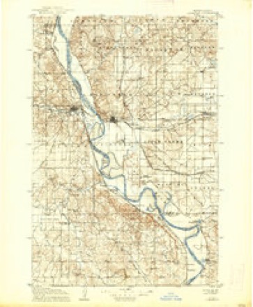
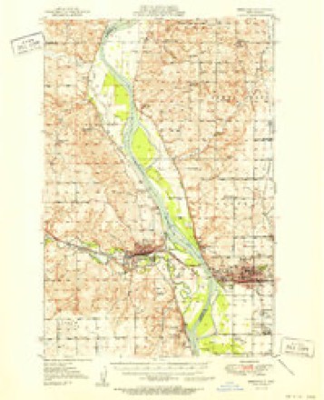
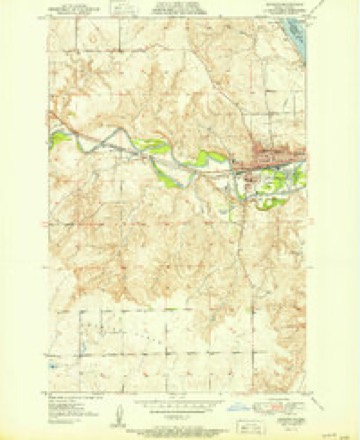
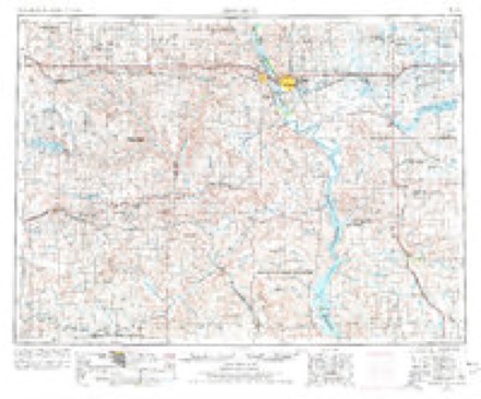
7 surveys from 10 printed sheetsMatched by testing this settlement's coordinate against the published boundary of every sheet in the United States Geological Survey's historical collection. Each opens the scanned sheet at the Survey.
- 1907 USGS Bismarck quadrangle1:125000, 2 printings
- 1951 USGS Bismarck quadrangle1:62500
- 1951 USGS Mandan quadrangle1:24000
- 1954 USGS Bismarck quadrangle1:250000, 2 printings
- 1958 USGS Bismarck quadrangle1:250000
- 1962 USGS Mandan quadrangle1:24000, 2 printings
- 1979 USGS Bismarck quadrangle1:100000
Fires near this place
47 since 2005Regional context, not property-specific evidence. The federal wildfire occurrence database lists 47 fires within 5 miles of Mandan between 2005 and 2020, burning about 144 acres in total. 2 started naturally. 1 was recorded as arson. Distance is straight-line from the map coordinates, so a fire counted here may appear on a neighbouring settlement's page as well.
| Reported cause | Fires |
|---|---|
| Missing data/not specified/undetermined | 15 |
| Fireworks | 8 |
| Equipment and vehicle use | 7 |
| Debris and open burning | 6 |
| Recreation and ceremony | 4 |
| Smoking | 4 |
| Natural | 2 |
| Arson/incendiarism | 1 |
The most recent of them, most recent first, with the day each was reported and the service that recorded it.
| Date | Cause | Size | Reported by | Name on the report |
|---|---|---|---|---|
| 6 September 2020 | Missing data/not specified/undetermined | 10 acres | North Dakota State Forest Service | CRESTWOOD FIRE |
| 30 September 2005 | Recreation and ceremony | 2.0 acres | North Dakota State Forest Service | not named |
| 25 September 2020 | Smoking | 1.0 acres | North Dakota State Forest Service | ROUGHRIDER |
| 21 September 2020 | Smoking | under an acre | North Dakota State Forest Service | RIVER RD |
| 21 September 2005 | Missing data/not specified/undetermined | 1.0 acres | North Dakota State Forest Service | not named |
| 17 September 2020 | Missing data/not specified/undetermined | under an acre | North Dakota State Forest Service | I-94 MM 122 |
| 17 September 2020 | Equipment and vehicle use | 1.0 acres | North Dakota State Forest Service | FD2009170004 |
| 7 August 2020 | Equipment and vehicle use | 5.0 acres | North Dakota State Forest Service | 57TH STREET FIRE |
Settlements close enough to share some of these fires:
Mines and quarries near this place
5 within 5 milesRegional context, not property-specific evidence. The federal mineral resources record lists 5 workings within 5 miles of Mandan: 4 producers, 1 past producer. 4 still produce. What was taken out: Sand and Gravel, Construction, Clay. Distance is straight-line from the map coordinates, so a quarry counted here may appear on a neighbouring settlement's page as well.
| Where | Site | Commodity | Status | Recorded |
|---|---|---|---|---|
| U S Noonlite Mine & Plant | Clay | Producer | ||
| Dakota Plant | Sand and Gravel, Construction | Producer | ||
| Helm Bros Sand & Gravel Pit | Sand and Gravel, Construction | Producer | ||
| Sunny Pit | Sand and Gravel, Construction | Past Producer | ||
| Wetch Pit | Sand and Gravel, Construction | Producer |
Storms near this place
60 of 160 shownRegional context, not property-specific evidence. The National Weather Service names Mandan in 160 storm reports between 1993 and 2025: 98 hail, 40 thunderstorm wind, 6 flash flood, 6 flood. The reports record 1 death and 4 injuries. Each account below is quoted exactly as the forecast office filed it, from the NOAA Storm Events Database, and each date opens the federal record of that event.
| When | Event | Place named | Harm | What the report says |
|---|---|---|---|---|
| June 1999 | Thunderstorm Wind | Mandan | 1 killed, $2,000,000 | One man killed while attempting to land small plane at the Mandan airport. Extensive damage occurred to building roofs and large trees were damage or destroyed. Widespread electrical outage. |
| May 1993 | Thunderstorm Wind | Mandan | 3 hurt, $50,000 | Winds overturned two tractor semi-trailers on Interstate 94 west of Mandan. Three occupants inside were injured. |
| April 2010 | Thunderstorm Wind | Mandan | 1 hurt, $25,000 | High winds from thunderstorms caused a large tree to fall on a mobile home in Mandan. One person in the home received minor injuries. Time is estimated. |
| June 2001 | Hail | Mandan | $113,000,000 | no account filed |
| June 2009 | Flash Flood | Mandan | $1,800,000 | Thunderstorms with heavy rainfall continuously redeveloped across far eastern Morton County for several hours during the evening of the 15th. Public reports of three to four inches of rainfall were received in the city of Mandan along with street flooding. Some homes had water in their basements. A 30 foot by 40 foot section of roof collapsed at a bowling alley in Mandan. Newspaper reports were that the flat roof failed as a result of the added stress from the weight of the rain water. Two elementary schools in Mandan also had water damage. There were no injuries or deaths. |
| May 1996 | Thunderstorm Wind | Mandan | $1,300,000 | no account filed |
| March 2009 | Flood | Mandan | $603,000 | Heavy overland flooding from the Heart River damaged state, county, and township roads. Eleven homes were flooded. Ice jams on the Heart contributed to flood severity. The Cannonball River also contributed to overland flooding along the Sioux County line. Flooding continued into April. |
| July 2024 | Hail | Mandan | $300,000 | An intense thunderstorm passed over the Harmon Lake area, including the campgrounds on the north side, and produced hail as large as three inches in diameter. Many campers and structures sustained significant damage. |
| July 2017 | Hail | Mandan | $250,000 | Large hail fell over a broad swath of the city of Mandan, with the largest hail reported near the baseball field on 3rd Street SW. |
| August 2016 | Hail | Mandan | $250,000 | no account filed |
| July 2001 | Flood | Mandan | $200,000 | Up to 5 inches of rain fell within a 24 hour period causing flooded roads. High water washed up debris over some rural roads and homes. Up to 4 feet of standing water on some roads in the city. |
| August 2016 | Hail | Mandan | $200,000 | no account filed |
| August 2016 | Hail | Mandan | $200,000 | no account filed |
| April 2009 | Flood | Mandan | $190,000 | Heavy overland flooding and flooding on the Heart River from snowmelt damaged numerous state, county, and local roads along with eleven homes. |
| August 2016 | Hail | Mandan | $150,000 | no account filed |
| September 2025 | Flash Flood | Mandan | $50,000 | Approximately two to three inches of rain fell in a short period of time, leading to flash flooding. Many rural roads over far eastern Morton County had water flowing over. |
| June 2015 | Thunderstorm Wind | Mandan | $50,000 | Parts of a roof were torn off of a group home. |
| July 2024 | Thunderstorm Wind | Mandan | $40,000 | Severe thunderstorm winds estimated at 70 mph combined with half-dollar size hail to cause damage to structures in the Roughrider Development area. In addition, multiple large branches were blown down. |
| August 1998 | Lightning | Mandan | $40,000 | no account filed |
| June 2015 | Thunderstorm Wind | Mandan | $30,000 | Many branches were broken by the strong wind gusts. |
| March 2019 | Flood | Mandan | $25,000 | Ice jam related high water created flooding along the Heart River in the Mandan area of Morton County from March 22 to March 26. Most flood damages were to agriculture. Four sheep were lost and a home was damaged. |
| July 2011 | Thunderstorm Wind | Mandan | $25,000 | Heavy rain accompanied the strong winds. Trees were downed in Mandan. |
| July 1997 | Thunderstorm Wind | Mandan | $20,000 | Tree fell on house, causing considerable roof and siding damage. |
| May 2006 | Hail | Mandan | $10,000 | Hail lasted 2027 until 2045 with the largest stone 2.50 inch diameter. Numerous windows broken. |
| August 2010 | Thunderstorm Wind | Mandan | $8,000 | The strong thunderstorm winds combined with large hail resulted in damage to siding on a home. |
| August 2011 | Flash Flood | Mandan | $5,000 | Very heavy rain was creating flash flood conditions in Mandan. |
| July 2011 | Flash Flood | Mandan | $5,000 | Very heavy rain was creating flash flood conditions in Mandan. |
| July 1994 | Hail | Mandan | $5,000 | no account filed |
| July 2006 | Thunderstorm Wind | Mandan | $1,500 | 18 inch diameter 25 foot tall tree uprooted and windows broken in businesses on the west side of Mandan. |
| June 2023 | Thunderstorm Wind | Mandan | $1,000 | A tree that was approximately ten inches in diameter split. |
| July 2018 | Thunderstorm Wind | Mandan | $1,000 | A tree blew over. |
| June 2023 | Thunderstorm Wind | Mandan | $1,000 | no account filed |
| July 2024 | Hail | Mandan | - | Severe thunderstorm winds estimated at 70 mph combined with half-dollar size hail to cause minor damage to structures in the Roughrider Development area. In addition, multiple large branches were blown down. Financial damages are noted in the corresponding wind entry for this location. |
| July 2016 | Thunderstorm Wind | Mandan | - | The public estimated thunderstorm wind gusts of 70 mph. |
| June 2015 | Thunderstorm Wind | Mandan | - | An amateur radio operator reported the very strong thunderstorm wind gusts. |
| August 2013 | Thunderstorm Wind | Mandan | - | Large hail accompanied the strong winds. |
| July 2013 | Hail | Mandan | - | Public report of large hail. |
| July 2013 | Hail | Mandan | - | Public report of large hail. |
| June 2012 | Thunderstorm Wind | Mandan | - | Pea size hail and heavy rain accompanied the severe winds. |
| June 2011 | Heavy Rain | Mandan | - | A report of 1.10 inches of heavy rain in 25 minutes. |
| August 2010 | Thunderstorm Wind | Mandan | - | Estimated winds of 70 mph were reported on the northwest side of Mandan. |
| August 2010 | Funnel Cloud | Mandan | - | Funnel clouds repeatedly formed and dissipated underneath a rotating wall cloud west of Mandan. None of the funnels touched the ground. |
| June 2010 | Hail | Mandan | - | Heavy rain accompanied the large hail. |
| June 2009 | Heavy Rain | Mandan | - | A measured rainfall amount of 4.00 inches was reported. |
| May 2008 | Hail | Mandan | - | Hail was falling over the east side of Mandan. |
| May 2008 | Hail | Mandan | - | Hail was reported on the west side of the city of Mandan. |
| June 2008 | Funnel Cloud | Mandan | - | A brief funnel cloud was reported south of Mandan. It was moving southeast. |
| June 2007 | Hail | Mandan | - | Hail continued off and on for 25 minutes, mostly pea size with stones as large as nickels from time to time. |
| June 2007 | Funnel Cloud | Mandan | - | Funnel remained just below cloud base. |
| April 2006 | Thunderstorm Wind | Mandan | - | Based on pictures taken of the event it was a gustnado. The event occurred on the gust front (forward outflow) of a line of convection. The small whirlwind had rotation that spun dust upward from the ground toward the sky. There was no damage. |
| June 2005 | Thunderstorm Wind | Mandan | - | A parked 24 foot pull type camper spun around in the high winds. |
| June 2005 | Funnel Cloud | Mandan | - | Several funnel clouds observed. |
| July 2005 | Hail | Mandan | - | Hail occurred in the southside of town. |
| July 2005 | Thunderstorm Wind | Mandan | - | Metal flag pole broken. Tree branches of 4 to 5 inches in diameter snapped off. |
| July 2005 | Hail | Mandan | - | Heavy rain accompanied the hail. Reported by a NWS cooperative observer. |
| August 2004 | Hail | Mandan | - | Street flooding was reported in the low lying areas of Mandan due to very heavy rain with this storm. |
| July 2001 | Thunderstorm Wind | Mandan | - | Reports of branches and a few tree's down. |
| July 2001 | Flash Flood | Mandan | - | Emergency manager reported some back roads washed out. |
| July 2001 | Flood | Mandan | - | An off duty NWS employee reported 4.75 inches of rain. Several roads accumulated up to 2 feet of water closing those roads to traffic. |
| July 2001 | Thunderstorm Wind | Mandan | - | Numerous tree's blown over. |
Nearest settlements
The eight closest, with where each one stands in the county. Distances are straight-line, computed from the Geographic Names Information System coordinates.
| Map | Place | Distance | Sheets |
|---|---|---|---|
| Meadow Park | 0.5 miles | 10 | |
| Frontier Homesteads | 0.8 miles | 11 | |
| Twin City Estates | 2.4 miles | 11 | |
| Rock Haven | 3.2 miles | 10 | |
| Sunny | 3.6 miles | 10 | |
| On-a-Slant Village (historical) | 4.7 miles | 11 | |
| Lyons | 8.7 miles | 5 | |
| Harmon | 9.2 miles | 10 |
Elsewhere
Matched on this settlement's Geographic Names Information System number rather than its name, so it cannot be a different place of the same name in another state.
| Wikipedia article on Mandan | An encyclopaedic summary. Its text is share-alike, so it is linked here rather than copied. |
| Wikidata item Q28419 | The structured record the population and elevation above come from. Public domain (CC0). |
Provenance
This settlement is recorded in the Geographic Names Information System as feature 1030076. The sheet list is computed by point-in-boundary test against the United States Geological Survey's historical topographic inventory. Both are works of the United States government and carry no copyright under 17 U.S.C. 105.
Wildfire. Short, Karen C. 2022. Spatial wildfire occurrence data for the United States, 1992-2020 [FPA_FOD_20221014]. 6th Edition. Fort Collins, CO: Forest Service Research Data Archive. https://doi.org/10.2737/RDS-2013-0009.6 Collected with United States Government funding and usable without additional permissions or fees.
Mines and quarries. USGS Mineral Resources Data System (MRDS) https://mrdata.usgs.gov/mrds/ A work of the United States government, no copyright under 17 U.S.C. 105.
Storms. NOAA National Centers for Environmental Information, Storm Events Database https://www.ncei.noaa.gov/stormevents/ A work of the United States government, no copyright under 17 U.S.C. 105. Narratives are quoted verbatim from the National Weather Service report and are not edited or summarised.