 Block
Minot, North Dakota
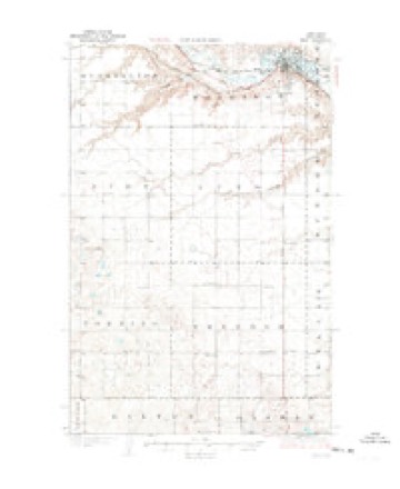
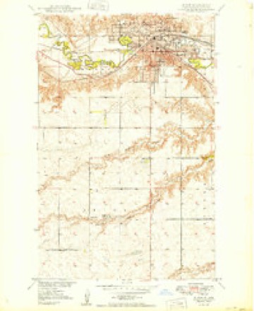
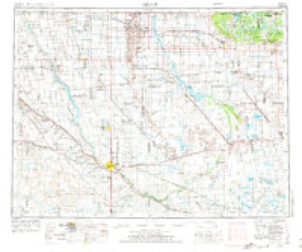
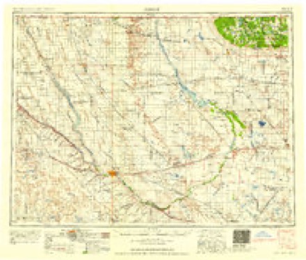
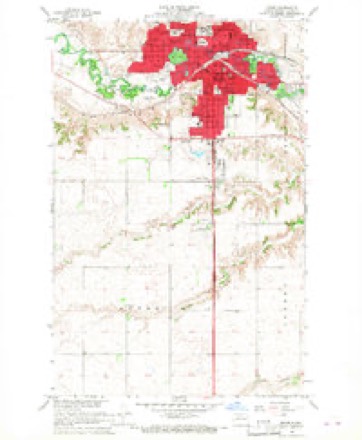
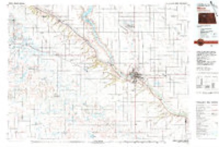
11 topographic sheets cover this place, the earliest surveyed in 1928 and the latest in 1980. It stands in Minot City. It lies in ZIP code area 58701. The Survey maps it on the Minot quadrangle. 48,377 people lived here at the 2020 count. It stands 1,611 feet above sea level.
Research this city
On record in Minot
Buildings and businesses the archive holds for this place. Each opens its own page, with the source record it came from.
On the National Register 12 of 13 shown
 Andrew Carr Sr. Houselisted 1984
 Eastwood Park Bridgelisted 1975
 Eastwood Park Historic Districtlisted 1986
 Minot Carnegie Librarylisted 1980
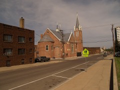 Minot Commercial Historic Districtlisted 1980
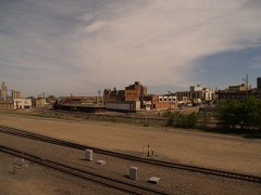 Minot Industrial Historic Districtlisted 1986
 Soo Line Passenger Depotlisted 1978
 Tufveson Houselisted 1984
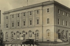 U.S. Post Officelisted 1980
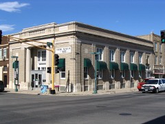 Union National Bank and Annexlisted 1983
 Ward County Courthouselisted 1985
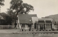 Westland Oil Filling Stationlisted 1987
Population over time
8 figuresMinot grew from 22,032 to 48,377 between 1950 and 2020. These are the recorded population figures Wikidata holds for this place, reached through the Geographic Names Information System number this page is keyed on rather than by name, so they belong to this place and not to another of the same name. Most are census counts, but not all are: an early figure may be a founding or settlement estimate, and an estimate published within five years of a census is left out. The change column is computed, and is left blank where more than 20 years separate a figure from the one before it, because a gap that long is not a change between two counts.
| Year | People | Change |
|---|---|---|
| 1950 | 22,032 | |
| 1960 | 30,987 | +8,955 (+41%) |
| 1970 | 32,290 | +1,303 (+4%) |
| 1980 | 32,843 | +553 (+2%) |
| 1990 | 34,544 | +1,701 (+5%) |
| 2000 | 36,567 | +2,023 (+6%) |
| 2010 | 40,888 | +4,321 (+12%) |
| 2020 | 48,377 | +7,489 (+18%) |
Topographic sheets covering this place
6 surveys from 11 printed sheetsMatched by testing this settlement's coordinate against the published boundary of every sheet in the United States Geological Survey's historical collection. Each opens the scanned sheet at the Survey.
- 1928 USGS Minot quadrangle1:62500, 3 printings
- 1949 USGS Minot quadrangle1:24000
- 1954 USGS Minot quadrangle1:250000, 3 printings
- 1958 USGS Minot quadrangle1:250000
- 1966 USGS Minot quadrangle1:24000, 2 printings
- 1980 USGS Minot quadrangle1:100000
Fires near this place
33 since 2005Regional context, not property-specific evidence. The federal wildfire occurrence database lists 33 fires within 5 miles of Minot between 2005 and 2020, burning about 82 acres in total. 1 started naturally. None was recorded as arson. Distance is straight-line from the map coordinates, so a fire counted here may appear on a neighbouring settlement's page as well.
| Reported cause | Fires |
|---|---|
| Missing data/not specified/undetermined | 10 |
| Debris and open burning | 7 |
| Recreation and ceremony | 4 |
| Fireworks | 3 |
| Equipment and vehicle use | 3 |
| Railroad operations and maintenance | 2 |
| Misuse of fire by a minor | 2 |
| Natural | 1 |
| Smoking | 1 |
The most recent of them, most recent first, with the day each was reported and the service that recorded it.
| Date | Cause | Size | Reported by | Name on the report |
|---|---|---|---|---|
| 9 August 2020 | Natural | under an acre | North Dakota State Forest Service | 2020-098 |
| 22 August 2006 | Equipment and vehicle use | 45 acres | Upper Souris National Wildlife Refuge | BOCK |
| 21 August 2020 | Fireworks | 1.0 acres | North Dakota State Forest Service | 4721 38TH ST SE FIRE |
| 9 July 2018 | Railroad operations and maintenance | under an acre | North Dakota State Forest Service | 107 |
| 7 July 2018 | Equipment and vehicle use | under an acre | North Dakota State Forest Service | INCIDENT # 105 |
| 4 July 2018 | Fireworks | 1.0 acres | North Dakota State Forest Service | 102 |
| 31 July 2020 | Debris and open burning | under an acre | North Dakota State Forest Service | OAK PARK |
| 31 July 2019 | Debris and open burning | under an acre | North Dakota State Forest Service | MRFD113 |
Settlements close enough to share some of these fires:
Mines and quarries near this place
10 of 22 shownRegional context, not property-specific evidence. The federal mineral resources record lists 22 workings within 5 miles of Minot: 18 unknowns, 4 producers. 4 still produce. What was taken out: Sand and Gravel, Construction. Distance is straight-line from the map coordinates, so a quarry counted here may appear on a neighbouring settlement's page as well.
| Where | Site | Commodity | Status | Recorded |
|---|---|---|---|---|
| Anderson Pit | Sand and Gravel, Construction | Unknown | ||
| Barsness Pit | Sand and Gravel, Construction | Unknown | ||
| Christianson Pit | Sand and Gravel, Construction | Unknown | ||
| Deutsch Pit | Sand and Gravel, Construction | Unknown | ||
| East Pit and Plant | Sand and Gravel, Construction | Producer | ||
| Flaherty Pit | Sand and Gravel, Construction | Unknown | ||
| Gravel Products Pit & Plant | Sand and Gravel, Construction | Producer | ||
| Halden Pit | Sand and Gravel, Construction | Unknown | ||
| Hill Pit | Sand and Gravel, Construction | Unknown | ||
| Johnsons Pit | Sand and Gravel, Construction | Producer |
Storms near this place
60 of 119 shownRegional context, not property-specific evidence. The National Weather Service names Minot in 119 storm reports between 1993 and 2025: 66 hail, 31 thunderstorm wind, 7 flash flood, 6 tornado. The reports record 3 injuries. Each account below is quoted exactly as the forecast office filed it, from the NOAA Storm Events Database, and each date opens the federal record of that event.
| When | Event | Place named | Harm | What the report says |
|---|---|---|---|---|
| August 1995 | Hail | Minot | 3 hurt, $40,000,000 | A severe thunderstorm moved through Ward County in the early morning hours. Hail the size of walnut to grapefruit did extensive damage to crops and property. A camper-bus convention was occuring at the time with extensive damage done to campers ranging in value up to 0.5M. Many wheat crops that were at or near maturity were completely destroyed with no hopes of any harvest. |
| June 2011 | Flash Flood | Minot | $5,000,000 | Runoff from very heavy rain forced rapid dam releases along the Souris River which resulted in an overtopping of levees and eventual levee failure. Communities through Ward County along the Souris River were very severely impacted. A mandatory evacuation was ordered along the river. In the end the river flooding resulted in impacts to around 15,000 residents. This levee ovetopping flash flooded these areas. Dollar damage indicated here is not all inclusive from the flooding. |
| June 2006 | Lightning | Minot | $125,000 | The Minot Fire Department determined that lightning striking a condominium in the city of Minot was the cause of a fire that damaged the condo. Newspaper reports stated that the unit sustained heavy damage to the roof and top floor. A thunderstorm was occurring at the time and there were reports of a lot of cloud to ground lightning. |
| July 1999 | Tornado (F1) | Minot | $120,000 | Significant damage to rural areas south and southeast of Minot. |
| June 2012 | Thunderstorm Wind | Minot | $100,000 | Multiple power lines were reported down in northwest Minot from the severe winds. |
| June 2024 | Thunderstorm Wind | Minot | $75,000 | Strong thunderstorm winds in the Minot area downed tree branches and caused some shingle damage. |
| August 1997 | Lightning | Minot | $65,000 | lightning struck a house in Minot. The fire smoldered until the afternoon when flames began shooting out of the roof. The house was a complete loss. |
| May 1993 | Thunderstorm Wind | Minot | $50,000 | no account filed |
| September 2009 | Lightning | Minot | $40,000 | An early morning lightning strike caused a fire in the attic of a townhouse complex in Minot. No injuries were reported. |
| May 2010 | Flash Flood | Minot | $35,000 | Two inches of rain resulted in a few feet of water running through Minot streets. Underpasses in the city were flooded and blocked. Minor damage occurred to culverts. |
| August 2025 | Thunderstorm Wind | Minot | $20,000 | A large tree fell onto a mobile home and caused 6 large holes in the roof. The tree may have been struck by lightning. |
| June 2014 | Hail | Minot | $15,000 | There was damage to vehicles. |
| June 2012 | Thunderstorm Wind | Minot | $10,000 | The very strong winds blew down a thirty inch in diameter tree. |
| June 2008 | Thunderstorm Wind | Minot | $6,000 | Several two foot diameter trees were blown down at Sunset Memorial Gardens Cemetary. |
| June 2012 | Thunderstorm Wind | Minot | $5,000 | The strong winds blew down a tree approximately twelve inches in diameter. |
| July 2007 | Thunderstorm Wind | Minot | $2,000 | Winds snapped electrical wire at spotter's home. |
| July 2025 | Thunderstorm Wind | Minot | - | Thunderstorm wind gusts were estimated by the public. |
| August 2019 | Thunderstorm Wind | Minot | - | The public estimated wind gusts to 60 mph. |
| July 2013 | Thunderstorm Wind | Minot | - | Severe thunderstorm winds were reported in the city Minot. |
| May 2011 | Heavy Rain | Minot | - | Over two inches of rain fell over an 18 hour period. Much of this rain fell during the afternoon. |
| May 2010 | Hail | Minot | - | Nickel to quarter size hail fell across the city of Minot. |
| August 2010 | Thunderstorm Wind | Minot | - | Estimated winds of 65 mph were reported. |
| August 2010 | Thunderstorm Wind | Minot | - | This was the second of two rounds of wind to strike the city of Minot. The first round was associated with a gust front, and this second gust was associated with heavy precipitation. |
| June 2008 | Hail | Minot | - | Quarter to golfball size hail fell just to the north of Minot. No report of damage was received from this event. |
| June 2008 | Hail | Minot | - | Pea to quarter size hail was reported throughout the city of Minot. |
| August 2008 | Hail | Minot | - | No damage reports were received. |
| August 2008 | Hail | Minot | - | A west to east swath of nickel to quarter size hail fell from the city of Minot to the town of Surrey. |
| May 2007 | Hail | Minot | - | Hail lasted on and off for about 30 minutes. |
| June 2007 | Thunderstorm Wind | Minot | - | Measured thunderstorm gust on ASOS Automated Surface Observing System. |
| June 2006 | Heavy Rain | Minot | - | Minor street flooding in the city of Minot. Radar estimates 1 to 1.5 inches of rain. |
| July 2006 | Thunderstorm Wind | Minot | - | Wind blew over a 600 pound motorcycle. |
| June 2005 | Flash Flood | Minot | - | Underpasses flooded. Water over some county roads 6 inches deep. |
| June 2005 | Flash Flood | Minot | - | Public reported a foot of water over highway 83. |
| August 2004 | Tornado (F0) | Minot | - | Tornado briefly touched down in open country then quickly lifted. |
| July 2003 | Thunderstorm Wind | Minot | - | Numerous trees and power lines down. |
| June 2002 | Thunderstorm Wind | Minot | - | Numerous shingles off roofs and wall of barn blown over. |
| July 2001 | Thunderstorm Wind | Minot | - | Cooperative observer reported shingles torn off roof's and tree damage. |
| August 2000 | Thunderstorm Wind | Minot | - | Barn destroyed. Numerous poles downed. (possible wet microburst). Very heavy rain with storm. |
| August 2000 | Hail | Minot | - | Dime size hail up to 6 inches deep on highway 83. Leaves were stripped from tree's. |
| July 1999 | Thunderstorm Wind | Minot | - | Power lines down. |
| July 1999 | Thunderstorm Wind | Minot | - | Urban flooding in the city of Minot caused severe storm drainage overload. |
| July 1998 | Lightning | Minot | - | Tree in Oak park exploding, spreading bark for 250 feet. |
| July 1998 | Lightning | Minot | - | Lightning disrupted power service to 2,300 NSP electrical customers. |
| July 1997 | Tornado (F0) | Minot | - | tornado moved from 8 S of Minot to 20 SE of Minot |
| July 1997 | Tornado (F0) | Minot | - | Brief touchdown 5 N Minot |
| July 1997 | Tornado (F0) | Minot | - | brief tornado touchdown 5 SW of Minot |
| July 1995 | Tornado (F0) | Minot | - | Tornado crossed over Highway 23. |
| July 2025 | Hail | Minot | - | no account filed |
| July 2025 | Thunderstorm Wind | Minot | - | no account filed |
| July 2024 | Hail | Minot | - | no account filed |
| July 2024 | Hail | Minot | - | no account filed |
| July 2024 | Hail | Minot | - | no account filed |
| July 2022 | Hail | Minot | - | no account filed |
| June 2022 | Hail | Minot | - | no account filed |
| June 2022 | Hail | Minot | - | no account filed |
| July 2021 | Hail | Minot | - | no account filed |
| July 2020 | Hail | Minot | - | no account filed |
| June 2020 | Hail | Minot | - | no account filed |
| August 2019 | Hail | Minot | - | no account filed |
| July 2017 | Hail | Minot | - | no account filed |
Nearest settlements
The eight closest, with where each one stands in the county. Distances are straight-line, computed from the Geographic Names Information System coordinates.
| Map | Place | Distance | Sheets |
|---|---|---|---|
| Burlington | 7.6 miles | 10 | |
| Surrey | 8.6 miles | 11 | |
| Drady | 8.8 miles | 11 | |
| Logan | 9.5 miles | 11 | |
| Ruthville | 9.6 miles | 10 | |
| Ralston | 9.6 miles | 11 | |
| South Prairie | 12.5 miles | 9 | |
| Des Lacs | 14.3 miles | 8 |
Elsewhere
Matched on this settlement's Geographic Names Information System number rather than its name, so it cannot be a different place of the same name in another state.
| Wikipedia article on Minot | An encyclopaedic summary. Its text is share-alike, so it is linked here rather than copied. |
| Wikidata item Q487201 | The structured record the population and elevation above come from. Public domain (CC0). |
Provenance
This settlement is recorded in the Geographic Names Information System as feature 1030249. The sheet list is computed by point-in-boundary test against the United States Geological Survey's historical topographic inventory. Both are works of the United States government and carry no copyright under 17 U.S.C. 105.
Wildfire. Short, Karen C. 2022. Spatial wildfire occurrence data for the United States, 1992-2020 [FPA_FOD_20221014]. 6th Edition. Fort Collins, CO: Forest Service Research Data Archive. https://doi.org/10.2737/RDS-2013-0009.6 Collected with United States Government funding and usable without additional permissions or fees.
Mines and quarries. USGS Mineral Resources Data System (MRDS) https://mrdata.usgs.gov/mrds/ A work of the United States government, no copyright under 17 U.S.C. 105.
Storms. NOAA National Centers for Environmental Information, Storm Events Database https://www.ncei.noaa.gov/stormevents/ A work of the United States government, no copyright under 17 U.S.C. 105. Narratives are quoted verbatim from the National Weather Service report and are not edited or summarised.