 Block
From the record
15 National Register listings published here.
Sources: the National Register database, National Park Service
72 topographic sheets cover 27 settlements here, and 15 properties are on the National Register of Historic Places.
15 National Register listings published here.
Sources: the National Register database, National Park Service
Every property in this county listed on the National Register of Historic Places, with the year it was listed and the federal nomination document.
| Photograph | Property | Type | Listed | Reference |
|---|---|---|---|---|
 | Andrew Carr Sr. House | building | 1984 | 84002771 |
 | Eastwood Park Bridge | structure | 1975 | 75001307 |
 | Eastwood Park Historic District | district | 1986 | 86002824 |
| Levi Glick Round Barn | building | 1987 | 86002760 | |
 | Minot Carnegie Library | building | 1980 | 80002929 |
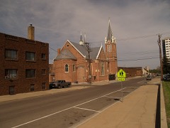 | Minot Commercial Historic District | district | 1980 | 86002823 |
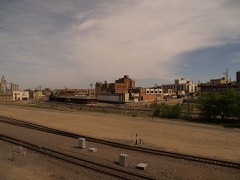 | Minot Industrial Historic District | district | 1986 | 86002818 |
 | Our Savior's Scandinavian Lutheran Church | building | 2005 | 05000060 |
 | Soo Line Passenger Depot | building | 1978 | 78001996 |
| South Prairie Community Hall | building | 2006 | 06000474 | |
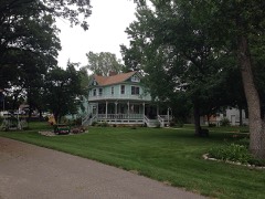 | Tufveson House | building | 1984 | 84002773 |
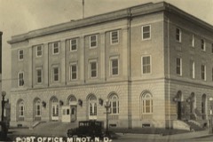 | U.S. Post Office | building | 1980 | 80002930 |
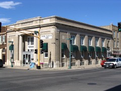 | Union National Bank and Annex | building | 1983 | 83001941 |
 | Ward County Courthouse | building | 1985 | 85002997 |
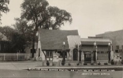 | Westland Oil Filling Station | building | 1987 | 86002816 |
Every wildfire the federal occurrence database records inside this county: 179 of them, burning about 14,632 acres. 7 started naturally and 1 was recorded as arson. Each settlement page carries the fires within five miles of it.
| Reported cause | Fires |
|---|---|
| Missing data/not specified/undetermined | 68 |
| Debris and open burning | 46 |
| Equipment and vehicle use | 21 |
| Railroad operations and maintenance | 16 |
| Natural | 7 |
| Fireworks | 5 |
| Smoking | 5 |
| Power generation/transmission/distribution | 4 |
| Recreation and ceremony | 4 |
| Misuse of fire by a minor | 2 |
| Arson/incendiarism | 1 |
The five largest, by the area the report gives. None of them was recorded as arson.
| Date | Cause | Size | Reported by | Name on the report |
|---|---|---|---|---|
| 5 April 2012 | Railroad operations and maintenance | 6,070 acres | North Dakota State Forest Service | DONNY BROOK FIRE |
| 2 October 1997 | Missing data/not specified/undetermined | 2,100 acres | J. Clark Salyer National Wildlife Refuge | FOXHOLM#1 |
| 5 April 2006 | Missing data/not specified/undetermined | 1,800 acres | North Dakota State Forest Service | RAGING HILLS |
| 8 April 2008 | Missing data/not specified/undetermined | 1,100 acres | North Dakota State Forest Service | SWARTWOUT |
| 31 October 1999 | Debris and open burning | 1,100 acres | Upper Souris National Wildlife Refuge | ASKVIG |
| 16 May 2008 | Missing data/not specified/undetermined | 300 acres | North Dakota State Forest Service | UNNAMED |
| 4 May 2015 | Debris and open burning | 200 acres | North Dakota State Forest Service | 26 |
| 13 April 2016 | Debris and open burning | 160 acres | North Dakota State Forest Service | WILDFIRE #1 |
Every settlement page carries the fires within five miles of it - see the settlement index below.
The NOAA Storm Events Database holds 585 reports for this county, causing 1 death, 5 injuries and about $151,646,560 in recorded property damage. Each settlement page carries the reports that name it.
| Kind of event | Reports |
|---|---|
| Hail | 290 |
| Thunderstorm Wind | 186 |
| Tornado | 55 |
| Funnel Cloud | 17 |
| Flash Flood | 15 |
| Flood | 10 |
| Lightning | 6 |
| Heavy Rain | 6 |
The most serious of them, by death, then injury, then recorded damage. The accounts are quoted exactly as the forecast office filed them.
| When | Event | Place named | Harm | What the report says |
|---|---|---|---|---|
| August 2010 | Tornado (EF3) | Niobe | 1 killed, 1 hurt, $500,000 | This tornado crossed from Burke County into Ward County. Note that for roughly three miles in the vicinity of the Des Lacs River, U.S. Highway 52 runs right on the Burke and Ward County line. The tornado was right on the highway in this area. This was the location of the worst damage with this tornado. Farm property on the north side of the highway, Burke County, and on the south side of the highway, Ward County, was impacted. One fatality and one injury occurred here, in a single automobile travelling along the highway, on the county line. The vehicle came to rest in a field, nearly 200 yards off the highway, on the south side of the highway, on the east side of the river, in Ward County. See the EF3 tornado entry for Burke County from August 12.||This third tornado touched down just northeast of Bowbells, Burke County, and tracked east-southeast along U.S. Highway 52, and into Ward County where it dissipated. This EF3 tornado was spawned from the same supercell thunderstorm that earlier produced two brief and weak tornadoes in Burke County.||Meteorologists from the National Weather Service conducted a storm damage survey on Friday, August 13, 2010. Meteorologists walked through the area and spoke with numerous people affected, some of whom were eye witnesses to the event.||Significant damage occurred nearly six miles east of Bowbells, near the Des Lacs River, where U.S. Highway 52 is on the Burke and Ward County line. Three farms were impacted. The worst damage was on the Burke County side of the highway and west side of the river, where a farm home (DI 2, DOD 8) and six outbuildings were destroyed. Nineteen of 21 grain bins were also damaged or destroyed. In addition, a fifty foot air seeder connected to a cultivator, with a combined estimated weight near 60,000 pounds, was moved approximately 100 yards. Based on a lack of scratch marks in the ground it was determined that this equipment was picked up and carried through the air. A second farm, on the Ward County side of the highway, had trees in shelter belts snapped and uprooted and the chimney on the house damaged. A third house, this one on the east side of the river and the Ward County side of the highway, also had significant damage. Here, one camper was thrown into the river on the south side of the Highway 52 bridge that crosses the river, while another camper was thrown into the river and landed on the north side of the bridge, back into Burke County. The house had damage to siding and shingles.||Of all the damage surveyed the absolute worst corresponded to a high EF3 on the Enhanced Fujita Tornado Scale. From that it was determined that peak wind speeds in the tornado were on the order of 165 mph.||One fatality and one injury occurred in an automobile in this same immediate area. A car with two occupants travelling east along U.S. Highway 52 was picked up and carried over the Des Lacs River, and came to rest 200 yards off the highway, in a field east of the river, and on the Ward County side of the highway. The driver of the vehicle was injured and the passenger was killed.||See the other three tornado entries for Burke County from this event on August 12. This tornado crossed into Ward County from Burke. |
| August 1995 | Hail | Minot | 3 hurt, $40,000,000 | A severe thunderstorm moved through Ward County in the early morning hours. Hail the size of walnut to grapefruit did extensive damage to crops and property. A camper-bus convention was occuring at the time with extensive damage done to campers ranging in value up to 0.5M. Many wheat crops that were at or near maturity were completely destroyed with no hopes of any harvest. |
| August 1960 | Tornado (F2) | not stated | 1 hurt, $30 | no account filed |
| May 2011 | Flood | Niobe | $100,000,000 | See the event episode narrative for details. |
| June 2011 | Flash Flood | Minot | $5,000,000 | Runoff from very heavy rain forced rapid dam releases along the Souris River which resulted in an overtopping of levees and eventual levee failure. Communities through Ward County along the Souris River were very severely impacted. A mandatory evacuation was ordered along the river. In the end the river flooding resulted in impacts to around 15,000 residents. This levee ovetopping flash flooded these areas. Dollar damage indicated here is not all inclusive from the flooding. |
| June 2010 | Flash Flood | Burlington | $800,000 | Flash flooding occurred in Minot and surrounding areas due to very heavy rain from thunderstorms. The total 24 hour precipitation total for Minot on June 17 was 3.75 inches, with much of this occurring during the mid afternoon hours. ||Water ran almost two feet deep over roads in many locations. Many homes reported water damage to their basements with water flowing into basement windows. Drainage systems also became overwhelmed, resulting in sewer backup in some residences. Multiple roads were washed out along with damage to storm sewers. One plugged storm sewer resulted in flooding and floor damage to the basement at the Minot Public High School. ||Damage amounts from this event were estimated based on newspaper articles and other storm reports. |
| June 2014 | Flood | Niobe | $618,000 | Flooding occurred over Ward County. Damage occurred to roads and culverts with many wash outs along township roads. There was crop damage as well. Rain amounts ranged from 2.50 inches in Bottineau County to as much as 7.00 inches in Renville County. |
| April 2009 | Flood | Carpio | $488,000 | An extremely snowy winter and rapid snowmelt caused overland flooding and flooding along the Souris River resulting in washed out roads and flood damage to eight homes. |
| April 2013 | Flood | Foxholm | $350,000 | A late season rapid snow melt caused flooding along the Souris (Mouse) River and Des Lacs River through Ward County. Additionally, there were necessary releases from upstream dams in North Dakota and Saskatchewan, Canada, due to rapid snow melt there. Homes in the Project Road area near Burlington took on water. Many county and township roads near the river were damaged. |
| June 2011 | Flash Flood | Sawyer | $300,000 | Runoff from very heavy rain forced rapid dam releases along the Souris River which resulted in an overtopping of levees and eventual levee failure. Communities through Ward County along the Souris River were very severely impacted. A mandatory evacuation was ordered along the river, including this one for Sawyer. In the end the river flooding resulted in impacts to around 15,000 residents along the river. This levee ovetopping flash flooded these areas. Dollar damage indicated here is not all inclusive from the flooding. |
| July 1990 | Tornado (F1) | not stated | $250,000 | no account filed |
| July 1978 | Tornado (F0) | not stated | $250,000 | no account filed |
| May 1977 | Tornado (F1) | not stated | $250,000 | no account filed |
| June 1974 | Tornado (F2) | not stated | $250,000 | no account filed |
| September 2019 | Hail | Burlington | $200,000 | Vehicle windshields were broken. On homes, windows were broken and siding was damaged. |
| June 2005 | Flash Flood | Surrey | $200,000 | no account filed |
| July 2015 | Thunderstorm Wind | Niobe | $150,000 | Large evergreen trees were snapped. Two roofs were torn from out-buildings. Three empty grain bins were tipped. Wind speed was estimated from the damage. |
| May 2013 | Flood | Foxholm | $150,000 | A late season rapid snow melt caused flooding along the Souris (Mouse) River and Des Lacs River through Ward County. Additionally, there were necessary releases from upstream dams in North Dakota and Saskatchewan, Canada, due to rapid snow melt there. Homes in the Project Road area near Burlington took on water. Many county and township roads near the rivers were damaged. |
| July 1999 | Tornado (F1) | Kenmare | $150,000 | Crop losses of 20 to 40 percent of 145,200 acres. |
| June 2006 | Lightning | Minot | $125,000 | The Minot Fire Department determined that lightning striking a condominium in the city of Minot was the cause of a fire that damaged the condo. Newspaper reports stated that the unit sustained heavy damage to the roof and top floor. A thunderstorm was occurring at the time and there were reports of a lot of cloud to ground lightning. |
| July 1999 | Tornado (F1) | Minot | $120,000 | Significant damage to rural areas south and southeast of Minot. |
| June 2005 | Flash Flood | Berthold | $114,000 | Flash flood affected area from Berthold to Carpio and Foxholm. NDDOT and NDHP closed Highway 52 from Carpio to Foxholm because a bridge between the two cities was washed out from the flash flood. Homes flooded in Berthold. |
| June 2012 | Thunderstorm Wind | Minot | $100,000 | Multiple power lines were reported down in northwest Minot from the severe winds. |
| July 2016 | Hail | Berthold | $100,000 | no account filed |
| April 2023 | Flood | Donnybrook | $90,000 | Flooding from snow melt runoff caused significant damages to county infrastructure. |
| June 2024 | Thunderstorm Wind | Minot | $75,000 | Strong thunderstorm winds in the Minot area downed tree branches and caused some shingle damage. |
| June 2013 | Flood | Foxholm | $75,000 | This river flooding was in part a continuation from the spring flooding that began in April and continued through May and into June. Some river points remained above flood stage through this period. The heavy rains through May and into June kept high water flowing through the system. |
| August 1997 | Lightning | Minot | $65,000 | lightning struck a house in Minot. The fire smoldered until the afternoon when flames began shooting out of the roof. The house was a complete loss. |
| July 2022 | Thunderstorm Wind | (Mib)Minot Afb | $50,000 | Tree and roof damage occurred at Minot Air Force Base. |
| August 2019 | Hail | Makoti | $50,000 | Hail was wind driven. |
| March 2009 | Flood | Carpio | $50,000 | Overland flooding damaged county and township roads. No homes were flooded in March. Flooding continued into April. |
| May 1993 | Thunderstorm Wind | Minot | $50,000 | no account filed |
| September 2009 | Lightning | Minot | $40,000 | An early morning lightning strike caused a fire in the attic of a townhouse complex in Minot. No injuries were reported. |
| August 2010 | Thunderstorm Wind | Coulee | $35,000 | A trained spotter reported his employer had has barn destroyed by strong thunderstorm winds. |
| May 2010 | Flash Flood | Minot | $35,000 | Two inches of rain resulted in a few feet of water running through Minot streets. Underpasses in the city were flooded and blocked. Minor damage occurred to culverts. |
| July 2010 | Hail | Ryder | $35,000 | Large hail up to the size of golf balls broke windows and damaged crops in and around the town of Ryder. |
| August 2001 | Thunderstorm Wind | Kenmare | $35,000 | The wind completely destroyed a new airplane hanger at the Kenmare airport. Other damage consisted of several large metal buildings and hopper. Numerous tree limbs down. |
| August 2025 | Thunderstorm Wind | Burlington | $30,000 | A large tree fell on a camper and totaled it. |
| August 1994 | Thunderstorm Wind | Kenmare | $30,000 | no account filed |
| June 2021 | Thunderstorm Wind | Ryder | $25,000 | A hopper-style grain bin blew over. |
| June 2012 | Thunderstorm Wind | Des Lacs | $25,000 | The very strong winds blew down a quonset. |
| May 2010 | Flash Flood | Burlington | $25,000 | Thunderstorms with very heavy rain fell across portions of central Ward County. In the city of Minot, underpasses became flooded along with several streets. Local firefighters rescued one person whose vehicle became submerged in the sixth street underpass in Minot. |
| July 1990 | Tornado (F0) | not stated | $25,000 | no account filed |
| July 1990 | Tornado (F0) | not stated | $25,000 | no account filed |
| July 1990 | Tornado (F0) | not stated | $25,000 | no account filed |
| July 1990 | Tornado (F0) | not stated | $25,000 | no account filed |
| June 1987 | Tornado (F0) | not stated | $25,000 | no account filed |
| July 1986 | Tornado (F0) | not stated | $25,000 | no account filed |
| June 1982 | Tornado (F2) | not stated | $25,000 | no account filed |
| August 2025 | Thunderstorm Wind | Minot | $20,000 | A large tree fell onto a mobile home and caused 6 large holes in the roof. The tree may have been struck by lightning. |
| August 2013 | Hail | Douglas | $20,000 | The large hail damaged a shed, tractor, and pickup truck. |
| May 2010 | Flash Flood | Coulee | $20,000 | Spotter reports indicated township roads being submerged from heavy runoff from thunderstorms. |
| June 2014 | Hail | Minot | $15,000 | There was damage to vehicles. |
| June 2012 | Flash Flood | (Mot)Minot Intl Arpt | $15,000 | Underpasses were flooded, along with moving or standing water on many city roads. |
| June 2010 | Thunderstorm Wind | Sawyer | $15,000 | Severe thunderstorm winds resulted in several trees to be uprooted. |
| June 2009 | Thunderstorm Wind | (Mib)Minot Afb | $15,000 | Severe thunderstorm winds resulted in the collapse of a cement and aluminum bus stop housing 10 to 12 feet in height at the Minot Air Force Base. |
| July 2020 | Thunderstorm Wind | South Prairie | $10,000 | An outdoor play set was tumbled and destroyed, and a vehicle was damaged. |
| June 2012 | Thunderstorm Wind | Minot | $10,000 | The very strong winds blew down a thirty inch in diameter tree. |
| June 2008 | Thunderstorm Wind | Minot | $6,000 | Several two foot diameter trees were blown down at Sunset Memorial Gardens Cemetary. |
| June 2012 | Thunderstorm Wind | Minot | $5,000 | The strong winds blew down a tree approximately twelve inches in diameter. |
The Survey's mineral resources record lists 18 workings inside this county. 4 still produce and 14 are closed or unrecorded. Each settlement page carries the workings within five miles of it.
| Commodity | Workings |
|---|---|
| Sand and Gravel, Construction | 18 |
The least common of them first, because a county's hundredth gravel pit says nothing its first ten did not.
| Where | Site | Commodity | Status | Recorded |
|---|---|---|---|---|
| Barsness Pit | Sand and Gravel, Construction | Unknown | ||
| Christianson Pit | Sand and Gravel, Construction | Unknown | ||
| Deutsch Pit | Sand and Gravel, Construction | Unknown | ||
| East Pit and Plant | Sand and Gravel, Construction | Producer | ||
| Flaherty Pit | Sand and Gravel, Construction | Unknown | ||
| Gravel Products Pit & Plant | Sand and Gravel, Construction | Producer | ||
| Halden Pit | Sand and Gravel, Construction | Unknown | ||
| Haugens Pit | Sand and Gravel, Construction | Past Producer | ||
| Hill Pit | Sand and Gravel, Construction | Unknown | ||
| Johnsons Pit | Sand and Gravel, Construction | Producer | ||
| Minot Paving Pit and Plant | Sand and Gravel, Construction | Past Producer | ||
| Minot Pit and Plant | Sand and Gravel, Construction | Producer | ||
| Norstag Pit | Sand and Gravel, Construction | Unknown | ||
| Olson Pit | Sand and Gravel, Construction | Unknown | ||
| Peterson Pit and Plant | Sand and Gravel, Construction | Unknown | ||
| Rau Pit | Sand and Gravel, Construction | Past Producer | ||
| Siebert Pit | Sand and Gravel, Construction | Unknown | ||
| Weltikol Pit | Sand and Gravel, Construction | Unknown |
Named settlements recorded in the Geographic Names Information System, each with the topographic sheets covering it. Villages, hamlets and abandoned places alike. Each is shown with the nearest named watercourse or landform and the survey quadrangle it falls on.
Burlington city · 58722 · On Des Lacs River · Burlington quadrangle
10 sheets, 1948 to 1980
Carbondale township · 58734 · Near Jack Power Coulee · Donnybrook quadrangle
7 sheets, 1947 to 1958
Kenmare township · 58746 · Near Ankenbauer Coulee · Kenmare quadrangle
8 sheets, 1948 to 1982