 Block
Williston, North Dakota
6 topographic sheets cover this place, the earliest surveyed in 1953 and the latest in 1983. It stands in Williston City. It lies in ZIP code area 58801. It stands on Sand Creek. The Survey maps it on the Williston East quadrangle. 29,479 people lived here at the 2020 count. It stands 1,877 feet above sea level.
Research this city
On record in Williston
Buildings and businesses the archive holds for this place. Each opens its own page, with the source record it came from.
On the National Register 6 records
 Creaser Buildinglisted 2016
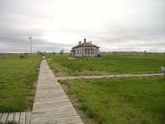 Fort Buford State Historic Sitelisted 1975
 James Memorial Librarylisted 1979
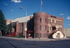 Old Armorylisted 1985
 Old US Post Officelisted 1979
- Williston High Schoollisted 2011
Topographic sheets covering this place
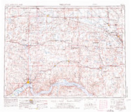
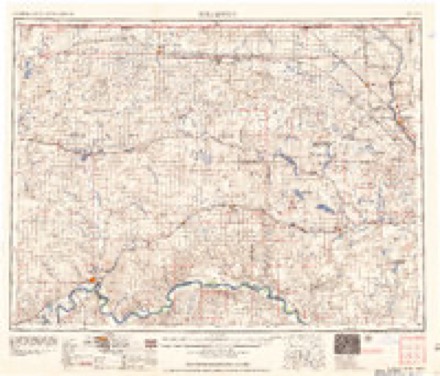
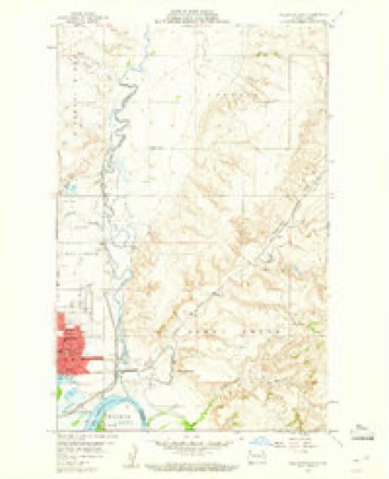
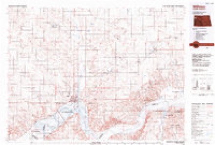
4 surveys from 6 printed sheetsMatched by testing this settlement's coordinate against the published boundary of every sheet in the United States Geological Survey's historical collection. Each opens the scanned sheet at the Survey.
- 1953 USGS Williston quadrangle1:250000, 2 printings
- 1957 USGS Williston quadrangle1:250000
- 1959 USGS Williston East quadrangle1:24000, 2 printings
- 1983 USGS Williston quadrangle1:100000
Fires near this place
57 since 2017Regional context, not property-specific evidence. The federal wildfire occurrence database lists 57 fires within 5 miles of Williston between 2017 and 2020, burning about 113 acres in total. None started naturally. 2 were recorded as arson. Distance is straight-line from the map coordinates, so a fire counted here may appear on a neighbouring settlement's page as well.
| Reported cause | Fires |
|---|---|
| Fireworks | 19 |
| Debris and open burning | 13 |
| Smoking | 6 |
| Power generation/transmission/distribution | 5 |
| Equipment and vehicle use | 5 |
| Missing data/not specified/undetermined | 4 |
| Recreation and ceremony | 3 |
| Arson/incendiarism | 2 |
The most recent of them, most recent first, with the day each was reported and the service that recorded it.
| Date | Cause | Size | Reported by | Name on the report |
|---|---|---|---|---|
| 6 September 2019 | Debris and open burning | under an acre | North Dakota State Forest Service | BON FIRE |
| 5 September 2020 | Debris and open burning | under an acre | North Dakota State Forest Service | 42 AVE BURN PILE |
| 21 September 2020 | Debris and open burning | 1.0 acres | North Dakota State Forest Service | NONE |
| 2 September 2020 | Power generation/transmission/distribution | under an acre | North Dakota State Forest Service | 200902 |
| 2 September 2020 | Power generation/transmission/distribution | under an acre | North Dakota State Forest Service | 200901 |
| 19 September 2020 | Smoking | under an acre | North Dakota State Forest Service | 200920 |
| 15 September 2020 | Power generation/transmission/distribution | under an acre | North Dakota State Forest Service | WEATHERFORD |
| 12 September 2018 | Fireworks | under an acre | North Dakota State Forest Service | THE MEADOWS |
Settlements close enough to share some of these fires:
Mines and quarries near this place
5 within 5 milesRegional context, not property-specific evidence. The federal mineral resources record lists 5 workings within 5 miles of Williston: 3 producers, 2 past producers. 3 still produce. What was taken out: Sand and Gravel, Construction. Distance is straight-line from the map coordinates, so a quarry counted here may appear on a neighbouring settlement's page as well.
| Where | Site | Commodity | Status | Recorded |
|---|---|---|---|---|
| Cactus 64sh Plant | Sand and Gravel, Construction | Producer | ||
| Cherry Pit | Sand and Gravel, Construction | Producer | ||
| Hoffelt Gravel Pit | Sand and Gravel, Construction | Producer | ||
| K Kulland Pit and Plant | Sand and Gravel, Construction | Past Producer | ||
| Streifel Pit and Plant | Sand and Gravel, Construction | Past Producer |
Storms near this place
60 of 85 shownRegional context, not property-specific evidence. The National Weather Service names Williston in 85 storm reports between 1993 and 2025: 50 hail, 27 thunderstorm wind, 4 funnel cloud, 2 lightning. No death or injury is recorded in these reports. Each account below is quoted exactly as the forecast office filed it, from the NOAA Storm Events Database, and each date opens the federal record of that event.
| When | Event | Place named | Harm | What the report says |
|---|---|---|---|---|
| June 2021 | Hail | Williston | $1,000,000 | This was the first of multiple rounds of hail to strike the Williston area the evening of June 10. With this round, hail up to the size of tennis balls fell over the Williston area. This caused damage to many roofs and vehicles, including damaging every police car in the city, and every vehicle parked in the Williams County facility lot. In addition, strong winds with this storm blew a roof off a truck and car wash. |
| September 2014 | Thunderstorm Wind | Williston | $1,000,000 | Analysis of damage photos indicated that the peak wind was around 80 mph. The Williston Airport ASOS measured 71 mph at 8:33 PM CDT, but the worst damage was in other parts of Williston. Large trees were snapped and uprooted, fences were destroyed, and vehicles were destroyed by falling trees. It was estimated that the high winds lasted for about 10 minutes. Half dollar sized hail was also reported at this time. |
| July 2022 | Hail | Williston | $500,000 | Large hail fell over the Williston area causing damage to roofs, siding, and vehicles. |
| August 1993 | Hail | Williston | $500,000 | Between 3.00 and 7.00 inches of rain fell over a large part of Williams, Divide, Burke, and Mountrail Counties overnight August 21st and 22nd. Water damage from the heavy rains was widespread. A section of Highway 1804 was completely washed out. The downpour swept a motor home off the highway near Lewis and Clark State Park. Fortunately, the occupants escaped injury. |
| June 2021 | Hail | Williston | $200,000 | This is the second in a series of storms to strike the Williston area. Ping pong size hail accompanied this storm, along with very heavy rainfall. Additional damage was done to roofs and vehicles. |
| June 2016 | Thunderstorm Wind | Williston | $100,000 | Estimated 75 mph thunderstorm wind gusts occurred at the Williams County Fairgrounds. The Williams County Fair was ongoing at the time, and almost all the large tents set up were blown over. No injuries or fatalities occurred. |
| August 2011 | Thunderstorm Wind | Williston | $45,000 | Tree branches were broken off at the Williston airport and a new hanger was damaged. |
| August 2010 | Hail | Williston | $40,000 | Windows were broken on the north side of a home, and car windshields were broken out. |
| July 1999 | Thunderstorm Wind | Williston | $40,000 | no account filed |
| August 2010 | Hail | Williston | $35,000 | Damage was sustained to vehicles and siding on a home. |
| August 2010 | Hail | Williston | $35,000 | no account filed |
| July 2020 | Thunderstorm Wind | Williston | $30,000 | Damage included a quonset door caving in, shingles and soffit being ripped off a building, and tree damage. |
| July 2010 | Lightning | Williston | $25,000 | Lightning struck a mobile home in Williston, resulting in a fire to the residence. Nobody was injured in the fire. |
| July 2017 | Thunderstorm Wind | Williston | $15,000 | Elm trees in a park were knocked over by the thunderstorm wind gusts. Minor damage occurred to a tin roof on a structure where some panels lifted off. |
| August 2010 | Hail | Williston | $12,000 | A camper and truck were dented. |
| July 2009 | Thunderstorm Wind | Williston | $10,000 | A severe thunderstorm wind gust resulted in the destruction of a storage pole barn. |
| August 1997 | Thunderstorm Wind | Williston | $5,000 | thunderstorm winds caused a tree to fall across a pickup |
| June 2007 | Thunderstorm Wind | Williston | $4,000 | Several small tree branches broken. Newspaper article showed one larger branch snapped off at the tree trunk and landed on a camper trailer parked under the tree. The roof of the camper was dented. Accompanied by penny size hail. |
| June 2021 | Tornado (EFU) | Williston | - | The tornado touched down in an open field east of Williston. There was no damage to evaluate and so by National Weather Service policy the tornado is rated EF Unknown. |
| September 2014 | Hail | Williston | - | The hail was accompanied by severe thunderstorm winds around 80 mph. Damage estimates are noted in the thunderstorm wind storm data entry from 8:30 to 8:40 PM CDT. Half-dollar and quarter sized hail were also reported at the same time in Williston by a co-op observer and by law enforcement respectively. |
| June 2013 | Thunderstorm Wind | Williston | - | Delete. |
| August 2013 | Thunderstorm Wind | Williston | - | Very heavy rain accompanied the strong winds. |
| July 2013 | Funnel Cloud | Williston | - | A brief funnel cloud was observed. |
| June 2012 | Thunderstorm Wind | Williston | - | A report of severe thunderstorm winds was received. |
| June 2012 | Thunderstorm Wind | Williston | - | Over one inch of rain accompanied the thunderstorm. |
| July 2010 | Thunderstorm Wind | Williston | - | Strong winds were reported in the city of Williston, resulting in power bumps and displaced trash dumpsters. |
| May 2008 | Hail | Williston | - | Hail was reported near the intersection of highways 2 and 85. |
| June 2007 | Hail | Williston | - | Storm was accompanied by high wind. No hail damage was reported. |
| June 2005 | Thunderstorm Wind | Williston | - | Wind speed 58 mph or higher for duration of event. Peak of 69 mph at 233 AM CST and 234 AM CST. Numerous large trees down from Williston to Trenton area. Wind ASOS measured. |
| July 2005 | Hail | Williston | - | Reported at Lewis and Clark State Park. |
| July 2003 | Hail | Williston | - | Winds estimated at 55 mph flipped a couple campers over on their sides and a picnic shelter was blown over at Blacktail Dam Recreational area. |
| July 2001 | Tornado (F0) | Williston | - | Briefly touched down in open country. |
| August 2000 | Lightning | Williston | - | Lightning started a fire which burned 20 acres near a golf course. |
| July 1999 | Hail | Williston | - | Broken windows in moble homes. |
| July 1999 | Thunderstorm Wind | Williston | - | Numerous power poles and lines down. |
| July 1998 | Thunderstorm Wind | Williston | - | Twentyone trailers/cabins were damaged at the trailer park near the Black Tail dam. Roofs were torn off trailers, north side windows were broken, trees were knocked over, and trailers were moved off their foundations. |
| July 1998 | Hail | Williston | - | Hail combined with strong winds to increase damage. |
| June 2025 | Hail | Williston | - | no account filed |
| July 2025 | Hail | Williston | - | no account filed |
| July 2022 | Hail | Williston | - | no account filed |
| June 2022 | Hail | Williston | - | no account filed |
| June 2021 | Hail | Williston | - | no account filed |
| June 2021 | Hail | Williston | - | no account filed |
| July 2020 | Hail | Williston | - | no account filed |
| May 2018 | Funnel Cloud | Williston | - | no account filed |
| July 2018 | Hail | Williston | - | no account filed |
| July 2018 | Hail | Williston | - | no account filed |
| June 2018 | Hail | Williston | - | no account filed |
| June 2016 | Hail | Williston | - | no account filed |
| July 2016 | Funnel Cloud | Williston | - | no account filed |
| September 2014 | Funnel Cloud | Williston | - | no account filed |
| June 2013 | Thunderstorm Wind | Williston | - | no account filed |
| August 2013 | Hail | Williston | - | no account filed |
| June 2012 | Hail | Williston | - | no account filed |
| June 2012 | Hail | Williston | - | no account filed |
| June 2012 | Hail | Williston | - | no account filed |
| June 2012 | Hail | Williston | - | no account filed |
| June 2012 | Hail | Williston | - | no account filed |
| August 2010 | Hail | Williston | - | no account filed |
| July 2010 | Thunderstorm Wind | Williston | - | no account filed |
Nearest settlements
The eight closest, with where each one stands in the county. Distances are straight-line, computed from the Geographic Names Information System coordinates.
| Map | Place | Distance | Sheets |
|---|---|---|---|
| Avoca | 5.6 miles | 6 | |
| Spring Brook | 11.1 miles | 7 | |
| Trenton | 12.7 miles | 6 | |
| Lake Jessie | 14.1 miles | 7 | |
| Epping | 16.6 miles | 7 | |
| Marmon | 16.7 miles | 5 | |
| Marley | 17.4 miles | 5 | |
| Long Creek | 19.3 miles | 7 |
Elsewhere
Matched on this settlement's Geographic Names Information System number rather than its name, so it cannot be a different place of the same name in another state.
| Wikipedia article on Williston | An encyclopaedic summary. Its text is share-alike, so it is linked here rather than copied. |
| Wikidata item Q1999172 | The structured record the population and elevation above come from. Public domain (CC0). |
Provenance
This settlement is recorded in the Geographic Names Information System as feature 1032815. The sheet list is computed by point-in-boundary test against the United States Geological Survey's historical topographic inventory. Both are works of the United States government and carry no copyright under 17 U.S.C. 105.
Wildfire. Short, Karen C. 2022. Spatial wildfire occurrence data for the United States, 1992-2020 [FPA_FOD_20221014]. 6th Edition. Fort Collins, CO: Forest Service Research Data Archive. https://doi.org/10.2737/RDS-2013-0009.6 Collected with United States Government funding and usable without additional permissions or fees.
Mines and quarries. USGS Mineral Resources Data System (MRDS) https://mrdata.usgs.gov/mrds/ A work of the United States government, no copyright under 17 U.S.C. 105.
Storms. NOAA National Centers for Environmental Information, Storm Events Database https://www.ncei.noaa.gov/stormevents/ A work of the United States government, no copyright under 17 U.S.C. 105. Narratives are quoted verbatim from the National Weather Service report and are not edited or summarised.