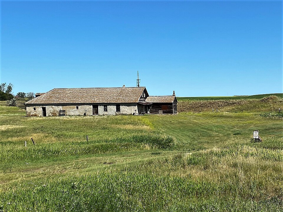
Listed on the National Register of Historic Places in 2008.
From the record
“The John and Fredricka (Roth) Stern Homestead near Mott, North Dakota, United States, was listed on the National Register of Historic Places in 2008. The listing included two contributing buildings and one contributing object on 160 acres (65 ha).”
Wikipedia article John and Fredricka (Roth) Stern Homestead, CC BY-SA 4.0.
One of 6 National Register listings published here for Hettinger County · listed in 2008 · category: Building.
National Register reference number.08000902- the number the National Park Service assigned this property when it was listed, and the key its nomination file is catalogued under at the National Archives.
Fires near this property
13 since 2015
Regional context, not property-specific
evidence. The
federal wildfire occurrence database
lists 13 fires within 5 miles of Stern, John and Fredricka (Roth), Homestead
between 2015 and 2019, burning about 129 acres in total. 2 started naturally. None was recorded as arson.
Distance is straight-line from the map coordinates, so a fire counted
here may appear on a neighbouring settlement's page as well.
Reported cause
Fires
Equipment and vehicle use
4
Missing data/not specified/undetermined
3
Other causes
3
Natural
2
Debris and open burning
1
The most recent of
them, most recent first, with the day each was reported and the service
that recorded it.
Regional context, not property-specific
evidence. The National Weather Service names
Mott, the town this property stands in, in 57 storm reports between 1995 and 2025: 30 hail, 23 thunderstorm wind, 3 tornado, 1 flood.
The reports record 2 deaths. Each account below is quoted exactly as the forecast office
filed it, from the NOAA Storm Events Database, and each date
opens the federal record of that event.
A married couple, both 74 years old, died after driving into the water at a low water crossing. This crossing is locally known to have water running through it during snowmelt and rain events. At the time of the attempted crossing, the water was approximately three to four feet deep over the low water crossing.
The tornado touched down roughly two miles north-northwest of Mott, and tracked to the south-southeast before lifting about one mile east-southeast of town, having passed through the northeast corner of the city. Extensive tree damage occurred in Mott, mostly from high winds associated with the Rear-Flank Downdraft of the tornado. Farm bins were torn from their foundations, a shed was destroyed, and a very large building on the fairgrounds was collapsed. Near the intersection of ND Highway 8 and 21 the roof was torn from a storage facility. A house just east of there, along ND Highway 21, had the attached garage shifted off its foundation and collapsed. Based on the damage done this tornado was rated EF1 with estimated wind speeds around 105 mph.
County officials reported up to baseball size hail in Mott. All vehicles left outside received major damage. The north side of homes sustained siding damage and broken windows. Roofs were also damaged from the large hail.
A large farm building was severely damaged. Part of roof was completely ripped off and blown away. Metal roofing was peeled off on remaining portion of the building. All walls were still standing, although doors were missing.
The wind gust was measured as a tornado passed to the east of the NDAWN (North Dakota Agricultural Weather Network) sensor located on the north side of Mott, just off the west side of ND Highway 8. These winds may have been in conjunction with a rear-flank downdraft.
No historic map-sheet match is published
for this property yet. That does not mean no map exists. This record needs
a coordinate-quality review before it can be joined to a sheet boundary.
Browse the county's mapped places while that work is
pending.
Listed places nearby
1 within 8 miles
Other National Register properties close
enough to walk or drive between, ordered by distance from this one. Both
positions come from the same geocoding pass that matched these properties
to their map sheets.
Listing record. National Park Service National Register of Historic Places, listed-properties dataset, current to 2026-05-22.
Map join. Address geocoded through the United States Census geocoder, then tested against the published boundary of every sheet in the USGS Historical Topographic Map Collection.
How this page is made. Listing fields come from federal records; map-sheet coverage is a labelled coordinate-to-boundary calculation, not a source-field claim.
Wildfire. Short, Karen C. 2022. Spatial wildfire occurrence data for the United States, 1992-2020 [FPA_FOD_20221014]. 6th Edition. Fort Collins, CO: Forest Service Research Data Archive. https://doi.org/10.2737/RDS-2013-0009.6 Collected with United States Government funding and usable without additional permissions or fees.
Storms. NOAA National Centers for Environmental Information, Storm Events Database https://www.ncei.noaa.gov/stormevents/ A work of the United States government, no copyright under 17 U.S.C. 105. Narratives are quoted verbatim from the National Weather Service report and are not edited or summarised.
 Block