 Block
From the record
14 National Register listings published here.
Sources: the county history on the Internet Archive · the National Register database, National Park Service
34 topographic sheets cover 7 settlements here, and 14 properties are on the National Register of Historic Places.
14 National Register listings published here.
Sources: the county history on the Internet Archive · the National Register database, National Park Service
Every property in this county listed on the National Register of Historic Places, with the year it was listed and the federal nomination document.
| Photograph | Property | Type | Listed | Reference |
|---|---|---|---|---|
 | Antelope County Courthouse | building | 1980 | 80002438 |
| Bridge | structure | 1992 | 92000725 | |
| Downtown Neligh Historic District | district | 2017 | 100001796 | |
 | Elkhorn River Bridge | structure | 1992 | 92000771 |
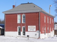 | Gates College Gymnasium | building | 1981 | 81000367 |
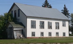 | Kester Planing Mill | building | 2014 | 14000463 |
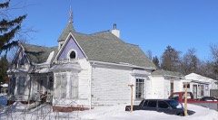 | Maybury-McPherson House | building | 1996 | 96000280 |
| Neligh Carnegie Library | building | 2024 | 100010466 | |
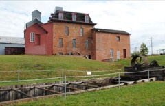 | Neligh Mill | building | 1969 | 69000128 |
| Neligh Mill (Boundary Increase) | district | 2010 | 10000134 | |
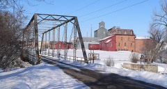 | Neligh Mill Bridge | structure | 1992 | 92000724 |
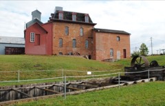 | Neligh Mill Elevators (Boundary Increase) | building | 1983 | 83003982 |
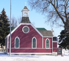 | St. Peter's Episcopal Church | building | 1980 | 80002439 |
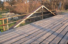 | Verdigris Creek Bridge | structure | 1992 | 92000770 |
Every wildfire the federal occurrence database records inside this county: 63 of them, burning about 2,599 acres. 2 started naturally and 1 was recorded as arson. Each settlement page carries the fires within five miles of it.
| Reported cause | Fires |
|---|---|
| Debris and open burning | 23 |
| Missing data/not specified/undetermined | 18 |
| Equipment and vehicle use | 14 |
| Power generation/transmission/distribution | 4 |
| Natural | 2 |
| Arson/incendiarism | 1 |
| Misuse of fire by a minor | 1 |
The five largest, by the area the report gives. None of them was recorded as arson.
| Date | Cause | Size | Reported by | Name on the report |
|---|---|---|---|---|
| 25 March 2008 | Equipment and vehicle use | 1,100 acres | Nebraska Forest Service | not named |
| 9 November 2010 | Debris and open burning | 1,000 acres | Nebraska Forest Service | not named |
| 30 August 2006 | Missing data/not specified/undetermined | 72 acres | Nebraska Forest Service | not named |
| 24 July 2011 | Equipment and vehicle use | 70 acres | Nebraska Forest Service | not named |
| 26 April 2018 | Debris and open burning | 45 acres | Nebraska Forest Service | not named |
| 2 March 2020 | Debris and open burning | 42 acres | Nebraska Forest Service | not named |
| 31 October 2020 | Debris and open burning | 30 acres | Nebraska Forest Service | not named |
| 8 March 2020 | Missing data/not specified/undetermined | 25 acres | Nebraska Forest Service | not named |
Every settlement page carries the fires within five miles of it - see the settlement index below.
The NOAA Storm Events Database holds 440 reports for this county, causing 1 death, no injuries and about $33,260,750 in recorded property damage. Each settlement page carries the reports that name it.
| Kind of event | Reports |
|---|---|
| Hail | 247 |
| Thunderstorm Wind | 131 |
| Tornado | 34 |
| Flash Flood | 16 |
| Flood | 9 |
| Heavy Rain | 2 |
| Lightning | 1 |
The most serious of them, by death, then injury, then recorded damage. The accounts are quoted exactly as the forecast office filed them.
| When | Event | Place named | Harm | What the report says |
|---|---|---|---|---|
| August 1996 | Thunderstorm Wind | Elgin | 1 killed | no account filed |
| May 1965 | Tornado (F4) | not stated | $25,000,000 | no account filed |
| June 2010 | Flood | Neligh | $4,000,000 | Rainfall of at least 3 to 5 inches fell over much of the upper Elkhorn River basin in the week ending 7am 6/12. This caused record or near record flooding along the Elkhorn River from around Clearwater and Neligh downstream to the Elkhorn's confluence with the Platte River which was prolonged by additional rains the next few days. In Antelope county many gravel roads along the Elkhorn were flooded as was Highway 275 between Neligh and Clearwater. A county board member estimated that one 2 mile stretch of road sustained up to $4 million in damage. Extensive sandbagging around the town of Clearwater saved some homes and businesses from damage, but around 100 still suffered flood damage, and 7 or 8 were probably a total loss. Homes in Neligh were also flooded and at least one water evacuation was made in the Neligh area. The park in Neligh sustained damage and a historic swinging bridge was wrenched loose and washed away by flood waters. For a while water approached the landing strip at the Neligh airport and washed out the road leading to it in several places. Farm fields along the river also sustained major damage to crops and had land covered in sand as the river receded. More than 100,000 acres of agricultural land were affected by flood waters in Antelope county. The Elkhorn River near Neligh reached a record crest of around 15.5 feet at 1230am CDT on June 15th, flood stage is 10 feet. The river at Neligh was above flood stage from around noon on the 13th through early evening on the 17th and the high water cut new channels of the river across Antelope county. |
| May 1962 | Tornado (F3) | not stated | $2,500,000 | no account filed |
| October 1980 | Tornado (F1) | not stated | $250,000 | no account filed |
| May 1980 | Tornado (F1) | not stated | $250,000 | no account filed |
| June 1979 | Tornado (F1) | not stated | $250,000 | no account filed |
| April 1964 | Tornado (F2) | not stated | $250,000 | no account filed |
| June 1996 | Hail | Orchard | $150,000 | no account filed |
| August 2015 | Flash Flood | Tilden | $75,000 | Local law enforcement, as well as local print media, indicated that flash flooding occurred from heavy repeated thunderstorms across parts of Antelope County. The worst of the flooding was near the areas of Oakdale and Elgin. The flooding led to water covering U.S. Highway 275 and State Highway 70 into the morning on the 29th. |
| August 2015 | Flood | Neligh Arpt | $50,000 | Local media indicated that areal flooding continued into the morning on the 28th of August. This included water across U.S. Highway 275 and State Highway 70. In addition numerous farm fields, ditches, and small streams flooded during this time as well. The flooding slowly receded through the morning as the rainfall had ended. |
| August 2009 | Flash Flood | Neligh Arpt | $50,000 | Another round of heavy rain producing thunderstorms caused additional flash flooding across a few county roads from near Clearwater to around Brunswick. Earlier in the evening over 3 inches of rain was reported around Clearwater and an additional inch or two of rain likely fell across the area either causing additional flooding or prolonging flooding that had already been occurring. The flooding caused some crop and culvert damage and also washed gravel off of sections of county roads. |
| August 2009 | Flash Flood | Neligh Arpt | $50,000 | Heavy rain caused ditches and culverts to run full or flood across a few county roads from near Clearwater to around Brunswick. A trained weather spotter near Clearwater measured 3.25 inches of rain in a several hour period through 745 pm CDT and additional heavy rain fell after that time in the area. Besides some crop damage in low areas, gravel was washed off a few county roads and a couple of culverts sustained damage. |
| June 1996 | Hail | Neligh | $50,000 | no account filed |
| June 2000 | Thunderstorm Wind | Elgin | $35,000 | An apparent thunderstorm microburst destroyed a large frame building and did some tree damage west of Elgin. |
| August 2017 | Flash Flood | Neligh | $30,000 | Flooding along Nebraska Highway 14 was reported north of Neligh. |
| June 1996 | Tornado (F0) | Orchard | $25,000 | no account filed |
| July 1986 | Tornado (F1) | not stated | $25,000 | no account filed |
| October 1980 | Tornado (F2) | not stated | $25,000 | no account filed |
| May 1964 | Tornado (F1) | not stated | $25,000 | no account filed |
| June 1960 | Tornado (F2) | not stated | $25,000 | no account filed |
| August 1959 | Tornado | not stated | $25,000 | no account filed |
| October 1956 | Tornado (F1) | not stated | $25,000 | no account filed |
| May 2012 | Flash Flood | Elgin | $15,000 | Rainfall of over 4 inches fell in a few hours in the Elgin area. The heavy rain caused flash flooding over a few roads and at least one bridge east of Elgin. |
| May 2024 | Flash Flood | Clearwater | $10,000 | Law enforcement reported water over several county roads within Antelope County. |
| August 2007 | Flash Flood | Tilden | $10,000 | Rainfall of 2 to 4 inches fell in the morning into the afternoon hours of August 22nd. The heavy rain caused flooding along numerous county roads in the area, mainly in low lying areas. One bridge south of Oakdale was almost completely covered by flood waters. Agricultural lowlands were also flooded. |
| June 2006 | Flash Flood | Neligh | $10,000 | Rainfall of 3.2 inches fell in Neligh in around 1 hour which caused flash flooding on Belmar Creek which flows near the city part. The heavy rain was accompanied by a lot of hail, some up to tennis ball size.One residence and a business near the creek experienced flooding, with water rising up to the door handle on a car, and flood damage or mud reported in a garage and the business. Standing water remained in the park well into the morning hours. |
| June 2000 | Hail | Brunswick | $10,000 | The second HP supercell also produced large hail, this report was near baseball size, about the size that fell the previous hour. The large hail broke a few car windows and damaged the siding of several houses in the area. |
| May 1999 | Tornado (F0) | Orchard | $10,000 | Metal farm grain bins were destroyed. |
| June 1997 | Thunderstorm Wind | Neligh | $6,000 | High winds blew down a large tree which fell on a deck. Also, a center pivot irrigation system was toppled and damaged. |
| June 2000 | Hail | Brunswick | $5,000 | Hail around baseball size destroyed an alfalfa field west of Brunswick and severely damaged a garage roof. |
| August 1996 | Lightning | Clearwater | $5,000 | no account filed |
| October 1996 | Thunderstorm Wind | Clearwater | $3,000 | no account filed |
| May 1977 | Tornado (F1) | not stated | $2,500 | no account filed |
| June 1975 | Tornado (F0) | not stated | $2,500 | no account filed |
| April 1957 | Tornado (F1) | not stated | $2,500 | no account filed |
| April 2000 | Tornado (F0) | Neligh | $2,000 | A narrow tornado touched down just west of Highway 14 north of Neligh and tracked around 4 miles before lifting. There was a very narrow, rapidly spinning white funnel, that never touched down, that was also associated with this tornadic thunderstorm, ahead of the actual tornado. The tornado did minor damage. The damage included 2 broken windows on one house 4 miles north of Neligh, while two doors were ripped off of a machine shed just to the east of that house. A pivot irrigation system was overturned around 5 miles northwest of Neligh. |
| June 2000 | Hail | Royal | $1,000 | The hail cracked the windshields of at least 5 cars in the area. |
| June 1997 | Thunderstorm Wind | Orchard | $1,000 | no account filed |
| June 1977 | Tornado (F0) | not stated | $250 | no account filed |
| June 2025 | Hail | Neligh Arpt | - | Trained spotter report of hail measured up to 1 inch in diameter. |
| June 2025 | Hail | Neligh | - | Delayed public report shared on social media with a hailstone measured at 1 inch in diameter. Time estimated from radar. |
| August 2025 | Hail | Oakdale | - | Public report of hail measured at 1 inch in diameter. |
| July 2025 | Flash Flood | Clearwater | - | During the evening of July 7th, heavy rainfall moved through central Antelope county with rainfall rates of 1-3 inches per hour at times with an estimated 1-3 inches of total rainfall. This led to flash flooding with law enforcement reporting water covering about 40 yards of the east bound land of Highway 275 heading into Clearwater, NE. |
| July 2025 | Hail | Clearwater | - | Fire department/rescue report of hail measured up to quarter sized, mixed in with mostly penny to nickel sized hail. |
| July 2025 | Thunderstorm Wind | Tilden | - | Video of approximately 18 inch diameter tree limb down. Time estimated from radar. Wind gusts estimated at 60 to 65 mph. |
| July 2025 | Thunderstorm Wind | Elgin | - | Personal weather station measured wind gust of 58 mph. |
| July 2025 | Hail | Neligh | - | Fire department report of hail estimated up to 1.75 in. in diameter. |
| August 2024 | Hail | Tilden | - | A storm chaser reported quarter sized hail. |
| July 2024 | Hail | Elgin | - | A storm chaser reported quarter sized hail. Time of the report was adjusted slightly to better align with radar data and account for the delay between the actual event and when the report was called in. |
| July 2024 | Hail | Neligh | - | A trained spotter reported quarter sized hail. |
| May 2023 | Hail | Neligh Arpt | - | Public reported multiple rounds of hail with the largest being ping pong ball sized hail. |
| May 2022 | Thunderstorm Wind | Neligh | - | Public reported large trees broken and uprooted an da tipped wooden playground. |
| May 2022 | Hail | Royal | - | Trained spotter reported dime to quarter size hail. |
| May 2022 | Thunderstorm Wind | Clearwater | - | Personal weather station measured a peak wind gust of 61 mph. |
| May 2022 | Thunderstorm Wind | Oakdale | - | Emergency manager reported significant damage to a fertilizer plant. |
| May 2022 | Hail | Brunswick | - | Public report from mPing for 1.5 inch hail. |
| July 2022 | Thunderstorm Wind | Royal | - | COOP observer reported small branches down and a screen door blown off of its hinges. |
| July 2022 | Thunderstorm Wind | Orchard | - | NWS Employee reported widespread tree damage northwest of Clearwater. |
| June 2021 | Hail | Brunswick | - | Trained spotter reported hail covering the ground with 1 inch stones being the largest. |
The Survey's mineral resources record lists 4 workings inside this county. 3 still produce and 1 is closed or unrecorded. Each settlement page carries the workings within five miles of it.
| Commodity | Workings |
|---|---|
| Sand and Gravel, Construction | 4 |
The least common of them first, because a county's hundredth gravel pit says nothing its first ten did not.
| Where | Site | Commodity | Status | Recorded |
|---|---|---|---|---|
| Coutts and Sons Co | Sand and Gravel, Construction | Producer | ||
| Midwest Bridge & Const Co Pit #15 | Sand and Gravel, Construction | Producer | ||
| Plainview Sand and Gravel | Sand and Gravel, Construction | Past Producer | ||
| Reigle Company | Sand and Gravel, Construction | Producer |
One book written about this county, cut here where the book itself is cut, at its printed chapters: 45 chapters in all. Every chapter is public domain, machine-read from the scan and reproduced complete. A chapter already given under one of the county's towns is not repeated in this list.
| Chapter | Length |
|---|---|
| Chapter 1 | 1,573 words |
| Chapter 2 | 2,057 words |
| Chapter 3 | 1,718 words |
| Chapter 4 | 1,698 words |
| Chapter 5 | 1,864 words |
| Chapter 6 | 1,656 words |
| Chapter 7 | 1,634 words |
| Chapter 8 | 1,471 words |
| Chapter 9 | 1,650 words |
| Chapter 10 | 1,499 words |
| Chapter 11 | 1,546 words |
| Chapter 12 | 1,366 words |
| Chapter 13 | 1,495 words |
| Chapter 14 | 1,372 words |
| Chapter 15: Doc" Middleton Makes His Appearance the Niobrara | 1,733 words |
| Chapter 16 | 1,762 words |
| Chapter 17 | 1,720 words |
| Chapter 18 | 2,019 words |
| Chapter 19 | 1,926 words |
| Chapter 20 | 1,720 words |
| Chapter 21 | 1,722 words |
| Chapter 22 | 2,133 words |
| Chapter 23 | 1,730 words |
| Chapter 24 | 1,745 words |
| Chapter 25 | 1,594 words |
| Chapter 26 | 1,701 words |
| Chapter 27 | 1,086 words |
| Chapter 28 | 1,742 words |
| Chapter 29 | 2,177 words |
| Chapter 30 | 1,164 words |
| Chapter 31 | 2,453 words |
| Chapter 32 | 2,053 words |
| Chapter 33 | 4,005 words |
| Chapter 34 | 2,422 words |
| Chapter 35 | 2,014 words |
| Chapter 36 | 1,257 words |
| Chapter 37 | 1,451 words |
| Chapter 38 | 1,811 words |
| Chapter 39 | 1,262 words |
| Chapter 40 | 1,431 words |
| Chapter 41 | 1,501 words |
| Chapter 42 | 1,884 words |
| Chapter 43 | 2,585 words |
| Chapter 44 | 1,248 words |
| Chapter 45 | 1,311 words |
Named settlements recorded in the Geographic Names Information System, each with the topographic sheets covering it. Villages, hamlets and abandoned places alike. Each is shown with the nearest named watercourse or landform and the survey quadrangle it falls on.