 Block
From the record
14 National Register listings published here, 1 of them a National Historic Landmark.
Sources: the National Register database, National Park Service
24 topographic sheets cover 9 settlements here, and 14 properties are on the National Register of Historic Places.
14 National Register listings published here, 1 of them a National Historic Landmark.
Sources: the National Register database, National Park Service
Every property in this county listed on the National Register of Historic Places, with the year it was listed and the federal nomination document.
| Photograph | Property | Type | Listed | Reference |
|---|---|---|---|---|
 | Army Theatre | building | 1988 | 88000930 |
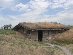 | Bordeaux Trading Post | building | 1972 | 72000746 |
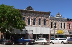 | Chadron Commercial Historic District | district | 2007 | 06001059 |
 | Chadron Public Library | building | 1990 | 90000985 |
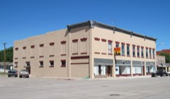 | Co-operative Block Building | building | 1985 | 85002146 |
 | Crites Hall | building | 1983 | 83001083 |
 | Dawes County Courthouse | district | 1990 | 90000975 |
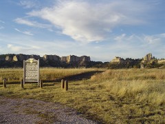 | Fort Robinson and Red Cloud Agency | district | 1966 | 66000442 |
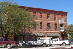 | Hotel Chadron | building | 2002 | 02000859 |
 | Library | building | 1983 | 83001084 |
 | Miller Hall | building | 1983 | 83001085 |
 | Sparks Hall | building | 1983 | 83001086 |
 | US Post Office-Crawford | building | 1992 | 92000477 |
 | Edna Work Hall | building | 1983 | 83001087 |
Every wildfire the federal occurrence database records inside this county: 240 of them, burning about 92,713 acres. 131 started naturally and none was recorded as arson. Each settlement page carries the fires within five miles of it.
| Reported cause | Fires |
|---|---|
| Natural | 131 |
| Equipment and vehicle use | 24 |
| Missing data/not specified/undetermined | 23 |
| Railroad operations and maintenance | 19 |
| Recreation and ceremony | 16 |
| Debris and open burning | 12 |
| Power generation/transmission/distribution | 6 |
| Smoking | 4 |
| Fireworks | 3 |
| Firearms and explosives use | 1 |
| Other causes | 1 |
The five largest, by the area the report gives. None of them was recorded as arson.
| Date | Cause | Size | Reported by | Name on the report |
|---|---|---|---|---|
| 28 August 2012 | Natural | 56,471 acres | Nebraska National Forest | WEST ASH |
| 28 July 2006 | Natural | 17,899 acres | Nebraska National Forest | SPOTTED TAIL #3 |
| 26 July 2006 | Natural | 10,079 acres | Nebraska National Forest | ROBERTS TRACT |
| 21 July 2012 | Natural | 2,300 acres | Nebraska National Forest | ASH CREEK |
| 15 September 2015 | Missing data/not specified/undetermined | 1,788 acres | Nebraska Forest Service | LONE TREE |
| 6 September 2000 | Natural | 1,278 acres | Nebraska National Forest | SAWLOG |
| 27 August 2010 | Equipment and vehicle use | 407 acres | Nebraska National Forest | ARISTROCRAT |
| 28 August 2020 | Natural | 391 acres | Nebraska National Forest | ARISTOCRAT |
Every settlement page carries the fires within five miles of it - see the settlement index below.
The NOAA Storm Events Database holds 554 reports for this county, causing no deaths, 21 injuries and about $2,085,370 in recorded property damage. Each settlement page carries the reports that name it.
| Kind of event | Reports |
|---|---|
| Hail | 298 |
| Thunderstorm Wind | 198 |
| Tornado | 36 |
| Heavy Rain | 6 |
| Flash Flood | 5 |
| Funnel Cloud | 5 |
| Flood | 3 |
| Lightning | 2 |
| Wildfire | 1 |
The most serious of them, by death, then injury, then recorded damage. The accounts are quoted exactly as the forecast office filed them.
| When | Event | Place named | Harm | What the report says |
|---|---|---|---|---|
| June 1986 | Hail | not stated | 20 hurt | no account filed |
| July 2001 | Thunderstorm Wind | Crawford | 1 hurt, $100,000 | Estimated 70 mph thunderstorm winds uprooted some trees and knockedout power in Crawford. |
| August 1996 | Lightning | Crawford | $400,000 | no account filed |
| July 2010 | Thunderstorm Wind | Chadron | $300,000 | Hail damage to many cars, shattered windows at Walmart parking lot. Many business signs were blown out or had holes in them from the hail. Many street signs and several power lines were down. Three trailer homes sustained major damage. One was flipped on its roof and the other two were blown to pieces into a nearby field. Orange construction barriers tossed 0.75 miles from the highway. |
| June 1983 | Tornado (F2) | not stated | $250,000 | no account filed |
| June 1960 | Tornado (F2) | not stated | $250,000 | no account filed |
| June 1960 | Tornado (F0) | not stated | $250,000 | no account filed |
| July 2010 | Hail | Chadron | $200,000 | Many business signs with holes in them. Windows shattered in the Walmart parking lot. Hail damage to many cars. |
| July 2009 | Hail | Whitney | $50,000 | Hail sizes ranged from around 1 to 2 inches in diameter near Whitney to over 2 inches in diameter north of Chadron. The large hail broke several auto and home windows. Wind gust to 66 mph was also recorded by ASOS at the Chadron airport. |
| July 1994 | Hail | Chadron | $50,000 | Large hail damaged a home, outbuildings, a car and crops. |
| July 2001 | Hail | Chadron | $50,000 | no account filed |
| August 1996 | Lightning | Chadron | $50,000 | no account filed |
| August 1982 | Tornado (F1) | not stated | $25,000 | no account filed |
| June 1982 | Tornado (F2) | not stated | $25,000 | no account filed |
| July 2004 | Hail | Chadron | $20,000 | 2 inch diameter hail and tree limbs down at Chadron State Park. |
| August 1999 | Hail | Chadron | $10,000 | no account filed |
| June 1998 | Hail | Crawford | $6,500 | A storm produced walnut size hail in Crawford. |
| May 1998 | Hail | Marsland | $6,000 | A storm produced golf ball size hail in Marsland. |
| July 1998 | Hail | Whitney | $6,000 | A storm produced golfball size hail in Whitney. |
| June 2009 | Thunderstorm Wind | Whitney | $5,000 | Strong wind gusts recorded at the Chadron airport with a roof blown off a renovated 2 story barn near Whitney Lake. |
| August 1998 | Hail | Chadron | $5,000 | A storm produced golfball size hail in Chadron State Park. |
| July 1998 | Hail | Whitney | $5,000 | A storm produced golf ball size hail 3 miles west of Whitney. |
| June 1998 | Hail | Chadron | $4,000 | A strom produced ping pong ball size hail 10 miles southwest of Chadron. |
| May 1998 | Hail | Chadron | $3,000 | A storm produced quarter size hail at the Chadron State Park. |
| July 1985 | Tornado (F1) | not stated | $2,500 | no account filed |
| April 1975 | Tornado (F1) | not stated | $2,500 | no account filed |
| May 1963 | Tornado (F1) | not stated | $2,500 | no account filed |
| June 1960 | Tornado (F1) | not stated | $2,500 | no account filed |
| July 1958 | Tornado (F0) | not stated | $2,500 | no account filed |
| July 2010 | Hail | Marsland | $1,000 | Golfball and larger. Broke windows on the north side of house. |
| June 2010 | Flash Flood | (Cdr)Chadron Airport | $1,000 | Report of 6-8 inches of water over 5th Street in Chadron. Canal out of its banks and flowing rapidly. |
| May 1958 | Tornado (F0) | not stated | $250 | no account filed |
| July 1989 | Tornado (F0) | not stated | $30 | no account filed |
| June 1983 | Tornado (F0) | not stated | $30 | no account filed |
| June 1982 | Tornado (F0) | not stated | $30 | no account filed |
| June 1982 | Tornado (F0) | not stated | $30 | no account filed |
| June 2025 | Hail | (Cdr)Chadron Airport | - | Trained spotter reported quarter sized hail. |
| August 2025 | Thunderstorm Wind | (Cdr)Chadron Airport | - | KCDR reported a wind gust of 63 mph with sustained winds around 40 mph at the time. |
| April 2025 | Thunderstorm Wind | Chadron | - | Chadron Airport reported a wind gust of 58 MPH AT 8:57 PM. |
| April 2025 | Hail | Box Butte Reservoir | - | Quarter-size hail reported by the public on social media. |
| August 2025 | Thunderstorm Wind | (Cdr)Chadron Airport | - | KCDR gusted 51 kts at 720pm. |
| September 2025 | Thunderstorm Wind | (Cdr)Chadron Airport | - | ASOS station at Chadron Chadron Airport. |
| June 2025 | Hail | (Cdr)Chadron Airport | - | Trained spotter reported ping pong ball sized hail just west of Chadron Nebraska. |
| June 2025 | Thunderstorm Wind | (Cdr)Chadron Airport | - | Reported at Chadron Airport ASOS station. |
| June 2025 | Thunderstorm Wind | Chadron | - | Report from Kings Canyon RAWS site. |
| July 2024 | Thunderstorm Wind | (Cdr)Chadron Airport | - | Chadron Airport ASOS station (KCDR) measured wind gust. |
| July 2024 | Thunderstorm Wind | (Cdr)Chadron Airport | - | Chadron Airport ASOS station (KCDR) measured maximum wind gust. |
| July 2024 | Thunderstorm Wind | Chadron | - | RAWS mesonet station Kings Canyon (HRSN1) measured wind gust 7 miles south of Chadron. |
| June 2024 | Hail | Box Butte Reservoir | - | The public reported golf ball sized hail 18 miles N of Hemingford. |
| June 2024 | Thunderstorm Wind | Horn | - | A trained weather spotter reported wind gusts up to 60 MPH. |
| June 2024 | Thunderstorm Wind | (Cdr)Chadron Airport | - | The Chadron Airport ASOS recorded a wind gust to 61 MPH. |
| September 2024 | Thunderstorm Wind | (Cdr)Chadron Airport | - | Wind gust of 59 MPH reported at Chadron ASOS, 4 miles west of Chadron Nebraska. |
| July 2023 | Thunderstorm Wind | (Cdr)Chadron Airport | - | Chadron Airport ASOS station KCDR measured maximum wind gust. |
| July 2023 | Hail | Chadron | - | Quarter sized hail reported by spotter 4 miles east southeast of Chadron. Lasted one minute. |
| July 2023 | Hail | Crawford | - | Report received of dented cars and 1.25 inch hail. |
| July 2023 | Hail | Chadron | - | Report from public received on Facebook of ping pong ball sized hail north side of Chadron. |
| July 2023 | Hail | Chadron | - | Quarter sized hail reported 1 mile west of Chadron. |
| June 2023 | Hail | Chadron | - | Quarter sized hail was reported 3 miles S of Chadron. |
| June 2023 | Hail | Chadron | - | Quarter sized hail was reported in the city of Chadron. |
| July 2023 | Hail | Chadron | - | Hail reported by spotter 5 miles north northwest of Chadron. Quarters to half dollar size reported. |
Named settlements recorded in the Geographic Names Information System, each with the topographic sheets covering it. Villages, hamlets and abandoned places alike. Each is shown with the nearest named watercourse or landform and the survey quadrangle it falls on.
Precinct 06 · 69337 · On Lone Tree Creek · Chadron West quadrangle
9 sheets, 1955 to 1986