Block
From the record
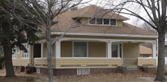
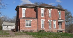
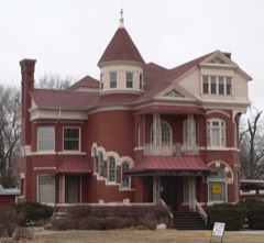
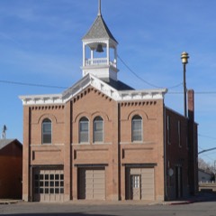
23 National Register listings published here.
Sources: the National Register database, National Park Service
31 topographic sheets cover 15 settlements here, and 23 properties are on the National Register of Historic Places.
23 National Register listings published here.
Sources: the National Register database, National Park Service
Every property in this county listed on the National Register of Historic Places, with the year it was listed and the federal nomination document.
Every wildfire the federal occurrence database records inside this county: 197 of them, burning about 591 acres. 1 started naturally and 5 were recorded as arson. Each settlement page carries the fires within five miles of it.
| Reported cause | Fires |
|---|---|
| Debris and open burning | 83 |
| Missing data/not specified/undetermined | 47 |
| Equipment and vehicle use | 34 |
| Recreation and ceremony | 8 |
| Railroad operations and maintenance | 6 |
| Smoking | 5 |
| Arson/incendiarism | 5 |
| Power generation/transmission/distribution | 4 |
| Fireworks | 3 |
| Natural | 1 |
| Misuse of fire by a minor | 1 |
The five largest, by the area the report gives. None of them was recorded as arson.
| Date | Cause | Size | Reported by | Name on the report |
|---|---|---|---|---|
| 21 March 2009 | Debris and open burning | 160 acres | Nebraska Forest Service | not named |
| 1 May 2010 | Recreation and ceremony | 80 acres | Nebraska Forest Service | not named |
| 30 April 2018 | Recreation and ceremony | 35 acres | Nebraska Forest Service | not named |
| 13 April 2011 | Debris and open burning | 21 acres | Nebraska Forest Service | not named |
| 27 April 2018 | Debris and open burning | 20 acres | Nebraska Forest Service | not named |
| 9 July 2020 | Debris and open burning | 20 acres | Nebraska Forest Service | not named |
| 21 February 2017 | Debris and open burning | 20 acres | Nebraska Forest Service | not named |
| 11 April 2018 | Debris and open burning | 20 acres | Nebraska Forest Service | not named |
Every settlement page carries the fires within five miles of it - see the settlement index below.
The NOAA Storm Events Database holds 611 reports for this county, causing no deaths, 17 injuries and about $16,507,500 in recorded property damage. Each settlement page carries the reports that name it.
| Kind of event | Reports |
|---|---|
| Hail | 274 |
| Thunderstorm Wind | 224 |
| Flood | 48 |
| Tornado | 31 |
| Flash Flood | 22 |
| Funnel Cloud | 6 |
| Lightning | 3 |
| Heavy Rain | 3 |
The most serious of them, by death, then injury, then recorded damage. The accounts are quoted exactly as the forecast office filed them.
| When | Event | Place named | Harm | What the report says |
|---|---|---|---|---|
| May 1962 | Tornado (F2) | not stated | 5 hurt, $25,000 | no account filed |
| June 1953 | Tornado (F0) | not stated | 5 hurt | no account filed |
| May 1980 | Tornado (F1) | not stated | 2 hurt, $2,500,000 | no account filed |
| April 2013 | Thunderstorm Wind | Bay State | 2 hurt | A NWS storm survey estimated that straight line winds reached an estimated 100 mph near North Bend. Twenty-one cars of a 138-car empty coal train derailed west of town and an unsecured mobile home was destroyed injuring 2 people. Trees were snapped in the area and center pivots were flipped along the path of the storm that began its damage in Colfax county to the west and continued east to just west of Fremont. |
| August 2004 | Thunderstorm Wind | Fremont | 2 hurt | Thunderstorm wind gusts estimated at over 60 mph downed many large cottonwood trees in the Big Island area along the Platte River south of Fremont. Some of the trees fell on mobile homes, vehicles and recreational vehicles causing extensive damage. A semitrailer truck was overturned at the intersection of Highways 77 and 30 in town slightly injuring 2 people. |
| April 1994 | Thunderstorm Wind | Fremont | 1 hurt, $50,000 | Thunderstorms produced a wind gust of 78 mph at the Fremont airport. The wind blew off part of the roof of an apartment complex in Fremont. Several homes had shingles blown off. Some power lines and power poles were blown down by the wind. A man was injured by flying debris that broke through the window of his minivan. |
| June 1996 | Hail | Hooper | $10,000,000 | no account filed |
| February 2021 | Flood | Fremont Arpt | $500,000 | Emergency management reported flooding due to an ice jam in low lying areas near South Ridge Road at Ridgeland Avenue and Big Island Road. |
| March 2021 | Flood | Fremont Arpt | $500,000 | Emergency management reported flooding due to an ice jam in low lying areas near South Ridge Road at Ridgeland Avenue and Big Island Road. |
| June 1998 | Tornado (F1) | Snyder | $500,000 | Several outbuildings and grain bins destroyed. A house was destroyed. A machine shed destroyed. A chimney was blown off the back porch of a house. Hog barn destroyed. |
| August 2007 | Tornado (EF1) | Uehling | $300,000 | A survey team from the National Weather Service office in Valley concluded that a tornado occurred from about 4 miles west of Uehling to just east of Highway 77 in Uehling. The maximum path width was around 1500 feet. The tornado was rated an EF-1 on the Enhanced Fujita Scale with maximum winds around 90 mph. According to Emergency Management Officials, 10 homes sustained minor damage due to falling tree limbs. Homes and buildings lost a considerable number of shingles. Immediately west of Uehling, there was damage to bleachers and fencing at a ballpark, numerous large tree limbs were blown down, and a few trees were uprooted or snapped at the base of the tree trunk. There were numerous patches of flattened corn west of the park area. |
| June 1996 | Tornado (F1) | Scribner | $300,000 | no account filed |
| June 2011 | Tornado (EF1) | Fremont | $280,000 | A NWS survey team determined a tornado tracked through the eastern and northern sections of Fremont before lifting a little north northeast of town. The tornado touched down near the intersection of old Highway 275 and Morningside Road and progressed north generally east of Lincoln Street. The tornado uprooted or snapped numerous trees, damaged a few homes and severely damaged a garage along its path. One vehicle was flipped over while other vehicles and homes sustained damage from fallen trees. The YMCA sustained major roof damage. A few power poles were snapped near and north of 23rd Street and center pivot was damaged on the north side of town before the tornado lifted. The path length was determined to be a little over 6 miles while the average width of the damage path was around 700 yards. As of late June the damage in town was estimated at a little over a quarter of million dollars. |
| July 1977 | Tornado | not stated | $250,000 | no account filed |
| June 2010 | Flood | Crowell | $200,000 | Rainfall of at least 3 to 5 inches fell over much of the upper Elkhorn River basin in the week ending 7am 6/12, including 1 to 2 inch 24 hour amounts ending 7am the 12th. This caused record or near record flooding along the Elkhorn River from around Clearwater and Neligh downstream to the Elkhorn's confluence with the Platte River. The flooding was prolonged by additional rains the week after 6/12. In Dodge county many gravel roads along the Elkhorn were flooded as was Highway 91 near Nickerson which suffered damage. Highway 275 near Scribner was closed for around week, at first because a temporary dike is used there when the river gets above 18 feet and then because water started flowing across the road. Scribner itself was spared from most of the flooding because of the dike. Highways 77 and 30 north and east of Fremont were also closed for a while because of flood waters. Flood waters washed a car off a county road near Winslow, although the occupants escaped unharmed. Farm fields along the Elkhorn River were flooded and farm houses along it were surrounded by flood waters and a few sustained flood damage, as did some cabins. The river near Hooper reached a little over 18.5 feet on 6/18, flood stage is 14 feet, and the record stage is around 19 feet. Logan Creek near Uehling also experienced some flooding, especially on 6/12 and 6/13, cresting nearly a foot above its 18 feet flood stage early on 6/13. Water along Logan Creek flooded the Uehling Park and surrounding fields and county roads. Emergency management said there was at least $100,000 in damage to public roads alone in Dodge and Washington counties. |
| May 2024 | Flash Flood | Fremont Arpt | $150,000 | Several rounds of thunderstorms training over Fremont resulted in flash flooding across the city during the early morning hours of the 21st. The first report of flooding in the city came into the office at 3:47 in the morning. Just before 5 in the morning, fast-flowing water was observed over East 11th Street. Flooded roadways continued to be reported through the morning hours between Fremont and south into Saunders and northwest Douglas Counties. |
| April 1999 | Tornado (F1) | North Bend | $125,000 | This tornado, which caused extensive damage to Morse Bluff in Saunders county crossed the Platte River just south of North Bend and damaged 14 houses in North Bend, 2 heavily. |
| June 2010 | Flood | Snyder | $100,000 | Several periods of heavy rain fell across the Pebble Creek basin from June 8th through the 14th which produced a prolonged period of high water and flooding along Pebble Creek near and west of Scribner. The high water flooded and closed sections of Highways 275 and 91 near town as well as county roads and farmland in the area. Pebble Creek near Scribner crested at just over 23 feet during the late afternoon of June 10th, flood stage is 18 feet. The creek near Scribner was above flood stage most of the period from around noon on the 10th until late in the afternoon on June 12th, although a few times during this stretch the creek dropped below flood stage. |
| June 2010 | Flood | Nickerson | $100,000 | Several periods of heavy rain fell across the Maple Creek basin from June 8th through the 14th which produced a prolonged period of flooding along Maple Creek near and northwest of Nickerson. The high water backed up along a railroad track and closed Highway 91 leading into Nickerson for a while. Farmland and county roads near the creek were flooded causing damage to both. Maple Creek near Nickerson crested around 15.5 feet during the early morning of June 12th and was at or above its 10 foot flood stage from the afternoon of June 10th through late in the evening on the 14th. |
| September 2007 | Lightning | Fremont | $100,000 | Lightning struck the Fremont County Sheriff's Department communication tower causing severe damage to nearly everthing electrical in the building. Total damage to repair or replace the items was estimated at around $100,000. |
| August 1999 | Flash Flood | Uehling | $100,000 | Rainfall of 3 to 5 inches caused extensive street flooding in Fremont, Uehling and Winslow with Clark, Logan and Bell Creeks among those which flooded. Water was reported curb to curb in Uehling with many basements flooded. Several long-time residents noted that the flood waters of Bell Creet and its tributaries were even higher than the 1944 flood. |
| July 2011 | Lightning | Fremont | $75,000 | Lightning from a thunderstorm caused a fire which in turn caused significant damage to a house in Fremont including burning most of the roof away. |
| March 2010 | Flood | Fremont Arpt | $50,000 | An ice jam that apparently broke free around the North Bend area moved downstream and temporarily caused flooding in the Big Island area a little southwest of Fremont. Large chunks of ice and flood waters caused damage to several homes along the river in the Big Island area and a frontage road that ran through the Fremont Lakes areas was flooded. Six to 10 people had to be evacuated by boat from the rising waters. |
| June 1996 | Tornado (F1) | Fremont | $50,000 | no account filed |
| March 2010 | Flood | Fremont Arpt | $25,000 | An ice jam around the North Bend area caused flooding of agricultural lowlands from around North Bend downstream to around Fremont. In addition, several homes were threatened by the flood waters, and a few county roads were flooded. Some water damage was likely noted due to rising ground water or backing up of sewers. This ice jam finally broke loose on March 10th which caused additional jamming and flooding around the Big Island area near Fremont on the 10th. The river at North Bend reached an ice impacted reading of nearly 11 feet during the morning of March 10th, flood stage is 8 feet. |
| August 1999 | Lightning | Hooper | $25,000 | Lightning struck a cottonwood tree which then fell through the Hooper Historical Building, coming down in the middle of the building. The roof was completely destroyed. |
| April 1977 | Tornado | not stated | $25,000 | no account filed |
| May 1959 | Tornado (F1) | not stated | $25,000 | no account filed |
| May 1959 | Tornado (F1) | not stated | $25,000 | no account filed |
| March 2009 | Flood | Bay State | $20,000 | An ice jam about 3/4 mile in length formed about 1 to 2 miles upstream of North Bend. The ice jam caused flooding along the Platte River in the vicinity of McGinns Lake area. The flooding surrounded several lake homes and flooded a few rooms of at least one home. |
| May 2000 | Thunderstorm Wind | Fremont | $20,000 | Tree limbs were downed by thunderstorm winds estimated at 60 mph. The fallen large limbs blocked a few roads and downed several power lines in Fremont. |
| June 2010 | Flash Flood | Crowell | $15,000 | Heavy rain of 2 inches or more in an hour or so produced flash flooding along Pebble Creek and its tributaries which brought 2 to 3 feet of water across the Junction of Highways 91 and 275 northwest of Scribner. The rain had fallen on saturated soils due to rains earlier in the week and flooding persisted for an extended period due to additional rains after the 10th. |
| June 2014 | Flood | Nickerson | $10,000 | Heavy rain caused Maple Creek to flood around and west of Nickerson. The creek at Nickerson reached a crest a little over 15 feet during the afternoon of June 21, flood stage is 11.5 feet. The flooding crossed a few county roads in the area and also flooded farmland near the creek. |
| June 2010 | Flood | North Bend | $10,000 | Rainfall of at least 3 to 5 inches fell over much central Nebraska the week ending 7am 6/12, with additional heavy rains the following several days. All of this water eventually worked into the Platte River causing it to rise above flood stage from around North Bend downstream to its confluence with the Missouri River. At North Bend the river crested a little below 8.5 feet early in the morning on 6/14, flood stage is 8 feet. The river was above flood stage near North Bend for most of the period from the afternoon of 6/13 through the morning of 6/16. The flooding mainly affected agricultural bottom lands along the river although some county roads and recreation areas were under water for a while. |
| March 2010 | Flood | Fremont | $10,000 | Snow melt and some light rain caused Rawhide Creek to flood low areas along it. A few driveways and county roads also experienced some flooding when water backed into ditches in the area. The high water caused some sewers to back up in some homes in the area. |
| June 2014 | Flood | Scribner | $5,000 | A band of 2 to 3 inches of rain fell across the Pebble Creek basin causing it to flood for the second time in around a week. The creek near Scribner reached a crest around 22.3 feet during the afternoon of June 27th, flood stage is 18 feet. The flooding impacted county roads and farmland near the stream. |
| June 2014 | Flood | Scribner Arpt | $5,000 | Heavy rain on June 20th caused Pebble Creek near Scribner to flood. The creek reached a crest around 20.65 feet during the morning of June 21, flood stage is 18 feet. The flooding impacted a few county roads and farmland in the area. |
| June 2011 | Flood | Ridgeley | $5,000 | A line of heavy rain producing thunderstorms dropped 2 to 3 inches of rain across the Maple Creek basing during the early morning hours of 6/20. The heavy rain caused Maple Creek to flood farm fields and a few county roads later that day, especially near and west of Nickerson where the creek climbed about a foot above its 10 foot flood stage. |
| June 1995 | Thunderstorm Wind | Uehling | $5,000 | Damage to trees and power lines. |
| June 1996 | Thunderstorm Wind | Snyder | $5,000 | no account filed |
| May 1982 | Tornado (F2) | not stated | $2,500 | no account filed |
| June 1963 | Tornado (F1) | not stated | $2,500 | no account filed |
| June 2014 | Flood | Uehling | $2,000 | Heavy rain caused Logan Creek to climb slightly above it's 18 foot flood stage around the Uehling area from the afternoon of June 15 into the morning hours of the 16th. The flooding mainly impacted some farmland and a few roads near the creek. |
| June 2010 | Flood | Webster | $2,000 | Rainfall of 2 to 3 inches fell across parts of the Maple Creek basin from late on June 7 through June 8th. This rain fell on saturated soil and caused Maple Creek to flood around the Nickerson area. There the creek reached around 13.3 feet during the evening of June 8, flood stage is 10 feet. The creek was above flood stage near Nickerson from the afternoon of June 8 until the early morning hours of June 9th. The water mainly impacted agricultural lowlands near the creek. |
| April 1999 | Thunderstorm Wind | Fremont | $2,000 | Probable thunderstorm microburst hit the YMCA's skateboard park flipping picnic tables and a skating ramp and damaged a pickup truck. |
| July 1997 | Thunderstorm Wind | Fremont | $2,000 | Strong winds blew tree branches down onto a house. |
| February 2011 | Flood | Crowell | $1,000 | Ice jam flooding was observed along the Elkhorn River from around the West Point area downstream to around Crowell. Although the flooding was confined mostly to agricultural lowlands along the river, the flood waters did cross Highway 275 near Crowell prompting its closure for around a week. The main ice jam was 1 mile upstream to 2 miles downstream of the Highway 32 bridge near West Point. The jam caused the Elkhorn River at West Point to reach a crest a little over 14 feet on Feb. 22nd, flood stage is 12 feet. |
| June 2000 | Thunderstorm Wind | North Bend | $1,000 | Thunderstorm winds caused a large tree limb to fall on a car causing some damage. |
| June 1997 | Hail | Dodge | $1,000 | Hail broke some windows in a home near the Dodge-Cuming county line |
| June 1997 | Thunderstorm Wind | Dodge | $1,000 | Thunderstorm winds blew a door off a machine shed on a farm on the Dodge-Cuming county line. |
| June 1989 | Tornado (F0) | not stated | $250 | no account filed |
| July 1953 | Tornado | not stated | $250 | no account filed |
| April 2026 | Hail | Uehling | - | Public report of hail estimated up to 1 inch in diameter in Uehling, NE. |
| April 2026 | Hail | Winslow | - | Trained spotter report of hail measured at 1.00 inch in diameter. |
| March 2025 | Thunderstorm Wind | Scribner | - | Trained spotter report of 2diameter tree limbs falling, with an estimated wind speed of 50-60 mph. |
| March 2025 | Thunderstorm Wind | Hooper | - | Estimated 50 to 60 mph wind gusts from Hooper Police. |
| May 2025 | Tornado (EF1) | Bay State | - | A tornado developed on the Platte River just west of County Road 3 at 4:29 PM CST. The tornado moved east on the river before coming on the north shore where it damaged some campers and mobile homes, as well as cottonwood and maple trees. This included one very large cottonwood tree which was uprooted and fell on to a home. The life cycle of the tornado was evaluated using time stamped video from storm chasers. The final part of the track was intermittent, and the entire tornado lasted for approximately 2 minutes and 30 seconds. Damage to trees and homes indicated a narrow swath of peak estimated wind speed of 90 to 100 mph. |
| May 2025 | Hail | Bay State | - | Amateur radio report of hail measured up to 1.75 in diameter. |
| May 2025 | Hail | Ridgeley | - | Public report of hail estimated up to 1.75 in diameter. |
| May 2025 | Hail | Hooper | - | Public report of hail measured up to 1.75 in diameter. Report received via mPING. |
The Survey's mineral resources record lists 1 working inside this county. It still produces. Each settlement page carries the workings within five miles of it.
| Commodity | Workings |
|---|---|
| Sand and Gravel, Construction | 1 |
The least common of them first, because a county's hundredth gravel pit says nothing its first ten did not.
| Where | Site | Commodity | Status | Recorded |
|---|---|---|---|---|
| No.5 Pasco Pit | Sand and Gravel, Construction | Producer |
Named settlements recorded in the Geographic Names Information System, each with the topographic sheets covering it. Villages, hamlets and abandoned places alike. Each is shown with the nearest named watercourse or landform and the survey quadrangle it falls on.
Pleasant Valley township · 68057 · Snyder quadrangle
8 sheets, 1955 to 1986
No longer a settlement
North Bend city · 68649 · Near Bignells Island · North Bend quadrangle
11 sheets, 1899 to 1982
The vanished settlements of Dodge County: the places named above that are no longer on the map.