 Block
From the record
3 National Register listings published here.
Sources: the National Register database, National Park Service
14 topographic sheets cover 6 settlements here, and 3 properties are on the National Register of Historic Places.
3 National Register listings published here.
Sources: the National Register database, National Park Service
Every property in this county listed on the National Register of Historic Places, with the year it was listed and the federal nomination document.
| Photograph | Property | Type | Listed | Reference |
|---|---|---|---|---|
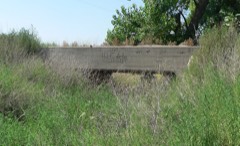 | Bridge | structure | 1992 | 92000714 |
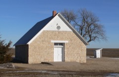 | St. Paul's Methodist Protestant Church | building | 1979 | 79001446 |
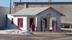 | Weyl Service Station | building | 2002 | 02000768 |
Every wildfire the federal occurrence database records inside this county: 63 of them, burning about 2,286 acres. 8 started naturally and none was recorded as arson. Each settlement page carries the fires within five miles of it.
| Reported cause | Fires |
|---|---|
| Debris and open burning | 20 |
| Equipment and vehicle use | 16 |
| Missing data/not specified/undetermined | 11 |
| Natural | 8 |
| Power generation/transmission/distribution | 4 |
| Railroad operations and maintenance | 2 |
| Misuse of fire by a minor | 1 |
| Recreation and ceremony | 1 |
The five largest, by the area the report gives. None of them was recorded as arson.
| Date | Cause | Size | Reported by | Name on the report |
|---|---|---|---|---|
| 22 March 2010 | Missing data/not specified/undetermined | 1,050 acres | Nebraska Forest Service | not named |
| 21 April 2019 | Equipment and vehicle use | 500 acres | Nebraska Forest Service | not named |
| 10 July 2020 | Equipment and vehicle use | 200 acres | Nebraska Forest Service | not named |
| 9 October 2010 | Natural | 160 acres | Nebraska Forest Service | not named |
| 8 August 2002 | Natural | 60 acres | Nebraska Forest Service | not named |
| 18 June 2020 | Missing data/not specified/undetermined | 40 acres | Nebraska Forest Service | not named |
| 26 July 2019 | Equipment and vehicle use | 35 acres | Nebraska Forest Service | not named |
| 14 September 2017 | Equipment and vehicle use | 30 acres | Nebraska Forest Service | not named |
Every settlement page carries the fires within five miles of it - see the settlement index below.
The NOAA Storm Events Database holds 553 reports for this county, causing 1 death, 1 injury and about $12,767,970 in recorded property damage. Each settlement page carries the reports that name it.
| Kind of event | Reports |
|---|---|
| Hail | 356 |
| Thunderstorm Wind | 138 |
| Tornado | 34 |
| Flash Flood | 15 |
| Flood | 4 |
| Funnel Cloud | 3 |
| Lightning | 3 |
The most serious of them, by death, then injury, then recorded damage. The accounts are quoted exactly as the forecast office filed them.
| When | Event | Place named | Harm | What the report says |
|---|---|---|---|---|
| August 2015 | Thunderstorm Wind | Stratton | 1 killed, $1,040,000 | The high wind gust snapped the top of an 80 foot tree off, with the top of the tree flying over a nearby house. The wind also flipped a swing set. The house shook because the winds were so strong. Elsewhere around town there was widespread, major tree damage. Twelve to eighteen inch diameter trees were snapped and uprooted. Power poles were damaged which lead to power outages in town and the surrounding area. In town one garage and one unanchored mobile home were destroyed. There were many roofs damaged as well as siding on houses. A camper was overturned, damaged and resulted in one (direct) fatality. |
| June 1990 | Tornado (F4) | not stated | 1 hurt, $2,500,000 | no account filed |
| August 2015 | Thunderstorm Wind | Palisade | $4,100,000 | Significant tree, utility pole and structural damage consistent with an intense downburst occurred in the eastern portions of Palisade and adjacent areas south and east of town. One large garage south of town was destroyed, several irrigation pivots were overturned, and grain bins were damaged or destroyed. An estimated 250 utility poles throughout the county were either snapped or pushed down. Power outages continue in the area. |
| May 2023 | Flood | Stratton | $740,000 | Highway 34 from Benkelman to Trenton was closed due to flooding. Highway 25 from Trenton to highway 6 was also closed. The train bridge west of Stratton was washed out due to the flooding. A road grader was also found to be almost fully submerged. |
| May 2025 | Tornado (EF3) | Stratton | $575,000 | The tornado touched down south of Muddy creek where it tore shingles off of a house. The tornado then traveled to the north and crossed Road 714. As it crossed the road it completely removed a metal machine shed, which included pulling bolts through the concrete foundation. The structure was tossed roughly 50 yards to the north. Other notable damage at this location included leveling two buildings at an old farmstead, pushing a combine roughly 60 feet, tipping over an empty grain cart into a grain truck, pushing a drill backward in the shape of a quarter circle, and then scattering seven empty cattle feeders feeders in a line going north into a wheat field. ||The tornado continued north to CR 717 where it damaged trees and grain bins, broke a power pole, and blew a stock tank over a hundred yards at a homestead. The tornado then turned northeast crossing 12th Ave and CR 720 causing damage to trees, pivots, or structures. It then turned back north after passing the CR 720 and Veteran's Highway intersection. It continued along Veteran's Highway, breaking off 30 power poles before ending just south of a homestead between CR 723 and CR722. ||The path north of CR 714 is estimated based on radar imagery and connecting the points of the tornado damage that was surveyed. |
| July 2020 | Thunderstorm Wind | Stratton | $500,000 | Emergency Manager reported power outages in Stratton, Culbertson, Trenton, and Palisade. |
| June 1994 | Hail | Swanson Lake | $500,000 | A hail swath four to nine-miles wide occurred from northwest to southeast across the county. Approximately 20,000 acres of wheat and 6,000 acres of corn were damaged. The damage was estimated at $4 million. The hail broke windows on several farmsteads east of Stratton. At Swanson Lake the hail damaged mobile homes, pontoons, and boats. |
| August 1993 | Hail | Palisade to | $500,000 | A severe thunderstorm produced an eight mile wide path of hail and wind damage across Hitchcock County. Hail up to dime-size was blown into drifts up to three feet high. Approximately 6,500 acres of corn, 1,500 acres of milo, 1,000 acres of sunflowers and about 1,500 acres of other crops were damaged. Numerous farm houses and buildings received roof damage and had windows broken. The strong winds also knocked down trees and power lines. |
| May 2025 | Thunderstorm Wind | Stratton | $350,000 | A storm survey found estimated 120 mph straight line winds that continued along Highway 34 to the northeast. Multiple sheds and at least 15 power poles were blown down along with numerous large tree limbs. 3 center pivots along the straight lined wind path were also flipped. The damage path was roughly 1600 yards wide. |
| August 2008 | Flash Flood | Culbertson | $250,000 | Hitchcock county commissioner estimated 5.25 of rain fell from overnight storms, with several roads in the extreme northeast part of Hitchcock county damaged and impassible. At approximately 11:45 am CDT, an earthen dam partially failed on the Hayes-Hitchcock county border, resulting in further flooding during the next 24 hours. |
| May 1978 | Tornado | not stated | $250,000 | no account filed |
| May 2023 | Flash Flood | Max | $202,000 | In around around Stratton, at least one home and multiple cars were being swept away from flash flooding. Water rescues were required to save at least 4 citizens inside their homes. The town of Palisade also had extensive flooding but to less of an extent than Stratton. Highway 34 from Benkelman to Trenton was closed due to flooding. Highway 25 from Trenton to highway 6 was also closed. The first report of flash flooding was when a driver became stranded near Palisade and needed rescue. |
| May 2007 | Flash Flood | Culbertson | $200,000 | Law enforcement reported that Frenchmen Creek was 25 feet wide at the river gauge. One home was flooded with some railroad damage between Palisade and Culbertson. Frenchman Creek near Palisade was running over bridge. County roads around Palisade have been washed out. 5.88 inches of rain produced flash flooding 4 SE of Palisade where roads are also washed out.||Frenchman Creek ultimately crested at 9.8 feet at Culbertson, which is 1.8 feet above flood stage (8.0 feet). The Frenchman was over flood stage for approximately 34 hours on May 30-31. This was the third highest crest reported in a nearly continuous period of record beginning in 1913. |
| May 2025 | Thunderstorm Wind | Palisade Rich Arpt | $180,000 | An NWS Storm Survey found a pivot tipped over along with damage to the end of it. 10 power poles were broken as well. |
| June 2025 | Thunderstorm Wind | Stratton | $80,000 | A spotter relayed via pictures of a flipped pivot in a open field with an associated shower overhead. |
| May 2025 | Tornado (EF0) | Stratton | $80,000 | A storm chaser relayed that a satellite tornado from the main tornado to the north crossed Highway 34 along with flipping a pivot. |
| May 2025 | Thunderstorm Wind | Palisade Rich Arpt | $80,000 | An NWS Storm Survey found a metal door to a shed partially torn off along with a flipped irrigation pivot. |
| May 2025 | Thunderstorm Wind | Stratton | $75,000 | A NWS storm survey found damage to a farmstead at the intersection of CR 716 and 351 from straight line winds. Damage included part of a wheat header rotated in place. An empty grain bin was destroyed, with parts of it blown against a machine shed to the northeast. Part of door blown off track; doors were closed. Part of the destroyed bin was impaled in the roof. Wheels on a grain auger were bent. Hardwood trees were snapped. A roof was also blown off of a well house. Another farmstead to the northeast across Road 351 sustained damage which included an empty gravity wagon tipped over along with a large swath of tree trunks apart of a wind break snapped. An old barn was also collapsed. |
| August 2011 | Hail | Trenton | $50,000 | Hail dented cars and broke siding on the house. |
| June 1994 | Hail | Stratton | $50,000 | no account filed |
| May 2025 | Thunderstorm Wind | Stratton | $40,000 | An NWS Storms survey found evidence of straight line winds along Road 714 north of Stratton in the form of 50 yards of fence posts broken near poles. An additional 3 power poles were also found snapped roughly 3-5 feet from the surface. Further east along Road 714 hardwood trees had been uprooted. Further to the east a large 10 inch tree uprooted; additional trees around 2 foot in diameter were also uprooted. |
| July 2015 | Thunderstorm Wind | Culbertson | $31,000 | A barn at the fair grounds had extreme damage done to the siding and parts of the roof were blown off the building. The barn eventually collapsed. A power pole was also blown down. |
| May 2021 | Flash Flood | Stratton | $25,000 | Heavy rain produced flash flooding, washing out a culvert and portions of County Road 714 along a creek. |
| April 2007 | Flash Flood | Culbertson | $25,000 | Rainfall of 3 to 5 inches fell Monday night (4/23) into Tuesday morning, resulting in county roads being washed out. Road 716 1 mile south of Culbertson was washed out with culverts overflowing. A bridge on Road 708, west of Hwy 17 about 10 miles south of Culbertson was washed out making the road impassible. Some county roads between Trenton and Culbertson under water. |
| June 1989 | Tornado (F1) | not stated | $25,000 | no account filed |
| July 1988 | Tornado (F0) | not stated | $25,000 | no account filed |
| May 1985 | Tornado (F1) | not stated | $25,000 | no account filed |
| May 1985 | Tornado (F1) | not stated | $25,000 | no account filed |
| May 1977 | Tornado | not stated | $25,000 | no account filed |
| June 1975 | Tornado (F1) | not stated | $25,000 | no account filed |
| May 1962 | Tornado (F1) | not stated | $25,000 | no account filed |
| May 1960 | Tornado (F0) | not stated | $25,000 | no account filed |
| August 2023 | Thunderstorm Wind | Culbertson | $21,000 | Report received of roof blown off home and barn door also torn off by a strong thunderstorm wind gust at location. Speed is estimated by damage indicators and time is estimated by radar. |
| August 2019 | Thunderstorm Wind | Palisade Rich Arpt | $15,000 | Storm survey by NWS North Platte confirms straight line wind damage to a farm southwest of Palisade. A barn was completely destroyed, as well as trees snapped, tree limbs down, power poles down, and crops down. |
| August 2019 | Thunderstorm Wind | Trenton | $10,000 | A roof was ripped off a barn by thunderstorm wind gusts. |
| August 2019 | Thunderstorm Wind | Culbertson | $10,000 | An irrigation pivot was reportedly overturned by thunderstorm wind gusts. |
| July 2013 | Hail | Palisade Rich Arpt | $10,000 | Hail estimated to be quarter to golf ball size damaged crops and the siding on the north side of a house. Approximately 2.5 of rain also fell with the storm. |
| September 1996 | Flash Flood | Swanson Lake | $10,000 | no account filed |
| August 2011 | Hail | Palisade Rich Arpt | $6,000 | House siding was torn up by hail, and several windows were broken. |
| May 2023 | Flood | Culbertson | $5,000 | The Frenchman creek was reported to be out of its bank and flooding county multiple roads, although it seemingly never flooded over highway 6. |
| August 2019 | Thunderstorm Wind | Beverly | $5,000 | The local fire department reported tree damage and power lines down at the intersection of US Highway 6 and NE Highway 25. |
| August 2019 | Thunderstorm Wind | Swanson Lake | $5,000 | A member of the public reported that power lines were down due to thunderstorm winds about 8 miles south of Palisade. |
| August 2015 | Flash Flood | Trenton | $5,000 | A culvert was washed out on North River Drive between Trenton and Culbertson. |
| August 2007 | Thunderstorm Wind | Trenton | $5,000 | Metal outbuilding rolled and destroyed, landing on top of pickup truck. |
| August 2007 | Lightning | Beverly | $5,000 | Lightning apparently struck an insulator at the Beverly, Nebraska substation, resulting in power outages across Dundy and Hitchcock counties for about an hour. |
| July 2009 | Hail | Swanson Lake | $3,000 | Hail broke double-paned windows on the house and multiple cars had broken windshields. Hail covered the ground and formed drifts up to two feet deep on the north side of the house. |
| June 2014 | Thunderstorm Wind | Trenton | $2,500 | An enclosed metal building had a roughly 10 by 12 foot section of roof ripped off at the airport. In addition, an old farm windmill nearby was twisted and bent. |
| June 1990 | Tornado (F1) | not stated | $2,500 | no account filed |
| August 1958 | Tornado | not stated | $2,500 | no account filed |
| June 1958 | Tornado | not stated | $2,500 | no account filed |
| June 1958 | Tornado | not stated | $2,500 | no account filed |
| July 1958 | Tornado | not stated | $2,500 | no account filed |
| June 1954 | Tornado (F1) | not stated | $2,500 | no account filed |
| July 2019 | Thunderstorm Wind | Swanson Lake | $2,000 | A calving shed was blown about one quarter mile away. A few fences were also blown down and an electric pole was leaning. Time is estimated from radar. |
| August 2002 | Thunderstorm Wind | Stratton | $1,500 | Roof of house damaged. |
| July 2020 | Thunderstorm Wind | Beverly | $1,000 | Citizen reported two double pane windows on the west side of a single family residence were blown out due to strong winds and 1 inch hail. |
| August 2019 | Thunderstorm Wind | Culbertson | $1,000 | A large tree was reportedly downed by thunderstorm wind gusts. |
| August 2019 | Thunderstorm Wind | Beverly | $1,000 | A road sign was reportedly ripped out of the ground by thunderstorm wind gusts. |
| April 2017 | Thunderstorm Wind | Palisade | $1,000 | Estimated 80 MPH wind gusts were reported in town. These wind gusts split a large hack-berry tree. |
| July 2010 | Hail | Palisade | $1,000 | Several windows in the house and the chicken coop were broken. |
Named settlements recorded in the Geographic Names Information System, each with the topographic sheets covering it. Villages, hamlets and abandoned places alike. Each is shown with the nearest named watercourse or landform and the survey quadrangle it falls on.
Cornell precinct · 69044 · On South Fork Driftwood Creek · Culbertson SW quadrangle
7 sheets, 1954 to 1979
No longer a settlement
Culbertson precinct · 69024 · On Frenchman Creek · Culbertson quadrangle
7 sheets, 1954 to 1979
The vanished settlements of Hitchcock County: the places named above that are no longer on the map.