 Block
From the record
2 National Register listings published here.
Sources: the National Register database, National Park Service
15 topographic sheets cover 5 settlements here, and 2 properties are on the National Register of Historic Places.
2 National Register listings published here.
Sources: the National Register database, National Park Service
Every property in this county listed on the National Register of Historic Places, with the year it was listed and the federal nomination document.
| Photograph | Property | Type | Listed | Reference |
|---|---|---|---|---|
 | Pavillion Hotel | building | 1989 | 89002039 |
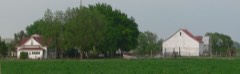 | Thomas and Mary Williams Homestead | building | 1998 | 98001565 |
Every wildfire the federal occurrence database records inside this county: 61 of them, burning about 3,488 acres. 10 started naturally and none was recorded as arson. Each settlement page carries the fires within five miles of it.
| Reported cause | Fires |
|---|---|
| Equipment and vehicle use | 18 |
| Debris and open burning | 17 |
| Missing data/not specified/undetermined | 11 |
| Natural | 10 |
| Power generation/transmission/distribution | 3 |
| Smoking | 1 |
| Fireworks | 1 |
The five largest, by the area the report gives. None of them was recorded as arson.
| Date | Cause | Size | Reported by | Name on the report |
|---|---|---|---|---|
| 20 December 2016 | Debris and open burning | 2,000 acres | Nebraska Forest Service | not named |
| 9 April 2010 | Debris and open burning | 800 acres | Nebraska Forest Service | not named |
| 12 August 2012 | Natural | 200 acres | Nebraska Forest Service | not named |
| 11 April 2018 | Debris and open burning | 100 acres | Nebraska Forest Service | not named |
| 4 July 2012 | Smoking | 85 acres | Nebraska Forest Service | not named |
| 11 April 2018 | Debris and open burning | 50 acres | Nebraska Forest Service | not named |
| 31 March 2012 | Debris and open burning | 50 acres | Nebraska Forest Service | not named |
| 21 October 2010 | Equipment and vehicle use | 50 acres | Nebraska Forest Service | not named |
Every settlement page carries the fires within five miles of it - see the settlement index below.
The NOAA Storm Events Database holds 234 reports for this county, causing no deaths, no injuries and about $4,559,000 in recorded property damage. Each settlement page carries the reports that name it.
| Kind of event | Reports |
|---|---|
| Hail | 169 |
| Thunderstorm Wind | 39 |
| Tornado | 21 |
| Flash Flood | 2 |
| Lightning | 1 |
| Flood | 1 |
| Funnel Cloud | 1 |
The most serious of them, by death, then injury, then recorded damage. The accounts are quoted exactly as the forecast office filed them.
| When | Event | Place named | Harm | What the report says |
|---|---|---|---|---|
| July 1979 | Tornado (F1) | not stated | $2,500,000 | no account filed |
| June 2010 | Flood | Almeria | $500,000 | Thunderstorms with prolonged heavy rain falling on already saturated ground caused widespread flooding. A foot of water covered Highway 91 from mile marker 35 to 37 between Brewster and Taylor. The Highway 183 bridge across the North Loup River was washed away as 4 to 6 inches of rain fell over the river basin. Numerous secondary roads were under water or washed away. |
| October 2000 | Tornado (F1) | Taylor | $500,000 | The tornado was on the ground as it moved into Loup county 2 miles southeast of Taylor. The tornado moved north northeast reaching a ranch 1 mile southeast of Taylor where several buildings were damaged. Then 2 outbuildings were destroyed at a farmstead 3 miles north northeast of Taylor with several buildings damaged including the home. There was also extensive damage to machinery, fences and power poles. As the tornado remained on the ground a farm building was damaged and pickup truck overturned 4 miles north northeast of Taylor before the tornado lifted. |
| June 1980 | Tornado (F1) | not stated | $250,000 | no account filed |
| August 2017 | Tornado (EF2) | Almeria | $100,000 | The tornado moved through a 100 year old shelter belt uprooting numerous trees. The tornado then passed through a recently vacated farmstead with several outbuildings. All of the outbuildings were completely destroyed. Sheet metal and wood from the outbuildings were found over a half a mile away. A boat parked at this location was destroyed and parts from the boat were found in a nearby field less than a mile away. Damage to the home was confined to the roof with debris from one of the outbuildings penetrating the attic of the home. |
| July 2000 | Hail | Taylor | $100,000 | no account filed |
| August 2017 | Thunderstorm Wind | Almeria | $55,000 | Thunderstorm winds estimated at 90 MPH flipped a center pivot and caused significant tree damage just west of Almeria. |
| August 2017 | Tornado (EF1) | Almeria | $50,000 | Tornado touched down and traveled approximately 2 miles to the south southeast. The tornado partially removed a roof off of a well built home. In addition, to the damaged roof, numerous power poles were snapped off along the tornado's path. |
| July 2001 | Tornado (F0) | Taylor | $50,000 | As the supercell continued to track northeast and intensify, a second tornado touched down on the north side of the reservoir about 17 miles north northeast of Taylor. The second tornado was larger and longer lived as it moved across open rangeland. Four windmills were destroyed and 36 cattle were instantly killed. An additional 14 cattle were destroyed due to injuries. The tornado lifted as it moved toward the Loup and Garfield county line on the north side of Calamus Reservoir. |
| August 2017 | Hail | Almeria | $30,000 | Numerous broken windows and holes in siding due to large hail at this location. |
| May 1998 | Hail | Taylor | $30,000 | Crops and property sustained significant damage due to large hail. |
| July 2001 | Hail | Almeria | $30,000 | no account filed |
| June 1990 | Tornado (F0) | not stated | $25,000 | no account filed |
| July 1986 | Tornado (F1) | not stated | $25,000 | no account filed |
| June 1975 | Tornado (F1) | not stated | $25,000 | no account filed |
| July 2001 | Hail | Almeria | $20,000 | The hail damaged a roof of a house. |
| March 1998 | Thunderstorm Wind | Taylor | $20,000 | Downburst thunderstorm winds caused damage to a couple of farmsteads. A trailer home sustained damage as well as livestock and irrigation equipment. Other losses included a few head of cattle killed. |
| May 2004 | Hail | Taylor | $20,000 | no account filed |
| July 2001 | Hail | Taylor | $20,000 | no account filed |
| June 2009 | Hail | Almeria | $18,000 | Baseball size hail broke windows out of vehicles and a house. |
| March 1998 | Lightning | Taylor | $16,000 | Lightning struck and killed 20 head of cattle. |
| September 2015 | Hail | Almeria | $15,000 | Tennis ball to grapefruit sized hail damaged a vehicle and buildings at Horsehoe Bend Lake. |
| July 2001 | Hail | Taylor | $15,000 | no account filed |
| July 2001 | Hail | Taylor | $15,000 | no account filed |
| August 2017 | Tornado (EF1) | Almeria | $10,000 | An outbuilding was flipped over and severe tree damage was reported along the tornado's path. |
| August 2002 | Hail | Taylor | $10,000 | Several corn fields were stripped around Taylor. |
| May 1998 | Hail | Taylor | $10,000 | Large hail damaged alfalfa, pastures and other crops. Considerable damage was sustained to windows, siding and roofs. |
| July 2001 | Hail | Taylor | $10,000 | no account filed |
| July 2000 | Hail | Taylor | $10,000 | no account filed |
| June 2009 | Hail | Taylor | $8,000 | no account filed |
| July 2003 | Hail | Almeria | $8,000 | no account filed |
| June 2004 | Thunderstorm Wind | Taylor | $7,000 | Strong thunderstorm winds up to 60 knots downed power lines and numerous trees. |
| October 2001 | Tornado (F0) | Taylor | $6,000 | An F0 tornado touched down briefly and destroyed two calving sheds. Doors were also blown off a pole barn, fences were destroyed and power lines were down. A 400 pound calf was killed by flying debris. |
| July 2008 | Thunderstorm Wind | Taylor | $5,000 | A full tree broke off and fell across power lines. |
| July 2000 | Thunderstorm Wind | Taylor | $5,000 | Trees uprooted due to high winds. |
| June 2007 | Hail | Taylor | $5,000 | no account filed |
| March 2005 | Hail | Taylor | $5,000 | no account filed |
| July 2001 | Hail | Almeria | $5,000 | no account filed |
| June 1997 | Thunderstorm Wind | Taylor | $4,000 | Thunderstorm winds blew down a large tree. |
| August 2002 | Hail | Taylor | $4,000 | no account filed |
| July 1999 | Hail | Taylor | $4,000 | no account filed |
| May 2003 | Hail | Taylor | $3,000 | no account filed |
| May 2004 | Hail | Taylor | $2,000 | no account filed |
| June 2002 | Hail | Taylor | $2,000 | no account filed |
| August 2002 | Hail | Almeria | $2,000 | no account filed |
| May 2008 | Hail | Almeria | $1,500 | no account filed |
| August 1997 | Hail | Taylor | $1,000 | Thunderstorm winds and hail broke house windows. |
| May 2004 | Hail | Taylor | $1,000 | no account filed |
| May 2004 | Hail | Almeria | $1,000 | no account filed |
| September 2009 | Thunderstorm Wind | Almeria | $500 | Thunderstorm winds blew over a privacy fence and broke off small tree branches. |
| June 2024 | Hail | Almeria | - | Motorist reported hail along highway 183. |
| June 2023 | Thunderstorm Wind | Taylor | - | Public estimated winds of at least 60 mph. |
| July 2023 | Hail | Taylor | - | Public reported quarter size hail near Taylor. |
| July 2023 | Tornado (EF0) | Almeria | - | Sherriff Smith reports tornado on the ground, location approximated with radar data. |
| May 2022 | Hail | Taylor | - | Hail up to 5 inches in diameter reported by a storm chaser at this location. |
| May 2022 | Hail | Almeria | - | Softball sized hail reported at this location. |
| May 2022 | Hail | Almeria | - | A storm chaser measured 6 inch diameter hail at this location. |
| June 2020 | Thunderstorm Wind | Taylor | - | Thunderstorm wind gusts around 60 MPH were reported by the Burwell Fire Department along with heavy rain and zero visibility. |
| August 2019 | Flash Flood | Taylor | - | There was reports of water over Highway 91 from Taylor to Burwell. |
| August 2019 | Hail | Taylor | - | Time of report is estimated between midnight and 1230 AM. |
Named settlements recorded in the Geographic Names Information System, each with the topographic sheets covering it. Villages, hamlets and abandoned places alike. Each is shown with the nearest named watercourse or landform and the survey quadrangle it falls on.
Kent precinct · 68823 · Near Bohys Canyon · Taylor SE quadrangle
10 sheets, 1952 to 1994
No longer a settlement
The vanished settlements of Loup County: the places named above that are no longer on the map.