 Block
Almeria, Nebraska
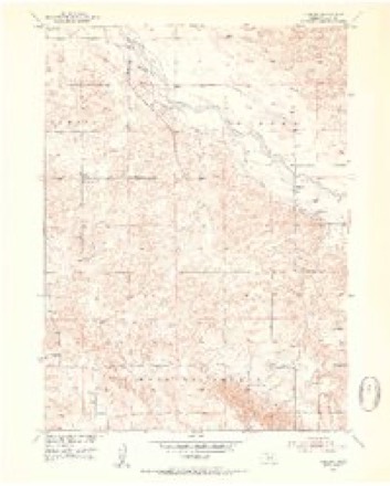
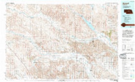
11 topographic sheets cover this place, the earliest surveyed in 1952 and the latest in 1994. It stands in Taylor precinct. It lies in ZIP code area 68879. The Survey maps it on the Almeria quadrangle.
Topographic sheets covering this place
5 surveys from 11 printed sheetsMatched by testing this settlement's coordinate against the published boundary of every sheet in the United States Geological Survey's historical collection. Each opens the scanned sheet at the Survey.
- 1952 USGS Almeria quadrangle1:24000, 3 printings
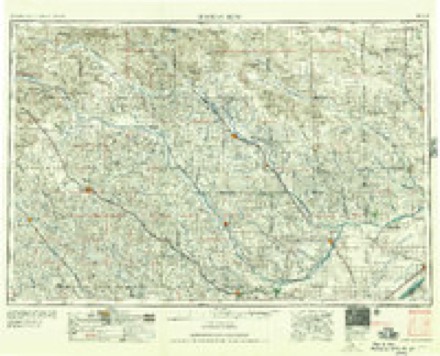
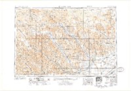
- 1955 USGS Broken Bow quadrangle1:250000, 5 printings
- 1956 USGS Broken Bow quadrangle1:250000
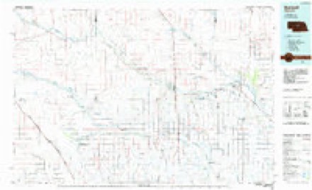
- 1985 USGS Burwell quadrangle1:100000
- 1994 USGS Burwell quadrangle1:100000
Fires near this place
14 since 2012Regional context, not property-specific evidence. The federal wildfire occurrence database lists 14 fires within 5 miles of Almeria between 2012 and 2018, burning about 211 acres in total. 1 started naturally. None was recorded as arson. Distance is straight-line from the map coordinates, so a fire counted here may appear on a neighbouring settlement's page as well.
| Reported cause | Fires |
|---|---|
| Equipment and vehicle use | 6 |
| Debris and open burning | 5 |
| Power generation/transmission/distribution | 2 |
| Natural | 1 |
The most recent of them, most recent first, with the day each was reported and the service that recorded it.
| Date | Cause | Size | Reported by | Name on the report |
|---|---|---|---|---|
| 4 August 2012 | Natural | under an acre | Nebraska Forest Service | not named |
| 28 August 2018 | Equipment and vehicle use | under an acre | Nebraska Forest Service | not named |
| 20 August 2017 | Power generation/transmission/distribution | 1.0 acres | Nebraska Forest Service | not named |
| 15 July 2012 | Equipment and vehicle use | under an acre | Nebraska Forest Service | not named |
| 27 May 2015 | Equipment and vehicle use | under an acre | Nebraska Forest Service | not named |
| 8 April 2018 | Debris and open burning | 5.0 acres | Nebraska Forest Service | not named |
| 8 April 2018 | Debris and open burning | 3.0 acres | Nebraska Forest Service | not named |
| 11 April 2018 | Debris and open burning | 50 acres | Nebraska Forest Service | not named |
Storms near this place
60 of 88 shownRegional context, not property-specific evidence. The National Weather Service names Almeria in 88 storm reports between 1997 and 2025: 66 hail, 14 thunderstorm wind, 6 tornado, 1 flood. No death or injury is recorded in these reports. Each account below is quoted exactly as the forecast office filed it, from the NOAA Storm Events Database, and each date opens the federal record of that event.
| When | Event | Place named | Harm | What the report says |
|---|---|---|---|---|
| June 2010 | Flood | Almeria | $500,000 | Thunderstorms with prolonged heavy rain falling on already saturated ground caused widespread flooding. A foot of water covered Highway 91 from mile marker 35 to 37 between Brewster and Taylor. The Highway 183 bridge across the North Loup River was washed away as 4 to 6 inches of rain fell over the river basin. Numerous secondary roads were under water or washed away. |
| August 2017 | Tornado (EF2) | Almeria | $100,000 | The tornado moved through a 100 year old shelter belt uprooting numerous trees. The tornado then passed through a recently vacated farmstead with several outbuildings. All of the outbuildings were completely destroyed. Sheet metal and wood from the outbuildings were found over a half a mile away. A boat parked at this location was destroyed and parts from the boat were found in a nearby field less than a mile away. Damage to the home was confined to the roof with debris from one of the outbuildings penetrating the attic of the home. |
| August 2017 | Thunderstorm Wind | Almeria | $55,000 | Thunderstorm winds estimated at 90 MPH flipped a center pivot and caused significant tree damage just west of Almeria. |
| August 2017 | Tornado (EF1) | Almeria | $50,000 | Tornado touched down and traveled approximately 2 miles to the south southeast. The tornado partially removed a roof off of a well built home. In addition, to the damaged roof, numerous power poles were snapped off along the tornado's path. |
| August 2017 | Hail | Almeria | $30,000 | Numerous broken windows and holes in siding due to large hail at this location. |
| July 2001 | Hail | Almeria | $30,000 | no account filed |
| July 2001 | Hail | Almeria | $20,000 | The hail damaged a roof of a house. |
| June 2009 | Hail | Almeria | $18,000 | Baseball size hail broke windows out of vehicles and a house. |
| September 2015 | Hail | Almeria | $15,000 | Tennis ball to grapefruit sized hail damaged a vehicle and buildings at Horsehoe Bend Lake. |
| August 2017 | Tornado (EF1) | Almeria | $10,000 | An outbuilding was flipped over and severe tree damage was reported along the tornado's path. |
| July 2003 | Hail | Almeria | $8,000 | no account filed |
| July 2001 | Hail | Almeria | $5,000 | no account filed |
| August 2002 | Hail | Almeria | $2,000 | no account filed |
| May 2008 | Hail | Almeria | $1,500 | no account filed |
| May 2004 | Hail | Almeria | $1,000 | no account filed |
| September 2009 | Thunderstorm Wind | Almeria | $500 | Thunderstorm winds blew over a privacy fence and broke off small tree branches. |
| June 2024 | Hail | Almeria | - | Motorist reported hail along highway 183. |
| July 2023 | Tornado (EF0) | Almeria | - | Sherriff Smith reports tornado on the ground, location approximated with radar data. |
| May 2022 | Hail | Almeria | - | Softball sized hail reported at this location. |
| May 2022 | Hail | Almeria | - | A storm chaser measured 6 inch diameter hail at this location. |
| September 2019 | Hail | Almeria | - | Tennis ball sized hail reported at this location. |
| July 2018 | Thunderstorm Wind | Almeria | - | No information available. |
| August 2017 | Tornado (EF0) | Almeria | - | Tornado briefly touched down with no damage reported. |
| August 2017 | Tornado (EF0) | Almeria | - | Tornado briefly touched down in a field with no damage reported. |
| May 2016 | Thunderstorm Wind | Almeria | - | Wind gusts estimated at 60 MPH. |
| June 2015 | Thunderstorm Wind | Almeria | - | Thunderstorm wind gusts of 60 mph located 8 miles west southwest of Almeria. |
| April 2015 | Hail | Almeria | - | Snow plows were deployed to remove hail from roadways. |
| July 2014 | Thunderstorm Wind | Almeria | - | Thunderstorm wind gusts estimated to 52 knots. |
| August 2014 | Thunderstorm Wind | Almeria | - | Thunderstorm wind gusts produced tree damage along with dime sized hail. |
| August 2010 | Thunderstorm Wind | Almeria | - | The public estimated that thunderstorm wind gusts were in excess of 60 mph. |
| June 2010 | Thunderstorm Wind | Almeria | - | Severe Thunderstorm Winds snapped large tree limbs out of trees, many tree limbs were six inches in diameter. |
| June 2010 | Thunderstorm Wind | Almeria | - | Thunderstorm wind gusts were estimated at over 60 mph and broke off trees. |
| July 2008 | Thunderstorm Wind | Almeria | - | The strong winds broke off numerous large tree branches. |
| June 2000 | Thunderstorm Wind | Almeria | - | Tree damage. |
| June 2025 | Hail | Almeria | - | no account filed |
| May 2022 | Hail | Almeria | - | no account filed |
| May 2022 | Hail | Almeria | - | no account filed |
| May 2022 | Hail | Almeria | - | no account filed |
| May 2022 | Hail | Almeria | - | no account filed |
| June 2022 | Hail | Almeria | - | no account filed |
| June 2020 | Hail | Almeria | - | no account filed |
| June 2020 | Hail | Almeria | - | no account filed |
| May 2019 | Hail | Almeria | - | no account filed |
| July 2018 | Hail | Almeria | - | no account filed |
| July 2018 | Hail | Almeria | - | no account filed |
| May 2016 | Hail | Almeria | - | no account filed |
| April 2015 | Hail | Almeria | - | no account filed |
| April 2015 | Hail | Almeria | - | no account filed |
| May 2015 | Hail | Almeria | - | no account filed |
| September 2015 | Hail | Almeria | - | no account filed |
| July 2014 | Hail | Almeria | - | no account filed |
| July 2014 | Hail | Almeria | - | no account filed |
| June 2014 | Hail | Almeria | - | no account filed |
| June 2014 | Hail | Almeria | - | no account filed |
| May 2013 | Hail | Almeria | - | no account filed |
| May 2012 | Hail | Almeria | - | no account filed |
| May 2012 | Funnel Cloud | Almeria | - | no account filed |
| August 2012 | Hail | Almeria | - | no account filed |
| July 2010 | Hail | Almeria | - | no account filed |
| September 2009 | Hail | Almeria | - | no account filed |
Nearest settlements
The eight closest, with where each one stands in the county. Distances are straight-line, computed from the Geographic Names Information System coordinates.
| Map | Place | Distance | Sheets |
|---|---|---|---|
| Taylor | 8.5 miles | 10 | |
| Kent (historical) | 12.3 miles | 10 | |
| Aggies Acres | 13.8 miles | 10 | |
| Mikes Meadows | 13.8 miles | 10 |
Provenance
This settlement is recorded in the Geographic Names Information System as feature 835227. The sheet list is computed by point-in-boundary test against the United States Geological Survey's historical topographic inventory. Both are works of the United States government and carry no copyright under 17 U.S.C. 105.
Wildfire. Short, Karen C. 2022. Spatial wildfire occurrence data for the United States, 1992-2020 [FPA_FOD_20221014]. 6th Edition. Fort Collins, CO: Forest Service Research Data Archive. https://doi.org/10.2737/RDS-2013-0009.6 Collected with United States Government funding and usable without additional permissions or fees.
Storms. NOAA National Centers for Environmental Information, Storm Events Database https://www.ncei.noaa.gov/stormevents/ A work of the United States government, no copyright under 17 U.S.C. 105. Narratives are quoted verbatim from the National Weather Service report and are not edited or summarised.