 Block
From the record
13 National Register listings published here, 1 of them a National Historic Landmark.
Sources: the National Register database, National Park Service
30 topographic sheets cover 11 settlements here, and 13 properties are on the National Register of Historic Places.
13 National Register listings published here, 1 of them a National Historic Landmark.
Sources: the National Register database, National Park Service
Every property in this county listed on the National Register of Historic Places, with the year it was listed and the federal nomination document.
| Photograph | Property | Type | Listed | Reference |
|---|---|---|---|---|
| Auburn Historic District | district | 2014 | 14000396 | |
 | John W. Bennett House | building | 1983 | 83001099 |
 | Brownville Bridge | structure | 1993 | 93000536 |
| Brownville Historic District | district | 1970 | 70000374 | |
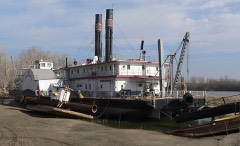 | CAPTAIN MERIWETHER LEWIS (dredge) | structure | 1977 | 77000833 |
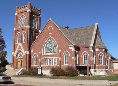 | First United Presbyterian Church of Auburn | building | 1982 | 82003199 |
| Legion Memorial Park | district | 2004 | 04001407 | |
 | Thomas J. Majors Farmstead | building | 1978 | 78001707 |
 | Nemaha County Courthouse | building | 1990 | 89002243 |
| New Opera House | building | 1988 | 88000936 | |
 | Wilber T. Reed House | building | 1980 | 80002458 |
 | St. John's Lutheran Church Complex | building | 1979 | 79001452 |
 | US Post Office-Auburn | building | 1992 | 92000480 |
Every wildfire the federal occurrence database records inside this county: 73 of them, burning about 982 acres. None started naturally and 1 was recorded as arson. Each settlement page carries the fires within five miles of it.
| Reported cause | Fires |
|---|---|
| Debris and open burning | 37 |
| Missing data/not specified/undetermined | 15 |
| Equipment and vehicle use | 9 |
| Power generation/transmission/distribution | 4 |
| Fireworks | 3 |
| Recreation and ceremony | 2 |
| Smoking | 2 |
| Arson/incendiarism | 1 |
The five largest, by the area the report gives. None of them was recorded as arson.
| Date | Cause | Size | Reported by | Name on the report |
|---|---|---|---|---|
| 4 April 2014 | Equipment and vehicle use | 235 acres | Nebraska Forest Service | not named |
| 3 February 2007 | Debris and open burning | 100 acres | Nebraska Forest Service | not named |
| 20 March 2014 | Debris and open burning | 90 acres | Nebraska Forest Service | not named |
| 16 April 2018 | Debris and open burning | 80 acres | Nebraska Forest Service | not named |
| 10 April 2018 | Debris and open burning | 69 acres | Nebraska Forest Service | not named |
| 3 April 2014 | Equipment and vehicle use | 50 acres | Nebraska Forest Service | not named |
| 14 March 2015 | Debris and open burning | 50 acres | Nebraska Forest Service | not named |
| 17 March 2013 | Power generation/transmission/distribution | 40 acres | Nebraska Forest Service | not named |
Every settlement page carries the fires within five miles of it - see the settlement index below.
The NOAA Storm Events Database holds 356 reports for this county, causing 1 death, 9 injuries and about $3,739,030 in recorded property damage. Each settlement page carries the reports that name it.
| Kind of event | Reports |
|---|---|
| Hail | 155 |
| Thunderstorm Wind | 119 |
| Flood | 41 |
| Tornado | 19 |
| Flash Flood | 14 |
| Funnel Cloud | 5 |
| Heavy Rain | 3 |
The most serious of them, by death, then injury, then recorded damage. The accounts are quoted exactly as the forecast office filed them.
| When | Event | Place named | Harm | What the report says |
|---|---|---|---|---|
| April 1963 | Tornado (F3) | not stated | 1 killed, 8 hurt, $25,000 | no account filed |
| May 1950 | Tornado (F2) | not stated | 1 hurt, $25,000 | no account filed |
| August 2025 | Thunderstorm Wind | Johnson | $1,220,000 | A damaging wind event impacted Nemaha County, Nebraska, on the morning of August 10th, 2025, primarily affecting the northwest to north-central portion of the county. The severity of the storm was characterized by a single, significant damage report 4 miles southeast of Julian, where straight-line wind gusts were estimated as high as 95 miles per hour by Emergency Management. This high-end wind estimate was based on the destruction of a grain bin and a shed in the area.||Although only one report was officially documented in the county, the resulting damage was larger. The estimated cost for repairs to public infrastructure in Nemaha County was $1,224,827.00. This relatively high figure, derived from utility and transportation structure damage, suggests that while the most extreme winds were highly localized, they caused considerable, widespread harm to public assets along the storm's path, despite the lack of numerous individual storm reports. |
| May 1996 | Flash Flood | Auburn | $680,000 | no account filed |
| May 1995 | Tornado (F2) | not stated | $450,000 | A tornado touched down four miles west and one-half mile south of Auburn and did extensive damage to a house, farm, its outbuildings, and power lines along the path of the tornado. A second farmsite was damage three and one-half miles west of Auburn. |
| May 1995 | Tornado (F1) | 1 W Auburn | $350,000 | A tornado touched down north of Auburn and west of Peru, damaging two farms. Roof damage was done to hog barns, outbuildings, and a house. |
| June 2010 | Flood | Peru | $250,000 | Heavy rain over much of eastern Nebraska and western Iowa during most of June caused a prolonged period of flooding along the Missouri River, especially downstream of Omaha through Rulo. The river near Brownville climbed above flood stage during the afternoon on June 11th and remained above flood stage into July. The river at Brownville crested at close to 43 feet during the evening of June 23rd, flood stage is 32 feet. This was the 2nd highest crest at Brownville second only to the flood of July 1993. An earlier crest of around 42 feet was recorded on 6/16/10. Besides considerable flooding of lowlands along the river, several roads were flooded including one that lead to the Cooper Nuclear power plant. Recreation areas also sustained flood damage. |
| June 1975 | Tornado (F1) | not stated | $250,000 | no account filed |
| April 2008 | Tornado (EF1) | Johnson | $100,000 | A tornado touched down on the southwest edge of Johnson near Chestnut and 1st Streets. The tornado moved northeast across town causing EF1 damage to several buildings in downtown Johnson along Main Street between 2nd and 3rd Streets. The tornado weakened as it approached the high school and then lifted around Walnut and 5th Streets.||Roofing material and the facade of several buildings were peeled or collapsed. Hardwood and softwood trees were snapped along the path and 2 garages were pushed off of their foundations. A building next to the fire station also had a large garage door blown in. No injuries were reported. |
| June 2011 | Flood | Peru | $50,000 | Flooding along the Missouri River gradually worsened during June as record releases from Gavins Point Dam and periodic heavy rains brought widespread flooding along the river. The Missouri River at Brownville started June around 39 feet, flood stage is 33 feet. The river gradually climbed to a record crest around 45 feet by the end of the month before falling as downstream levees were breached and widened by flooding. However, significant flooding persisted into July. One man drowned early on June 26th when the boat he was fishing in capsized as it traveled from the Little Nemaha River, where it was launched, onto the flood waters of the Missouri River. Roads, including Highway 136 in Missouri, and the access road to a nuclear power plant, flooded as did recreation areas and farmland along the river. The flooding of Highway 136 prompted the closure of the Brownville, Nebraska bridge over the Missouri River. Over 8,000 acres were covered in flood waters at one point early in June and that number likely grew as the month progressed. |
| September 2011 | Flood | Peru | $50,000 | Flooding along the Missouri River gradually worsened over Nemaha county during June as record releases from Gavins Point Dam and periodic heavy rains brought widespread flooding along the river. The river at Brownville started June around 39 feet, flood stage is 33 feet. The river gradually climbed to a record crest around 45 feet by the end of that month before falling as downstream levees were breached and widened by flooding. Moderate flooding persisted through July and into late August before the river fell even more due to decreased releases from upstream reservoirs. However, minor flooding persisted through September and into early October. At the peak of the flooding Highway 136 in Missouri, and the access road to a nuclear power plant were under water along with recreation areas and farmland along the river. The flooding of Highway 136 prompted the closure of the Brownville, Nebraska bridge over the Missouri River. Over 8,000 acres were covered in flood waters during the peak of the flooding in early summer. |
| October 2000 | Tornado (F0) | Brock | $30,000 | A brief touchdown of a tornado destroyed 3 outbuildings and did some roof damage of a farm house southwest of Brock. |
| June 2014 | Flood | Peru | $25,000 | Several episodes of heavy rain caused prolonged flooding along the Missouri River. At Brownville the river reached around 38.5 feet during the early morning hours of June 25th, flood stage is 33 feet. The flooding impacted a few roads and cabins near the river and also flooded farmland. This flooding continued into July. |
| August 2011 | Flood | Peru | $25,000 | Flooding along the Missouri River gradually worsened over Nemaha county during June as record releases from Gavins Point Dam and periodic heavy rains brought widespread flooding along the River. The river at Brownville started June around 39 feet, flood stage is 33 feet. The river gradually climbed to a record crest around 45 feet by the end of that month before falling as downstream levees were breached and widened by flooding. Moderate flooding persisted through July and into late August before the river fell even more due to decreased releases from upstream reservoirs. However, minor flooding persisted into September. Roads, including Highway 136 in Missouri, and the access road to a nuclear power plant, flooded as did recreation areas and farmland along the river. The flooding of Highway 136 prompted the closure of the Brownville, Nebraska bridge over the Missouri River. Over 8,000 acres were covered in flood waters during the peak of the flooding in early summer. |
| April 1968 | Tornado (F2) | not stated | $25,000 | no account filed |
| July 2011 | Flood | Peru | $20,000 | Flooding along the Missouri River gradually worsened during June as record releases from Gavins Point Dam and periodic heavy rains brought widespread flooding along the River. The river at Brownville, started June around 39 feet, flood stage is 33 feet. The river gradually climbed to a record crest around 45 feet by the end of the June before falling as downstream levees were breached and widened by flooding. However, significant flooding persisted through July and continued into August. Roads, including Highway 136 in Missouri, and the access road to a nuclear power plant, flooded as did recreation areas and farmland along the river. The flooding of Highway 136 prompted the closure of the Brownville, Nebraska bridge over the Missouri River. Over 8,000 acres were covered in flood waters. |
| July 2010 | Flood | Peru | $20,000 | Heavy rain over much of eastern Nebraska and western Iowa during most of June caused a prolonged period of flooding along the Missouri River, especially downstream of Omaha through Rulo. The river near Brownville climbed above flood stage during the afternoon on June 11th and remained above flood stage through July and into August aided by additional rain and increased releases from upstream reservoirs. The river at Brownville crested close to 43 feet during the evening of June 23rd, flood stage is 32 feet. During July the river crested a little under 39 feet for the first several days of the month. Besides considerable flooding of lowlands along the river, several roads were flooded including one that lead to the Cooper Nuclear power plant. Recreation areas also sustained flood damage. |
| May 2007 | Thunderstorm Wind | Auburn | $15,000 | Thunderstorm winds estimated at 60 to 80 mph damaged a hog building and destroyed a 100 by 60 foot machine shed southeast of Auburn. |
| June 2000 | Flash Flood | Brock | $15,000 | Heavy rainfall fell over Nemaha county Friday evening the 23rd of June. An observer north of Auburn reported 6.84 inches of rain that evening with 3 to 4 inches common throughout the county. The rain flooded highway 75 near the Otoe county border and near its intersection with highway 67, and also washed a culvert out near Brock. |
| June 2024 | Flood | Peru | $10,000 | Excessive rainfall across much of eastern South Dakota resulted in river flooding along the Missouri River at the end of June. Moderate flood stage was observed along the Missouri. The Missouri River flooding in Nemaha County did not crest until July 1, and will be included on in July StormData. At 8:30 am CDT on 6/26, emergency management sent in photos of flooding at the Brownville Campground. |
| September 2014 | Flood | Peru | $10,000 | The Missouri River reached flood stage near Brownville on the 10th and created in the early morning hours of the 11th at 34.95 feet. The river fell below flood stage on the morning of the 12th. The flooding was confined to low areas along the river. |
| March 2010 | Flood | Brownville | $10,000 | Melting snow, along with several rain events, brought a prolonged period of lowland flooding along the Missouri River, especially downstream of its confluence with the Platte River near Plattsmouth. The river at Brownville first crossed flood stage, 32 feet, during the afternoon on 3/11 and remained above flood stage into early April. The river at Brownville crested at around 38 feet during the evening of the 23nd. Agricultural lowlands and a few county roads near the river flooded in Nemaha county. |
| June 2000 | Thunderstorm Wind | Peru | $10,000 | A pole barn was destroyed west of Peru by thunderstorm winds. |
| May 1998 | Thunderstorm Wind | Auburn | $8,000 | Tree and roof damage. |
| June 2003 | Thunderstorm Wind | Johnson | $6,000 | Thunderstorm wind gusts estimated at around 60 mph broke a 22 inch in diameter tree off and blew it through the roof of a trailer house. |
| October 2014 | Flood | Paul | $5,000 | Heavy rainfall at the end of September caused the Missouri River to go into flood. The river rose above flood stage in the afternoon on the 1st, crested on the evening of the 2nd, and fell below flood stage on the evening of the 3rd. The river flooding was minor and mainly confined to low-lying areas along the river. |
| April 2011 | Flood | Peru | $5,000 | Several periods of moderate to heavy rain combined with upstream inflows due to snow melt and rain caused the Missouri River to flood from around Nebraska City downstream through Rulo. The flooding began a little after the middle of the month and persisted into May. In Nemaha county the flooding mainly affected marshy lowlands and low-lying farm fields along the river although a few recreational areas were flooded as well. The river at Brownville climbed above its 33 foot flood stage in the afternoon of 4/17 and continued above flood stage into May. The river had a prolonged crest around and a little above 35 feet during the last week or so of April. The flooding and crest carried over into May. |
| May 2011 | Flood | Peru | $5,000 | This flooding carried over from April when several episodes of heavy rain combined with high releases from upstream reservoirs and caused a prolonged flood event along the Missouri River. The river at Brownville, which climbed above its 33 foot flood stage in mid April, dropped toward it's flood stage on May 10th but then rose in stages after that and ended the month around 39 feet. The flooding carried over into June. Although the high water mainly flooded marshy areas and farmland along the river, it also started flooding a few roads and recreational areas by the river by the middle and end of May. |
| June 2010 | Flood | Auburn | $5,000 | Rainfall of 2 to 4 inches that fell during the evening of 6/20 caused flooding along Little Nemaha River in Nemaha county. The river near Auburn crested at almost 27 feet during the evening of 6/21, flood stage is 22 feet. The river near Auburn was above flood stage from the morning of 6/21 until the morning of 6/22. The flooding along the Little Nemaha and tributaries led to the closure of Highways 34 and 75 in the Auburn area and also flooded county roads and agricultural lowlands near the river. |
| August 2010 | Flood | Peru | $5,000 | Heavy rain over much of eastern Nebraska and western Iowa during most of June caused a prolonged period of flooding along the Missouri River, especially downstream of Omaha through Rulo. The river near Brownville climbed above flood stage during the afternoon on June 11th and remained above flood stage through July and for most of August. The prolonged flooding was aided by additional rain in July and increased releases from upstream reservoirs. The river at Brownville crested at close to 43 feet during the evening of June 23rd, flood stage is 32 feet. During July the river crested a little under 39 feet for the first several days of the month and in August the crest was a little over 38 feet on the 5th. Besides considerable flooding of lowlands along the river, several roads were flooded including one that lead to the Cooper Nuclear power plant. Recreation areas also sustained flood damage, but most of the damage was done in June and July. |
| May 2000 | Thunderstorm Wind | Auburn | $5,000 | Possible thunderstorm microburst downed a few trees and blew a roof off of a garage. |
| June 2014 | Flood | Peru | $4,000 | A few days of heavy rain caused flooding along the Missouri River from Brownville downstream through Rulo. At Brownville the river crested at nearly 34.5 feet during the late evening of June 4th, flood stage is 33 feet. The flooding impacted mainly agricultural land near the river. |
| October 2011 | Flood | Peru | $4,000 | Flooding along the Missouri River finally came to end in Nemaha county in early October as continued decreases in releases from Gavins Point Dam allowed the river at Brownville to fall below its 33 foot flood stage. Earlier in the Summer the river reached a record crest of around 45 feet. At the peak of the flooding Highway 136 in Missouri, and the access road to a nuclear power plant were under water along with recreation areas and farmland along the river. The flooding of Highway 136 prompted the closure of the Brownville, Nebraska bridge over the Missouri River. Over 8,000 acres were covered in flood waters during the peak of the flooding in early summer. |
| May 1997 | Thunderstorm Wind | Auburn | $4,000 | no account filed |
| August 1958 | Tornado (F0) | not stated | $2,500 | no account filed |
| April 1956 | Tornado (F2) | not stated | $2,500 | no account filed |
| July 2014 | Flood | Peru | $2,000 | This flooding carried over from June when heavy rain in late June and early July brought prolonged flooding along the Missouri River from around Brownville downstream to Rulo. At Brownville the river crested around 36 feet, on July 3rd, fell below flood stage briefly on July 4th and 5th, and reached a second crest a little over 34 feet late on the 6th before falling below flood stage on the 7th. Flood stage at Brownville is 33 feet. The flooding impacted a few county roads in the area. |
| September 2010 | Flood | Peru | $2,000 | High levels of the Missouri River from summer rains and increased flows from upstream reservoirs were pushed back above flood stage in the Brownville area by additional heavy rain events in mid to late September 2010. The flooding continued into October. At Brownville the river crossed back above its 32 foot flood stage a little after midnight CDT on the 20th. Mainly agricultural lowlands were affected. |
| September 2010 | Flood | Peru | $2,000 | Heavy rain events across eastern Nebraska and western Iowa from June into September, and high upstream reservoir releases, caused a prolonged period of flooding along the Missouri River, especially downstream of Omaha through Rulo. The river near Brownville first climbed above flood stage during the afternoon on June 11th and remained above flood stage through July, for most of August, September and into October. The river at Brownville crested at close to 43 feet during the evening of June 23rd, flood stage is 32 feet. The river near Brownville had an early September crest of a little under 34 feet during the early morning hours of Sept. 3. Besides considerable flooding of lowlands along the river, several roads and recreation areas were flooded. However, most of the more significant flooding and damage was done in June and July. |
| August 2007 | Flash Flood | Johnson | $2,000 | Rainfall of around 2 inches in an hour caused a local creek to flood across some county roads southwest of Johnson. The rain was on top of 1 to 3 inches that fell about 12 to 18 hours prior. |
| August 2007 | Thunderstorm Wind | Johnson | $2,000 | Thunderstorm winds knocked a 10 inch limb onto house and blew a small shed away. Corn was also flattened in the area. |
| October 2010 | Flood | Peru | $1,000 | This flooding carried over from September when periodic heavy rain events combined with increased releases from upstream reservoirs and high rivers in northwest Iowa. The Missouri River at Brownville began the month a little under 35 feet, flood stage is 32 feet. The river gradually rose to a little over 35 feet on the 3rd and 4th before slowly falling eventually falling below flood stage around noon CDT on the 17th. The flooding mainly affected agricultural lowlands near the river. |
| June 2007 | Flash Flood | Auburn | $1,000 | Heavy rain caused water to flow out of a field washing mud and corn stalk debris across Highway 75 near Auburn. Rainfall of 3.31 was reported in Auburn with 4.8 inches reported south of town. |
| July 1995 | Thunderstorm Wind | Julian | $1,000 | Satellite dish blown down. |
| September 1959 | Tornado (F1) | not stated | $30 | no account filed |
| April 2026 | Thunderstorm Wind | Brock | - | Delayed report of thunderstorm wind damage received from the public of a large tree limb broken on a house. Time estimated with radar. Wind speeds were estimated at 60-70 mph. |
| April 2026 | Hail | Auburn | - | Delayed social media report of hail estimated up to 1.25 inches in diameter. Time estimated from radar. |
| April 2026 | Hail | Nemaha | - | Public report of hail estimated at one inch in diameter. |
| May 2024 | Thunderstorm Wind | Nemaha | - | A 64 miles per hour wind gust was measured by a personal weather station. |
| April 2024 | Hail | Auburn | - | The office received a public report of quarter sized hail. |
| April 2024 | Hail | Nemaha | - | The Nemaha County Emergency Manager reported baseball sized hail was falling in Nemaha. |
| April 2024 | Hail | Johnson | - | The office received a report from the Nemaha County EM of quarter sized hail. |
| May 2024 | Thunderstorm Wind | Brownville | - | A 58 miles per hour wind gust was recorded on a personal weather station. |
| May 2024 | Thunderstorm Wind | Brownville | - | A 58 miles per hour wind gust was recorded on a personal weather station. |
| July 2024 | Flood | Julian | - | After the first of the month, flood waters continued to rise along this stretch of the Missouri River. River levels crested at 2030 CST on 7/1, reaching a height of 40.67 feet. Flooding lasted for approximately 1 week after the river crest. There were no new impacts to address that haven't been included in June StormData. Damage estimates can also be found in June StormData. |
| June 2024 | Thunderstorm Wind | Nemaha | - | A 69 miles per hour wind gust was reported by the public. |
| September 2024 | Thunderstorm Wind | Nemaha | - | A 59 miles per hour wind gust was measured on a personal weather station. |
| June 2024 | Thunderstorm Wind | Nemaha | - | A 60 miles per hour wind gust was measured by a personal weather station. |
| June 2024 | Thunderstorm Wind | Nemaha | - | A 69 miles per hour wind gust was measured by a personal weather station. |
| August 2024 | Thunderstorm Wind | Nemaha | - | A personal weather station measured a 58 miles per hour wind gust. |
The Survey's mineral resources record lists 1 working inside this county. It still produces. Each settlement page carries the workings within five miles of it.
| Commodity | Workings |
|---|---|
| Stone, Crushed/Broken | 1 |
The least common of them first, because a county's hundredth gravel pit says nothing its first ten did not.
| Where | Site | Commodity | Status | Recorded |
|---|---|---|---|---|
| Hooper Bros. Auburn Quarry & Mill | Stone, Crushed/Broken | Producer |
Named settlements recorded in the Geographic Names Information System, each with the topographic sheets covering it. Villages, hamlets and abandoned places alike. Each is shown with the nearest named watercourse or landform and the survey quadrangle it falls on.
Nemaha precinct · 68437 · Langdon quadrangle
14 sheets, 1915 to 1986
No longer a settlement
The vanished settlements of Nemaha County: the places named above that are no longer on the map.