 Block
Peru, Nebraska
13 topographic sheets cover this place, the earliest surveyed in 1915 and the latest in 1986. It stands in Peru precinct. It lies in ZIP code area 68421. The Survey maps it on the Peru quadrangle. 648 people lived here at the 2020 count. It stands 1,083 feet above sea level.
On record in Peru
Buildings and businesses the archive holds for this place. Each opens its own page, with the source record it came from.
On the National Register 1 record
 Thomas J. Majors Farmsteadlisted 1978
Population over time
2 figuresPeru fell from 865 to 648 between 2010 and 2020. These are the recorded population figures Wikidata holds for this place, reached through the Geographic Names Information System number this page is keyed on rather than by name, so they belong to this place and not to another of the same name. Most are census counts, but not all are: an early figure may be a founding or settlement estimate, and an estimate published within five years of a census is left out. The change column is computed, and is left blank where more than 20 years separate a figure from the one before it, because a gap that long is not a change between two counts.
| Year | People | Change |
|---|---|---|
| 2010 | 865 | |
| 2020 | 648 | -217 (-25%) |
Topographic sheets covering this place
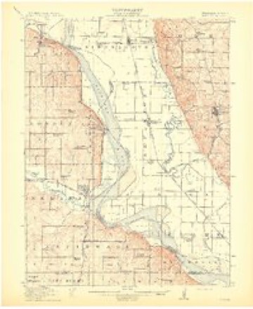
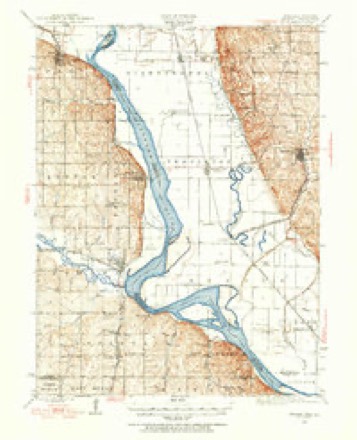
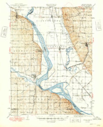
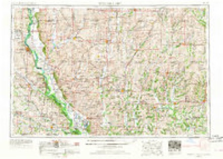
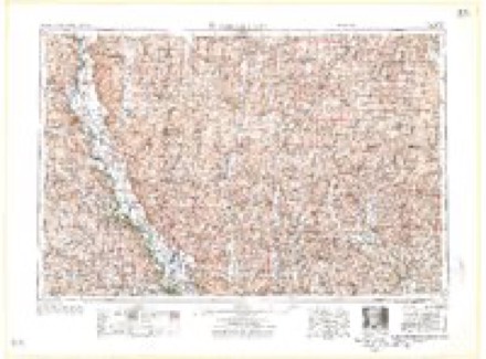
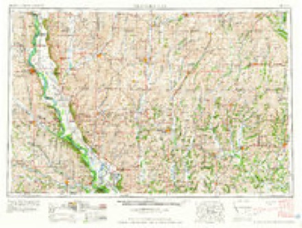
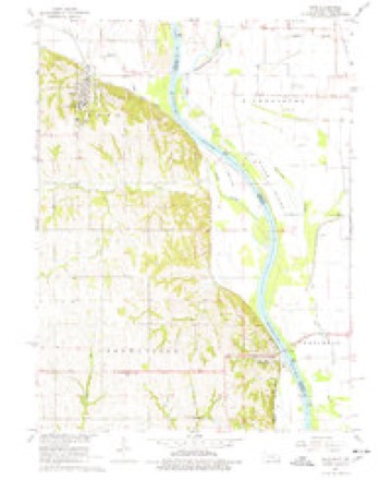
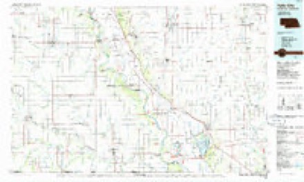
8 surveys from 13 printed sheetsMatched by testing this settlement's coordinate against the published boundary of every sheet in the United States Geological Survey's historical collection. Each opens the scanned sheet at the Survey.
- 1915 USGS Nemaha quadrangle1:62500, 2 printings
- 1939 USGS Nemaha quadrangle1:62500
- 1949 USGS Nemaha quadrangle1:62500
- 1955 USGS Nebraska City quadrangle1:250000, 3 printings
- 1957 USGS Nebraska City quadrangle1:250000
- 1958 USGS Nebraska City quadrangle1:250000
- 1966 USGS Peru quadrangle1:24000, 2 printings
- 1986 USGS Falls City quadrangle1:100000, 2 printings
Fires near this place
21 since 2011Regional context, not property-specific evidence. The federal wildfire occurrence database lists 21 fires within 5 miles of Peru between 2011 and 2020, burning about 307 acres in total. None started naturally. None was recorded as arson. Distance is straight-line from the map coordinates, so a fire counted here may appear on a neighbouring settlement's page as well.
| Reported cause | Fires |
|---|---|
| Debris and open burning | 11 |
| Missing data/not specified/undetermined | 5 |
| Equipment and vehicle use | 2 |
| Power generation/transmission/distribution | 2 |
| Fireworks | 1 |
The most recent of them, most recent first, with the day each was reported and the service that recorded it.
| Date | Cause | Size | Reported by | Name on the report |
|---|---|---|---|---|
| 19 August 2017 | Power generation/transmission/distribution | 1.0 acres | Nebraska Forest Service | not named |
| 31 July 2016 | Fireworks | 1.5 acres | Nebraska Forest Service | not named |
| 11 July 2020 | Missing data/not specified/undetermined | under an acre | Nebraska Forest Service | not named |
| 8 April 2020 | Debris and open burning | 5.0 acres | Nebraska Forest Service | not named |
| 4 April 2013 | Debris and open burning | 8.0 acres | Nebraska Forest Service | not named |
| 19 April 2018 | Debris and open burning | under an acre | Nebraska Forest Service | not named |
| 8 March 2015 | Missing data/not specified/undetermined | 30 acres | Nebraska Forest Service | not named |
| 26 March 2014 | Equipment and vehicle use | 35 acres | Nebraska Forest Service | not named |
Settlements close enough to share some of these fires:
Storms near this place
47 since 1993Regional context, not property-specific evidence. The National Weather Service names Peru in 47 storm reports between 1993 and 2024: 25 flood, 11 hail, 6 thunderstorm wind, 2 funnel cloud. No death or injury is recorded in these reports. Each account below is quoted exactly as the forecast office filed it, from the NOAA Storm Events Database, and each date opens the federal record of that event.
| When | Event | Place named | Harm | What the report says |
|---|---|---|---|---|
| June 2010 | Flood | Peru | $250,000 | Heavy rain over much of eastern Nebraska and western Iowa during most of June caused a prolonged period of flooding along the Missouri River, especially downstream of Omaha through Rulo. The river near Brownville climbed above flood stage during the afternoon on June 11th and remained above flood stage into July. The river at Brownville crested at close to 43 feet during the evening of June 23rd, flood stage is 32 feet. This was the 2nd highest crest at Brownville second only to the flood of July 1993. An earlier crest of around 42 feet was recorded on 6/16/10. Besides considerable flooding of lowlands along the river, several roads were flooded including one that lead to the Cooper Nuclear power plant. Recreation areas also sustained flood damage. |
| June 2011 | Flood | Peru | $50,000 | Flooding along the Missouri River gradually worsened during June as record releases from Gavins Point Dam and periodic heavy rains brought widespread flooding along the river. The Missouri River at Brownville started June around 39 feet, flood stage is 33 feet. The river gradually climbed to a record crest around 45 feet by the end of the month before falling as downstream levees were breached and widened by flooding. However, significant flooding persisted into July. One man drowned early on June 26th when the boat he was fishing in capsized as it traveled from the Little Nemaha River, where it was launched, onto the flood waters of the Missouri River. Roads, including Highway 136 in Missouri, and the access road to a nuclear power plant, flooded as did recreation areas and farmland along the river. The flooding of Highway 136 prompted the closure of the Brownville, Nebraska bridge over the Missouri River. Over 8,000 acres were covered in flood waters at one point early in June and that number likely grew as the month progressed. |
| September 2011 | Flood | Peru | $50,000 | Flooding along the Missouri River gradually worsened over Nemaha county during June as record releases from Gavins Point Dam and periodic heavy rains brought widespread flooding along the river. The river at Brownville started June around 39 feet, flood stage is 33 feet. The river gradually climbed to a record crest around 45 feet by the end of that month before falling as downstream levees were breached and widened by flooding. Moderate flooding persisted through July and into late August before the river fell even more due to decreased releases from upstream reservoirs. However, minor flooding persisted through September and into early October. At the peak of the flooding Highway 136 in Missouri, and the access road to a nuclear power plant were under water along with recreation areas and farmland along the river. The flooding of Highway 136 prompted the closure of the Brownville, Nebraska bridge over the Missouri River. Over 8,000 acres were covered in flood waters during the peak of the flooding in early summer. |
| June 2014 | Flood | Peru | $25,000 | Several episodes of heavy rain caused prolonged flooding along the Missouri River. At Brownville the river reached around 38.5 feet during the early morning hours of June 25th, flood stage is 33 feet. The flooding impacted a few roads and cabins near the river and also flooded farmland. This flooding continued into July. |
| August 2011 | Flood | Peru | $25,000 | Flooding along the Missouri River gradually worsened over Nemaha county during June as record releases from Gavins Point Dam and periodic heavy rains brought widespread flooding along the River. The river at Brownville started June around 39 feet, flood stage is 33 feet. The river gradually climbed to a record crest around 45 feet by the end of that month before falling as downstream levees were breached and widened by flooding. Moderate flooding persisted through July and into late August before the river fell even more due to decreased releases from upstream reservoirs. However, minor flooding persisted into September. Roads, including Highway 136 in Missouri, and the access road to a nuclear power plant, flooded as did recreation areas and farmland along the river. The flooding of Highway 136 prompted the closure of the Brownville, Nebraska bridge over the Missouri River. Over 8,000 acres were covered in flood waters during the peak of the flooding in early summer. |
| July 2011 | Flood | Peru | $20,000 | Flooding along the Missouri River gradually worsened during June as record releases from Gavins Point Dam and periodic heavy rains brought widespread flooding along the River. The river at Brownville, started June around 39 feet, flood stage is 33 feet. The river gradually climbed to a record crest around 45 feet by the end of the June before falling as downstream levees were breached and widened by flooding. However, significant flooding persisted through July and continued into August. Roads, including Highway 136 in Missouri, and the access road to a nuclear power plant, flooded as did recreation areas and farmland along the river. The flooding of Highway 136 prompted the closure of the Brownville, Nebraska bridge over the Missouri River. Over 8,000 acres were covered in flood waters. |
| July 2010 | Flood | Peru | $20,000 | Heavy rain over much of eastern Nebraska and western Iowa during most of June caused a prolonged period of flooding along the Missouri River, especially downstream of Omaha through Rulo. The river near Brownville climbed above flood stage during the afternoon on June 11th and remained above flood stage through July and into August aided by additional rain and increased releases from upstream reservoirs. The river at Brownville crested close to 43 feet during the evening of June 23rd, flood stage is 32 feet. During July the river crested a little under 39 feet for the first several days of the month. Besides considerable flooding of lowlands along the river, several roads were flooded including one that lead to the Cooper Nuclear power plant. Recreation areas also sustained flood damage. |
| June 2024 | Flood | Peru | $10,000 | Excessive rainfall across much of eastern South Dakota resulted in river flooding along the Missouri River at the end of June. Moderate flood stage was observed along the Missouri. The Missouri River flooding in Nemaha County did not crest until July 1, and will be included on in July StormData. At 8:30 am CDT on 6/26, emergency management sent in photos of flooding at the Brownville Campground. |
| September 2014 | Flood | Peru | $10,000 | The Missouri River reached flood stage near Brownville on the 10th and created in the early morning hours of the 11th at 34.95 feet. The river fell below flood stage on the morning of the 12th. The flooding was confined to low areas along the river. |
| June 2000 | Thunderstorm Wind | Peru | $10,000 | A pole barn was destroyed west of Peru by thunderstorm winds. |
| April 2011 | Flood | Peru | $5,000 | Several periods of moderate to heavy rain combined with upstream inflows due to snow melt and rain caused the Missouri River to flood from around Nebraska City downstream through Rulo. The flooding began a little after the middle of the month and persisted into May. In Nemaha county the flooding mainly affected marshy lowlands and low-lying farm fields along the river although a few recreational areas were flooded as well. The river at Brownville climbed above its 33 foot flood stage in the afternoon of 4/17 and continued above flood stage into May. The river had a prolonged crest around and a little above 35 feet during the last week or so of April. The flooding and crest carried over into May. |
| May 2011 | Flood | Peru | $5,000 | This flooding carried over from April when several episodes of heavy rain combined with high releases from upstream reservoirs and caused a prolonged flood event along the Missouri River. The river at Brownville, which climbed above its 33 foot flood stage in mid April, dropped toward it's flood stage on May 10th but then rose in stages after that and ended the month around 39 feet. The flooding carried over into June. Although the high water mainly flooded marshy areas and farmland along the river, it also started flooding a few roads and recreational areas by the river by the middle and end of May. |
| August 2010 | Flood | Peru | $5,000 | Heavy rain over much of eastern Nebraska and western Iowa during most of June caused a prolonged period of flooding along the Missouri River, especially downstream of Omaha through Rulo. The river near Brownville climbed above flood stage during the afternoon on June 11th and remained above flood stage through July and for most of August. The prolonged flooding was aided by additional rain in July and increased releases from upstream reservoirs. The river at Brownville crested at close to 43 feet during the evening of June 23rd, flood stage is 32 feet. During July the river crested a little under 39 feet for the first several days of the month and in August the crest was a little over 38 feet on the 5th. Besides considerable flooding of lowlands along the river, several roads were flooded including one that lead to the Cooper Nuclear power plant. Recreation areas also sustained flood damage, but most of the damage was done in June and July. |
| June 2014 | Flood | Peru | $4,000 | A few days of heavy rain caused flooding along the Missouri River from Brownville downstream through Rulo. At Brownville the river crested at nearly 34.5 feet during the late evening of June 4th, flood stage is 33 feet. The flooding impacted mainly agricultural land near the river. |
| October 2011 | Flood | Peru | $4,000 | Flooding along the Missouri River finally came to end in Nemaha county in early October as continued decreases in releases from Gavins Point Dam allowed the river at Brownville to fall below its 33 foot flood stage. Earlier in the Summer the river reached a record crest of around 45 feet. At the peak of the flooding Highway 136 in Missouri, and the access road to a nuclear power plant were under water along with recreation areas and farmland along the river. The flooding of Highway 136 prompted the closure of the Brownville, Nebraska bridge over the Missouri River. Over 8,000 acres were covered in flood waters during the peak of the flooding in early summer. |
| July 2014 | Flood | Peru | $2,000 | This flooding carried over from June when heavy rain in late June and early July brought prolonged flooding along the Missouri River from around Brownville downstream to Rulo. At Brownville the river crested around 36 feet, on July 3rd, fell below flood stage briefly on July 4th and 5th, and reached a second crest a little over 34 feet late on the 6th before falling below flood stage on the 7th. Flood stage at Brownville is 33 feet. The flooding impacted a few county roads in the area. |
| September 2010 | Flood | Peru | $2,000 | High levels of the Missouri River from summer rains and increased flows from upstream reservoirs were pushed back above flood stage in the Brownville area by additional heavy rain events in mid to late September 2010. The flooding continued into October. At Brownville the river crossed back above its 32 foot flood stage a little after midnight CDT on the 20th. Mainly agricultural lowlands were affected. |
| September 2010 | Flood | Peru | $2,000 | Heavy rain events across eastern Nebraska and western Iowa from June into September, and high upstream reservoir releases, caused a prolonged period of flooding along the Missouri River, especially downstream of Omaha through Rulo. The river near Brownville first climbed above flood stage during the afternoon on June 11th and remained above flood stage through July, for most of August, September and into October. The river at Brownville crested at close to 43 feet during the evening of June 23rd, flood stage is 32 feet. The river near Brownville had an early September crest of a little under 34 feet during the early morning hours of Sept. 3. Besides considerable flooding of lowlands along the river, several roads and recreation areas were flooded. However, most of the more significant flooding and damage was done in June and July. |
| October 2010 | Flood | Peru | $1,000 | This flooding carried over from September when periodic heavy rain events combined with increased releases from upstream reservoirs and high rivers in northwest Iowa. The Missouri River at Brownville began the month a little under 35 feet, flood stage is 32 feet. The river gradually rose to a little over 35 feet on the 3rd and 4th before slowly falling eventually falling below flood stage around noon CDT on the 17th. The flooding mainly affected agricultural lowlands near the river. |
| May 2019 | Heavy Rain | Peru | - | The public reported 3.40 inches of rain in Peru. |
| March 2019 | Flood | Peru | - | This is for flooding along the Missouri River. The river gage at Brownville, operated by the Army Corps of Engineers, peaked at 45.48 feet at 5 pm on March 17th. Minor flood stage is 34 feet, moderate flood stage is 38.5 feet while major flood stage is 43 feet. Preliminary this peak is a record crest. Flooding continued into the next month. |
| June 2019 | Hail | Peru | - | The emergency manager reported 1 inch hail with minor roof damage. |
| June 2019 | Hail | Peru | - | The emergency manager reported 1.5 inch hail west of Peru. |
| June 2019 | Hail | Peru | - | The public reported 1.75 hail west of Peru. |
| June 2019 | Hail | Peru | - | The emergency manager reported 1.75 inch hail in Peru. |
| May 2019 | Heavy Rain | Peru | - | Up to 3.5 inches of rain reported in Peru. |
| June 2017 | Thunderstorm Wind | Peru | - | Large tree limbs were blown down by damaging winds. |
| May 2015 | Flood | Peru | - | Runoff from heavy rainfall over parts of southeast Nebraska from the 6 into the 7th of May lead to minor flooding along the Missouri River. The river crested just above flood stage at 33.04 feet during the evening of the 8th of May, and resulted in just minor flooding of low-lands along the river. |
| September 2013 | Thunderstorm Wind | Peru | - | Thunderstorm wind gusts estimated at 60 to 70 mph downed trees and power lines in the area. |
| June 2013 | Flood | Peru | - | Heavy rainfall from thunderstorms over the last two weeks of May prompted the Missouri River to flood. The Missouri River at Brownville crested on May 31st and eventually fell below flood stage during the early afternoon on June 1st. The lowland flooding along the river in Nemaha county was observed from late May into the first day of June. |
| March 2012 | Hail | Peru | - | Hail up to quarter-size fell in the Peru area for nearly 10 minutes. |
| April 2010 | Hail | Peru | - | Law enforcement reported half dollar-size hail just north of Peru. A few minutes earlier a report of nickel size hail was reported in town. |
| May 2008 | Flood | Peru | - | Heavy rainfall during the evening of May 29th culminated nearly a week of scattered heavy rain producing thunderstorms that occurred along the Missouri River basin. The heavy rains caused the Missouri River to flood from near its confluence with the Platte River near Plattsmouth downstream through Rulo which is in extreme southeast Richardson county. The Flooding from this event along the Missouri River in Nemaha county began during the mid afternoon hours of May 30th. Additional heavy rains during the first week of June kept the river above flood stage in Nemaha county until the 3rd week of June. The river at Brownville crested at around 40 feet late in the evening of June 13th, flood stage is 32 feet. The flooding affected agricultural lowlands and also flooded a few county roads in the area. |
| June 2008 | Flood | Peru | - | This flooding event carried over from May when heavy rain producing thunderstorms during the last week of May occurred along the Missouri River basin. The heavy rains caused the Missouri River to flood from near its confluence with the Platte River near Plattsmouth downstream through Rulo which is in extreme southeast Richardson county. Heavy rain which continued over sections of the Missouri River basin during the first week of June caused the flooding to continue along the Missouri River in Nemaha county until mid morning on June 21st. The river at Brownville crested at around 40 feet late in the evening of June 13th, flood stage is 32 feet. The flooding affected agricultural lowlands and also flooded county roads in the area. |
| August 2007 | Thunderstorm Wind | Peru | - | Thunderstorm wind gusts were estimated at 70 mph by the Emergency manager of Nemaha county. |
| May 2007 | Flood | Peru | - | Heavy rainfall over the weekend of May 4th through the 6th caused a prolonged flood along the Missouri River in southeast Nebraska. At Brownville the Missouri River first crossed it's 32 foot flood stage around 930 am CDT on May 6th and didn't drop below flood stage until around 2 pm CDT on May 13th. The river at Brownville crested just under 39 feet from late in the evening on the 8th until mid afternoon on the 9th.|The flooding affected mainly agricultural lowlands, but some county roads were closed due to the flood waters. In addition, the Steamboat Trace between Brownville and Peru was closed for an extended length of time due to a levy breach that significantly flooded a section of the trail leaving behind tree and other debris. Several large cottonwood trees were uprooted due to saturated soil and flood waters. |
| October 2007 | Flood | Peru | - | Heavy rain along the Missouri River and its tributaries in southeast Nebraska and southwest Iowa caused the Missouri River to flood in extreme southeast Nebraska from upstream near Peru through Brownville and then down to Rulo. At Brownville, the Missouri River crested at 33.6 feet for around 4 hours beginning around 115 pm CDT on October 15th. Flood stage is 32 feet. The river at Brownville was above flood stage from around 730 am CDT on the 15th until 515 am on the 16th. |
| April 2006 | Funnel Cloud | Peru | - | Several cold-air, or non-thunderstorm funnel clouds were reported around the Peru area. These very narrow funnels did not appear to touch the ground, and were not even associated with any precipitation. At one point 4 were observed at the same time around Peru. These funnels were observed on both sides of the Missouri River from south of Omaha toward the Onawa Iowa area and made the local news reports. |
| June 2000 | Funnel Cloud | Peru | - | Reported by law enforcement. |
| April 1999 | Thunderstorm Wind | Peru | - | Trees uprooted. |
| May 1998 | Thunderstorm Wind | Peru | - | Large tree uprooted. |
| May 1995 | Tornado (F0) | Peru | - | A brief touchdown with a tornado was reported just west of Peru. |
| May 2016 | Hail | Peru | - | no account filed |
| August 2014 | Hail | Peru | - | no account filed |
| June 2009 | Hail | Peru | - | no account filed |
| May 1999 | Hail | Peru | - | no account filed |
| September 1993 | Hail | Peru | - | no account filed |
Nearest settlements
The eight closest, with where each one stands in the county. Distances are straight-line, computed from the Geographic Names Information System coordinates.
Elsewhere
Matched on this settlement's Geographic Names Information System number rather than its name, so it cannot be a different place of the same name in another state.
| Wikipedia article on Peru | An encyclopaedic summary. Its text is share-alike, so it is linked here rather than copied. |
| Wikidata item Q965135 | The structured record the population and elevation above come from. Public domain (CC0). |
Provenance
This settlement is recorded in the Geographic Names Information System as feature 832047. The sheet list is computed by point-in-boundary test against the United States Geological Survey's historical topographic inventory. Both are works of the United States government and carry no copyright under 17 U.S.C. 105.
Wildfire. Short, Karen C. 2022. Spatial wildfire occurrence data for the United States, 1992-2020 [FPA_FOD_20221014]. 6th Edition. Fort Collins, CO: Forest Service Research Data Archive. https://doi.org/10.2737/RDS-2013-0009.6 Collected with United States Government funding and usable without additional permissions or fees.
Storms. NOAA National Centers for Environmental Information, Storm Events Database https://www.ncei.noaa.gov/stormevents/ A work of the United States government, no copyright under 17 U.S.C. 105. Narratives are quoted verbatim from the National Weather Service report and are not edited or summarised.