 Block
From the record
5 National Register listings published here.
Sources: the National Register database, National Park Service
20 topographic sheets cover 10 settlements here, and 5 properties are on the National Register of Historic Places.
5 National Register listings published here.
Sources: the National Register database, National Park Service
Every property in this county listed on the National Register of Historic Places, with the year it was listed and the federal nomination document.
| Photograph | Property | Type | Listed | Reference |
|---|---|---|---|---|
 | Athletic Park Band Shell | building | 1992 | 92001573 |
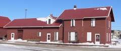 | Fremont, Elkhorn and Missouri Valley Railroad Depot | building | 2005 | 05001291 |
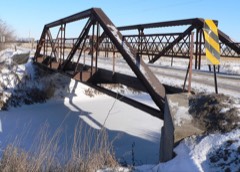 | Meridian Highway | structure | 2001 | 01001273 |
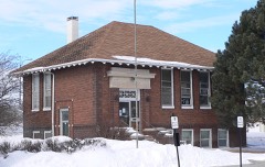 | Plainview Carnegie Library | building | 1993 | 93000056 |
 | Willow Creek Bridge | structure | 1992 | 92000706 |
Every wildfire the federal occurrence database records inside this county: 126 of them, burning about 943 acres. 4 started naturally and none was recorded as arson. Each settlement page carries the fires within five miles of it.
| Reported cause | Fires |
|---|---|
| Debris and open burning | 61 |
| Equipment and vehicle use | 24 |
| Power generation/transmission/distribution | 11 |
| Missing data/not specified/undetermined | 8 |
| Smoking | 8 |
| Natural | 4 |
| Fireworks | 4 |
| Railroad operations and maintenance | 4 |
| Recreation and ceremony | 2 |
The five largest, by the area the report gives. None of them was recorded as arson.
| Date | Cause | Size | Reported by | Name on the report |
|---|---|---|---|---|
| 19 February 2016 | Debris and open burning | 150 acres | Nebraska Forest Service | not named |
| 11 October 2020 | Debris and open burning | 100 acres | Nebraska Forest Service | not named |
| 6 November 2012 | Smoking | 100 acres | Nebraska Forest Service | not named |
| 26 March 2012 | Debris and open burning | 80 acres | Nebraska Forest Service | not named |
| 21 November 2013 | Debris and open burning | 80 acres | Nebraska Forest Service | not named |
| 29 March 2010 | Debris and open burning | 70 acres | Nebraska Forest Service | not named |
| 20 December 2017 | Debris and open burning | 50 acres | Nebraska Forest Service | not named |
| 11 October 2013 | Debris and open burning | 40 acres | Nebraska Forest Service | not named |
Every settlement page carries the fires within five miles of it - see the settlement index below.
The NOAA Storm Events Database holds 279 reports for this county, causing no deaths, 2 injuries and about $4,682,250 in recorded property damage. Each settlement page carries the reports that name it.
| Kind of event | Reports |
|---|---|
| Hail | 138 |
| Thunderstorm Wind | 88 |
| Tornado | 28 |
| Flood | 11 |
| Flash Flood | 7 |
| Funnel Cloud | 5 |
| Lightning | 2 |
The most serious of them, by death, then injury, then recorded damage. The accounts are quoted exactly as the forecast office filed them.
| When | Event | Place named | Harm | What the report says |
|---|---|---|---|---|
| June 1953 | Tornado (F2) | not stated | 2 hurt, $25,000 | no account filed |
| May 1962 | Tornado (F3) | not stated | $2,500,000 | no account filed |
| April 1994 | Thunderstorm Wind | Plainview | $500,000 | Strong thunderstorm winds did around $300,000 damage to mainly farm buildings around Plainview. |
| August 1993 | Tornado (F1) | Pierce | $500,000 | A tornado touched down and traveled across two farms. A large granary was rolled off of its foundation, four buildings were damaged, and a few trees were knocked down. |
| March 2019 | Flash Flood | Pierce | $475,000 | A levee on the North Fork of the Elkhorn River broke due to heavy rains and snow melt. This allowed water to flood Pierce. Homes and businesses were flooded in Pierce. |
| June 1973 | Tornado (F2) | not stated | $250,000 | no account filed |
| July 1996 | Tornado (F0) | Plainview | $120,000 | no account filed |
| May 1993 | Thunderstorm Wind | Pierce | $50,000 | Strong thunderstorm winds blew over a center pivot irrigation system, ripped tin off of an outbuilding, killed a calf and blew over trees. |
| June 1997 | Lightning | Plainview | $28,000 | Lightning struck a home causing damage. |
| April 1974 | Tornado (F0) | not stated | $25,000 | no account filed |
| May 1963 | Tornado | not stated | $25,000 | no account filed |
| June 1960 | Tornado (F2) | not stated | $25,000 | no account filed |
| August 2009 | Flash Flood | Pierce | $20,000 | Heavy rain producing thunderstorms caused flash flooding across some county roads from around Pierce to near Plainview. Besides washing the gravel off of a few county roads, some crops in low areas also sustained damage. Pierce had 4.13 inches from the storm with 4.18 inches reported several miles south of Plainview. The rain began falling during the late afternoon hours of the 15th and persisted a bit past midnight on the 16th. |
| May 2000 | Thunderstorm Wind | Pierce | $20,000 | A second wave of thunderstorm wind gusts hit pierce at 1125 pm cdt. Law enforcement personel estimated the wind gusts at between 80 and 100 mph. These strong winds uprooted or split quite a few trees in town which closed several roads and damaged a few buildings. |
| July 1998 | Thunderstorm Wind | Plainview | $20,000 | One grain bin destroyed and another damaged. |
| July 1998 | Thunderstorm Wind | Osmond | $20,000 | Large trees downed. One of the trees fell on a home. Barn damaged. |
| July 1997 | Lightning | Pierce | $15,000 | Lightning struck a tree outside a home. The electrical current caused damage to the roof and garage door of the home. Some electrical problems also resulted. |
| July 1997 | Thunderstorm Wind | Pierce | $15,000 | no account filed |
| June 2010 | Flood | Hadar | $10,000 | Rainfall of at least 3 to 5 inches fell over much of the upper Elkhorn River basin in the week ending 7am 6/12. This caused lowland flooding along the North Fork of the Elkhorn River near and a bit north of Pierce. Farmland and a few county roads near the river were flooded. Some flooding also occurred along creeks in the Pierce area which flooded a city park in Pierce, a parking lot of a senior manor, and a few roads, all of which prompted the sandbagging of several houses. The North Fork of the Elkhorn River near Pierce crested a little over 14 feet during the late morning of 6/13, flood stage is 12 feet. The river at Pierce was above flood stage from the early morning hours of June 12th until the early evening of 6/16. |
| June 2000 | Hail | Plainview | $10,000 | The hail broke a few car windows and damaged the siding of several houses in the area. |
| August 1997 | Thunderstorm Wind | Pierce | $10,000 | Roof blown off a trailer home along Highway 81 near the Pierce/Madison county line. |
| October 2017 | Flood | Plainview | $5,000 | The North Fork Elkhorn River rose above flood stage for 65 hours. The river crested at 13.36 feet, flood stage is 12 feet. Several county roads near the river flooded. |
| March 2010 | Flood | Osmond | $5,000 | Melting snow, possibly aggravated by ice jamming, caused minor flooding across a few county roads northeast of Osmond. The flooding mainly just washed away some gravel and flooded agricultural lowlands. |
| July 1996 | Tornado (F0) | Pierce | $3,000 | no account filed |
| June 1955 | Tornado (F0) | not stated | $2,500 | no account filed |
| August 1996 | Thunderstorm Wind | Plainview | $2,000 | no account filed |
| June 2006 | Flash Flood | Pierce | $1,000 | Unofficial rainfall amounts of 3 to 4 inches fell locally over sections of Pierce county during the afternoon of 6/17/06. The rain caused flash flooding across Old Highway 98 north of Pierce for several hours. Other than washing out some crops and gravel off of roads, little damage was reported in the area. |
| April 1985 | Tornado (F0) | not stated | $250 | no account filed |
| April 1985 | Tornado (F1) | not stated | $250 | no account filed |
| June 1953 | Tornado (F1) | not stated | $250 | no account filed |
| June 2025 | Hail | Pierce | - | Public report of hail estimated up to 1 inch in diameter. |
| June 2025 | Hail | Pierce | - | Trained spotter report of hail measured up to 1.3 inches in diameter, accompanied by 45 mph wind gusts. |
| June 2025 | Hail | Pierce | - | Law enforcement report of hail up to quarter sized along with heavy rain. |
| August 2025 | Hail | Osmond | - | Public report of hail estimated at 1.25 inch in diameter. |
| July 2025 | Thunderstorm Wind | Pierce | - | Personal weather station measured wind gust of 59 mph. |
| July 2025 | Hail | Foster | - | Trained spotter report of hail measured up to 1 inch in diameter. |
| May 2024 | Funnel Cloud | Mc Lean | - | The office received a photo of a funnel cloud taken by the public. |
| May 2024 | Funnel Cloud | Mc Lean | - | The office received a public report of a funnel cloud that had been observed for 5 minutes before dissipating. |
| May 2024 | Funnel Cloud | Pierce | - | A funnel cloud was reported by the Randolph Fire Chief. |
| August 2024 | Hail | Osmond | - | Broadcast media reported a hailstone that measured 3.25 inches in diameter. |
| August 2024 | Hail | Pierce | - | A trained spotter reported quarter sized hail. |
| July 2024 | Hail | Mc Lean | - | The office received a public report of half dollar sized hail. |
| June 2024 | Hail | Foster | - | The office received a report from a trained sporter of hail ranging from penny to quarter sized. |
| July 2023 | Hail | Mc Lean | - | Trained spotter reported 1-inch hail. |
| July 2023 | Hail | Foster | - | Public reported 1-inch hail. |
| July 2023 | Thunderstorm Wind | Mc Lean | - | Trained spotter reported trees leaning against power lines near Highway 20. |
| July 2023 | Thunderstorm Wind | Plainview | - | Local newspaper reported that the roof was torn off of the Plainview Elementary School. |
| July 2023 | Hail | Osmond | - | Public reported 2-inch hail via social media. |
| April 2023 | Hail | Osmond | - | Public reported 1-inch hail via Mping. |
| April 2023 | Hail | Foster | - | Public reported 1-inch hail. |
| October 2022 | Thunderstorm Wind | Pierce | - | Personal weather station measured a peak wind gust of 72 mph. |
| May 2022 | Thunderstorm Wind | Plainview | - | Emergency manager reported a couple of small sheds destroyed and power lines down. Several grain bins were collapsed from the top and sides. Also reported roof and fence damage. |
| May 2022 | Thunderstorm Wind | Pierce | - | Emergency manager reported trees down a few power poles snapped. |
| May 2022 | Thunderstorm Wind | Osmond | - | Emergency manager reported roof damage to several business and houses. Also reported many trees uprooted. |
| May 2022 | Thunderstorm Wind | Plainview | - | Law enforcement reported damage to a roof of a business and power lines down. |
| August 2021 | Hail | Hadar | - | Trained spotter reported quarter size hail in Hadar. |
| August 2021 | Flood | Plainview Muni Arpt | - | Numerous roads with water over the roadway from 2 miles northeast of Plainview to the Knox/Pierce county border. |
| July 2021 | Thunderstorm Wind | Pierce | - | Emergency manager reported tree damage east of Pierce. |
| July 2021 | Thunderstorm Wind | Foster | - | Personal weather station measured a peak wind gust of 58 mph. |
| August 2021 | Hail | Osmond | - | Public reported quarter sized hail falling in Osmond. |
The Survey's mineral resources record lists 1 working inside this county. It still produces. Each settlement page carries the workings within five miles of it.
| Commodity | Workings |
|---|---|
| Sand and Gravel, Construction | 1 |
The least common of them first, because a county's hundredth gravel pit says nothing its first ten did not.
| Where | Site | Commodity | Status | Recorded |
|---|---|---|---|---|
| Pierce Pit & Plant | Sand and Gravel, Construction | Producer |
Named settlements recorded in the Geographic Names Information System, each with the topographic sheets covering it. Villages, hamlets and abandoned places alike. Each is shown with the nearest named watercourse or landform and the survey quadrangle it falls on.
Plum Grove precinct · 68765 · On East Branch North Fork Elkhorn River · Osmond quadrangle
10 sheets, 1955 to 1985
Eastern precinct · 68771 · Randolph North quadrangle
9 sheets, 1955 to 1985
No longer a settlement
The vanished settlements of Pierce County: the places named above that are no longer on the map.