 Block
Pierce, Nebraska
10 topographic sheets cover this place, the earliest surveyed in 1955 and the latest in 1985. It stands in Pierce City. It lies in ZIP code area 68767. It stands on Willow Creek. The Survey maps it on the Pierce quadrangle. 1,845 people lived here at the 2020 count. It stands 1,581 feet above sea level.
Research this city
On record in Pierce
Buildings and businesses the archive holds for this place. Each opens its own page, with the source record it came from.
On the National Register 1 record
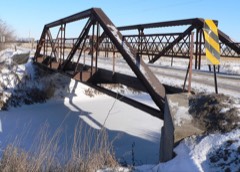 Meridian Highwaylisted 2001
Population over time
2 figuresPierce grew from 1,767 to 1,845 between 2010 and 2020. These are the recorded population figures Wikidata holds for this place, reached through the Geographic Names Information System number this page is keyed on rather than by name, so they belong to this place and not to another of the same name. Most are census counts, but not all are: an early figure may be a founding or settlement estimate, and an estimate published within five years of a census is left out. The change column is computed, and is left blank where more than 20 years separate a figure from the one before it, because a gap that long is not a change between two counts.
| Year | People | Change |
|---|---|---|
| 2010 | 1,767 | |
| 2020 | 1,845 | +78 (+4%) |
Topographic sheets covering this place
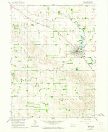
5 surveys from 10 printed sheetsMatched by testing this settlement's coordinate against the published boundary of every sheet in the United States Geological Survey's historical collection. Each opens the scanned sheet at the Survey.
- 1955 USGS Sioux City quadrangle1:250000, 4 printings
- 1958 USGS Sioux City quadrangle1:250000
- 1959 USGS Sioux City quadrangle1:250000
- 1963 USGS Pierce quadrangle1:24000, 2 printings
- 1985 USGS Norfolk quadrangle1:100000, 2 printings
Fires near this place
37 since 2007Regional context, not property-specific evidence. The federal wildfire occurrence database lists 37 fires within 5 miles of Pierce between 2007 and 2020, burning about 137 acres in total. 1 started naturally. None was recorded as arson. Distance is straight-line from the map coordinates, so a fire counted here may appear on a neighbouring settlement's page as well.
| Reported cause | Fires |
|---|---|
| Debris and open burning | 16 |
| Equipment and vehicle use | 10 |
| Power generation/transmission/distribution | 5 |
| Missing data/not specified/undetermined | 3 |
| Fireworks | 2 |
| Natural | 1 |
The most recent of them, most recent first, with the day each was reported and the service that recorded it.
| Date | Cause | Size | Reported by | Name on the report |
|---|---|---|---|---|
| 26 September 2018 | Equipment and vehicle use | under an acre | Nebraska Forest Service | not named |
| 9 July 2009 | Power generation/transmission/distribution | under an acre | Nebraska Forest Service | not named |
| 7 July 2007 | Equipment and vehicle use | 1.0 acres | Nebraska Forest Service | not named |
| 5 July 2013 | Fireworks | under an acre | Nebraska Forest Service | not named |
| 22 July 2013 | Equipment and vehicle use | 2.0 acres | Nebraska Forest Service | not named |
| 4 June 2010 | Power generation/transmission/distribution | under an acre | Nebraska Forest Service | not named |
| 27 June 2017 | Power generation/transmission/distribution | 1.0 acres | Nebraska Forest Service | not named |
| 25 June 2017 | Fireworks | 1.0 acres | Nebraska Forest Service | not named |
Settlements close enough to share some of these fires:
Storms near this place
60 of 88 shownRegional context, not property-specific evidence. The National Weather Service names Pierce in 88 storm reports between 1993 and 2025: 49 hail, 22 thunderstorm wind, 6 tornado, 4 flash flood. No death or injury is recorded in these reports. Each account below is quoted exactly as the forecast office filed it, from the NOAA Storm Events Database, and each date opens the federal record of that event.
| When | Event | Place named | Harm | What the report says |
|---|---|---|---|---|
| August 1993 | Tornado (F1) | Pierce | $500,000 | A tornado touched down and traveled across two farms. A large granary was rolled off of its foundation, four buildings were damaged, and a few trees were knocked down. |
| March 2019 | Flash Flood | Pierce | $475,000 | A levee on the North Fork of the Elkhorn River broke due to heavy rains and snow melt. This allowed water to flood Pierce. Homes and businesses were flooded in Pierce. |
| May 1993 | Thunderstorm Wind | Pierce | $50,000 | Strong thunderstorm winds blew over a center pivot irrigation system, ripped tin off of an outbuilding, killed a calf and blew over trees. |
| August 2009 | Flash Flood | Pierce | $20,000 | Heavy rain producing thunderstorms caused flash flooding across some county roads from around Pierce to near Plainview. Besides washing the gravel off of a few county roads, some crops in low areas also sustained damage. Pierce had 4.13 inches from the storm with 4.18 inches reported several miles south of Plainview. The rain began falling during the late afternoon hours of the 15th and persisted a bit past midnight on the 16th. |
| May 2000 | Thunderstorm Wind | Pierce | $20,000 | A second wave of thunderstorm wind gusts hit pierce at 1125 pm cdt. Law enforcement personel estimated the wind gusts at between 80 and 100 mph. These strong winds uprooted or split quite a few trees in town which closed several roads and damaged a few buildings. |
| July 1997 | Lightning | Pierce | $15,000 | Lightning struck a tree outside a home. The electrical current caused damage to the roof and garage door of the home. Some electrical problems also resulted. |
| July 1997 | Thunderstorm Wind | Pierce | $15,000 | no account filed |
| August 1997 | Thunderstorm Wind | Pierce | $10,000 | Roof blown off a trailer home along Highway 81 near the Pierce/Madison county line. |
| July 1996 | Tornado (F0) | Pierce | $3,000 | no account filed |
| June 2006 | Flash Flood | Pierce | $1,000 | Unofficial rainfall amounts of 3 to 4 inches fell locally over sections of Pierce county during the afternoon of 6/17/06. The rain caused flash flooding across Old Highway 98 north of Pierce for several hours. Other than washing out some crops and gravel off of roads, little damage was reported in the area. |
| June 2025 | Hail | Pierce | - | Public report of hail estimated up to 1 inch in diameter. |
| June 2025 | Hail | Pierce | - | Trained spotter report of hail measured up to 1.3 inches in diameter, accompanied by 45 mph wind gusts. |
| June 2025 | Hail | Pierce | - | Law enforcement report of hail up to quarter sized along with heavy rain. |
| July 2025 | Thunderstorm Wind | Pierce | - | Personal weather station measured wind gust of 59 mph. |
| May 2024 | Funnel Cloud | Pierce | - | A funnel cloud was reported by the Randolph Fire Chief. |
| August 2024 | Hail | Pierce | - | A trained spotter reported quarter sized hail. |
| October 2022 | Thunderstorm Wind | Pierce | - | Personal weather station measured a peak wind gust of 72 mph. |
| May 2022 | Thunderstorm Wind | Pierce | - | Emergency manager reported trees down a few power poles snapped. |
| July 2021 | Thunderstorm Wind | Pierce | - | Emergency manager reported tree damage east of Pierce. |
| August 2021 | Hail | Pierce | - | Public reported vis social media 1.5-inch hail in Pierce. |
| April 2014 | Hail | Pierce | - | The ground was covered with mostly pea size hail, but a few up to quarter size was also observed in Pierce. The hail extended north of Pierce for several miles were hail up to half dollar size was measured. |
| June 2014 | Thunderstorm Wind | Pierce | - | The public reported wind gusts to 60 mph. |
| May 2012 | Hail | Pierce | - | Hail up to baseball-size fell from the Willow Creek State Recreation area into Pierce. Several campers and vehicles were damaged. |
| August 2011 | Hail | Pierce | - | Most of the hail was quarter-size, but a few were around ping-pong ball-size. |
| February 2011 | Flood | Pierce | - | Melting snow and a possible ice jam caused minor flooding along the North Fork of the Elkhorn River around and downstream of the Pierce area. The river at Pierce crested a little over its 12 foot flood stage during the late afternoon and evening of Feb. 18th. The flood waters mainly affected agricultural lowlands. |
| June 2011 | Tornado (EF1) | Pierce | - | An EF1 tornado was determined to cause damage from southeast of Pierce to east of Osmond. The initial damage from the tornado was noted near 522nd Avenue and 852nd Street where trees were uprooted. The tornado tracked north northwest striking a farm after it crossed Highway 98 destroying farm outbuildings and uprooting trees in the area. The tornado uprooted or caused other tree damage along its path and destroyed other farm outbuildings and flipped center pivots. In one area along its path the track became visible in a corn field. Some power poles were downed and in one case farm equipment was tossed over 300 yards while another farmstead had its debris carried nearly a quarter of a mile to the northwest. In addition, a steel bin was blown about 300 feet onto Highway 81 near the Jct. with Old Highway 98 where a car hit it injuring a man and totaling his car. A small part of a roof of a home of another farmstead was removed. A large chicken barn near Old Highway 98 had its roof blown off. The tornado appeared to weaken as it moved north toward 864th Road overturning more pivots and producing tree damage before ending near that area. |
| June 2011 | Thunderstorm Wind | Pierce | - | Thunderstorm wind gusts estimated at over 70 mph caused significant tree and outbuilding damage from around 2 miles southwest of Willow Lake through Pierce and a little northwest of town. A house also lost part of its roof south of Willow Lake. Downed power lines also caused loss of power in the area. The damage could have been from a possible tornado that a NWS storm assessment team determined to track near this area. |
| April 2010 | Hail | Pierce | - | Hail, mostly up to 1 inch in diameter, covered the ground west of Pierce. A few hailstones reached golfball-size. |
| April 2010 | Hail | Pierce | - | From the second severe storm to hit the area in about 1 hour. |
| June 2010 | Hail | Pierce | - | The hail was accompanied by winds that were estimated at over 60 mph. The wind driven hail caused crop damage in the area and also some damage in town. |
| June 2010 | Thunderstorm Wind | Pierce | - | Thunderstorm winds estimated at around 70 mph caused extensive damage in and near Pierce. Buildings sustained roof damage and numerous trees were downed which also downed some power lines. Especially hard hit was Gilman Park where one large cottonwood fell on the park shelter house destroying it. About 15 dump-truck loads of cut-up trees and branches were hauled away from the park alone. A center pivot was flipped and other personal property damage was noted. Several roads were blocked by the fallen trees. According to the park superintendent the damage was mainly in a 5-mile-by-3 mile area. Crops in the area also sustained damage due wind driven hail that was up to 1 inch in diameter. |
| June 2009 | Thunderstorm Wind | Pierce | - | Law enforcement reported thunderstorm wind gusts estimated at 60 mph. |
| March 2008 | Flood | Pierce | - | The flooding crossed county roads around 25 times near Pierce, closing many of them for a time. |
| July 2008 | Thunderstorm Wind | Pierce | - | Large tree limbs and power lines were downed in the Pierce area by thunderstorm wind gusts estimated at over 60 mph. |
| March 2007 | Flood | Pierce | - | Snow melt on top of saturated or frozen soils caused the North Fork of the Elkhorn River to flood a park and some county roads near Pierce. |
| July 2007 | Hail | Pierce | - | Hail up to 1.5 inches in diameter was reported 12 miles west of Pierce and corn was reported stripped by the hail about 8 miles west of town. |
| September 2006 | Thunderstorm Wind | Pierce | - | Thunderstorm winds estimated at 70 mph destroyed a 40 foot by 100 foot machine building. |
| June 2005 | Thunderstorm Wind | Pierce | - | Thunderstorm wind gusts in excess of 60 mph blew down several trees on roads in Pierce. |
| April 2004 | Tornado (F0) | Pierce | - | A small tornado was seen by a trained spotter in an open field northwest of Pierce. The tornado caused no apparent damage and was only briefly on the ground. |
| April 2004 | Hail | Pierce | - | Hail around 1 inch in diameter fell for about 20 minutes near Pierce. |
| April 2004 | Tornado (F0) | Pierce | - | The emergency manager of Pierce county followed this tornado for nearly 6 miles. The tornado touched down from a different storm that produced the tornado a few minutes earlier to the west of Pierce. This tornado also remained in open fields and caused no apparent damage. |
| May 2004 | Flash Flood | Pierce | - | Rainfall of 2 to 3 inches fell across much of Pierce county during the evening of 5/22. The rains fell on saturated soils due to 1 to 2 inches of rain that fell during the previous night. The rain produced flash flooding in the town of Pierce which closed Highway 13 in town for a while. |
| July 2003 | Thunderstorm Wind | Pierce | - | Thunderstorm wind gusts estimated at 60 mph downed large tree limbs in Pierce. |
| August 2002 | Hail | Pierce | - | Hail up to tennis ball size did extensive damage to houses, vehicles and trees in town. |
| July 2001 | Hail | Pierce | - | Hail up to nickel size caused extensive damage to grapes at a vineyard near Pierce. |
| May 2000 | Thunderstorm Wind | Pierce | - | Thunderstorm wind gusts of 70 mph were reported by 2 separate storm spotters in Pierce. |
| June 2000 | Tornado (F0) | Pierce | - | This tornado apparently tracked from southwest Pierce county into northwest Madison county. The tornado did little if any damage as it tracked mainly in open country...and it also might not have been on the ground for the whole track of the storm. |
| July 1997 | Hail | Pierce | - | Corn crops were flattened in fields southwest of Pierce. |
| June 1997 | Thunderstorm Wind | Pierce | - | Few tree limbs downed. |
| July 1994 | Thunderstorm Wind | Pierce | - | Minor wind damage occurred in Pierce. |
| June 2018 | Hail | Pierce | - | no account filed |
| April 2017 | Hail | Pierce | - | no account filed |
| June 2016 | Hail | Pierce | - | no account filed |
| June 2015 | Hail | Pierce | - | no account filed |
| September 2015 | Hail | Pierce | - | no account filed |
| June 2014 | Hail | Pierce | - | no account filed |
| August 2011 | Hail | Pierce | - | no account filed |
| September 2010 | Hail | Pierce | - | no account filed |
| June 2008 | Hail | Pierce | - | no account filed |
| June 2008 | Hail | Pierce | - | no account filed |
Nearest settlements
The eight closest, with where each one stands in the county. Distances are straight-line, computed from the Geographic Names Information System coordinates.
| Map | Place | Distance | Sheets |
|---|---|---|---|
| Wee Town | 5.4 miles | 10 | |
| Hadar | 7.7 miles | 10 | |
| Foster | 8.9 miles | 9 | |
| Osmond | 11.7 miles | 10 | |
| McLean | 13.2 miles | 9 | |
| Breslau | 13.9 miles | 9 | |
| West Randolph (historical) | 15.0 miles | 9 | |
| East End Tailer Court | 17.0 miles | 9 |
Elsewhere
Matched on this settlement's Geographic Names Information System number rather than its name, so it cannot be a different place of the same name in another state.
| Wikipedia article on Pierce | An encyclopaedic summary. Its text is share-alike, so it is linked here rather than copied. |
| Wikidata item Q963193 | The structured record the population and elevation above come from. Public domain (CC0). |
Provenance
This settlement is recorded in the Geographic Names Information System as feature 832093. The sheet list is computed by point-in-boundary test against the United States Geological Survey's historical topographic inventory. Both are works of the United States government and carry no copyright under 17 U.S.C. 105.
Wildfire. Short, Karen C. 2022. Spatial wildfire occurrence data for the United States, 1992-2020 [FPA_FOD_20221014]. 6th Edition. Fort Collins, CO: Forest Service Research Data Archive. https://doi.org/10.2737/RDS-2013-0009.6 Collected with United States Government funding and usable without additional permissions or fees.
Storms. NOAA National Centers for Environmental Information, Storm Events Database https://www.ncei.noaa.gov/stormevents/ A work of the United States government, no copyright under 17 U.S.C. 105. Narratives are quoted verbatim from the National Weather Service report and are not edited or summarised.