 Block
From the record
8 National Register listings published here, 1 of them a National Historic Landmark.
Sources: the National Register database, National Park Service
19 topographic sheets cover 9 settlements here, and 8 properties are on the National Register of Historic Places.
8 National Register listings published here, 1 of them a National Historic Landmark.
Sources: the National Register database, National Park Service
Every property in this county listed on the National Register of Historic Places, with the year it was listed and the federal nomination document.
| Photograph | Property | Type | Listed | Reference |
|---|---|---|---|---|
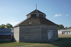 | Bartley Sales Barn | building | 2018 | 100001356 |
 | Keystone Hotel | building | 2001 | 01000710 |
 | McCook Public-Carnegie Library | building | 1985 | 85002142 |
 | McCook YMCA | building | 2000 | 00000167 |
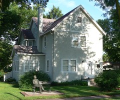 | Senator George William Norris House | building | 1967 | 67000006 |
 | Red Willow County Courthouse | building | 1990 | 90000966 |
| Second-Generation Norden Bombsight Vault | structure | 1993 | 93000534 | |
 | H. P. Stutton House | building | 1978 | 78001708 |
Every wildfire the federal occurrence database records inside this county: 100 of them, burning about 1,504 acres. 4 started naturally and none was recorded as arson. Each settlement page carries the fires within five miles of it.
| Reported cause | Fires |
|---|---|
| Debris and open burning | 33 |
| Equipment and vehicle use | 21 |
| Missing data/not specified/undetermined | 18 |
| Power generation/transmission/distribution | 11 |
| Railroad operations and maintenance | 5 |
| Natural | 4 |
| Smoking | 3 |
| Fireworks | 3 |
| Recreation and ceremony | 2 |
The five largest, by the area the report gives. None of them was recorded as arson.
| Date | Cause | Size | Reported by | Name on the report |
|---|---|---|---|---|
| 18 October 2016 | Missing data/not specified/undetermined | 265 acres | Nebraska Forest Service | not named |
| 5 March 2018 | Debris and open burning | 215 acres | Nebraska Forest Service | not named |
| 7 March 2018 | Missing data/not specified/undetermined | 200 acres | Nebraska Forest Service | not named |
| 6 March 2018 | Missing data/not specified/undetermined | 200 acres | Nebraska Forest Service | not named |
| 15 March 2018 | Debris and open burning | 50 acres | Nebraska Forest Service | not named |
| 18 March 2011 | Smoking | 50 acres | Nebraska Forest Service | not named |
| 4 March 2009 | Equipment and vehicle use | 50 acres | Nebraska Forest Service | not named |
| 9 July 2008 | Equipment and vehicle use | 41 acres | Nebraska Forest Service | not named |
Every settlement page carries the fires within five miles of it - see the settlement index below.
The NOAA Storm Events Database holds 596 reports for this county, causing no deaths, 9 injuries and about $6,151,070 in recorded property damage. Each settlement page carries the reports that name it.
| Kind of event | Reports |
|---|---|
| Hail | 294 |
| Thunderstorm Wind | 237 |
| Tornado | 40 |
| Flash Flood | 13 |
| Flood | 5 |
| Lightning | 4 |
| Funnel Cloud | 3 |
The most serious of them, by death, then injury, then recorded damage. The accounts are quoted exactly as the forecast office filed them.
| When | Event | Place named | Harm | What the report says |
|---|---|---|---|---|
| August 2011 | Hail | Mc Cook | 3 hurt, $1,000 | Hail sizes from one inch to 1.75 inches in diameter were reported. One person was injured at Wal-Mart while trying to move out of the way of broken glass falling from a skylight. A woman was injured when a hail stone struck her thumb, breaking it. Another woman had glass blown in her face and eyes when a hail stone broke a window in front of her. Preliminary estimates have 10,000 acres of crops suffering 75 percent damage or more as reported in the Gazette. |
| July 2002 | Thunderstorm Wind | Mc Cook | 2 hurt, $100,000 | Refer to event narrative for July 21st. |
| July 1986 | Thunderstorm Wind | not stated | 2 hurt | no account filed |
| July 1994 | Thunderstorm Wind | McCook | 1 hurt, $500,000 | A Walmart store was damaged by strong winds. An eleven year old boy standing near a fireworks stand in the parking lot was thrown 40 yards and injured slightly with scrapes and bruises. |
| April 2008 | Lightning | Mc Cook | 1 hurt | A 9-year old boy ran outside to retrieve a cardboard box before the storm arrived so it wouldn't blow away. As he was retrieving the box which was near a yard light, lightning struck the light pole and jumped to a metal button on his coat. He complained of shoulder pain, a tingling sensation in his body and a metal taste in his mouth. He was taken to the hospital where tests were performed, then treated and released. |
| June 1990 | Tornado (F4) | not stated | $2,500,000 | no account filed |
| August 1996 | Tornado (F2) | Indianola | $750,000 | no account filed |
| May 2024 | Thunderstorm Wind | Mc Cook | $500,000 | Variety of damage to a property due to damaging winds ranging from 78 to 118 mph. Five sets of double poles snapped near the ground for a half mile going north from this location in addition to some power lines down facing the east. Parts of boards from an outbuilding were impaled into a metal shed. A yard shed was also overturned. |
| May 2008 | Tornado (EF1) | Lebanon | $350,000 | This tornado moved into Red Willow county from Decatur county, Kansas. A garage lost a roof and 2 walls approximately 3.5 miles north of Lebanon. A stock trailer was pushed 6 feet and 4 oil tanks were blown over, one being tossed 1/4 mile. About 25 utility poles were either broken or damaged in this area. |
| June 2000 | Hail | Bartley | $250,000 | Reports of Baseball size Hail resulted in broken windows and crop damage in and around Bartley. Crop Damage unknown. |
| May 1990 | Tornado (F1) | not stated | $250,000 | no account filed |
| May 2008 | Flood | Mc Cook | $200,000 | Several days of heavy rainfall resulted in widespread flooding of county roads across the county. |
| May 2024 | Thunderstorm Wind | Mc Cook | $80,000 | A pivot was blown over by straight line winds. |
| May 2024 | Thunderstorm Wind | Mc Cook | $80,000 | A pivot was blown over by straight line winds. |
| May 2024 | Thunderstorm Wind | Mc Cook | $80,000 | A pivot was blown over by straight line winds into power poles. The power poles didn't appear to be damaged. A road sign was also blown towards the east-northeast. |
| April 2008 | Thunderstorm Wind | Danbury | $79,000 | In Marion, a grain bin was blown over in the SW corner of town, a garage was damaged and several power poles were down. In Danbury, a tree was blown onto a porch, a pivot irrigation system was toppled and tree and mobile home damage was reported west of town. |
| July 2013 | Thunderstorm Wind | Mc Cook | $50,000 | A large metal industrial building oriented east-west lost its roof and the south wall by an intense thunderstorm downburst. The roof debris was blown to the north, with pieces thrown onto Hwy 34. Time of damage is estimated from a nearby wind gust at the McCook airport and by Doppler radar. |
| August 2013 | Thunderstorm Wind | Mc Cook | $47,500 | Multiple trees split/uprooted. One tree crushed two vehicles and damaged a garage near E 1st and D St. Damage report relayed via Spotter Network. |
| August 2010 | Thunderstorm Wind | (Mck)Mc Cook Arpt | $41,000 | An apparent microburst in McCook resulted in a small area of damage. A 6000 square foot section of roof was torn from the local lumberyard and the sheet metal wrapped around and damaged several vehicles causing severe body and tire damage. A light pole was downed and a nearby car dealership sustained damage. A peak wind gust of 59 mph occurred at the airport as measured by ASOS, but damage in town occurred from an estimated 80 mph wind gust. |
| April 2007 | Flash Flood | Mc Cook | $25,000 | Rainfall of 3 to 5 inches fell Monday night (4/23) into Tuesday morning, resulting in about 10 county roads being washed out. Road 714 south of McCook was reported closed, and many others suffered damage. A man had to be rescued from a small island in the Republican River in McCook where he camped out, when swift moving water rose and ultimately submerged the island. Coop observer 3 N of McCook received 4.25 of rain overnight, with 4.00 falling in McCook. |
| June 1975 | Tornado (F1) | not stated | $25,000 | no account filed |
| June 1975 | Tornado (F0) | not stated | $25,000 | no account filed |
| June 1964 | Tornado (F1) | not stated | $25,000 | no account filed |
| May 1950 | Tornado (F1) | not stated | $25,000 | no account filed |
| March 2021 | Thunderstorm Wind | Mc Cook | $20,000 | A loud southwest wind pulled posts out of the ground of a three sided shed open to the east. The roof was blown 30-40 ft. away to the east of the rest of the building, and the walls were leaning outward. Minor damage was done to the vehicles in the shed. The same winds blew some of the shingles off the northeast corner of the house and garage nearby. Estimated time of report from radar. Key impacts: damaging winds, straight-line winds, property damage. |
| July 2021 | Thunderstorm Wind | Mc Cook | $20,000 | Multiple McCook school buses had many side windows blown out of them. The city of McCook was also out of power for approximately four hours. |
| July 2020 | Thunderstorm Wind | (Mck)Mc Cook Arpt | $15,200 | Citizen reported a two car garage door and window blown out due to strong winds. |
| May 2024 | Thunderstorm Wind | Mc Cook | $15,000 | Variety of damage to two neighboring residences with gusts estimated of 90 to 110 mph. An anchored yard shed was rolled. Several hardwood trees were uprooted or had broken limbs. |
| September 2007 | Thunderstorm Wind | Indianola | $10,000 | Damage to farmstead. Porch roof blown off...damaged outbuildings and scattered sheet metal around yard. Radar indicated strong outflow winds from thunderstorm. Wind speed estimated and time based on radar. |
| August 2002 | Thunderstorm Wind | Mc Cook | $10,000 | Roof damage to shopping center |
| June 1999 | Tornado (F1) | Danbury | $6,500 | no account filed |
| May 2011 | Lightning | Mc Cook | $6,000 | Time is estimated from radar. Newspaper account only mentioned the strike occurred during the overnight hours. Three separate rounds of thunderstorms moved through the McCook area overnight. Radar indicated one such storm moved through around midnight CDT time. |
| July 2020 | Thunderstorm Wind | Mc Cook | $5,250 | Law enforcement reported tree limbs of various sizes down along with a snapped power pole in northern McCook. The damage occurred near the time of a measured 79 mph wind gust at the McCook ASOS station. |
| May 2024 | Thunderstorm Wind | Mc Cook | $5,000 | A variety of hardwood and softwood trees were uprooted or had trunks snapped. |
| May 2024 | Thunderstorm Wind | Mc Cook | $5,000 | Top of a cedar tree was broken off next to uprooted pine trees. A Trampoline was moved roughly 30 feet behind pine trees. |
| August 2021 | Thunderstorm Wind | Mc Cook | $5,000 | Report received of an estimated 70 mph thunderstorm wind gust that broke one-inch tree limbs and blew shingles off of a house. Wind speed is estimated based on the storm damage. |
| May 1993 | Hail | McCook to | $5,000 | no account filed |
| August 2019 | Thunderstorm Wind | Bartley | $4,000 | Power lines were reported down along US Highway 34 just west of the Red Willow/Furnas County line. Time estimated by radar. |
| May 2023 | Flood | (Mck)Mc Cook Arpt | $3,500 | Barnett Park in McCook flooded due to the Republican River rising out of its banks. It remained flooded until the afternoon of the 28th. Highway 34 and 83 both had to be closed due to the river flooding over them. |
| May 1990 | Tornado (F1) | not stated | $2,500 | no account filed |
| May 1990 | Tornado (F0) | not stated | $2,500 | no account filed |
| June 1975 | Tornado (F1) | not stated | $2,500 | no account filed |
| June 1971 | Tornado (F0) | not stated | $2,500 | no account filed |
| July 2021 | Thunderstorm Wind | Mc Cook | $2,000 | As storms moved across Red Willow County, winds associated with the storm's outflow blew a fence down on the north side of McCook. |
| June 2018 | Thunderstorm Wind | Indianola | $2,000 | A large tree was destroyed and a camper trailer was moved at a residence in Indianola. |
| June 1997 | Thunderstorm Wind | Indianola | $2,000 | no account filed |
| May 2024 | Thunderstorm Wind | Mc Cook | $1,500 | Building frame for new garage pushed east. |
| May 2020 | Thunderstorm Wind | Marion | $1,500 | A public report was received with damaging wind gusts causing the following damage at location: a small shed was destroyed on the property and a few large trees were snapped in half. Estimated wind speed based on storm damage. |
| July 2011 | Thunderstorm Wind | (Mck)Mc Cook Arpt | $1,500 | Numerous large tree limbs were downed across the city of McCook. |
| July 2015 | Thunderstorm Wind | Mc Cook | $1,300 | A mature tree at West 3rd near the elementary school in McCook was uprooted, large limbs of at least a foot in diameter were blown down in Barnett Park, and two inch diameter tree limbs were blown down at Kiplinger arena. |
| July 2025 | Flash Flood | Marlon | $1,000 | Storm chaser livestream showed water running over Nebraska road 89. Estimated 3 to 6 inches deep. |
| May 2024 | Thunderstorm Wind | Mc Cook | $1,000 | A hardwood tree was uprooted. |
| May 2024 | Thunderstorm Wind | Mc Cook | $1,000 | Pine trees snapped or uprooted on property. |
| May 2024 | Tornado (EF0) | Perry | $1,000 | A brief two-minute duration EF-0 tornado snapped branches off a cedar tree, which was the only damage found along the path. Winds were estimated to be 85 mph. |
| June 2011 | Thunderstorm Wind | (Mck)Mc Cook Arpt | $1,000 | Two wind gusts were reported...a 60 mph gust at 907 pm CDT and a 67 mph gust at 912 pm CDT. Numerous tree limbs and some trees were reported down in McCook as a result of the storm. |
| August 2011 | Hail | Danbury | $1,000 | Spotter reported windows broken. |
| April 2009 | Lightning | Mc Cook | $1,000 | KIOD radio reported a lightning strike near 5th and Q Street in McCook. The utility pole was destroyed and fire units were dispatched to the scene due to downed live wires. |
| August 2002 | Thunderstorm Wind | Mc Cook | $1,000 | Several power poles down, and minor tree damage. |
| June 2019 | Thunderstorm Wind | Bartley | $500 | Reported thunderstorm wind damage with a patio umbrella broken off an outdoor table. |
| August 2010 | Thunderstorm Wind | Bartley | $500 | Large tree was blown down by thunderstorm winds. |
The Survey's mineral resources record lists 1 working inside this county. It still produces. Each settlement page carries the workings within five miles of it.
| Commodity | Workings |
|---|---|
| Sand and Gravel, Construction | 1 |
The least common of them first, because a county's hundredth gravel pit says nothing its first ten did not.
| Where | Site | Commodity | Status | Recorded |
|---|---|---|---|---|
| Mccook West Pit & Plant | Sand and Gravel, Construction | Producer |
Named settlements recorded in the Geographic Names Information System, each with the topographic sheets covering it. Villages, hamlets and abandoned places alike. Each is shown with the nearest named watercourse or landform and the survey quadrangle it falls on.
Red Willow precinct · 69034 · On Red Willow Creek · Indianola quadrangle
8 sheets, 1954 to 1979