 Block
Arago, Nebraska
14 topographic sheets cover this place, the earliest surveyed in 1920 and the latest in 1986. It stands in Arago precinct. It lies in ZIP code area 68355. The Survey maps it on the Corning quadrangle. The federal gazetteer marks this settlement historical: it is no longer a populated place, though the surveys that recorded it still are.
Topographic sheets covering this place
6 surveys from 14 printed sheetsMatched by testing this settlement's coordinate against the published boundary of every sheet in the United States Geological Survey's historical collection. Each opens the scanned sheet at the Survey.
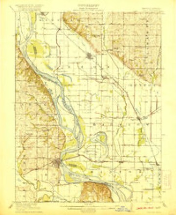
- 1920 USGS Craig quadrangle1:62500, 5 printings
- 1955 USGS Nebraska City quadrangle1:250000, 3 printings
- 1957 USGS Nebraska City quadrangle1:250000
- 1958 USGS Nebraska City quadrangle1:250000
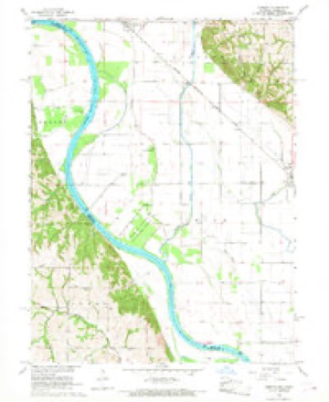
- 1966 USGS Corning quadrangle1:24000, 2 printings
- 1986 USGS Falls City quadrangle1:100000, 2 printings
In the county-history sources
2,503 words on this townshipHistory of Richardson County, Nebraska : Its People, Industries and Institutions, published 1917 names this settlement in its chapter on Arago Precinct. These are the passages that mention it, exactly as the scans read.
The town of Arago gives the name to the precinct. This town was founded by a colony of Germans from Buffalo, Xew York, in the summer of 1858. Owing to its location on the ^Missouri river, where it had a boat service both up and down that stream, and its other flattering prospects as a town, the sale of town lots was quite lively. Judge C. H. Walther was the pioneer merchant of the place, antl there also was at the time Hon. Lewis Algewahr, who was then running a saw-mill, surveying the township, etc. Somerland was with the Burchards, Fredericks (Uncle Peter), the Neitzels, Nutzmans, Stock and Wirth among its citizens. The first and greatest attempt at a packing house was the pork-packing establishment conducted at this place, by Mr. Lewis Algewahr. As a grain market Arago stood second to no other place in the county in the early days. It had dry goods, drugs, meat market, pork-packing establishment, cooper shop, flour- and saw-mills, grain merchants, brewery, furniture store, jewelry, blacksmith, tin, and shoe shops, hotels, saloon, a singer hall, a fine brass band, etc.. etc., besides a jolly, good-natured population.
Passage source: History of Richardson County, Nebraska : Its People, Industries and Institutions, published 1917.
The German settlement was first commenced by a colony from Buft'alo. to which we ha\e already alluded as founding the village of Arago in 1858. Rallying around the little nucleus formed at Arago, the settlement rapidly extended until it became a large and distinctive element in our population. Prior to the organization and location of the German colony, there was some settlement made in this precinct, but mostly from Missouri. The lands of this i)recinct being altogether on the Half-Breed Reserve, were allotted to half-breed Indians.
Passage source: History of Richardson County, Nebraska : Its People, Industries and Institutions, published 1917.
Machine-read from a century-old scan, so expect the errors a machine makes: misspelled names, dropped words, stray characters.
Read the whole chapter on Arago Precinct - it names this place 1 more 1 time.
Fires near this place
6 since 2009Regional context, not property-specific evidence. The federal wildfire occurrence database lists 6 fires within 5 miles of Arago (historical) between 2009 and 2020, burning about 53 acres in total. None started naturally. None was recorded as arson. Distance is straight-line from the map coordinates, so a fire counted here may appear on a neighbouring settlement's page as well.
| Reported cause | Fires |
|---|---|
| Equipment and vehicle use | 3 |
| Debris and open burning | 2 |
| Smoking | 1 |
The most recent of them, most recent first, with the day each was reported and the service that recorded it.
| Date | Cause | Size | Reported by | Name on the report |
|---|---|---|---|---|
| 20 September 2018 | Equipment and vehicle use | 25 acres | Nebraska Forest Service | not named |
| 7 February 2009 | Smoking | 2.0 acres | Nebraska Forest Service | not named |
| 18 February 2018 | Debris and open burning | under an acre | Nebraska Forest Service | not named |
| 10 February 2009 | Debris and open burning | 3.0 acres | Nebraska Forest Service | not named |
| 18 November 2020 | Equipment and vehicle use | 20 acres | Nebraska Forest Service | not named |
| 9 October 2010 | Equipment and vehicle use | 3.0 acres | Nebraska Forest Service | not named |
Settlements close enough to share some of these fires:
Nearest settlements
The eight closest, with where each one stands in the county. Distances are straight-line, computed from the Geographic Names Information System coordinates.
| Map | Place | Distance | Sheets |
|---|---|---|---|
| Williamsville (historical) | 4.1 miles | 12 | |
| Yancton (historical) | 6.0 miles | 13 | |
| Archer (historical) | 6.5 miles | 12 | |
| Barada | 7.0 miles | 12 | |
| Rulo | 7.4 miles | 13 | |
| Preston | 8.4 miles | 12 | |
| Preston Census Designated Place | 8.4 miles | 12 | |
| Straussville | 8.8 miles | 11 |
Provenance
This settlement is recorded in the Geographic Names Information System as feature 1883545. The sheet list is computed by point-in-boundary test against the United States Geological Survey's historical topographic inventory. Both are works of the United States government and carry no copyright under 17 U.S.C. 105.
Wildfire. Short, Karen C. 2022. Spatial wildfire occurrence data for the United States, 1992-2020 [FPA_FOD_20221014]. 6th Edition. Fort Collins, CO: Forest Service Research Data Archive. https://doi.org/10.2737/RDS-2013-0009.6 Collected with United States Government funding and usable without additional permissions or fees.