 Block
From the record
11 National Register listings published here.
Sources: the county history on the Internet Archive · the National Register database, National Park Service
33 topographic sheets cover 19 settlements here, and 11 properties are on the National Register of Historic Places.
11 National Register listings published here.
Sources: the county history on the Internet Archive · the National Register database, National Park Service
Every property in this county listed on the National Register of Historic Places, with the year it was listed and the federal nomination document.
| Photograph | Property | Type | Listed | Reference |
|---|---|---|---|---|
 | R.A. Clark House | building | 2015 | 15000395 |
| Falls City Commercial Historic District | district | 2013 | 13001023 | |
 | Gehling's Theatre | building | 1988 | 88000942 |
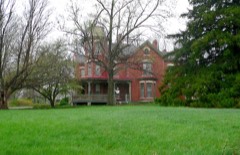 | John Holman House | building | 1972 | 72000756 |
| Humboldt Commercial Historic District | district | 2005 | 05000999 | |
 | Miles Ranch | building | 2012 | 12001075 |
 | Richardson County Courthouse | district | 1990 | 90000965 |
 | Rulo Bridge | structure | 92000718 | |
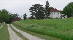 | Alfred and Magdalena Schmid Farmstead | building | 2005 | 05001292 |
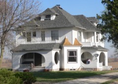 | Way Side Stock Farm | building | 2015 | 15000090 |
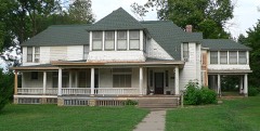 | Gov. Arthur J. Weaver House | building | 2005 | 05000356 |
Every wildfire the federal occurrence database records inside this county: 97 of them, burning about 2,413 acres. None started naturally and none was recorded as arson. Each settlement page carries the fires within five miles of it.
| Reported cause | Fires |
|---|---|
| Debris and open burning | 73 |
| Missing data/not specified/undetermined | 11 |
| Equipment and vehicle use | 8 |
| Power generation/transmission/distribution | 2 |
| Smoking | 2 |
| Railroad operations and maintenance | 1 |
The five largest, by the area the report gives. None of them was recorded as arson.
| Date | Cause | Size | Reported by | Name on the report |
|---|---|---|---|---|
| 5 March 2005 | Missing data/not specified/undetermined | 1,020 acres | Nebraska Forest Service | not named |
| 2 March 2012 | Debris and open burning | 200 acres | Nebraska Forest Service | not named |
| 17 April 2019 | Debris and open burning | 110 acres | Nebraska Forest Service | not named |
| 6 March 2020 | Debris and open burning | 100 acres | Nebraska Forest Service | not named |
| 12 March 2012 | Debris and open burning | 95 acres | Nebraska Forest Service | not named |
| 17 February 2020 | Debris and open burning | 80 acres | Nebraska Forest Service | not named |
| 4 April 2016 | Debris and open burning | 70 acres | Nebraska Forest Service | not named |
| 11 March 2016 | Debris and open burning | 60 acres | Nebraska Forest Service | not named |
Every settlement page carries the fires within five miles of it - see the settlement index below.
The NOAA Storm Events Database holds 348 reports for this county, causing no deaths, no injuries and about $4,485,000 in recorded property damage. Each settlement page carries the reports that name it.
| Kind of event | Reports |
|---|---|
| Hail | 133 |
| Thunderstorm Wind | 124 |
| Flood | 41 |
| Tornado | 23 |
| Flash Flood | 12 |
| Heavy Rain | 12 |
| Lightning | 2 |
| Funnel Cloud | 1 |
The most serious of them, by death, then injury, then recorded damage. The accounts are quoted exactly as the forecast office filed them.
| When | Event | Place named | Harm | What the report says |
|---|---|---|---|---|
| October 2024 | Thunderstorm Wind | Falls City | $1,500,000 | A swath of destructive straight line winds impacted portions of southeast Richardson County including Falls City. The Falls City ASOS measured a 91 miles per hour wind gust at 1:09 pm CDT, and again at 1:12 pm CDT. The ASOS lost power and stopped transmitting data at 1:15 pm CDT. Widespread tree damage was reported across Falls City with snow plows assisting in the removal of tree debris. Trees went through the roofs of two homes, and an additional house had a wall blown down as reported by law enforcement. A large factory in town lost approximately 3 to 4 thousand square feet of its roof. Powerlines were down across the southeast portion of the county, debris was strewn out across fields, and a school bus was reported to have been moved by the wind. |
| June 2010 | Flood | Barada | $500,000 | Heavy rain over much of eastern Nebraska and western Iowa during most of June caused a prolonged period of flooding along the Missouri River, especially downstream of Omaha through Rulo. The river at Rulo reached a record crest of around 26.6 feet during the evening of 6/23, flood stage is 17 feet. An earlier crest of around 25 feet was measured on 6/17. The river remained flood stage into and through July. Highway 159 near Rulo was closed for a time and substantial flooding of lowlands along the river occurred including cabins, homes and recreation areas. At least 30 to 40 people were evacuated from 20 homes that were damaged by flood waters. |
| March 2019 | Flood | Shubert | $425,000 | This is for flooding along the Missouri River. The river gage at Rulo, operated by the USGS, peaked at 28.14 feet at 5 pm on March 17th. Major flood stage is 26 feet. Preliminarily this peak is the highest on record. Flooding continued into the next month. Levee R520 overtopped as a result of this high water. Several houses just to the Northeast on the Rulo side of the bridge were under water and the bridge crossing the Missouri River from Nebraska to Missouri was closed due to water over the road. |
| June 2008 | Flood | Shubert | $400,000 | This flooding event carried over from May when heavy rain producing thunderstorms during the last week of May occurred along the Missouri River basin. The heavy rains caused the Missouri River to flood from near its confluence with the Platte River near Plattsmouth downstream through Rulo which is in extreme southeast Richardson county. Heavy rain which continued over sections of the Missouri River basin during the first week of June caused the flooding to continue along the Missouri River in Richardson county until mid evening on June 21st. The Flooding from this event along the Missouri River in Richardson county began during the mid afternoon hours of May 30th. The river at Rulo crested just above 25 feet early in the evening of June 14th, flood stage is 17 feet. The town of Rulo sustained damage to a few streets, park buildings and one of its boat ramps. It was estimated that around 30 homes and a few businesses sustained some damage from flood waters. The flooding also affected agricultural lowlands and flooded county roads in the area. |
| March 2010 | Flood | Barada | $250,000 | Melting snow, along with several rain events, brought a prolonged period of lowland flooding along the Missouri River, especially downstream of its confluence with the Platte River near Plattsmouth. The river at Rulo first crossed flood stage, 17 feet, during the evening of 3/11 and remained above flood stage until the morning of the 31st. The river at Rulo crested around 22 feet during the morning of the 25th. Agricultural lowlands and a few county roads near the river flooded in Richardson county and some cabins and recreational areas near Rulo also experienced flood waters. |
| September 1975 | Tornado (F0) | not stated | $250,000 | no account filed |
| July 1965 | Tornado (F1) | not stated | $250,000 | no account filed |
| June 2015 | Flood | Salem | $125,000 | Significant flooding was observed along the Big Nemaha River near Falls City. The flooding including closing of many gravel and county roads, as well State Highway 8. The flooding also included agricultural low-lands along the river as well. |
| July 2011 | Flood | Barada | $100,000 | Flooding along the Missouri River gradually worsened during June as record releases from Gavins Point Dam brought widespread flooding along the River. The river at Rulo rose to a record crest around 27 feet by the end of the June before falling slightly as levees were breached and widened by the flood waters. Flood stage is 17 feet. The flooding persisted into August. The high water flooded farmland along the river, along with roads, cabins, recreation areas and a few businesses. Highway 159 in Holt county Missouri flooded by the middle of the June prompting the closure of the Rulo, Nebraska bridge over the Missouri River for the summer. Over $100 thousand had already been spent by early July shoring up pump houses and wells in the Falls City area to protect the water supply. |
| June 2024 | Flood | Barada | $75,000 | Excessive rainfall across much of eastern South Dakota resulted in river flooding along the Missouri River at the end of June. Moderate flood stage was observed along the Missouri. The Missouri River flooding in Richardson County did not crest until July 1, and will be included on in July StormData. At 1:25 pm CDT on the 28th, emergency management reported several feet of water in the parking lot of the Rulo boat ramp. At 10:38 am, emergency management sent multiple photos to the office of roads and homes near the river edge that had begun to be inundated with water. |
| June 2015 | Flood | Rulo | $75,000 | This was the second, and more significant flood of the Missouri River near Rulo in the month of June. The river crested at 21.47 ft, or 5.47 feet above flood stage. In addition to significant agricultural low-land flooding, some cabins along the river also flooded. |
| May 2006 | Lightning | Falls City | $75,000 | Lightning struck a tree next to a house and then traveled into the house and set in on fire. By the time firefighters arrived the house was completely in flames. The house and all of its contents were destroyed. There was nobody home at the time and no injuries were reported. |
| June 1997 | Lightning | Stella | $60,000 | Lightning struck a roof of a home and caused a fire. |
| September 2011 | Flood | Barada | $50,000 | Flooding along the Missouri River gradually worsened during June as record releases from Gavins Point Dam brought widespread flooding along the river. The river at Rulo rose to a record crest around 27 feet by the end of the June before falling slightly as levees were breached and widened by the flood waters. Flood stage is 17 feet. Although river levels steadily fell after mid August as upstream reservoirs reduced releases, moderate flooding persisted into early September. As releases decreased even further during September, river levels fell even more and at Rulo they were just a foot or so above flood stage by the end of September. At the height of the flooding, farmland along the river was flooded, along with roads, cabins, recreation areas and a few businesses. Highway 159 in Holt county Missouri flooded by the middle of the June prompting the closure of the Rulo, Nebraska bridge over the Missouri River for the summer. |
| August 2011 | Flood | Barada | $50,000 | Flooding along the Missouri River gradually worsened during June as record releases from Gavins Point Dam brought widespread flooding along the River. The river at Rulo rose to a record crest around 27 feet by the end of the June before falling slightly as levees were breached and widened by the flood waters. Flood stage is 17 feet. Although river levels steadily fell after mid August as upstream reservoirs reduced releases, moderate flooding persisted through August and into early September. The high water flooded farmland along the river, along with roads, cabins, recreation areas and a few businesses. Highway 159 in Holt county Missouri flooded by the middle of the June prompting the closure of the Rulo, Nebraska bridge over the Missouri River for the summer. |
| June 2011 | Flood | Barada | $50,000 | Flooding along the Missouri River gradually worsened during June as record releases from Gavins Point Dam brought widespread flooding along the river. The river at Rulo started June a little under 23 feet, flood stage is 17 feet. The river rose to a record crest around 27 feet by the end of the month before falling slightly as levees were breached and widened by the flood waters. However, flooding persisted into July. The high water initially flooded marshy areas and farmland along the river, but then it began flooding roads, cabins and recreation areas by the river. Highway 159 in Holt county Missouri flooded by the middle of the month prompting the closure of the Rulo, Nebraska bridge over the Missouri River. |
| May 1996 | Hail | Humboldt | $30,000 | no account filed |
| May 1960 | Tornado (F1) | not stated | $25,000 | no account filed |
| June 1960 | Tornado (F1) | not stated | $25,000 | no account filed |
| July 2010 | Flood | Barada | $20,000 | Heavy rain over much of eastern Nebraska and western Iowa during most of June caused a prolonged period of flooding along the Missouri River, especially downstream of Omaha through Rulo. The river remained above flood stage through July and into August, with the high water aided by additional rains and increased releases from upstream reservoirs. The river at Rulo reached a record around 26.6 feet during the evening of 6/24, flood stage is 17 feet. A July crest of just under 23 feet late on the 5th was observed. Highway 159 near Rulo was closed for a time and substantial flooding of lowlands along the river occurred including cabins and recreation areas. At least 20 homes along the river were evacuated in June when flooding forced 30 to 40 people to find other shelter. |
| June 2014 | Flood | Barada | $15,000 | Several episodes of heavy rain produced a prolonged flood event along the Missouri River. The river near Rulo crested around 21.75 feet during the evening of June 25th, flood stage at Rulo is 17 feet. The flooding impacted several cabins, roads and farmland near the river. |
| September 2014 | Flood | Rulo | $10,000 | The Missouri River rose above flood stage during the afternoon of the 10th, and crested during the early morning hours on the 11th, before falling below flood stage on the afternoon of the 12th. The flooding was minor and confined to low-lying areas along the river. |
| May 2011 | Flood | Barada | $10,000 | This flooding carried over from April when several episodes of heavy rain combined with high releases from upstream reservoirs and caused a prolonged flood event along the Missouri River. The river at Rulo, which climbed above its 17 foot flood stage in mid April, briefly fell to around flood stage on the 10th then steadily rose ending the month a little under 23 feet. The flooding carried over into June. The high water initially flooded marshy areas and farmland along the river, but then it began flooding a few roads, cabins and recreation areas by the river. |
| June 2009 | Flash Flood | Salem | $10,000 | Heavy rain for the second night in a row caused flash flooding along Rock Creek and another unnamed creek near Salem. The flooding crossed several county roads causing some gravel washout and culvert damage. |
| April 1999 | Tornado (F1) | Verdon | $10,000 | Empty mobil home and barn destroyed as well as roof damage to several buildings. |
| June 1997 | Thunderstorm Wind | Humboldt | $10,000 | Trees downed. Few outbuildings on a farm just west of cemetary damaged. |
| July 1996 | Tornado (F0) | Dawson | $10,000 | no account filed |
| April 1999 | Tornado (F0) | Falls City | $8,000 | Brief touchdown downed a few power poles and outbuildings. |
| September 1998 | Thunderstorm Wind | Humboldt | $8,000 | Thunderstorm winds took the roof off of a 150 ft machine shed. |
| August 1998 | Thunderstorm Wind | Verdon | $8,000 | Thunderstorm winds tore corner of a roof off of a home in addition to uprooting several trees. |
| October 2024 | Thunderstorm Wind | Preston | $5,000 | Emergency management reported 6 train cars on a double-stacked train that were leaning from a tree that had fallen on them. Time was estimated by radar. |
| July 2014 | Flood | Barada | $5,000 | Heavy rain events in late June and early July brought prolonged flooding along the Missouri River from around Brownville through Rulo. At Rulo the river crested around 18.5 feet on July 3rd, fell briefly below its 17 foot flood stage on the 4th and 5th and then reached a second crest around 18 feet late on the 6th. The river fell below flood stage midday on the 7th. The flooding impacted a few county roads and cabins along the River. |
| October 2014 | Flood | Rulo | $5,000 | Heavy rainfall at the end of September caused the Missouri River to go into flood. The river rose above flood stage in the afternoon on the 1st, crested on the afternoon of the 2nd, and fell below flood stage on the evening of the 3rd. The river flooding was minor and mainly confined to low-lying areas along the river. |
| April 2011 | Flood | Barada | $5,000 | Several periods of moderate to heavy rain combined with upstream inflows due to snow melt and rain caused the Missouri River to flood from around Nebraska City downstream through Rulo. The flooding began a little after the middle of the month and persisted into May. In Richardson county the flooding mainly affected marshy lowlands and low-lying farm fields along the river although a few recreational areas were flooded as well. The river at Rulo climbed above its 17 foot flood stage during the evening of 4/19 and continued above flood stage into May. The river had a prolonged crest of around and just over 18 feet over the last week or so of April. The flooding and crest carried over into May. |
| August 2010 | Flood | Barada | $5,000 | Heavy rain over much of eastern Nebraska and western Iowa during most of June caused a prolonged period of flooding along the Missouri River, especially downstream of Omaha through Rulo. The river at Rulo reached a record crest of around 26.6 feet during the evening of 6/24, flood stage is 17 feet. The river remained above flood stage through July and into August, with the high water aided by additional rains and increased releases from upstream reservoirs. A July crest of just under 23 feet late on the 5th was observed and an August crest of a little under 21 feet was measured on the 6th. Highway 159 near Rulo was closed for a time in June and July and substantial flooding of lowlands along the river occurred including cabins and recreation areas. At least 20 homes along the river were evacuated in June when flooding forced 30 to 40 people to find other shelter. Most of the damage and evacuations occurred in June and July. |
| October 2011 | Flood | Barada | $4,000 | Flooding along the Missouri River in Richardson county finally ended in early October as decreasing releases from Gavins Point Dam allowed the river to drop below its 17 foot at Rulo. Earlier in the summer the river at Rulo rose to a record crest of around 27 feet by the end of the June. At the height of the flooding, farmland along the river was flooded, along with roads, cabins, recreation areas and a few businesses. Highway 159 in Holt county Missouri flooded by the middle of the June prompting the closure of the Rulo, Nebraska bridge over the Missouri River for the summer. |
| April 1999 | Tornado (F0) | Shubert | $4,000 | Outbuildings damaged, small building destroyed and windows broke out of a home due to flying debris. |
| April 1999 | Tornado (F0) | Salem | $3,000 | Brief touchdown did some tree and outbuilding damage. |
| May 1960 | Tornado (F1) | not stated | $2,500 | no account filed |
| June 1960 | Tornado (F1) | not stated | $2,500 | no account filed |
| May 1953 | Tornado (F1) | not stated | $2,500 | no account filed |
| May 1998 | Thunderstorm Wind | Falls City | $2,000 | Damage to shed roof. |
| May 2011 | Flash Flood | Falls City | $1,000 | Two to three inches of rain fell over much of Richardson county over several hours during the afternoon/early evening of 5/25...2.29 inches was measured at Falls City. The heavy rain caused flash flooding for a few hours across Pony Creek Road south of Falls City causing its brief closure. |
| September 2010 | Flood | Barada | $1,000 | High levels of the Missouri River were pushed back above flood stage in the Rulo area in late September 2010 by a few heavy rain events in mid to late September plus increased flows from rivers in western Iowa and southeast South Dakota from heavy rain earlier in the month there. The river at Rulo crossed above it's 17 foot flood stage during the morning of Sept. 27th and remained above flood stage into October. The flooding mainly affected agricultural lowlands. |
| October 2010 | Flood | Barada | $1,000 | This flooding carried over from September when periodic heavy rain events combined with increased releases from upstream reservoirs and high rivers in northwest Iowa. The Missouri River at Rulo began the month a little over 17.5 feet, flood stage is 17 feet. The river gradually rose to a little over 18 feet during the evening of the 3rd before slowly falling, eventually below flood stage by late in the evening on the 9th. Mainly agricultural lowlands were affected by the minor flooding. |
| August 2007 | Flash Flood | Falls City | $1,000 | Rainfall of around 2 inches in an hour or so caused flooding across Highway 73 north of Falls City closing it for a while this evening. |
| February 2000 | Thunderstorm Wind | Dawson | $1,000 | Window blown out of a house, wind damage to outbuildings. |
| May 1993 | Tornado (F1) | Dawson to | $500 | A tornado continued from the Kansas/Nebraska state line three miles northeast of Bern, Kansas to two miles north of the junction of Highways 8 and 75. The path was intermittent. Damage was confined to trees, fences and power lines. |
| April 2026 | Hail | Humboldt | - | Public report of hail estimated up to 1 inch in diameter near Humboldt, NE. |
| April 2026 | Hail | Falls City | - | Trained spotter report of hail estimated up to 1 inch in diameter in Falls City, NE. |
| April 2026 | Thunderstorm Wind | Falls City Arpt | - | Fall City, Nebraska Airport ASOS (KFNB) measured wind gust of 68 mph. |
| March 2025 | Hail | Humboldt | - | Public report of mostly smaller hail, but a couple of soft hail stones up to the size of a quarter. |
| March 2025 | Thunderstorm Wind | Humboldt | - | Mesonet measured wind gust of 58 mph. |
| May 2025 | Tornado (EFU) | Humboldt | - | Storm chaser videos indicate that an intermittent weak tornado tracked just south of Highway 8, beginning in an open field east of Highway 50, and continuing with an intermittent ground-level circulation and dust until ending prior to reaching 631 road. The ground level dust circulation did appear to be connected to a cloud base circulation, although without a fully visible condensation funnel. No damage was noted with this tornado. |
| May 2025 | Hail | Dawson | - | Storm chaser report of hail measured up to 1 in diameter. |
| May 2024 | Thunderstorm Wind | Humboldt | - | A trained spotter recorded a wind gust of 71 miles per hour. |
| April 2024 | Funnel Cloud | Dawson | - | The National Weather Serivce in Topeka relayed a report to the Omaha-Valley National Weather Service of a funnel cloud in Richardson County, to the east of Du Bois. |
| April 2024 | Thunderstorm Wind | Falls City | - | The Falls City ASOS recorded a 58 mile per hour wind gust. |
| April 2024 | Hail | Stella | - | The office received a public report of golf ball sized hail. |
| July 2024 | Flood | Barada | - | After the first of the month, flood waters continued to rise along this stretch of the Missouri River. River levels crested at 0130 CST on 7/2, reaching a height of 24.01 feet. At 3 pm CDT on 7/1, photos were taken by emergency management of waters rising under a bridge that crossed over the Missouri, with lowland flooding impacting several homes and private roads. Damage estimates and flooding impacts that began in June can be found in June StormData. |
The Survey's mineral resources record lists 1 working inside this county. It still produces. Each settlement page carries the workings within five miles of it.
| Commodity | Workings |
|---|---|
| Stone, Crushed/Broken | 1 |
The least common of them first, because a county's hundredth gravel pit says nothing its first ten did not.
| Where | Site | Commodity | Status | Recorded |
|---|---|---|---|---|
| Nemaha Valley Quarry & Mill | Stone, Crushed/Broken | Producer |
History of Richardson County, Nebraska : Its People, Industries and Institutions devotes a chapter to each township: its boundaries and streams, who settled it and when, the mills, the schools and the churches. All 6 are reproduced here in full. Each row shows the township's own shape and where it lies in the county, drawn from the Census Bureau's boundary. Which settlements belong to which township is computed from that same boundary, not taken from the book.
| Shape and position in the county | Township | Settlements in it | Length | Sections |
|---|---|---|---|---|
| Arago Precinct | Arago | 2,503 words | 2 | |
| Humboldt City | Humboldt | 11,575 words | 14 | |
| Liberty Precinct | Verdon | 191 words | 0 | |
| Nemaha Precinct | Nim City | 1,551 words | 4 | |
| Rulo Precinct | Nohart, Rulo, Yancton | 11,072 words | 17 | |
| Salem Precinct | Salem | 1,683 words | 1 |
One book written about this county, cut here where the book itself is cut, at its printed chapters: 24 chapters in all. Every chapter is public domain, machine-read from the scan and reproduced complete. A chapter already given under one of the county's towns is not repeated in this list.
| Chapter | Length |
|---|---|
| Chapter 1 | 11,572 words |
| Chapter 2 | 9,129 words |
| Chapter 5 | 7,060 words |
| Chapter 6 | 6,422 words |
| Chapter with an unread heading (no. 6 of those read) | 3,246 words |
| Chapter 10 | 2,617 words |
| Agrtcri.ture and Stockraising | 18,171 words in 2 parts |
| Chapter 12 | 14,015 words |
| Chapter 13 | 15,283 words |
| Chapter 14 | 12,191 words |
| Chapter 15 | 10,187 words |
| Chapter 16 | 16,073 words in 2 parts |
| Chapter 18 | 3,425 words |
| Chapter 19 | 3,408 words |
| Chapter 20 | 14,908 words |
| Chapter 21 | 8,601 words |
| Chapter 22 | 5,972 words |
| Chapter 23 | 11,261 words |
| Chapter with an unread heading (no. 22 of those read) | 25,618 words in 2 parts |
| Chapter 25 | 6,845 words |
| Chapter 26 | 13,954 words |
| N'ii | 9,889 words |
| \'iii | 9,131 words |
| Biographical sketches | 297,604 words in 19 parts |
Named settlements recorded in the Geographic Names Information System, each with the topographic sheets covering it. Villages, hamlets and abandoned places alike. Each is shown with the nearest named watercourse or landform and the survey quadrangle it falls on.
Ohio precinct · 68355 · On Halfbreed Creek · Falls City quadrangle
12 sheets, 1915 to 1986
No longer a settlement
Speiser precinct · 68376 · Humboldt SW quadrangle
12 sheets, 1916 to 1986
No longer a settlement
Rulo precinct · 68431 · On Roys Creek · Big Lake quadrangle
13 sheets, 1920 to 1986
No longer a settlement
Jefferson precinct · 68355 · On Berard Creek · Falls City quadrangle
12 sheets, 1915 to 1986
Jefferson precinct · 68355 · On Berard Creek · Falls City quadrangle
12 sheets, 1915 to 1986
Salem precinct · 68433 · On North Fork Big Nemaha River · Salem quadrangle
11 sheets, 1915 to 1986
Barada precinct · 68355 · Barada quadrangle
12 sheets, 1915 to 1986
No longer a settlement
Rulo precinct · 68431 · On Winnebago Creek · Rulo quadrangle
13 sheets, 1920 to 1986
No longer a settlement
The vanished settlements of Richardson County: the places named above that are no longer on the map.