 Block
Avery, Nebraska
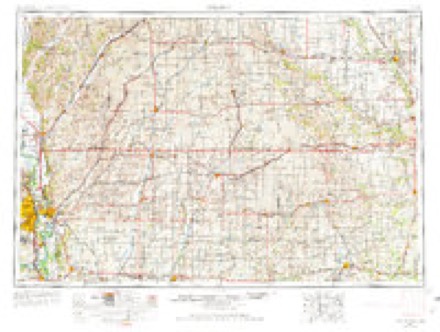
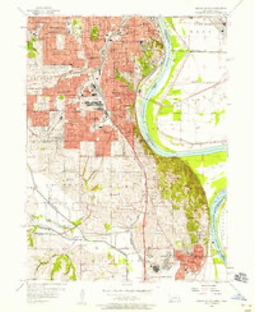
15 topographic sheets cover this place, the earliest surveyed in 1954 and the latest in 1994. It stands in Bellevue precinct. It lies in ZIP code area 68005. It stands on Wolf Creek. The Survey maps it on the Omaha South quadrangle.
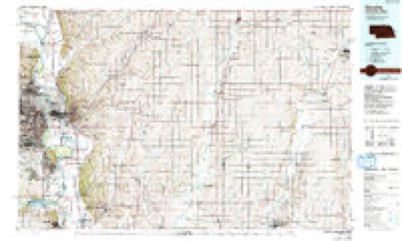
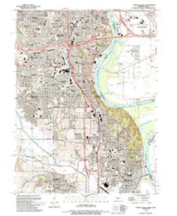
Topographic sheets covering this place
6 surveys from 15 printed sheetsMatched by testing this settlement's coordinate against the published boundary of every sheet in the United States Geological Survey's historical collection. Each opens the scanned sheet at the Survey.
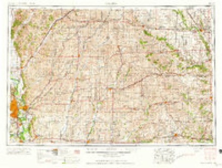
- 1954 USGS Omaha quadrangle1:250000, 3 printings
- 1956 USGS Omaha South quadrangle1:24000, 6 printings
- 1957 USGS Omaha quadrangle1:250000
- 1958 USGS Omaha quadrangle1:250000, 2 printings
- 1985 USGS Omaha quadrangle1:100000, 2 printings
- 1994 USGS Omaha South quadrangle1:24000
Fires near this place
82 since 2011Regional context, not property-specific evidence. The federal wildfire occurrence database lists 82 fires within 5 miles of Avery between 2011 and 2020, burning about 374 acres in total. 3 started naturally. 2 were recorded as arson. Distance is straight-line from the map coordinates, so a fire counted here may appear on a neighbouring settlement's page as well.
| Reported cause | Fires |
|---|---|
| Missing data/not specified/undetermined | 50 |
| Debris and open burning | 10 |
| Fireworks | 5 |
| Recreation and ceremony | 5 |
| Natural | 3 |
| Smoking | 3 |
| Equipment and vehicle use | 2 |
| Power generation/transmission/distribution | 2 |
| Arson/incendiarism | 2 |
The most recent of them, most recent first, with the day each was reported and the service that recorded it.
| Date | Cause | Size | Reported by | Name on the report |
|---|---|---|---|---|
| 7 September 2019 | Missing data/not specified/undetermined | under an acre | Nebraska Forest Service | not named |
| 4 September 2020 | Smoking | under an acre | Nebraska Forest Service | not named |
| 29 September 2012 | Missing data/not specified/undetermined | under an acre | Nebraska Forest Service | not named |
| 28 September 2012 | Missing data/not specified/undetermined | under an acre | Nebraska Forest Service | not named |
| 23 September 2020 | Missing data/not specified/undetermined | under an acre | Nebraska Forest Service | not named |
| 18 September 2012 | Missing data/not specified/undetermined | under an acre | Nebraska Forest Service | not named |
| 8 August 2012 | Missing data/not specified/undetermined | under an acre | Nebraska Forest Service | not named |
| 8 August 2012 | Missing data/not specified/undetermined | under an acre | Nebraska Forest Service | not named |
Settlements close enough to share some of these fires:
Mines and quarries near this place
1 within 5 milesRegional context, not property-specific evidence. The federal mineral resources record lists 1 working within 5 miles of Avery: 1 producer. All of them still produce. What was taken out: Perlite. Distance is straight-line from the map coordinates, so a quarry counted here may appear on a neighbouring settlement's page as well.
| Where | Site | Commodity | Status | Recorded |
|---|---|---|---|---|
| Zonolite Perlite Plant | Perlite | Producer |
Storms near this place
29 since 2008Regional context, not property-specific evidence. The National Weather Service names Avery in 29 storm reports between 2008 and 2017: 11 hail, 9 thunderstorm wind, 8 flood, 1 flash flood. No death or injury is recorded in these reports. Each account below is quoted exactly as the forecast office filed it, from the NOAA Storm Events Database, and each date opens the federal record of that event.
| When | Event | Place named | Harm | What the report says |
|---|---|---|---|---|
| August 2011 | Flood | Avery | $250,000 | Flooding along the Missouri River gradually worsened during June and moderate flooding persisted into late August before releases from Gavins Point Dam began dropping. Initially the high releases and flooding was due to snow melt and heavy rain, but persistent heavy rain events above Sioux City as the summer wore on kept the reservoirs full and releases high. The river near Omaha climbed to around its 29 foot flood stage late in May and rose steadily through June reaching around 36 feet toward the end of the month. The river fell slightly during the first week of July but continued around 35 feet through much July before falling to around 34 feet over the first half of August. By the end of August the river near Omaha had fallen to around 31 feet as decreased releases from Gavins Point allowed the river to fall into the minor flood category. However, minor flooding continued into September. Flooding in Sarpy county spread into at least one park causing its closure. Boating and other recreational areas were also either flooded or closed. A section of the rail track that Amtrak used had to be closed to allow for its use as a levee during the height of the flooding. The U.S. Army Corps of Engineers estimated that close to $1 million was spent on levee work/repair in Sarpy county during the flooding. |
| September 2011 | Flood | Avery | $250,000 | Flooding along the Missouri River in Sarpy county gradually worsened during June and moderate flooding persisted into late August before releases from Gavins Point Dam began dropping. Initially the high releases and flooding was due to snow melt and heavy rain, but persistent heavy rain events above Sioux City as the summer wore on kept the reservoirs full and releases high. The river near Omaha climbed to around its 29 foot flood stage late in May and rose steadily through June reaching around 36 feet toward the end of the month. The river fell slightly during the first week of July but continued around 35 feet through much July before falling to around 34 feet over the first half of August. By the first of September the river near Omaha had fallen to around 31 feet as decreased releases from Gavins Point allowed the river to fall into the minor flood category. The river finally dropped below flood stage around Sept. 12th, although releases were slowed for several weeks in mid September to keep levees from sloughing off from too fast of a water drop. So although river levels had dropped below flood stage at Omaha by mid month, they were still high enough so that some minor overflows continued for much of September across a few of the normally flooded areas near the river. Earlier in the summer flooding in Sarpy county spread into at least one park causing its closure and boating and other recreational areas were also closed because of flooding. During the height of the flooding a section of the rail track that Amtrak used had to be closed to allow for its use as a levee. |
| June 2010 | Flood | Avery | $75,000 | Heavy rain over much of eastern Nebraska and western Iowa during most of June caused a prolonged period of flooding along the Missouri River, especially downstream of Omaha through Rulo. The flood damage was increased near the confluence of the Platte River where flood waters from the Platte added to the flow and caused the Missouri River to back up in Sarpy county. In Sarpy county the river flooded a few parks, including Haworth Park which was under nearly 4 feet of water for an extended period. Roads along the river were also flooded and houses that were between the levee and the river were also flooded or had their entrances blocked by flood waters. In Plattsmouth, just south of Sarpy county, the Missouri River crested a little over 33 feet in the late afternoon of June 22nd, flood stage is 26 feet. The river climbed above flood stage in the afternoon of June 11 and remained above flood stage into early July. |
| June 2014 | Flash Flood | Avery | $50,000 | Heavy rainfall led to street flooding in the city of Bellevue. |
| June 2011 | Flood | Avery | $50,000 | Flooding along the Missouri River gradually worsened during June as record releases from Gavins Point Dam brought widespread flooding along the river. The river near Omaha climbed to around its 29 foot flood stage late in May and steadily rose through June reaching around 36 feet toward the end of the month. The flooding then persisted into July. The flooding in Sarpy county spread into at least one park causing its closure. Boating and other recreational areas were also either flooded or closed. A section of the rail track that Amtrak used had to be closed to allow for its use as a levee. |
| July 2011 | Flood | Avery | $25,000 | Flooding along the Missouri River gradually worsened during June and persisted into July as record releases from Gavins Point Dam brought widespread flooding along the River. The river near Omaha climbed to around its 29 foot flood stage late in May and steadily rose through June reaching around 36 feet toward the end of the month. The river fell slightly during the first week of July but continued around 35 feet the rest of the month. The flooding persisted into August. Flooding in Sarpy county spread into at least one park causing its closure. Boating and other recreational areas were also either flooded or closed. A section of the rail track that Amtrak used had to be closed to allow for its use as a levee. |
| July 2010 | Flood | Avery | $15,000 | This flooding carried over from June when heavy rain over much of eastern Nebraska and western Iowa during that month caused a prolonged period of flooding along the Missouri River, especially downstream of Omaha through Rulo. Although the river at Plattsmouth dropped below flood stage on July 8th, it remained high all of July climbing back above flood stage in the middle of the month and again several times late in the month into August. The flood damage was increased near the confluence of the Platte River early in July where high water from the Missouri caused the Platte River to back up even though the Platte had fallen below flood stage. High waters along the Platte flooded a park south of Bellevue forcing its closure. Other parks and a few roads were closed in Sarpy county along the Missouri River and houses that were between a levee and the river were also flooded or had access to them flooded. In Plattsmouth, just south of Sarpy county, the Missouri River crested a little over 33 feet in the late afternoon of June 22nd, flood stage is 26 feet. A July crest of around 29.5 feet was observed on the first. |
| May 2011 | Flood | Avery | $5,000 | High releases from upstream reservoirs brought steadily increasing flows along the Missouri River. The river near Omaha climbed to around its 29 foot flood stage late on May 27th, and then continued rising into June. The flooding in Sarpy county spread into at least one park causing its closure. Boating and other recreational areas were also either flooded or closed. |
| August 2010 | Flood | Avery | $5,000 | This flooding carried over from June and July when heavy rain over much of eastern Nebraska and western Iowa during those months causing a prolonged period of flooding along the Missouri River, especially downstream of Omaha through Rulo. Although the river at Plattsmouth dropped below flood stage on July 8th, it remained high all of July climbing back above flood stage in the middle of the month and again several times late in the month into August. Parks and a few roads were closed in Sarpy county along the Missouri River due to flood waters. In Plattsmouth, just south of Sarpy county, the Missouri River crested a little over 33 feet in the late afternoon of June 22nd, flood stage is 26 feet. A July crest of around 29.5 feet was observed on the first with a crest of around 29 feet in August was seen on the 4th. |
| June 2017 | Thunderstorm Wind | Avery | - | An estimated gust of 80 mph wind gust was reported in Bellevue. |
| April 2016 | Thunderstorm Wind | Avery | - | The gusts were estimated up to 60 mph. |
| May 2014 | Thunderstorm Wind | Avery | - | A measured wind gust was recorded at AFWA. |
| June 2014 | Thunderstorm Wind | Avery | - | Broken tree limbs were reported. |
| August 2011 | Hail | Avery | - | Hail up to 2 to 3 inches in diameter fell in the Bellevue area causing some vehicle and house damage. |
| May 2011 | Hail | Avery | - | Near 25th and Fairview Road. |
| May 2011 | Hail | Avery | - | Hail up to golf ball-size fell in the Bellevue area from at least the 3rd storm that produced severe-size hail in Sarpy county this evening. The hail was reported to cause some damage to vehicles near 205th and Industrial Road. |
| August 2011 | Thunderstorm Wind | Avery | - | Thunderstorm wind gusts were estimated at to have reached at least 60 mph by spotters in the Bellevue area. |
| August 2010 | Thunderstorm Wind | Avery | - | The Automated weather sensor at Offutt AFB measured a thunderstorm wind gust of 74 mph. The winds downed numerous tree limbs and large trees with the Olde Towne area especially hard hit where at least 4 streets were blocked and several power poles were broken along with downed power lines. Some damage to homes and vehicles also occurred in this area. Around 1,700 people lost power for a while. |
| June 2009 | Thunderstorm Wind | Avery | - | A wet micro-burst thunderstorm knocked down trees and limbs which downed power lines on the north side of Bellevue. |
| June 2008 | Hail | Avery | - | Near the intersection of 36th and Highway 370. |
| May 2008 | Thunderstorm Wind | Avery | - | Thunderstorm wind gusts of 60 to 70 mph were reported across the Bellevue area. A gust to 58 mph was measured at Offutt Afb. The winds caused tree damage and blew around lawn furniture. Some siding was also reported torn off of a apartment building near Highway 75 and Platteview Rd. |
| July 2008 | Thunderstorm Wind | Avery | - | Thunderstorm gusts were measured at 68 mph by Awos at Offutt Afb. The strong winds caused scattered power outages in the Bellevue area. |
| June 2008 | Hail | Avery | - | Reported along Washington Street. |
| June 2017 | Hail | Avery | - | no account filed |
| June 2017 | Hail | Avery | - | no account filed |
| August 2015 | Hail | Avery | - | no account filed |
| June 2014 | Hail | Avery | - | no account filed |
| October 2013 | Hail | Avery | - | no account filed |
| June 2010 | Hail | Avery | - | no account filed |
Nearest settlements
The eight closest, with where each one stands in the county. Distances are straight-line, computed from the Geographic Names Information System coordinates.
| Map | Place | Distance | Sheets |
|---|---|---|---|
| Gilmore Junction | 1.1 miles | 15 | |
| Gilmore | 2.0 miles | 15 | |
| Bellevue | 2.5 miles | 15 | |
| Fort Crook | 2.6 miles | 15 | |
| Capehart | 3.2 miles | 15 | |
| Paradise Park | 3.2 miles | 14 | |
| Rumsey | 3.9 miles | 15 | |
| La Vista | 5.9 miles | 18 |
Elsewhere
Matched on this settlement's Geographic Names Information System number rather than its name, so it cannot be a different place of the same name in another state.
| Wikipedia article on Avery | An encyclopaedic summary. Its text is share-alike, so it is linked here rather than copied. |
| Wikidata item Q17985692 | The structured record the population and elevation above come from. Public domain (CC0). |
Provenance
This settlement is recorded in the Geographic Names Information System as feature 827122. The sheet list is computed by point-in-boundary test against the United States Geological Survey's historical topographic inventory. Both are works of the United States government and carry no copyright under 17 U.S.C. 105.
Wildfire. Short, Karen C. 2022. Spatial wildfire occurrence data for the United States, 1992-2020 [FPA_FOD_20221014]. 6th Edition. Fort Collins, CO: Forest Service Research Data Archive. https://doi.org/10.2737/RDS-2013-0009.6 Collected with United States Government funding and usable without additional permissions or fees.
Mines and quarries. USGS Mineral Resources Data System (MRDS) https://mrdata.usgs.gov/mrds/ A work of the United States government, no copyright under 17 U.S.C. 105.
Storms. NOAA National Centers for Environmental Information, Storm Events Database https://www.ncei.noaa.gov/stormevents/ A work of the United States government, no copyright under 17 U.S.C. 105. Narratives are quoted verbatim from the National Weather Service report and are not edited or summarised.