 Block
From the record
15 National Register listings published here.
Sources: the National Register database, National Park Service
58 topographic sheets cover 22 settlements here, and 15 properties are on the National Register of Historic Places.
15 National Register listings published here.
Sources: the National Register database, National Park Service
Every property in this county listed on the National Register of Historic Places, with the year it was listed and the federal nomination document.
| Photograph | Property | Type | Listed | Reference |
|---|---|---|---|---|
| Bellevue College Dormitories | building | 2017 | 100001357 | |
| Big Papillion Creek Bridge | structure | 1992 | 92000728 | |
| Blacksmith Shop | building | 1978 | 78001711 | |
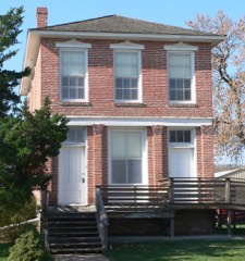 | Fontanelle Bank | building | 1969 | 69000136 |
| Fort Crook Historic District | district | 1976 | 76001139 | |
 | William E. Gordon House | building | 2006 | 06000997 |
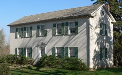 | William Hamilton House | building | 1969 | 69000137 |
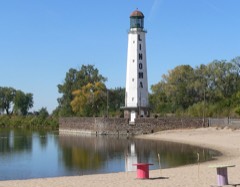 | Linoma Beach | district | 2003 | 03000107 |
| McCarty-Lilley House | building | 1978 | 78001712 | |
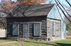 | Old Log Cabin | building | 1970 | 70000376 |
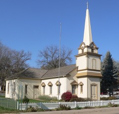 | Presbyterian Church | building | 1970 | 70000377 |
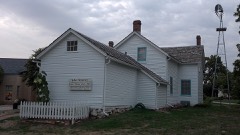 | John Sautter Farmhouse | building | 1980 | 80002463 |
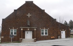 | Springfield Community Hall | building | 1998 | 98000893 |
 | Third Sarpy County Courthouse | building | 1990 | 90000964 |
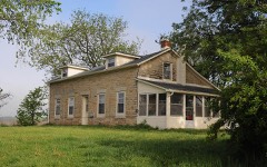 | Zweibel Farmstead | building | 2000 | 00001377 |
Every wildfire the federal occurrence database records inside this county: 161 of them, burning about 283 acres. 2 started naturally and 3 were recorded as arson. Each settlement page carries the fires within five miles of it.
| Reported cause | Fires |
|---|---|
| Missing data/not specified/undetermined | 72 |
| Debris and open burning | 28 |
| Recreation and ceremony | 14 |
| Power generation/transmission/distribution | 11 |
| Fireworks | 11 |
| Smoking | 9 |
| Equipment and vehicle use | 8 |
| Arson/incendiarism | 3 |
| Misuse of fire by a minor | 3 |
| Natural | 2 |
The five largest, by the area the report gives. None of them was recorded as arson.
| Date | Cause | Size | Reported by | Name on the report |
|---|---|---|---|---|
| 5 March 2020 | Debris and open burning | 169 acres | Nebraska Forest Service | not named |
| 2 April 2005 | Debris and open burning | 25 acres | Nebraska Forest Service | not named |
| 19 April 2014 | Missing data/not specified/undetermined | 10 acres | Nebraska Forest Service | not named |
| 26 February 2012 | Missing data/not specified/undetermined | 10 acres | Nebraska Forest Service | not named |
| 7 December 2019 | Debris and open burning | 6.0 acres | Nebraska Forest Service | not named |
| 15 March 2014 | Missing data/not specified/undetermined | 5.0 acres | Nebraska Forest Service | not named |
| 5 April 2011 | Debris and open burning | 3.0 acres | Nebraska Forest Service | not named |
| 15 March 2014 | Missing data/not specified/undetermined | 3.0 acres | Nebraska Forest Service | not named |
Every settlement page carries the fires within five miles of it - see the settlement index below.
The NOAA Storm Events Database holds 531 reports for this county, causing 3 deaths, 16 injuries and about $460,909,000 in recorded property damage. Each settlement page carries the reports that name it.
| Kind of event | Reports |
|---|---|
| Hail | 248 |
| Thunderstorm Wind | 212 |
| Flood | 28 |
| Tornado | 15 |
| Flash Flood | 15 |
| Lightning | 6 |
| Funnel Cloud | 4 |
| Heavy Rain | 3 |
The most serious of them, by death, then injury, then recorded damage. The accounts are quoted exactly as the forecast office filed them.
| When | Event | Place named | Harm | What the report says |
|---|---|---|---|---|
| May 1988 | Tornado (F2) | not stated | 2 killed, 1 hurt, $2,500,000 | no account filed |
| June 2014 | Flash Flood | Portal | 1 killed | Significant flash flooding occurred in central and eastern Sarpy County due to heavy rainfall. Slow moving thunderstorms deposited over 7 inches of rainfall during the evening and early morning hours of June 20th into the 21st. In addition to street flooding, that led to several road closures, the Papio Creek reached flood stage and flooded areas along the creek, including into the Twin Creek Apartments. Unfortunately one direct death occurred from the flooding in this area as a man abandoned his car and was swept away by the flood waters. The Big Papillion Creek at Ft. Crook reached 36.21 feet early in the morning of June 21, a record crest for the site, flood stage is 33 feet. The flooding also topped a levee along the creek. |
| May 1975 | Tornado (F4) | not stated | 15 hurt, $250,000 | no account filed |
| March 2019 | Flood | (Off)Offutt Afb | $420,000,000 | Levee R-613 failed causing major flooding at Offutt Air Force Base and the Papillion Creek Wastewater Plant. |
| May 1995 | Hail | Bellevue | $20,000,000 | A lunchtime hailstorm pounded parts of the Omaha metropolitan area, resulting in at least 12,000 damage claims. One to three inch hail produced damage estimates to homes and cars close to $20 million. |
| July 2024 | Thunderstorm Wind | Gretna | $15,000,000 | A line of intense thunderstorms swept across Sarpy county, resulting in widespread significant wind damage. While the greatest measured wind gust was 80 miles per hour, recorded by a mesonet station in Papillion, narrow swaths of enhanced straight line wind damage was consistent with wind speeds closer to 100 miles per hour. One such swath impacted portions of northeast Gretna, where multiple homes had windows blown out, trees uprooted, and large portions of their roofs blown off. Most of this damage was noted around the intersection of 168th Street and Meridian Street. Additionally, numerous powerlines and traffic lights were damaged or blown down across the county. Multiple semis were also noted as being flipped off of the road, one in north Gretna off of 204th street, and another off of Highway 370 in east Gretna. Power outages lasted for several days after the storms moved through. Total damages from these storms were estimated to be around 15 million dollars, with approximately 10 million in damages to the OPPD infrastructure. |
| June 1997 | Flash Flood | Offutt Afb | $1,050,000 | Heavy rains caused debris to clog a drainage ditch near a railroad track. The ditch filled with water and washed part of the track away. This lead to a derailment of 28 train box cars that were filled with grain. |
| July 1996 | Hail | Offutt Afb | $800,000 | no account filed |
| August 2011 | Flood | Avery | $250,000 | Flooding along the Missouri River gradually worsened during June and moderate flooding persisted into late August before releases from Gavins Point Dam began dropping. Initially the high releases and flooding was due to snow melt and heavy rain, but persistent heavy rain events above Sioux City as the summer wore on kept the reservoirs full and releases high. The river near Omaha climbed to around its 29 foot flood stage late in May and rose steadily through June reaching around 36 feet toward the end of the month. The river fell slightly during the first week of July but continued around 35 feet through much July before falling to around 34 feet over the first half of August. By the end of August the river near Omaha had fallen to around 31 feet as decreased releases from Gavins Point allowed the river to fall into the minor flood category. However, minor flooding continued into September. Flooding in Sarpy county spread into at least one park causing its closure. Boating and other recreational areas were also either flooded or closed. A section of the rail track that Amtrak used had to be closed to allow for its use as a levee during the height of the flooding. The U.S. Army Corps of Engineers estimated that close to $1 million was spent on levee work/repair in Sarpy county during the flooding. |
| September 2011 | Flood | Avery | $250,000 | Flooding along the Missouri River in Sarpy county gradually worsened during June and moderate flooding persisted into late August before releases from Gavins Point Dam began dropping. Initially the high releases and flooding was due to snow melt and heavy rain, but persistent heavy rain events above Sioux City as the summer wore on kept the reservoirs full and releases high. The river near Omaha climbed to around its 29 foot flood stage late in May and rose steadily through June reaching around 36 feet toward the end of the month. The river fell slightly during the first week of July but continued around 35 feet through much July before falling to around 34 feet over the first half of August. By the first of September the river near Omaha had fallen to around 31 feet as decreased releases from Gavins Point allowed the river to fall into the minor flood category. The river finally dropped below flood stage around Sept. 12th, although releases were slowed for several weeks in mid September to keep levees from sloughing off from too fast of a water drop. So although river levels had dropped below flood stage at Omaha by mid month, they were still high enough so that some minor overflows continued for much of September across a few of the normally flooded areas near the river. Earlier in the summer flooding in Sarpy county spread into at least one park causing its closure and boating and other recreational areas were also closed because of flooding. During the height of the flooding a section of the rail track that Amtrak used had to be closed to allow for its use as a levee. |
| April 2001 | Thunderstorm Wind | Papillion | $250,000 | Thunderstorm gusts estimated at 70 to 80 mph did major roof damage to several homes and businesses in Papillion. |
| August 2002 | Lightning | Bellevue | $125,000 | Lightning struck a house in Bellevue igniting a fire that caused about $75,000 in damage to the structure and $50,000 damage to its contents. |
| June 2010 | Flood | Meadow | $75,000 | Rainfall of at least 3 to 5 inches fell over much central Nebraska the week ending 7am 6/12, with additional heavy rains the following several days. All of this water eventually worked into the Platte River causing it to rise above flood stage from around North Bend downstream to its confluence with the Missouri River. At Louisville the river was above its 9 foot flood stage for most of the period from the afternoon of 6/11 until the afternoon of 6/16. The river crested at a little under 10.5 feet around noon on the 14th. The river gauge near Ashland was above its 20 foot flood stage for much of the period from the evening of 6/11 until the evening of the 20th. Although some lowlands were flooded all along the Platte River in Sarpy county, which forced evacuations of residents of Hanson's Lakes, most of the more significant flooding was restricted to the area near confluence of the Missouri River around Plattsmouth. County roads and some recreation areas in that vicinity sustained flood damage. |
| June 2010 | Flood | Avery | $75,000 | Heavy rain over much of eastern Nebraska and western Iowa during most of June caused a prolonged period of flooding along the Missouri River, especially downstream of Omaha through Rulo. The flood damage was increased near the confluence of the Platte River where flood waters from the Platte added to the flow and caused the Missouri River to back up in Sarpy county. In Sarpy county the river flooded a few parks, including Haworth Park which was under nearly 4 feet of water for an extended period. Roads along the river were also flooded and houses that were between the levee and the river were also flooded or had their entrances blocked by flood waters. In Plattsmouth, just south of Sarpy county, the Missouri River crested a little over 33 feet in the late afternoon of June 22nd, flood stage is 26 feet. The river climbed above flood stage in the afternoon of June 11 and remained above flood stage into early July. |
| June 2014 | Flash Flood | Avery | $50,000 | Heavy rainfall led to street flooding in the city of Bellevue. |
| June 2011 | Flood | Avery | $50,000 | Flooding along the Missouri River gradually worsened during June as record releases from Gavins Point Dam brought widespread flooding along the river. The river near Omaha climbed to around its 29 foot flood stage late in May and steadily rose through June reaching around 36 feet toward the end of the month. The flooding then persisted into July. The flooding in Sarpy county spread into at least one park causing its closure. Boating and other recreational areas were also either flooded or closed. A section of the rail track that Amtrak used had to be closed to allow for its use as a levee. |
| May 2000 | Thunderstorm Wind | Bellevue | $30,000 | Thunderstorm winds estimated at between 75 and 85 mph knocked down a wall of a movie theatre that was under construction. |
| July 1997 | Thunderstorm Wind | Gretna | $30,000 | no account filed |
| June 2024 | Flood | South Omaha Arpt | $25,000 | Excessive rainfall across much of eastern South Dakota resulted in river flooding along the Missouri River at the end of June. Moderate flood stage was observed along the Missouri, with the river gauge in Bellevue cresting at 33.84 feet on 6/29. Flood stage at this river gauge is 30.0 feet. |
| July 2011 | Flood | Avery | $25,000 | Flooding along the Missouri River gradually worsened during June and persisted into July as record releases from Gavins Point Dam brought widespread flooding along the River. The river near Omaha climbed to around its 29 foot flood stage late in May and steadily rose through June reaching around 36 feet toward the end of the month. The river fell slightly during the first week of July but continued around 35 feet the rest of the month. The flooding persisted into August. Flooding in Sarpy county spread into at least one park causing its closure. Boating and other recreational areas were also either flooded or closed. A section of the rail track that Amtrak used had to be closed to allow for its use as a levee. |
| July 2010 | Flood | Avery | $15,000 | This flooding carried over from June when heavy rain over much of eastern Nebraska and western Iowa during that month caused a prolonged period of flooding along the Missouri River, especially downstream of Omaha through Rulo. Although the river at Plattsmouth dropped below flood stage on July 8th, it remained high all of July climbing back above flood stage in the middle of the month and again several times late in the month into August. The flood damage was increased near the confluence of the Platte River early in July where high water from the Missouri caused the Platte River to back up even though the Platte had fallen below flood stage. High waters along the Platte flooded a park south of Bellevue forcing its closure. Other parks and a few roads were closed in Sarpy county along the Missouri River and houses that were between a levee and the river were also flooded or had access to them flooded. In Plattsmouth, just south of Sarpy county, the Missouri River crested a little over 33 feet in the late afternoon of June 22nd, flood stage is 26 feet. A July crest of around 29.5 feet was observed on the first. |
| April 2001 | Tornado (F0) | Springfield | $10,000 | A brief touchdown of a tornado near Springfield which severely damaged a horse barn, downed power lines and pushed a car into a trailer causing some damage to each. The first report of damage from a broken line of mini-supercell thunderstorms that produced several small and relatively short-lived tornadoes across extreme eastern Nebraska and southwest Iowa this day. |
| July 1996 | Lightning | Gretna | $10,000 | no account filed |
| February 2011 | Flood | Louisville Station | $5,000 | A relatively short-lived ice jam along the Platte River caused some flooding damage to a few picnic tables, docks and outdoor furniture in the Villa Springs subdivision near 120th and Buffalo road in southern Sarpy county. |
| May 2011 | Flood | Avery | $5,000 | High releases from upstream reservoirs brought steadily increasing flows along the Missouri River. The river near Omaha climbed to around its 29 foot flood stage late on May 27th, and then continued rising into June. The flooding in Sarpy county spread into at least one park causing its closure. Boating and other recreational areas were also either flooded or closed. |
| August 2010 | Flood | Avery | $5,000 | This flooding carried over from June and July when heavy rain over much of eastern Nebraska and western Iowa during those months causing a prolonged period of flooding along the Missouri River, especially downstream of Omaha through Rulo. Although the river at Plattsmouth dropped below flood stage on July 8th, it remained high all of July climbing back above flood stage in the middle of the month and again several times late in the month into August. Parks and a few roads were closed in Sarpy county along the Missouri River due to flood waters. In Plattsmouth, just south of Sarpy county, the Missouri River crested a little over 33 feet in the late afternoon of June 22nd, flood stage is 26 feet. A July crest of around 29.5 feet was observed on the first with a crest of around 29 feet in August was seen on the 4th. |
| May 2000 | Thunderstorm Wind | Papillion | $5,000 | Thunderstorm winds knocked over an 80 foot tree which crashed into a car. |
| June 2000 | Thunderstorm Wind | Gretna | $5,000 | A fence and playground equipment were damaged by thunderstorm wind gusts over 60 mph. |
| May 2000 | Lightning | Bellevue | $2,500 | Lightning struck a house causing around $2,500 worth of damage to the roof, blasting a 10-foot-widehole. |
| June 1971 | Tornado (F0) | not stated | $2,500 | no account filed |
| May 1957 | Tornado (F1) | not stated | $2,500 | no account filed |
| May 1957 | Tornado (F1) | not stated | $2,500 | no account filed |
| June 1997 | Thunderstorm Wind | Gretna | $2,000 | no account filed |
| July 2004 | Lightning | Bellevue | $1,000 | Lightning struck Christmas lights which were still up on a Bellevue home. The lightning then traveled along a gutter and ignited a gas meter on the side of the house which was leaking natural gas. The resulting fire did minimal exterior damage. |
| June 1997 | Thunderstorm Wind | Bellevue | $1,000 | no account filed |
| March 2026 | Hail | La Vista | - | Public report of hail measured at 1.00 inch in diameter received via an image on social media. |
| April 2026 | Hail | Chalco | - | Public report of hail estimated up to 1 inch in diameter near Chalco, NE. |
| April 2026 | Hail | Papillion | - | Public report of hail measured up to 1 inch in diameter near Chalco, NE. |
| April 2026 | Hail | Papillion | - | Delayed hail report received via social media. Sizes ranged from nickel to quarter size and lasted for around 8 to 10 minutes. Time estimated via radar. |
| April 2026 | Hail | Papillion | - | Public report of hail estimated up to 1.25 inches in diameter near La Vista, NE. |
| April 2026 | Hail | Chalco | - | Public report of hail estimated up to 1 inch in diameter near Chalco, NE. |
| June 2025 | Thunderstorm Wind | Gretna | - | Trained spotter report of a measured 60 mph wind gusts with a handheld weather station. |
| August 2025 | Thunderstorm Wind | Chalco | - | Personal weather station measured wind gust of 64 mph. |
| August 2025 | Thunderstorm Wind | Chalco | - | Personal weather station measured wind gust of 68 mph near 192nd and Harrison Street. |
| July 2025 | Flash Flood | Gretna | - | On the morning of July 31st, 2025, intense rainfall moved through the Omaha metropolitan area, causing flash floods in both Sarpy and Douglas Counties. Rainfall rates were estimated at 1.50 to 3.00 inches per hour, with total accumulations ranging from 3.15 to 4.03 inches based on measured reports. At 5:37 AM CST, the Nebraska Department of Transportation confirmed that floodwaters were partially covering sections of US Highway 6 between Ashland and Gretna. |
| July 2025 | Thunderstorm Wind | Ft Crook | - | Mesonet report of wind gusts measured at 59 mph, associated with the outflow boundary of a thunderstorm. |
| June 2025 | Thunderstorm Wind | Ft Crook | - | Mesonet measured wind gust of 68 mph, associated with an outflow boundary ahead of an approaching thunderstorm. |
| June 2025 | Thunderstorm Wind | Ft Crook | - | Mesonet measured wind gust of 58 mph, associated with an outflow boundary ahead of an approaching thunderstorm. |
| June 2025 | Thunderstorm Wind | Ft Crook | - | Personal weather station measured wind gust of 58 mph, associated with an outflow boundary ahead of an approaching thunderstorm. |
| May 2024 | Thunderstorm Wind | Bellevue | - | The office received a public report of a tree that had snapped and fallen onto a home in Bellevue. |
| April 2024 | Thunderstorm Wind | Papillion | - | The office received a photo on social media of a large tree limb down across Coach Road south of Cedardale Road. The time was estimated based on radar. |
| April 2024 | Hail | La Vista | - | The office received a public report of quarter sized hail in La Vista. |
| April 2024 | Hail | Papillion | - | The office received several reports from the public and trained spotters in the Papillion area of hail ranging from 1 to 2 inches in diameter. The largest hail stone, measured at 2 inches, was reported in downtown Papillion by the public. |
| April 2024 | Hail | Springfield | - | A report was received from the public via mPING of golf ball sized hail. |
| May 2024 | Thunderstorm Wind | Papillion | - | An 82 miles per hour wind gust was recorded on a personal weather station. |
| May 2024 | Thunderstorm Wind | (Off)Offutt Afb | - | Approximately 10 minutes of severe wind gusts were reported at KOFF. The peak wind gust measured by the station was 68 miles per hour. |
| May 2024 | Tornado (EF0) | Ft Crook | - | This tornado developed just south of Looking Glass Park and damaged a couple of trees. The tornado quickly move northeast over Offutt Air Force Base damaging several trees, overturning an enclosed trailer, and causing minor roof damage to a building. The tornado then continued northeast until ending in Old Towne Bellevue. Peak winds in this tornado were estimated to be at 80 miles per hour. The maximum track width was estimated to be at 300 yards, with an average width estimated at 100 yards. |
| May 2024 | Tornado (EF0) | Gretna | - | This brief tornado damaged powerpoles along Capehart Road approximately 2 miles southeast of Gretna. Peak winds in this tornado were estimated to be at 79 miles per hour. The max path width and average path width were both 50 yards for this tornado. |
| May 2024 | Thunderstorm Wind | (Off)Offutt Afb | - | The office received a report of a large tree uprooted from the public. A subsequent storm damage survey also found a farm outbuilding that had a damaged roof. |
| May 2024 | Tornado (EF0) | La Vista | - | This very brief tornado near Shadow Lake Elementary produced minor damage to homes and damaged numerous trees in the neighborhood. Some fences were also damaged. Peak winds in this tornado were estimated to be at 79 miles per hour. The maximum path width and average path width for this tornado were both 60 yards. |
The Survey's mineral resources record lists 2 workings inside this county. All of them still produce. Each settlement page carries the workings within five miles of it.
| Commodity | Workings |
|---|---|
| Sand and Gravel, Construction | 1 |
| Stone, Crushed/Broken | 1 |
The least common of them first, because a county's hundredth gravel pit says nothing its first ten did not.
| Where | Site | Commodity | Status | Recorded |
|---|---|---|---|---|
| Amick Pit | Sand and Gravel, Construction | Producer | ||
| La Platt Quarry & Mill | Stone, Crushed/Broken | Producer |
Named settlements recorded in the Geographic Names Information System, each with the topographic sheets covering it. Villages, hamlets and abandoned places alike. Each is shown with the nearest named watercourse or landform and the survey quadrangle it falls on.
Bellevue precinct · 68123 · On North Whitted Creek · Omaha South quadrangle
15 sheets, 1954 to 1994
Richland VIII precinct · 68138 · On Wehrspann Creek · Gretna quadrangle
19 sheets, 1893 to 1982
Fairview precinct · 68046 · Cedar Creek quadrangle
18 sheets, 1893 to 1982
No longer a settlement
Bellevue Second I precinct · 68123 · On Mud Creek · Omaha South quadrangle
15 sheets, 1954 to 1994
Bellevue precinct · 68005 · On Wolf Creek · Omaha South quadrangle
15 sheets, 1954 to 1994
Platford-Springfield II precinct · 68059 · Springfield quadrangle
17 sheets, 1893 to 1982
No longer a settlement
La Vista precinct · 68128 · On South Papillion Creek · Ralston quadrangle
18 sheets, 1893 to 1982
Bellevue Second II precinct · 68133 · On Behm Creek · Omaha South quadrangle
15 sheets, 1954 to 1994
Springfield precinct · 68059 · On Turtle Creek · Springfield quadrangle
17 sheets, 1893 to 1982
The vanished settlements of Sarpy County: the places named above that are no longer on the map.