 Block
Brule, Nebraska
16 topographic sheets cover this place, the earliest surveyed in 1897 and the latest in 1985. It stands in Brule precinct. It lies in ZIP code area 69127. It lies near Chase Canyon. The Survey maps it on the Brule quadrangle. 331 people lived here at the 2020 count. It stands 3,291 feet above sea level.
On record in Brule
Buildings and businesses the archive holds for this place. Each opens its own page, with the source record it came from.
On the National Register 2 records
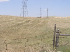 California Hilllisted 1974
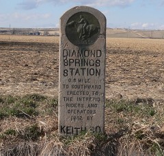 Diamond Springs Stage Station Sitelisted 1970
Population over time
2 figuresBrule grew from 326 to 331 between 2010 and 2020. These are the recorded population figures Wikidata holds for this place, reached through the Geographic Names Information System number this page is keyed on rather than by name, so they belong to this place and not to another of the same name. Most are census counts, but not all are: an early figure may be a founding or settlement estimate, and an estimate published within five years of a census is left out. The change column is computed, and is left blank where more than 20 years separate a figure from the one before it, because a gap that long is not a change between two counts.
| Year | People | Change |
|---|---|---|
| 2010 | 326 | |
| 2020 | 331 | +5 (+2%) |
Topographic sheets covering this place
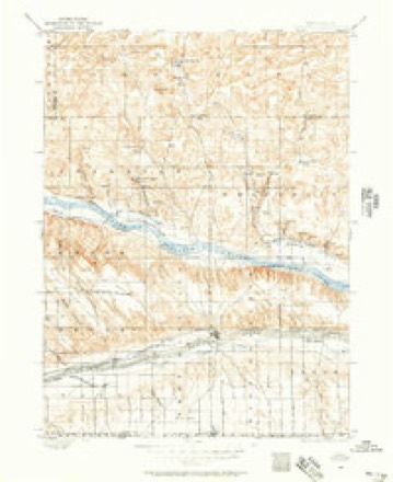
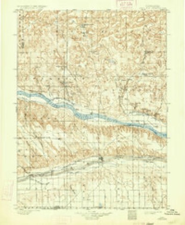
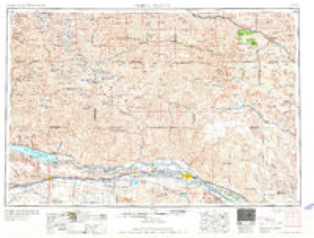
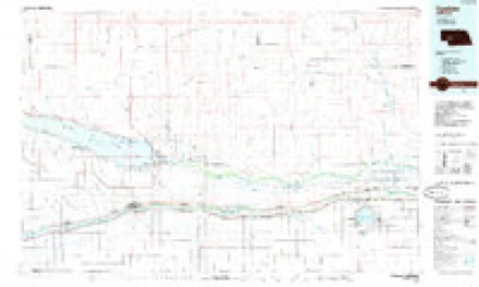
8 surveys from 16 printed sheetsMatched by testing this settlement's coordinate against the published boundary of every sheet in the United States Geological Survey's historical collection. Each opens the scanned sheet at the Survey.
- 1897 USGS Ogallala quadrangle1:125000
- 1900 USGS Ogallala quadrangle1:125000, 6 printings
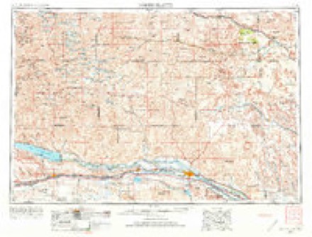
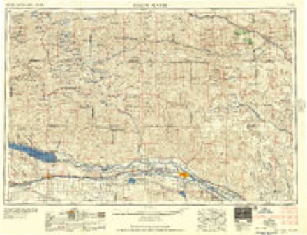
- 1954 USGS North Platte quadrangle1:250000, 3 printings
- 1956 USGS North Platte quadrangle1:250000
- 1957 USGS North Platte quadrangle1:250000
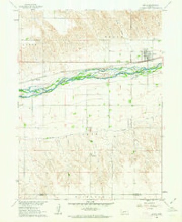
- 1961 USGS Brule quadrangle1:24000
- 1967 USGS North Platte quadrangle1:250000
- 1985 USGS Ogallala quadrangle1:100000, 2 printings
Fires near this place
34 since 2006Regional context, not property-specific evidence. The federal wildfire occurrence database lists 34 fires within 5 miles of Brule between 2006 and 2020, burning about 109 acres in total. 1 started naturally. None was recorded as arson. Distance is straight-line from the map coordinates, so a fire counted here may appear on a neighbouring settlement's page as well.
| Reported cause | Fires |
|---|---|
| Debris and open burning | 13 |
| Equipment and vehicle use | 8 |
| Missing data/not specified/undetermined | 6 |
| Recreation and ceremony | 3 |
| Railroad operations and maintenance | 2 |
| Natural | 1 |
| Fireworks | 1 |
The most recent of them, most recent first, with the day each was reported and the service that recorded it.
| Date | Cause | Size | Reported by | Name on the report |
|---|---|---|---|---|
| 4 September 2011 | Railroad operations and maintenance | under an acre | Nebraska Forest Service | not named |
| 30 September 2016 | Debris and open burning | 1.0 acres | Nebraska Forest Service | not named |
| 28 September 2016 | Debris and open burning | 1.0 acres | Nebraska Forest Service | not named |
| 23 September 2020 | Missing data/not specified/undetermined | under an acre | Nebraska Forest Service | not named |
| 6 August 2014 | Debris and open burning | 1.0 acres | Nebraska Forest Service | not named |
| 24 August 2016 | Debris and open burning | under an acre | Nebraska Forest Service | not named |
| 18 August 2014 | Natural | 40 acres | Nebraska Forest Service | not named |
| 17 August 2020 | Equipment and vehicle use | under an acre | Nebraska Forest Service | not named |
Settlements close enough to share some of these fires:
Storms near this place
60 of 113 shownRegional context, not property-specific evidence. The National Weather Service names Brule in 113 storm reports between 1993 and 2025: 80 hail, 25 thunderstorm wind, 3 tornado, 2 flash flood. No death or injury is recorded in these reports. Each account below is quoted exactly as the forecast office filed it, from the NOAA Storm Events Database, and each date opens the federal record of that event.
| When | Event | Place named | Harm | What the report says |
|---|---|---|---|---|
| May 2024 | Tornado (EF1) | Brule | $600,000 | The tornado touched down near road M5 south and Road West 40 in southwestern Keith county where it damaged power poles, snapped several trees off and destroyed a 5000 bushel grain bin. The tornado traveled to the east, overturning two center pivot irrigation systems approximately a quarter mile east of the initial touchdown point. The tornado continued east, damaging outbuildings and overturning a third pivot. The tornado traveled further east, overturning a semi trailer, damaging a shelter belt and striping shingles and siding off a house at a farmstead. The tornado then tracked northeast, where it flipped a fourth center pivot, and damaged outbuildings at a farmstead. The tornado traveled another mile to the northeast before dissipating. Before it dissipated two more center pivot irrigation systems were destroyed. |
| May 2024 | Tornado (EF1) | Brule | $450,000 | A tornado touched down in the vicinity of Road west I south and road west 50 damaging several trees and overturning a center pivot irrigation system. The tornado traveled approximately 1 mile to the east southeast, destroying two more center pivot irrigation systems. About a half a mile east of this point, the tornado struck a farmstead, destroying a large covered building, destroyed trees and caused roof damage to a farm house. The tornado dissipated approximately a half a mile east of this point, where it overturned a center pivot irrigation system. |
| September 2013 | Flood | Brule | $335,000 | Flooding occurred along the South Platte River from September 18th through September 27th as water from the historic rains in Colorado moved through the river system. Cropland and pastureland along the river was flooded. The Nebraska Link 51A Link and Nebraska Link 51B connecting Interstate 80 with the towns of Brule and Roscoe were closed. At least three businesses sustained minor flooding in and near the cities of Brule and Ogallala. Septic problems were noted at several residences around Brule causing some basement damage. Two homes southeast of Roscoe near Nebraska Link 51B suffered severe damage. |
| June 2007 | Flash Flood | Brule | $125,000 | Heavy rain of 3 to 6 inches caused rapid runoff. Water flowed across secondary roads south of Ogallala and around Lake McConaughy. Some secondary roads were washed out. |
| June 2009 | Hail | Brule | $15,000 | no account filed |
| July 2012 | Hail | Brule | $10,000 | no account filed |
| June 2018 | Thunderstorm Wind | Brule | $5,000 | Power lines reported down at this location. Winds estimated at 60 MPH. |
| July 2013 | Thunderstorm Wind | Brule | $5,000 | Public reports tree damage with 10 inch diameter limbs down west of Brule. |
| August 2012 | Thunderstorm Wind | Brule | $5,000 | General public reported large trees blown down. Windows were broken out in quonset building and vehicle. A corral was also knocked down by thunderstorm wind gusts. |
| September 2007 | Hail | Brule | $5,000 | Hail nearly covered the ground. |
| April 2024 | Thunderstorm Wind | Brule | $1,000 | Thunderstorm wind gusts, estimated at 70 MPH, uprooted a 1 foot diameter tree at this location. Report was from social media. |
| May 2000 | Thunderstorm Wind | Brule | $1,000 | 70 mph wind caused power pole to snap off |
| July 2023 | Hail | Brule | - | Public reported golf ball size hail near Brule. |
| July 2023 | Hail | Brule | - | Public reported tennis ball size hail near Brule. |
| May 2022 | Hail | Brule | - | Half dollar sized hail along with 68 MPH winds broke an egress window and damaged a mesonet station. Hail was piled up 6 inches on the ground. |
| May 2022 | Thunderstorm Wind | Brule | - | Thunderstorm wind gust of 59 MPH measured by a Union Pacific Railroad mesonet. |
| July 2022 | Thunderstorm Wind | Brule | - | A trained weather spotter estimated wind gusts of at least 60 mph west of Ogallala. |
| July 2022 | Hail | Brule | - | Public reported quarter size hail northeast of Big Springs. |
| May 2020 | Hail | Brule | - | Quarter sized hail and smaller hail stones reported at this location. Time estimated by radar. |
| May 2019 | Hail | Brule | - | Tennis to golf ball sized hail reported at this location. |
| September 2019 | Thunderstorm Wind | Brule | - | Nickel sized hail and 60 MPH wind gusts reported at this location. |
| June 2018 | Flash Flood | Brule | - | Cooperative observer reports water over highway 30 approximately 3 miles west of Brule. |
| August 2018 | Hail | Brule | - | A picture report was provided on social media. |
| August 2018 | Thunderstorm Wind | Brule | - | Public estimated 60 mph wind gusts. |
| June 2018 | Tornado (EF0) | Brule | - | Tornado briefly touched down in an open field with no damage reported. |
| June 2016 | Thunderstorm Wind | Brule | - | No significant damage reported from this wind gust. |
| September 2016 | Thunderstorm Wind | Brule | - | Estimated 60 mph wind gusts. |
| September 2016 | Thunderstorm Wind | Brule | - | Mesonet Observation from 515 PM MDT. |
| July 2015 | Thunderstorm Wind | Brule | - | Thunderstorm wind gusts to 60 MPH produced near zero visibility due to blowing dust. |
| June 2015 | Thunderstorm Wind | Brule | - | Social media report of numerous empty center pivot irrigation systems flipped over 8 miles southwest of Brule. Estimated winds in the vicinity of 70 mph. |
| September 2015 | Thunderstorm Wind | Brule | - | Strong winds were accompanied by nickle size hail. |
| August 2012 | Lightning | Brule | - | A lightning strike ignited a wildfire at the Eagle Canyon Hideaway that burned up to 3,000 acres of grassland and timber. |
| June 2010 | Funnel Cloud | Brule | - | The local Coperative Observer reported a well defined funnel cloud. |
| June 2010 | Thunderstorm Wind | Brule | - | Severe Thunderstorm Winds drove construction cones, signs, metal road signs, and other items into the Interstate 80 roadway, west of Big Springs, near Brule. |
| September 2007 | Hail | Brule | - | Heavy rain and very gusty winds accompanied the hail. |
| July 2003 | Thunderstorm Wind | Brule | - | Large tree limbs were broken off trees. |
| June 1998 | Hail | Brule | - | Large tree limbs blown down. |
| October 1994 | Thunderstorm Wind | Brule | - | Thunderstorm winds levelled a convenience store/gas station under construction; 45 foot by 55 foot, at the I-80 interchange. |
| October 1994 | Thunderstorm Wind | Brule | - | Thunderstorm winds lifted the roof off a home and then set it back down. |
| August 1993 | Hail | Brule | - | Hail up to nickel-size combined with winds of over 60 mph damaged crops across the county. The crops damaged severely included 3,000 acres of corn, 600 acres of beans, 200 acres of popcorn and 200 acres of alfalfa. |
| August 1993 | Thunderstorm Wind | Brule | - | Hail up to nickel-size combined with winds of over 60 mph damaged crops across the county. The crops damaged severely included 3,000 acres of corn, 600 acres of beans, 200 acres of popcorn and 200 acres of alfalfa. |
| August 1993 | Hail | Brule | - | A line of severe thunderstorms pushed through Keith county. Dime-size hail covered the ground and formed drifts north of Roscoe. A hail drift 6 inches deep remained there during the early afternoon. Hail up to golfball-size fell at Roscoe, south of Ogallala and at Brule. The hail damaged 1,000 acres of corn, 300 acres of sunflowers, 250 acres of beans, along with some hay. There was also some structural damage to buildings, windows were broken , and cars were dented. |
| June 2025 | Hail | Brule | - | no account filed |
| June 2025 | Thunderstorm Wind | Brule | - | no account filed |
| August 2025 | Hail | Brule | - | no account filed |
| May 2024 | Hail | Brule | - | no account filed |
| June 2022 | Hail | Brule | - | no account filed |
| June 2022 | Hail | Brule | - | no account filed |
| May 2019 | Hail | Brule | - | no account filed |
| May 2019 | Hail | Brule | - | no account filed |
| August 2019 | Hail | Brule | - | no account filed |
| September 2019 | Hail | Brule | - | no account filed |
| May 2018 | Hail | Brule | - | no account filed |
| May 2018 | Hail | Brule | - | no account filed |
| May 2018 | Hail | Brule | - | no account filed |
| August 2018 | Hail | Brule | - | no account filed |
| August 2018 | Hail | Brule | - | no account filed |
| September 2016 | Hail | Brule | - | no account filed |
| July 2015 | Hail | Brule | - | no account filed |
| July 2015 | Hail | Brule | - | no account filed |
Nearest settlements
The eight closest, with where each one stands in the county. Distances are straight-line, computed from the Geographic Names Information System coordinates.
Elsewhere
Matched on this settlement's Geographic Names Information System number rather than its name, so it cannot be a different place of the same name in another state.
| Wikipedia article on Brule | An encyclopaedic summary. Its text is share-alike, so it is linked here rather than copied. |
| Wikidata item Q731766 | The structured record the population and elevation above come from. Public domain (CC0). |
Provenance
This settlement is recorded in the Geographic Names Information System as feature 827701. The sheet list is computed by point-in-boundary test against the United States Geological Survey's historical topographic inventory. Both are works of the United States government and carry no copyright under 17 U.S.C. 105.
Wildfire. Short, Karen C. 2022. Spatial wildfire occurrence data for the United States, 1992-2020 [FPA_FOD_20221014]. 6th Edition. Fort Collins, CO: Forest Service Research Data Archive. https://doi.org/10.2737/RDS-2013-0009.6 Collected with United States Government funding and usable without additional permissions or fees.
Storms. NOAA National Centers for Environmental Information, Storm Events Database https://www.ncei.noaa.gov/stormevents/ A work of the United States government, no copyright under 17 U.S.C. 105. Narratives are quoted verbatim from the National Weather Service report and are not edited or summarised.