 Block
From the record
9 National Register listings published here.
Sources: the National Register database, National Park Service
40 topographic sheets cover 13 settlements here, and 9 properties are on the National Register of Historic Places.
9 National Register listings published here.
Sources: the National Register database, National Park Service
Every property in this county listed on the National Register of Historic Places, with the year it was listed and the federal nomination document.
| Photograph | Property | Type | Listed | Reference |
|---|---|---|---|---|
 | Leonidas A. Brandhoefer Mansion | building | 1973 | 73001065 |
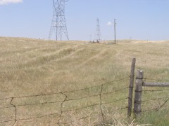 | California Hill | site | 1974 | 74001126 |
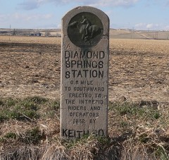 | Diamond Springs Stage Station Site | site | 1970 | 70000371 |
 | Front Street | building | 2015 | 14001128 |
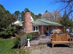 | Dr. Burdette and Myrna Gainsforth House | building | 2002 | 02001476 |
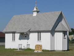 | Keystone Community Church | building | 1979 | 79001447 |
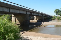 | Roscoe State Aid Bridge | structure | 1992 | 92000709 |
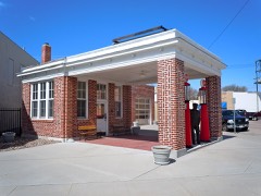 | Standard Oil Red Crown Service Station | building | 2004 | 04000897 |
 | US Post Office-Ogallala | building | 1992 | 92000481 |
Every wildfire the federal occurrence database records inside this county: 228 of them, burning about 74,292 acres. 23 started naturally and 4 were recorded as arson. Each settlement page carries the fires within five miles of it.
| Reported cause | Fires |
|---|---|
| Debris and open burning | 54 |
| Equipment and vehicle use | 49 |
| Missing data/not specified/undetermined | 35 |
| Natural | 23 |
| Recreation and ceremony | 18 |
| Railroad operations and maintenance | 17 |
| Fireworks | 13 |
| Power generation/transmission/distribution | 9 |
| Smoking | 5 |
| Arson/incendiarism | 4 |
| Misuse of fire by a minor | 1 |
The five largest, by the area the report gives. None of them was recorded as arson.
| Date | Cause | Size | Reported by | Name on the report |
|---|---|---|---|---|
| 2 August 2012 | Natural | 60,000 acres | Nebraska Forest Service | KEITH COUNTY COMPLEX |
| 13 April 2010 | Power generation/transmission/distribution | 6,400 acres | Nebraska Forest Service | not named |
| 5 October 1999 | Missing data/not specified/undetermined | 2,080 acres | Nebraska Forest Service | not named |
| 6 May 2017 | Smoking | 800 acres | Nebraska Forest Service | not named |
| 19 March 2017 | Equipment and vehicle use | 500 acres | Nebraska Forest Service | not named |
| 26 March 2010 | Debris and open burning | 500 acres | Nebraska Forest Service | not named |
| 6 September 2010 | Natural | 500 acres | Nebraska Forest Service | not named |
| 11 August 2012 | Natural | 500 acres | Nebraska Forest Service | not named |
Every settlement page carries the fires within five miles of it - see the settlement index below.
The NOAA Storm Events Database holds 775 reports for this county, causing 1 death, 9 injuries and about $13,061,180 in recorded property damage. Each settlement page carries the reports that name it.
| Kind of event | Reports |
|---|---|
| Hail | 451 |
| Thunderstorm Wind | 243 |
| Tornado | 53 |
| Flash Flood | 16 |
| Lightning | 6 |
| Funnel Cloud | 5 |
| Flood | 1 |
The most serious of them, by death, then injury, then recorded damage. The accounts are quoted exactly as the forecast office filed them.
| When | Event | Place named | Harm | What the report says |
|---|---|---|---|---|
| July 2002 | Flash Flood | South Portion | 1 killed, $800,000 | A tropical-like system moved into Southwest Nebraska Friday night and Saturday. Thunderstorms formed along a stationary front and persisted over the same area . Total rainfall was from 8 to 11 inches. Flood waters began to inundate hotels and businesses along Interstate 80 in Ogallala at 7 AM MST. One bridge and numerous roads were damaged or washed out. One person was killed 4 miles west of Ogallala at 759 AM MST as a bridge approach collapsed on Interstate 80. There were 64 homes with water damage. Forty of the homes sustained minor damage while the remaining 24 were total losses or sustained major damage. |
| July 2005 | Thunderstorm Wind | Lake Mc Conaghy | 3 hurt | Thunderstorm outflow winds of approximately 75 mph overturned 5 campers, capsized 2 boats, broke numerous large tree limbs, and caused severe damage to 2 sailboats. There were 3 people injured by the winds. One person was injured when a tree limb fell and cut a woman's leg. Another female was injured when a tree limb fell on her head causing head injuries and a broken collar bone. Finally, a male was injured when a sailboat tipped over on shore and the mast hit the man's head. |
| June 2018 | Thunderstorm Wind | Lake Mc Conaghy | 1 hurt, $150,000 | Thunderstorm wind gusts estimated at 88 MPH uprooted several trees, snapped tree trunks and brought down several large branches. One branch struck a camper, killing the occupant inside. Several RV trailers were rolled over and one was rolled 5 times, landing in Lake McConaughy. |
| April 2012 | Thunderstorm Wind | Roscoe | 1 hurt, $80,000 | Strong downburst winds caused a semi-truck to be blown off Interstate 80 and overturned at the Roscoe interchange near mile-marker 134 and produced one injury. |
| April 1977 | Tornado | not stated | 1 hurt, $25,000 | no account filed |
| April 2012 | Thunderstorm Wind | Roscoe | 1 hurt, $5,000 | Downburst winds blew a car off the road along Interstate Highway 80 at mile-marker 137 with one injury. |
| July 2024 | Hail | Lemoyne | 1 hurt | Fire department reports one injury from 2 inch diameter hail. |
| July 2001 | Lightning | Ogallala | 1 hurt | Lightning struck a woman as she walked past a utility pole during a thunderstorm. The woman was knocked to the ground. She was taken to the hospital but then released with no serious injuries. |
| May 2024 | Tornado (EF2) | Lake Mc Conaghy | $3,500,000 | A brief, but significant, tornado developed in the Lakeview Subdivision and traveled to the northeast. Multiple dwellings suffered damage, including a large pole barn destroyed and single family homes with roof or exterior wall loss. Multiple trees were also downed. |
| July 2024 | Hail | Ogallala | $1,000,000 | Golf ball to tennis ball sized hail reported on the west side of Ogallala. |
| July 2003 | Hail | Ogallala | $1,000,000 | Hail initially struck the west side of Ogallala and then moved southeast across the town with numerous cars and boats sustaining severe body damage and broken windshields. Vinyl siding on homes were also damaged and windows broken. |
| May 2024 | Tornado (EF1) | Brule | $600,000 | The tornado touched down near road M5 south and Road West 40 in southwestern Keith county where it damaged power poles, snapped several trees off and destroyed a 5000 bushel grain bin. The tornado traveled to the east, overturning two center pivot irrigation systems approximately a quarter mile east of the initial touchdown point. The tornado continued east, damaging outbuildings and overturning a third pivot. The tornado traveled further east, overturning a semi trailer, damaging a shelter belt and striping shingles and siding off a house at a farmstead. The tornado then tracked northeast, where it flipped a fourth center pivot, and damaged outbuildings at a farmstead. The tornado traveled another mile to the northeast before dissipating. Before it dissipated two more center pivot irrigation systems were destroyed. |
| May 2019 | Hail | Ogallala | $500,000 | Multiple reports of 2 inch diameter hail reported in Ogallala with numerous reports of damaged windows and car windows. |
| July 1999 | Tornado (F1) | Ogallala | $500,000 | The tornado touched down briefly 4 miles southwest of Ogallala where its intensity was F0. The tornado then lifted and touched down again in the southeast part of Ogallala as an F1 and travelled northwest through a mobile home park destroying two trailers and damaging ten others. It then crossed Highway 61 and struck Indian Hills Manor breaking all the windows on the east side of the building and taking the roof off WEL-Life, a senior residence near Indian Hills. It then hit two homes, taking the roof off one and removing the garage from the other. |
| August 1993 | Thunderstorm Wind | Ogallala | $500,000 | Thunderstorm winds estimated at over 70 mph uprooted trees, demolished a building at the grain elevator, and blew out a plate glass window at a business. Two of the trees fell onto cars. The debris from the demolished building blocked the neighboring railroad tracks for 2 hours and tore out a power line. |
| May 2024 | Tornado (EF1) | Brule | $450,000 | A tornado touched down in the vicinity of Road west I south and road west 50 damaging several trees and overturning a center pivot irrigation system. The tornado traveled approximately 1 mile to the east southeast, destroying two more center pivot irrigation systems. About a half a mile east of this point, the tornado struck a farmstead, destroying a large covered building, destroyed trees and caused roof damage to a farm house. The tornado dissipated approximately a half a mile east of this point, where it overturned a center pivot irrigation system. |
| September 2013 | Flood | Brule | $335,000 | Flooding occurred along the South Platte River from September 18th through September 27th as water from the historic rains in Colorado moved through the river system. Cropland and pastureland along the river was flooded. The Nebraska Link 51A Link and Nebraska Link 51B connecting Interstate 80 with the towns of Brule and Roscoe were closed. At least three businesses sustained minor flooding in and near the cities of Brule and Ogallala. Septic problems were noted at several residences around Brule causing some basement damage. Two homes southeast of Roscoe near Nebraska Link 51B suffered severe damage. |
| June 1998 | Hail | Ogallala | $250,000 | Hail, accumulating several inches deep, produced widespread damage to roofs, cars, and crops in and around Ogallala. Hail was accompanied by extensive street flooding. |
| June 1996 | Tornado (F1) | Ogallala | $250,000 | no account filed |
| May 1990 | Tornado (F1) | not stated | $250,000 | no account filed |
| July 1983 | Tornado (F2) | not stated | $250,000 | no account filed |
| May 1978 | Tornado | not stated | $250,000 | no account filed |
| October 1971 | Tornado (F1) | not stated | $250,000 | no account filed |
| July 2003 | Thunderstorm Wind | Ogallala | $240,000 | Thunderstorm outflow winds snapped off large tree limbs, broke off the top 150 feet of a 247 ft tower for KOGA radio, and destroyed six campers and extensively damaged seven other campers at a business one half mile south of Kingsley Dam. Nearby farmsteads received extensive damage to garages, barns, and outbuildings. Most doors on a storage facility near Kingsley Dam were damaged. Power poles and trees were also snapped off. |
| June 2007 | Flash Flood | Brule | $125,000 | Heavy rain of 3 to 6 inches caused rapid runoff. Water flowed across secondary roads south of Ogallala and around Lake McConaughy. Some secondary roads were washed out. |
| June 2014 | Thunderstorm Wind | Paxton | $120,000 | Three center pivot irrigation systems were overturned. |
| August 2017 | Hail | Sarben | $100,000 | Golf ball sized hail along with 40 to 50 MPH wind damaged siding on numerous houses, broke windows and wind shields on numerous cars in Sarben. |
| March 2007 | Tornado (EF1) | Ogallala | $100,000 | A tornado touched down along the Union Pacific railroad tracks near Highway 30 on the far west side of Ogallala and moved north-northeast. In the path, the tornado destroyed a garage, broke off power poles, destroyed outbuildings, lifted and moved vehicles, broke off trees, damaged roofs, and overturned horse trailers at a small farm and a veterinary hospital before lifting. |
| October 1994 | Tornado (F1) | Ogallala | $100,000 | A tornado moved along a narrowrow path from southwest to northeast for about nine city blocks on the west edge of Ogallala. The tornado touched down by the Union Pacific tracks south of West United States Highway 30; uprooting a tree there. The tornado moved across United States Highway 30 and felled a tree on a home, causing extensive damage to the roof. The tornado then ripped a 24 foot by 96 foot roof from a storage building. The roof was scattered across the Keith County fairgrounds and into an electrical feeder station, causing power outages to 25 homes. Tops were taken out of trees along the entire path and tree limbs ripped electrical services off numerous homes. Several trees were also uprooted along the path. Fifty feet of edging was blown off the elementary school's roof and three windows were broken. A tree fell on the roof of a home and a vehicle near the home. Hayes County 15NE Hayes Center,05,2250CST,,,0,0,?,?,Thunderstorm Winds (G60) Thunderstorm winds moved a double-wide trailer off of its foundation. Two storage sheds were destroyed and a solar panel from the roof of the trailer. Crops were destroyed in an adjacent cornfield. |
| June 1998 | Hail | Keystone | $75,000 | Hail accompanied by 45 to 50 mph winds. Damage to cars, campers, and mobile homes. |
| May 2024 | Tornado (EF1) | Lake Mc Conaghy | $50,000 | A tornado developed over the North Shore neighborhood near Lazy Ike Road and traveled to the southeast. On building experienced complete roof loss and several large cottonwood trees were either uprooted or had top branches snapped off. One tree, approximately two feet in diameter, fell on a vehicle. |
| June 1998 | Hail | Lemoyne | $50,000 | Damage to vehicles and campers. |
| August 1993 | Hail | Ogallala | $50,000 | A line of severe thunderstorms pushed through Keith county. Dime-size hail covered the ground and formed drifts north of Roscoe. A hail drift 6 inches deep remained there during the early afternoon. Hail up to golfball-size fell at Roscoe, south of Ogallala and at Brule. The hail damaged 1,000 acres of corn, 300 acres of sunflowers, 250 acres of beans, along with some hay. There was also some structural damage to buildings, windows were broken , and cars were dented. |
| August 1993 | Hail | Roscoe | $50,000 | A line of severe thunderstorms pushed through Keith county. Dime-size hail covered the ground and formed drifts north of Roscoe. A hail drift 6 inches deep remained there during the early afternoon. Hail up to golfball-size fell at Roscoe, south of Ogallala and at Brule. The hail damaged 1,000 acres of corn, 300 acres of sunflowers, 250 acres of beans, along with some hay. There was also some structural damage to buildings, windows were broken , and cars were dented. |
| July 1996 | Thunderstorm Wind | Paxton | $50,000 | no account filed |
| July 2003 | Hail | Lake Mc Conaghy | $40,000 | Boats, campers, and vehicles sustained body and windshield damage from the hail. |
| June 2009 | Hail | Ogallala | $35,000 | Golf ball size hail was reported covering Interstate 80 near mile marker 122 west of Ogallala. |
| June 2009 | Hail | Lake Mc Conaghy | $35,000 | Trained storm spotters reported 5 minutes of mostly half dollar size hail with some of the hail as large as softballs. |
| April 2012 | Thunderstorm Wind | Roscoe | $30,000 | Downburst winds destroyed a two car garage, snapped a 12 inch diameter pine tree in half eight feet above the ground and downed several large cottonwood tree limbs. In the same area, the strong winds caused two power poles to bend over at 45 degree angles. |
| May 2007 | Hail | Keystone | $30,000 | The hail stripped siding on homes, broke windows, damaged roofs, and severely damaged vehicles. |
| June 1999 | Hail | Ogallala | $30,000 | A severe thunderstorm that developed in western Keith County produced tennis ball sized hail which destroyed approximately 10000 acres of wheat. Corn and sugar beets were also damaged; but, those crops were not as sensitive to hail damage because of the early developmental stage of the corn and the underground growth of beets.. |
| July 2003 | Hail | Ogallala | $30,000 | no account filed |
| June 2024 | Thunderstorm Wind | Ogallala | $25,000 | Thunderstorm wind gusts measured at 68 MPH reported with several 6 inch diameter tree limbs down in Ogallala. |
| July 2009 | Hail | Ogallala | $25,000 | The hail hit the golf course southeast of Ogallala. |
| July 2003 | Hail | Lemoyne | $25,000 | Hail damaged numerous car and boat bodies and broke out numerous windshields. Vinyl siding on homes was also damaged. |
| August 1976 | Tornado (F1) | not stated | $25,000 | no account filed |
| June 1970 | Tornado (F2) | not stated | $25,000 | no account filed |
| May 2024 | Tornado (EF0) | Lake Mc Conaghy | $20,000 | A brief tornado developed along the northern beach, generally east of North Shore and south of Lakeview Neighborhood, and traveled east. One camper was flipped and another camper rolled approximately twice. Multiple cottonwood trees were either uprooted or had large branches broken. |
| June 2015 | Hail | Sarben | $20,000 | The fire department reported that hail up to softball size knocked out all windows on the north side of the house and most windows of the vehicles on the property. |
| June 2014 | Hail | Paxton | $20,000 | General public reported damage to a corn crop from the hail. |
| June 2014 | Thunderstorm Wind | Sarben | $20,000 | A trained spotter reported a grain bin destroyed and moved 300 to 400 yards. |
| June 2006 | Thunderstorm Wind | Keystone | $20,000 | Strong thunderstorm outflow winds destroyed an airplane hangar, broke off numerous large tree limbs, destroyed a new pole barn, and broke out 2 windows in a house. |
| July 2004 | Hail | Lake Mc Conaghy | $20,000 | Hail broke windows in vehicles, damaged campers, and destroyed tents at a campground at Lake McConaughy. |
| June 1999 | Hail | Ogallala | $20,000 | The thunderstorm became severe in south central Garden County just southeast of Oshkosh and crossed the county line in western Keith County and travelled to near Brule in southwest Keith County. The swath of the hail storm was approximately 4 miles wide and 25 miles long, and it brushed the northeast corner of Deuel county. The wheat on about 64,000 acres was destroyed. |
| June 2004 | Hail | Lemoyne | $20,000 | no account filed |
| June 2025 | Thunderstorm Wind | Ogallala | $15,000 | Law enforcement reports wind damage to a home in Ogallala. |
| June 2024 | Thunderstorm Wind | Lemoyne | $15,000 | Thunderstorm wind gusts, estimated at 80 MPH, collapsed part of a pole barn, bent a flag pole and broke a power pole at this location. Was reported from social media. |
| May 2019 | Flash Flood | Roscoe | $15,000 | County road East H reported washed out near Roscoe. Time and location estimated. |
| July 2009 | Hail | Keystone | $15,000 | The hail was accompanied by very strong winds in excess of 60 mph. |
| July 2001 | Thunderstorm Wind | Ogallala | $15,000 | Strong winds overturned several boats on Lake McConaughy. |
The Survey's mineral resources record lists 3 workings inside this county. All of them still produce. Each settlement page carries the workings within five miles of it.
| Commodity | Workings |
|---|---|
| Sand and Gravel, Construction | 3 |
The least common of them first, because a county's hundredth gravel pit says nothing its first ten did not.
| Where | Site | Commodity | Status | Recorded |
|---|---|---|---|---|
| Brown Sand & Gravel Pit & Plant | Sand and Gravel, Construction | Producer | ||
| East Pits & Plants No. 1 & 2 | Sand and Gravel, Construction | Producer | ||
| River Pit & Plant | Sand and Gravel, Construction | Producer |
Named settlements recorded in the Geographic Names Information System, each with the topographic sheets covering it. Villages, hamlets and abandoned places alike. Each is shown with the nearest named watercourse or landform and the survey quadrangle it falls on.