 Block
Comstock, Nebraska
11 topographic sheets cover this place, the earliest surveyed in 1952 and the latest in 1994. It stands in Comstock Township. It lies in ZIP code area 68828. It stands on Wagner Creek. The Survey maps it on the Comstock quadrangle. 68 people lived here at the 2020 count. It stands 2,241 feet above sea level.
Population over time
2 figuresComstock fell from 93 to 68 between 2010 and 2020. These are the recorded population figures Wikidata holds for this place, reached through the Geographic Names Information System number this page is keyed on rather than by name, so they belong to this place and not to another of the same name. Most are census counts, but not all are: an early figure may be a founding or settlement estimate, and an estimate published within five years of a census is left out. The change column is computed, and is left blank where more than 20 years separate a figure from the one before it, because a gap that long is not a change between two counts.
| Year | People | Change |
|---|---|---|
| 2010 | 93 | |
| 2020 | 68 | -25 (-27%) |
Topographic sheets covering this place
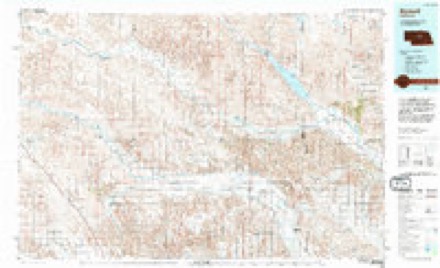
5 surveys from 11 printed sheetsMatched by testing this settlement's coordinate against the published boundary of every sheet in the United States Geological Survey's historical collection. Each opens the scanned sheet at the Survey.
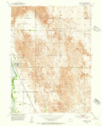
- 1952 USGS Comstock quadrangle1:24000, 3 printings
- 1955 USGS Broken Bow quadrangle1:250000, 5 printings
- 1956 USGS Broken Bow quadrangle1:250000
- 1985 USGS Burwell quadrangle1:100000
- 1994 USGS Burwell quadrangle1:100000
In the county-history sources
18,484 words on this townshipHistory of Custer County, Nebraska; a Narrative of the Past, with Special Emphasis Upon the Pioneer Period of the County's History, Its Social, Commercial, Educational, Religous, and Civic Developement from the Early Days to the Present Time, published 1919 names this settlement in its chapter on Comstock Township. These are the passages that mention it, exactly as the scans read.
The village of Comstock, the youngest town in Custer county, is located on the east bank of the Middle Loup river, on the Aurora and Sargent extension of the B. & M. Railroad. The town was located and surveyed in 1899. A store building was moved over from Wescott, bv W. H. Comstock. and located on the
Passage source: History of Custer County, Nebraska; a Narrative of the Past, with Special Emphasis Upon the Pioneer Period of the County's History, Its Social, Commercial, Educational, Religous, and Civic Developement from the Early Days to the Present Time, published 1919.
I. Fried opened with a line of implements. Elias Cleveland finished his dwelling and moved into it in February. J. F. Westcott, contractor and builder, moved into town in February, but did not complete his dwelling until the following Alay. F. H. Kernohan had his brick store and residence read)' for occupancy in May. In September J. W. Com- stock opened a harness store and repair shop. In December Wescott & Gibbons moved their general merchandise store from the west side of the river and began business in Comstock. In January, 1901, Frank Hammond began business in a new blacksmith and wagon repair shop. R. R. Bangs moved into the hotel in January. C. N. McWorthy built his house for a residence, millinery and dressmaking store in February. In March the ^Modern Woodmen commenced the erection of a twostory building, the ground floor to be used as a drug store, bank, and meat market, and the upper floor for a public hall. A commodious schoolhouse was built in the fall of 1900. The first child born in the village of Comstock was Helen Apperson, February 23, 1900. Concerning the town to-day, E. F. Skolil makes the following resume :
Passage source: History of Custer County, Nebraska; a Narrative of the Past, with Special Emphasis Upon the Pioneer Period of the County's History, Its Social, Commercial, Educational, Religous, and Civic Developement from the Early Days to the Present Time, published 1919.
In Comstock there are the following lodges : Knights of Pythias. Independent Order of Odd Fellows, and Modern Woodmen of America. One doctor, four cream stations, one city hall one telephone exchange (which has been under the good management of E. B Wait since
Passage source: History of Custer County, Nebraska; a Narrative of the Past, with Special Emphasis Upon the Pioneer Period of the County's History, Its Social, Commercial, Educational, Religous, and Civic Developement from the Early Days to the Present Time, published 1919.
Machine-read from a century-old scan, so expect the errors a machine makes: misspelled names, dropped words, stray characters.
Read the whole chapter on Comstock Township - it names this place 7 more 7 times.
Fires near this place
6 since 2004Regional context, not property-specific evidence. The federal wildfire occurrence database lists 6 fires within 5 miles of Comstock between 2004 and 2018, burning about 289 acres in total. None started naturally. None was recorded as arson. Distance is straight-line from the map coordinates, so a fire counted here may appear on a neighbouring settlement's page as well.
| Reported cause | Fires |
|---|---|
| Missing data/not specified/undetermined | 2 |
| Debris and open burning | 2 |
| Equipment and vehicle use | 2 |
The most recent of them, most recent first, with the day each was reported and the service that recorded it.
| Date | Cause | Size | Reported by | Name on the report |
|---|---|---|---|---|
| 15 August 2004 | Equipment and vehicle use | 100 acres | Nebraska Forest Service | not named |
| 5 April 2018 | Debris and open burning | 1.0 acres | Nebraska Forest Service | not named |
| 23 April 2018 | Missing data/not specified/undetermined | 2.0 acres | Nebraska Forest Service | not named |
| 12 April 2018 | Debris and open burning | 65 acres | Nebraska Forest Service | not named |
| 13 March 2018 | Missing data/not specified/undetermined | 1.0 acres | Nebraska Forest Service | not named |
| 6 October 2011 | Equipment and vehicle use | 120 acres | Nebraska Forest Service | not named |
Settlements close enough to share some of these fires:
Storms near this place
38 since 1996Regional context, not property-specific evidence. The National Weather Service names Comstock in 38 storm reports between 1996 and 2024: 25 hail, 9 thunderstorm wind, 3 tornado, 1 flood. The reports record 1 injury. Each account below is quoted exactly as the forecast office filed it, from the NOAA Storm Events Database, and each date opens the federal record of that event.
| When | Event | Place named | Harm | What the report says |
|---|---|---|---|---|
| August 2003 | Thunderstorm Wind | Comstock | 1 hurt, $350,000 | One middle aged male was injured when hit in the head by flying debris and was taken to the hospital for stitches. Outflow winds from a dissipating thunderstorm ripped though an outdoor music concert event. The winds blew over the lights and ceiling over the stage which then fell back onto sound equipment and two power poles behind the stage snapped off. Tents, lawn chairs, and porta-potties were also blown over. |
| June 1999 | Tornado (F2) | Comstock | $300,000 | no account filed |
| March 2019 | Flood | Comstock | $100,000 | Bridge approaches on highway 21C crossing the Middle Loup River just west of Comstock have been compromised. |
| June 1999 | Thunderstorm Wind | Comstock | $100,000 | no account filed |
| June 2003 | Tornado (F1) | Comstock | $25,000 | The tornado touched down in an open field and then moved east through a corn field overturning a pivot irrigation system and snapping off hundreds of large tree limbs in the adjacent shelter belt. The tornado also destroyed a barn and grain bins at a nearby farm. The tornado then crossed the county road just 2 miles north of Comstock and destroyed another barn, overturned another pivot irrigation system, and broke off several power poles. As the tornado continued to move east, it broke off and uprooted numerous trees. Baseball size hail associated with the storm broke many windows in homes near the path of the tornado and also in the town of Comstock. |
| August 2002 | Hail | Comstock | $15,000 | no account filed |
| June 2002 | Thunderstorm Wind | Comstock | $4,000 | The roof was ripped off a hog shed. |
| May 2024 | Thunderstorm Wind | Comstock | $1,000 | Tree limbs 12 inches reported down along with patio furniture being scattered about the yard. |
| July 2015 | Thunderstorm Wind | Comstock | $1,000 | Thunderstorm wind gusts estimated at 60 MPH brought down tree limbs of 6 to 8 inches in diameter. |
| May 2020 | Hail | Comstock | - | Heavy rain along with ping pong ball sized hail reported at this location. |
| April 2018 | Hail | Comstock | - | Report from social media. Time estimated by radar. |
| July 2018 | Thunderstorm Wind | Comstock | - | Wind driven hail damaged crops. |
| July 2014 | Thunderstorm Wind | Comstock | - | Winds estimated to 60 mph with hail up to quarter size. |
| May 2013 | Tornado (EF0) | Comstock | - | At 1545CST, a tornado briefly touched down a half mile west of Comstock with no damage produced. Average path width was 35 yards. |
| August 2019 | Hail | Comstock | - | no account filed |
| April 2018 | Hail | Comstock | - | no account filed |
| July 2018 | Hail | Comstock | - | no account filed |
| August 2017 | Hail | Comstock | - | no account filed |
| July 2017 | Hail | Comstock | - | no account filed |
| July 2017 | Hail | Comstock | - | no account filed |
| September 2015 | Hail | Comstock | - | no account filed |
| June 2014 | Hail | Comstock | - | no account filed |
| June 2014 | Hail | Comstock | - | no account filed |
| September 2008 | Hail | Comstock | - | no account filed |
| September 2008 | Hail | Comstock | - | no account filed |
| June 2008 | Thunderstorm Wind | Comstock | - | no account filed |
| April 2007 | Thunderstorm Wind | Comstock | - | no account filed |
| May 2007 | Hail | Comstock | - | no account filed |
| July 2004 | Hail | Comstock | - | no account filed |
| August 2002 | Hail | Comstock | - | no account filed |
| May 2000 | Hail | Comstock | - | no account filed |
| May 1999 | Hail | Comstock | - | no account filed |
| July 1997 | Hail | Comstock | - | no account filed |
| June 1997 | Hail | Comstock | - | no account filed |
| May 1997 | Hail | Comstock | - | no account filed |
| June 1997 | Hail | Comstock | - | no account filed |
| June 1997 | Hail | Comstock | - | no account filed |
| July 1996 | Hail | Comstock | - | no account filed |
Nearest settlements
The eight closest, with where each one stands in the county. Distances are straight-line, computed from the Geographic Names Information System coordinates.
| Map | Place | Distance | Sheets |
|---|---|---|---|
| Wescott | 2.0 miles | 10 | |
| Sargent | 9.0 miles | 11 | |
| Weissert | 12.4 miles | 11 | |
| Elton (historical) | 12.9 miles | 11 | |
| Westerville | 13.3 miles | 11 | |
| West Union (historical) | 13.4 miles | 12 | |
| Round Valley | 14.8 miles | 11 | |
| Cummings Park (historical) | 17.5 miles | 11 |
Elsewhere
Matched on this settlement's Geographic Names Information System number rather than its name, so it cannot be a different place of the same name in another state.
| Wikipedia article on Comstock | An encyclopaedic summary. Its text is share-alike, so it is linked here rather than copied. |
| Wikidata item Q3007555 | The structured record the population and elevation above come from. Public domain (CC0). |
Provenance
This settlement is recorded in the Geographic Names Information System as feature 828289. The sheet list is computed by point-in-boundary test against the United States Geological Survey's historical topographic inventory. Both are works of the United States government and carry no copyright under 17 U.S.C. 105.
Wildfire. Short, Karen C. 2022. Spatial wildfire occurrence data for the United States, 1992-2020 [FPA_FOD_20221014]. 6th Edition. Fort Collins, CO: Forest Service Research Data Archive. https://doi.org/10.2737/RDS-2013-0009.6 Collected with United States Government funding and usable without additional permissions or fees.
Storms. NOAA National Centers for Environmental Information, Storm Events Database https://www.ncei.noaa.gov/stormevents/ A work of the United States government, no copyright under 17 U.S.C. 105. Narratives are quoted verbatim from the National Weather Service report and are not edited or summarised.