 Block
East Omaha, Nebraska
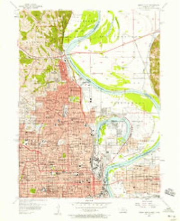
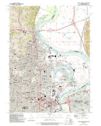
15 topographic sheets cover this place, the earliest surveyed in 1893 and the latest in 1994. It stands in Omaha City. It lies in ZIP code area 68110. The Survey maps it on the Omaha North quadrangle.
On record in East Omaha
Buildings and businesses the archive holds for this place. Each opens its own page, with the source record it came from.
On the National Register within a mile 2 records
The National Register names another town for these. They stand within one mile of this settlement's coordinate.
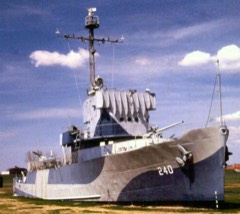 USS HAZARD (AM-240) National Historic LandmarkNational Historic Landmark · listed 1979 · 0.6 miles away
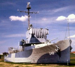 U.S.S. HAZARD and U.S.S. MARLINlisted 1979 · 0.6 miles away
Topographic sheets covering this place
7 surveys from 15 printed sheetsMatched by testing this settlement's coordinate against the published boundary of every sheet in the United States Geological Survey's historical collection. Each opens the scanned sheet at the Survey.
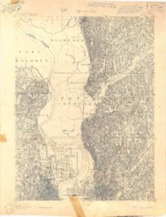
- 1893 USGS Omaha quadrangle1:62500
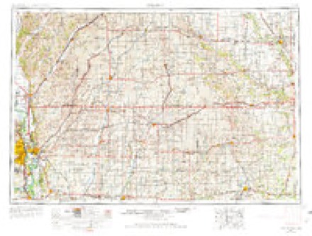
- 1954 USGS Omaha quadrangle1:250000, 3 printings
- 1956 USGS Omaha North quadrangle1:24000, 5 printings
- 1957 USGS Omaha quadrangle1:250000
- 1958 USGS Omaha quadrangle1:250000, 2 printings
- 1985 USGS Omaha quadrangle1:100000, 2 printings
- 1994 USGS Omaha North quadrangle1:24000
What happened here
An account from the chapter on Omaha city. The inset identifies its exact source book and publication year.
Urban B. Balcombe
Urban B. Balcombe, who died at Excelsior Springs, Missouri, March 7, 191 7, was born in Elgin, Illinois,' in 1852. His father. Saint A. D. Balcombe, removed with his family to Omaha from Winona, Minnesota, July 5, 1865. He had formerly been agent for the captured Sioux and Winnebago Indians and in 1863 removed them to St.
Fires near this place
14 since 2007Regional context, not property-specific evidence. The federal wildfire occurrence database lists 14 fires within 5 miles of East Omaha between 2007 and 2020, burning about 331 acres in total. 1 started naturally. 1 was recorded as arson. Distance is straight-line from the map coordinates, so a fire counted here may appear on a neighbouring settlement's page as well.
| Reported cause | Fires |
|---|---|
| Missing data/not specified/undetermined | 6 |
| Debris and open burning | 4 |
| Smoking | 2 |
| Natural | 1 |
| Arson/incendiarism | 1 |
The most recent of them, most recent first, with the day each was reported and the service that recorded it.
| Date | Cause | Size | Reported by | Name on the report |
|---|---|---|---|---|
| 3 September 2020 | Missing data/not specified/undetermined | 1.0 acres | Iowa Department of Natural Resources | not named |
| 27 September 2020 | Missing data/not specified/undetermined | 1.0 acres | Iowa Department of Natural Resources | not named |
| 7 April 2020 | Debris and open burning | 9.0 acres | Iowa Department of Natural Resources | not named |
| 22 April 2018 | Natural | 300 acres | Iowa Department of Natural Resources | not named |
| 21 April 2018 | Missing data/not specified/undetermined | 1.0 acres | Iowa Department of Natural Resources | not named |
| 20 April 2018 | Debris and open burning | 3.0 acres | Iowa Department of Natural Resources | not named |
| 19 April 2018 | Arson/incendiarism | 1.0 acres | Iowa Department of Natural Resources | not named |
| 17 April 2018 | Missing data/not specified/undetermined | 5.0 acres | Iowa Department of Natural Resources | not named |
Settlements close enough to share some of these fires:
Mines and quarries near this place
8 within 5 milesRegional context, not property-specific evidence. The federal mineral resources record lists 8 workings within 5 miles of East Omaha: 7 past producers, 1 producer. 1 still produces. What was taken out: Sand and Gravel, Construction, Lead, Smelter, Sand and Gravel, Construction, Stone, Crushed/Broken. Distance is straight-line from the map coordinates, so a quarry counted here may appear on a neighbouring settlement's page as well.
| Where | Site | Commodity | Status | Recorded |
|---|---|---|---|---|
| Asarco (Omaha) Refinery | Lead, Smelter | Past Producer | ||
| Crescent Quarry | Sand and Gravel, Construction, Stone, Crushed/Broken | Producer | ||
| Hively Pit | Sand and Gravel, Construction | Past Producer | ||
| Unknown | Sand and Gravel, Construction | Past Producer | ||
| Unknown | Sand and Gravel, Construction | Past Producer | ||
| Unknown | Sand and Gravel, Construction | Past Producer | ||
| Unknown | Sand and Gravel, Construction | Past Producer | ||
| Wickham Pit | Sand and Gravel, Construction | Past Producer |
Storms near this place
9 since 2010Regional context, not property-specific evidence. The National Weather Service names East Omaha in 9 storm reports between 2010 and 2024: 7 flood, 1 thunderstorm wind, 1 flash flood. No death or injury is recorded in these reports. Each account below is quoted exactly as the forecast office filed it, from the NOAA Storm Events Database, and each date opens the federal record of that event.
| When | Event | Place named | Harm | What the report says |
|---|---|---|---|---|
| August 2011 | Flood | East Omaha | $5,000,000 | Flooding along the Missouri River in Douglas county gradually worsened during June and moderate flooding persisted into August as record releases from Gavins Point Dam brought widespread flooding along the River. Initially the high releases were due to heavy rain and snow melt, but as the summer wore on persistent heavy rain events above Sioux City and some lingering snow melt in the higher elevations of the rockies kept the reservoir system full and with high releases. At Omaha the river climbed to around its 29 foot flood stage late in May and rose steadily through June reaching around 35 feet late in the month, briefly crossed 36 feet in early July before settling back to around 34 feet in early to mid August. By the end of August decreasing outflows from Gavins Point Dam had allowed the river near Omaha to drop to around 31 feet. The flooding in Douglas county along the Missouri River closed several parks, boating accesses, and recreational areas. Low areas around downtown on the river side of the federal levee were flooded. The high water and persistent pressure on levees forced Eppley airfield and other businesses to constantly monitor the situation and have pumps on standby as either rains, storm sewer backups or minor boils near the levee would force pumping of the water back over the levee. The U.S. Army Corps of Engineers estimated to have spent a little over $2 million on levee repair/work in Omaha alone for the event. By the end of August the city of Omaha's tab for the flood fight had totaled $10 million. Minor flooding persisted into mid September. |
| June 2011 | Flood | East Omaha | $3,000,000 | Flooding along the Missouri River gradually worsened during June as record releases from Gavins Point Dam brought widespread flooding along the river. At Omaha the river climbed to around its 29 foot flood stage late in May and rose steadily through June reaching around 35 feet late in the month. The flooding in Douglas county along the Missouri River closed several parks, boating accesses, and recreational areas. Low areas around downtown on the river side of the Levee began flooding when a flood wall was installed. The south Omaha waste water treatment plant was forced to send 6 million gallons of waste water daily into the river early in June due to flood waters affecting the facility. The high water and persistent pressure on levees forced Eppley Airfield and other businesses to constantly monitor the situation and have pumps on standby as either rains, storm sewer backups or minor boils near the levee would force pumping of the water back over the levee. By June 22nd Eppley had already spent 2.5 million dollars on flood prevention. Burlington Northern had to shut down one of its tracks to allow it to be used as a levee, this forced Amtrak to close that link of service. The flooding persisted into July. |
| July 2011 | Flood | East Omaha | $500,000 | Flooding along the Missouri River gradually worsened during June and persisted into July as record releases from Gavins Point Dam brought widespread flooding along the River. At Omaha the river climbed to around its 29 foot flood stage late in May and rose steadily through June reaching around 35 feet late in the month, briefly crossed 36 feet in early July before settling back to around 35 feet except for a second peak of around 36 feet around July 24th. The flooding in Douglas county along the Missouri River closed several parks, boating accesses, and recreational areas. Low areas around downtown on the river side of the federal levee were flooded. The south Omaha waste water treatment plant was forced to send 6 million gallons of waste water daily into the river beginning early in June due to flood waters affecting the facility. The high water and persistent pressure on levees forced Eppley airfield and other businesses to constantly monitor the situation and have pumps on standby as either rains, storm sewer backups or minor boils near the levee would force pumping of the water back over the levee. By June 22nd Eppley had already spent 2.5 million dollars on flood prevention. Burlington Northern had to shut down one of its tracks to allow it to be used as a levee, this forced Amtrak to close that link of service. The flooding persisted into August. |
| May 2024 | Flash Flood | East Omaha | $150,000 | Following several rounds of thunderstorms and heavy rain which resulted in flash flooding across the Omaha metro, flood waters continued to linger through the morning of the 21st. Broadcast Media reported multiple stalled vehicles at Center and 67th Street. |
| June 2024 | Flood | East Omaha | $50,000 | Excessive rainfall across much of eastern South Dakota resulted in river flooding along the Missouri River at the end of June. Moderate flood stage was observed along the Missouri, with two Omaha river gauges cresting between 32.5 and 33.0 feet. Flood stage for this stretch of the Missouri is 27 feet. |
| July 2010 | Flood | East Omaha | $25,000 | Persistent and heavy rains during June and July combined with increased releases from Gavin's Point Dam and caused the Missouri River to approach its 29 foot flood stage several times in July (although there was a period from the 7th through the 24th when the river dropped below 25 feet or so). The high water flooded some parks in the flood plain including N.P. Dodge park causing its closure. The high water continued into August and eventually prompted the closure of N.P. Dodge Park for the season and causing 20,000 dollars in lost revenue for the city of Omaha. |
| August 2010 | Flood | East Omaha | $20,000 | This flooding carried over from June and July after persistent and heavy rains during those months combined with increased releases from Gavin's Point Dam and caused the Missouri River to approach its 29 foot flood stage several times in July and also in early August. The high water flooded some parks in the flood plain including N.P. Dodge park causing its closure. The high water continued into August and eventually prompted the closure of N.P. Dodge Park for the season and causing 20,000 dollars in lost revenue for the city of Omaha. |
| July 2024 | Flood | East Omaha | - | This is a continuation of river flooding from the end of June. River levels crested along this stretch of the Missouri at the end of June, hence flood waters were receding by this time. As such, the greatest impacts were felt in June (and discussed in the June entry for StormData). For the first part of July while flood waters continued to recede, continued impacts were felt in the form of residual flooding in low-lying areas of roads, trails, and riverfront properties. Damage estimates can be found in June StormData. |
| June 2018 | Thunderstorm Wind | East Omaha | - | Trees were blown down near N 36th St and Ponca Road in Omaha. |
Nearest settlements
The eight closest, with where each one stands in the county. Distances are straight-line, computed from the Geographic Names Information System coordinates.
| Map | Place | Distance | Sheets |
|---|---|---|---|
| Garden Valley Courts | 2.6 miles | 15 | |
| Omaha | 2.7 miles | 15 | |
| Home Park | 3.2 miles | 15 | |
| Beechwood | 3.5 miles | 15 | |
| South Omaha | 6.1 miles | 15 | |
| Debolt | 6.5 miles | 18 | |
| Briggs | 7.3 miles | 18 | |
| Irvington | 8.6 miles | 18 |
Provenance
This settlement is recorded in the Geographic Names Information System as feature 828982. The sheet list is computed by point-in-boundary test against the United States Geological Survey's historical topographic inventory. Both are works of the United States government and carry no copyright under 17 U.S.C. 105.
Wildfire. Short, Karen C. 2022. Spatial wildfire occurrence data for the United States, 1992-2020 [FPA_FOD_20221014]. 6th Edition. Fort Collins, CO: Forest Service Research Data Archive. https://doi.org/10.2737/RDS-2013-0009.6 Collected with United States Government funding and usable without additional permissions or fees.
Mines and quarries. USGS Mineral Resources Data System (MRDS) https://mrdata.usgs.gov/mrds/ A work of the United States government, no copyright under 17 U.S.C. 105.
Storms. NOAA National Centers for Environmental Information, Storm Events Database https://www.ncei.noaa.gov/stormevents/ A work of the United States government, no copyright under 17 U.S.C. 105. Narratives are quoted verbatim from the National Weather Service report and are not edited or summarised.