 Block
South Omaha, Nebraska
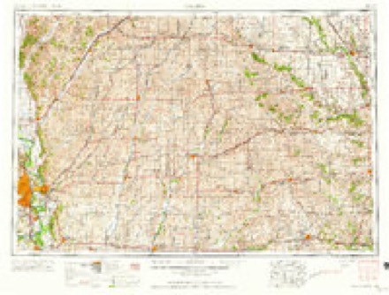
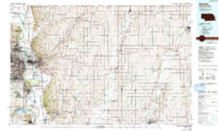
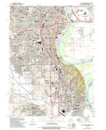
15 topographic sheets cover this place, the earliest surveyed in 1954 and the latest in 1994. It stands in Omaha City. It lies in ZIP code area 68107. The Survey maps it on the Omaha South quadrangle.
On record in South Omaha
Buildings and businesses the archive holds for this place. Each opens its own page, with the source record it came from.
On the National Register within a mile 8 records
The National Register names another town for these. They stand within one mile of this settlement's coordinate.
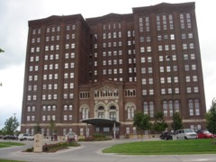 Livestock Exchange Buildinglisted 1999 · 0.3 miles away
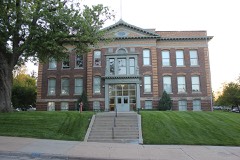 Franklin Schoollisted 1998 · 0.7 miles away
 Polish Home, Thelisted 2015 · 0.8 miles away
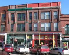 South Omaha Main Street Historic Districtlisted 1989 · 0.8 miles away
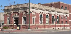 Packer's National Bank Buildinglisted 1985 · 0.8 miles away
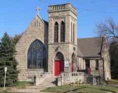 St. Martin of Tours Episcopal Churchlisted 1982 · 0.9 miles away
- Omaha Fire Department No. 5listed 2024 · 0.7 miles away
- South Omaha Main Street Historic District (Boundary Increase) (Additional Documentation)listed 2023 · 0.8 miles away
Topographic sheets covering this place
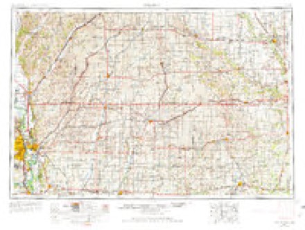
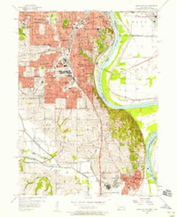
6 surveys from 15 printed sheetsMatched by testing this settlement's coordinate against the published boundary of every sheet in the United States Geological Survey's historical collection. Each opens the scanned sheet at the Survey.
- 1954 USGS Omaha quadrangle1:250000, 3 printings
- 1956 USGS Omaha South quadrangle1:24000, 6 printings
- 1957 USGS Omaha quadrangle1:250000
- 1958 USGS Omaha quadrangle1:250000, 2 printings
- 1985 USGS Omaha quadrangle1:100000, 2 printings
- 1994 USGS Omaha South quadrangle1:24000
What happened here
An account from the chapter on Omaha city. The inset identifies its exact source book and publication year.
Urban B. Balcombe
Urban B. Balcombe, who died at Excelsior Springs, Missouri, March 7, 191 7, was born in Elgin, Illinois,' in 1852. His father. Saint A. D. Balcombe, removed with his family to Omaha from Winona, Minnesota, July 5, 1865. He had formerly been agent for the captured Sioux and Winnebago Indians and in 1863 removed them to St.
Fires near this place
53 since 2007Regional context, not property-specific evidence. The federal wildfire occurrence database lists 53 fires within 5 miles of South Omaha between 2007 and 2020, burning about 341 acres in total. 2 started naturally. 2 were recorded as arson. Distance is straight-line from the map coordinates, so a fire counted here may appear on a neighbouring settlement's page as well.
| Reported cause | Fires |
|---|---|
| Missing data/not specified/undetermined | 31 |
| Debris and open burning | 5 |
| Smoking | 5 |
| Recreation and ceremony | 4 |
| Fireworks | 3 |
| Arson/incendiarism | 2 |
| Natural | 2 |
| Power generation/transmission/distribution | 1 |
The most recent of them, most recent first, with the day each was reported and the service that recorded it.
| Date | Cause | Size | Reported by | Name on the report |
|---|---|---|---|---|
| 7 September 2019 | Missing data/not specified/undetermined | under an acre | Nebraska Forest Service | not named |
| 4 September 2020 | Smoking | under an acre | Nebraska Forest Service | not named |
| 29 September 2012 | Missing data/not specified/undetermined | under an acre | Nebraska Forest Service | not named |
| 23 September 2020 | Missing data/not specified/undetermined | under an acre | Nebraska Forest Service | not named |
| 18 September 2012 | Missing data/not specified/undetermined | under an acre | Nebraska Forest Service | not named |
| 30 August 2012 | Missing data/not specified/undetermined | under an acre | Nebraska Forest Service | not named |
| 28 August 2012 | Missing data/not specified/undetermined | 1.0 acres | Nebraska Forest Service | not named |
| 24 August 2012 | Missing data/not specified/undetermined | under an acre | Nebraska Forest Service | not named |
Settlements close enough to share some of these fires:
Mines and quarries near this place
2 within 5 milesRegional context, not property-specific evidence. The federal mineral resources record lists 2 workings within 5 miles of South Omaha: 1 producer, 1 past producer. 1 still produces. What was taken out: Perlite, Lead, Smelter. Distance is straight-line from the map coordinates, so a quarry counted here may appear on a neighbouring settlement's page as well.
| Where | Site | Commodity | Status | Recorded |
|---|---|---|---|---|
| Asarco (Omaha) Refinery | Lead, Smelter | Past Producer | ||
| Zonolite Perlite Plant | Perlite | Producer |
Storms near this place
20 since 2008Regional context, not property-specific evidence. The National Weather Service names South Omaha in 20 storm reports between 2008 and 2026: 7 flash flood, 6 hail, 6 thunderstorm wind, 1 heavy rain. No death or injury is recorded in these reports. Each account below is quoted exactly as the forecast office filed it, from the NOAA Storm Events Database, and each date opens the federal record of that event.
| When | Event | Place named | Harm | What the report says |
|---|---|---|---|---|
| May 2024 | Flash Flood | South Omaha | $200,000 | Shortly after 4:30 PM CDT, a strong thunderstorm moved into the Omaha metro from the west bringing with it gusty winds, small hail and heavy rain. This slow moving thunderstorm remained over the Omaha metro for over an hour before weakening and slowly moving east into Iowa. Light rain behind this storm continued until around 6:15 PM CDT. There were public reports of stalled cars in flooded roadways south of Dodge Street and west of Interstate 480. There was also a report from amateur radio of flooding making Farnam Street south of Turner Boulevard impassible. |
| April 2026 | Hail | South Omaha | - | Public report received via social media video of hail measured up to 1 inch in diameter mixed with a lot of pea sized hail in Omaha, NE. |
| May 2024 | Thunderstorm Wind | South Omaha | - | Broadcast media reported powerlines down at the intersection of Pacific and 32nd Street. |
| June 2024 | Hail | South Omaha | - | This is a continuation of the hail swath from far western Pottawattamie County in Iowa. This storm continued to slowly move south, impacting portions of far southeastern Douglas County. The office continued to received numerous reports from multiple sources of quarter to tennis ball sized hail as it moved into northeast Sarpy County. |
| July 2023 | Thunderstorm Wind | South Omaha | - | Public reported a medium sized tree snapped at the trunk. |
| April 2023 | Flash Flood | South Omaha | - | Public reported flooding along I480 heading toward US75 south. |
| June 2021 | Thunderstorm Wind | South Omaha | - | Trained spotter reported a large diameter tree broken at the trunk and laying across the road. |
| June 2021 | Thunderstorm Wind | South Omaha | - | Report of significant tree damage down in the city. |
| August 2021 | Flash Flood | South Omaha | - | Public reported major flash flooding. Water flowing fast at a depth of 2 to 3 feet. |
| August 2021 | Flash Flood | South Omaha | - | Public reported people stranded in an elevator in a parking garage due to flooding. Significant flooding occurring in the downtown Omaha area. |
| August 2021 | Flash Flood | South Omaha | - | Emergency manager reported considerable flash flooding in the Omaha Metro Area. Six water rescues have already occurred in southeastern Omaha. Significant street flooding with flowing water. |
| August 2021 | Thunderstorm Wind | South Omaha | - | Public report from mping for 3 inch tree limbs broken or downed power lines. |
| August 2021 | Flash Flood | South Omaha | - | Public reported cars completely submerged and the occupants were rescued. |
| August 2021 | Flash Flood | South Omaha | - | Public reported water up to 2-3 feet deep at 11th and Leavenworth. |
| June 2020 | Thunderstorm Wind | South Omaha | - | Report from mPing reported small tree limbs broken and shingles blown off roof. |
| June 2014 | Hail | South Omaha | - | Quarter size hail fell at 20th street and I-80. |
| June 2014 | Hail | South Omaha | - | The hail occurred at I-480 and Martha Street. |
| July 2008 | Hail | South Omaha | - | Hail up to penny-size was reported near Interstate 80 and 13th Street. This was from another storm that developed just to the southeast of the first one that produced large hail from the Ft. Calhoun area into north Omaha. |
| June 2008 | Heavy Rain | South Omaha | - | Heavy rain caused a roof of a storage building to collapse in east Omaha damaging a truck, trailer and granite supplies. Rainfall at Eppley from the storm was around 2.25 inches. The heavy rain also caused flash flooding across the city. |
| June 2017 | Hail | South Omaha | - | no account filed |
Nearest settlements
The eight closest, with where each one stands in the county. Distances are straight-line, computed from the Geographic Names Information System coordinates.
| Map | Place | Distance | Sheets |
|---|---|---|---|
| Omaha | 3.6 miles | 15 | |
| Ralston | 4.3 miles | 18 | |
| East Omaha | 6.1 miles | 15 | |
| Garden Valley Courts | 6.9 miles | 15 | |
| Home Park | 7.7 miles | 15 | |
| Beechwood | 7.9 miles | 15 | |
| Debolt | 8.2 miles | 18 | |
| Millard | 8.4 miles | 18 |
Provenance
This settlement is recorded in the Geographic Names Information System as feature 833605. The sheet list is computed by point-in-boundary test against the United States Geological Survey's historical topographic inventory. Both are works of the United States government and carry no copyright under 17 U.S.C. 105.
Wildfire. Short, Karen C. 2022. Spatial wildfire occurrence data for the United States, 1992-2020 [FPA_FOD_20221014]. 6th Edition. Fort Collins, CO: Forest Service Research Data Archive. https://doi.org/10.2737/RDS-2013-0009.6 Collected with United States Government funding and usable without additional permissions or fees.
Mines and quarries. USGS Mineral Resources Data System (MRDS) https://mrdata.usgs.gov/mrds/ A work of the United States government, no copyright under 17 U.S.C. 105.
Storms. NOAA National Centers for Environmental Information, Storm Events Database https://www.ncei.noaa.gov/stormevents/ A work of the United States government, no copyright under 17 U.S.C. 105. Narratives are quoted verbatim from the National Weather Service report and are not edited or summarised.