 Block
Gretna, Nebraska
19 topographic sheets cover this place, the earliest surveyed in 1893 and the latest in 1982. It stands in Forest City No. 1 precinct. It lies in ZIP code area 68028. The Survey maps it on the Gretna quadrangle. 5,083 people lived here at the 2020 count. It stands 1,270 feet above sea level.
On record in Gretna
Buildings and businesses the archive holds for this place. Each opens its own page, with the source record it came from.
On the National Register 1 record
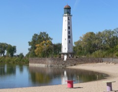 Linoma Beachlisted 2003
Population over time
2 figuresGretna grew from 4,441 to 5,083 between 2010 and 2020. These are the recorded population figures Wikidata holds for this place, reached through the Geographic Names Information System number this page is keyed on rather than by name, so they belong to this place and not to another of the same name. Most are census counts, but not all are: an early figure may be a founding or settlement estimate, and an estimate published within five years of a census is left out. The change column is computed, and is left blank where more than 20 years separate a figure from the one before it, because a gap that long is not a change between two counts.
| Year | People | Change |
|---|---|---|
| 2010 | 4,441 | |
| 2020 | 5,083 | +642 (+14%) |
Topographic sheets covering this place
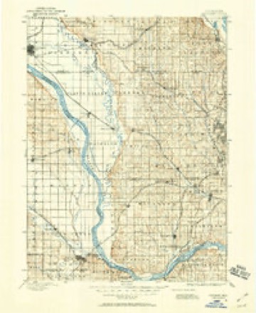
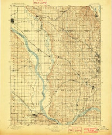
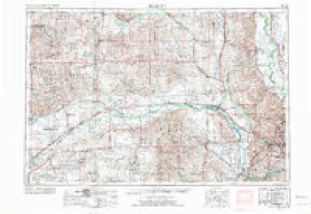
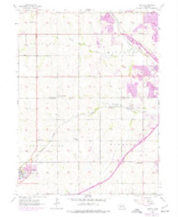
7 surveys from 19 printed sheetsMatched by testing this settlement's coordinate against the published boundary of every sheet in the United States Geological Survey's historical collection. Each opens the scanned sheet at the Survey.
- 1893 USGS Fremont quadrangle1:125000
- 1896 USGS Fremont quadrangle1:125000, 5 printings
- 1955 USGS Fremont quadrangle1:250000, 3 printings
- 1956 USGS Gretna quadrangle1:24000, 6 printings
- 1957 USGS Fremont quadrangle1:250000
- 1958 USGS Fremont quadrangle1:250000
- 1982 USGS Fremont quadrangle1:100000, 2 printings
Fires near this place
3 since 2005Regional context, not property-specific evidence. The federal wildfire occurrence database lists 3 fires within 5 miles of Gretna between 2005 and 2020, burning about 31 acres in total. None started naturally. None was recorded as arson. Distance is straight-line from the map coordinates, so a fire counted here may appear on a neighbouring settlement's page as well.
| Reported cause | Fires |
|---|---|
| Debris and open burning | 2 |
| Equipment and vehicle use | 1 |
The most recent of them, most recent first, with the day each was reported and the service that recorded it.
| Date | Cause | Size | Reported by | Name on the report |
|---|---|---|---|---|
| 30 September 2020 | Equipment and vehicle use | under an acre | Nebraska Forest Service | not named |
| 2 April 2005 | Debris and open burning | 25 acres | Nebraska Forest Service | not named |
| 7 December 2019 | Debris and open burning | 6.0 acres | Nebraska Forest Service | not named |
Settlements close enough to share some of these fires:
Storms near this place
60 of 91 shownRegional context, not property-specific evidence. The National Weather Service names Gretna in 91 storm reports between 1996 and 2025: 38 thunderstorm wind, 37 hail, 6 flood, 3 flash flood. No death or injury is recorded in these reports. Each account below is quoted exactly as the forecast office filed it, from the NOAA Storm Events Database, and each date opens the federal record of that event.
| When | Event | Place named | Harm | What the report says |
|---|---|---|---|---|
| July 2024 | Thunderstorm Wind | Gretna | $15,000,000 | A line of intense thunderstorms swept across Sarpy county, resulting in widespread significant wind damage. While the greatest measured wind gust was 80 miles per hour, recorded by a mesonet station in Papillion, narrow swaths of enhanced straight line wind damage was consistent with wind speeds closer to 100 miles per hour. One such swath impacted portions of northeast Gretna, where multiple homes had windows blown out, trees uprooted, and large portions of their roofs blown off. Most of this damage was noted around the intersection of 168th Street and Meridian Street. Additionally, numerous powerlines and traffic lights were damaged or blown down across the county. Multiple semis were also noted as being flipped off of the road, one in north Gretna off of 204th street, and another off of Highway 370 in east Gretna. Power outages lasted for several days after the storms moved through. Total damages from these storms were estimated to be around 15 million dollars, with approximately 10 million in damages to the OPPD infrastructure. |
| July 1997 | Thunderstorm Wind | Gretna | $30,000 | no account filed |
| July 1996 | Lightning | Gretna | $10,000 | no account filed |
| June 2000 | Thunderstorm Wind | Gretna | $5,000 | A fence and playground equipment were damaged by thunderstorm wind gusts over 60 mph. |
| June 1997 | Thunderstorm Wind | Gretna | $2,000 | no account filed |
| June 2025 | Thunderstorm Wind | Gretna | - | Trained spotter report of a measured 60 mph wind gusts with a handheld weather station. |
| July 2025 | Flash Flood | Gretna | - | On the morning of July 31st, 2025, intense rainfall moved through the Omaha metropolitan area, causing flash floods in both Sarpy and Douglas Counties. Rainfall rates were estimated at 1.50 to 3.00 inches per hour, with total accumulations ranging from 3.15 to 4.03 inches based on measured reports. At 5:37 AM CST, the Nebraska Department of Transportation confirmed that floodwaters were partially covering sections of US Highway 6 between Ashland and Gretna. |
| May 2024 | Tornado (EF0) | Gretna | - | This brief tornado damaged powerpoles along Capehart Road approximately 2 miles southeast of Gretna. Peak winds in this tornado were estimated to be at 79 miles per hour. The max path width and average path width were both 50 yards for this tornado. |
| May 2024 | Thunderstorm Wind | Gretna | - | The office received a public report of numerous trees down on Capehart Road between 192nd and 180th Street. |
| June 2024 | Flood | Gretna | - | Training thunderstorms brought a swath of heavy rain to portions of southern Nebraska, beginning in Dawson County, and expanding into portions of northeast and east-central Nebraska. Areas upstream the Platte River, primarily in Merrick, Howard and Nance counties saw over 5 inches of rain with these storms. As such, this heavy upstream rain in addition to about an inch of additional rain that fell across Dodge county resulted in the Platte River reaching flood stage. The Platte near the intersection of Dodge, Douglas and Saunders counties crested at 1:15 CDT at 11.89 feet. Flood stage at this portion of the river is 11.0 feet. |
| August 2023 | Thunderstorm Wind | Gretna | - | Public reported via social media large tree branches broken. |
| April 2023 | Thunderstorm Wind | Gretna | - | NWS storm damage survey confirmed an area of damaging downburst winds approximately 3 miles long and 1.7 miles wide. Damage patterns and video supported that this was most likely downburst wind damage. The winds snapped or uprooted trees, damaged grain bins, and caused roof damage to barns and at least one home. At least two damage indicators indicated max wind speeds of 90 to 93 mph. |
| April 2023 | Hail | Gretna | - | Mping report for 1-inch hail. |
| August 2021 | Thunderstorm Wind | Gretna | - | Report from mping for 3-inch tree limbs broken; power poles broken. |
| August 2021 | Thunderstorm Wind | Gretna | - | NWS Employee reported a couple of uprooted trees, tree branches down, a shed door flown off, soccer goals blown over, and street lights damaged from winds. |
| June 2020 | Hail | Gretna | - | Public reported 1 inch hail. |
| August 2020 | Thunderstorm Wind | Gretna | - | Former NWS Employee called in estimating winds at 60 mph. |
| March 2019 | Flood | Gretna | - | Highway 6 closed by Linoma Beach between Ashland and Gretna due to flooding. |
| May 2017 | Hail | Gretna | - | Quarter size hail reported at Highway 6 south of Highway 370. |
| May 2017 | Thunderstorm Wind | Gretna | - | A tree was blown down at 168th and Giles Road. |
| June 2017 | Thunderstorm Wind | Gretna | - | A spotter measured a 74 mph wind gust 4 miles southwest of Gretna. |
| June 2017 | Thunderstorm Wind | Gretna | - | Estimated 85 mph winds were measured northeast of Gretna. |
| June 2017 | Thunderstorm Wind | Gretna | - | A trained spotter estimated 70 mph winds southeast of Gretna. |
| June 2017 | Thunderstorm Wind | Gretna | - | A spotter estimated an 80 mph wind gust near Gretna. |
| June 2014 | Thunderstorm Wind | Gretna | - | The public estimated the gust near Gretna. |
| April 2013 | Hail | Gretna | - | Hail up to 2 inches in diameter, covering the ground in many areas, fell from near Gretna northeast into Douglas county near 161st and Harrison Streets. The hail caused some roof, window and vehicle damage in the area. |
| August 2011 | Thunderstorm Wind | Gretna | - | Thunderstorm wind gusts estimated at close to 60 mph damaged machine shed near Gretna. |
| February 2011 | Flood | Gretna | - | Minor flooding along the Platte River due to an ice jam was noted around the Linoma Beach area in far southwest Sarpy county. No damage was reported in the area. |
| May 2011 | Funnel Cloud | Gretna | - | Several weak/small funnel clouds briefly formed on at least one storm that moved across Sarpy county. No touchdowns were observed, but numerous pictures of the funnels were taken and some made the local news report. |
| April 2010 | Hail | Gretna | - | Hail up to 1 inch in diameter was observed by off duty NWS meteorologists along Interstate 80 near exit 432. |
| March 2010 | Flood | Gretna | - | A local ice jam caused minor flooding which crossed a county road near Harrison and 252nd Streets. This ice jam caused a little more flooding in Saunders county. Little damage was noted in Sarpy county from this flooding. |
| June 2010 | Hail | Gretna | - | Hail up to 1.5 inches in diameter fell near Gretna. |
| July 2010 | Thunderstorm Wind | Gretna | - | Thunderstorm wind gusts estimated at close to 60 mph caused scattered tree damage in the Gretna area including several large limbs that temporarily blocked traffic. |
| March 2009 | Hail | Gretna | - | Hail 3/4 to 1.5 inches in diameter was reported from around Gretna northeast to the Chalco area. There was also a rotating wall cloud reported in the Chalco area from this storm. |
| April 2009 | Hail | Gretna | - | Hail up to 1 inch in diameter fell around and in the Gretna area for at least 5 minutes. |
| June 2008 | Flash Flood | Gretna | - | Rainfall of around 3 inches in an hour and a half fell across sections of western Sarpy county. The heavy rain produced flash flooding of a couple of subdivisions in the Gretna area with 6 basements flooded. The flood waters came from a cornfield to the west with debris from the field crossing a road in the subdivision. |
| June 2008 | Tornado (EF2) | Gretna | - | This was the first touchdown of 2 tornadoes that hit the Omaha metro area this night. Tornado number 1 started just southeast of 232ND and West Angus Road about a mile west of Gretna. A garage was demolished at this point, suggesting EF1 damage. The tornado moved east northeast at 45 mph and produced scattered EF0 damage in Gretna with tree and shingle damage noted. From there tornado number 1 continued northeast to near 156th and Giles Road. EF 2 damage was noted just southwest of that point with major roof damage to a home. The tornado then crossed over into the Millard area of Douglas county where it continued for about 3 more miles before merging with tornado number 2. Tornado 1 also caused EF2 damage in Douglas county with much of it concentrated in the vicinity of 137th and Y Streets.||The tornadoes spun up on the leading edge of a bow echo that gathered strength as it raced through the Omaha metropolitan area. More than 500 homeowners reported damage from the storm and OPPD reported that 13,800 customers lost power. |
| June 2008 | Thunderstorm Wind | Gretna | - | Taken from wind equipment from the home of a meteorologist. This was from the bow echo that spun up 2 tornadoes, with the first one touching down a few miles southwest of this location at about this time. |
| June 2008 | Flood | Gretna | - | Areas of heavy rain continued to fall across the Platte River basin during the first week of June, culminating with heavy rain producing thunderstorms late on June 7th and early on the 8th. This caused another round of flooding along the Platte River from mid afternoon on June 9th through early afternoon on the 10th from just northeast of Ashland downstream through the Louisville area. The Platte River reached a crest of 20.4 at Ashland around 230am CDT on June 10, flood stage is 20 feet. The river crested at 9.1 feet at Louisville around 515am on June 10, flood stage at Louisville is 9 feet. The flooding affected mainly just agricultural bottom-lands. |
| February 2007 | Flood | Gretna | - | Ice jams and rising water due to snow melt on the Platte River caused water to flood and very large chunks of ice to be thrown up on the banks along the Platte River from northwest of Gretna to southeast of Springfield. During the late evening of the 22nd 5 rescues were made and dozens of homes were evacuated in Sarpy county due to the rising flood waters. The worst flooding appeared to be near where the Elkhorn and Platte Rivers joined. Although large blocks of ice were pushed up on the banks and the water flooded roads and farmland, damage extended to homes or cabins was generally reserved to carpets and other low-lying objects. |
| March 2007 | Hail | Gretna | - | The hail was mostly 1/2 inch in diameter, but a few stones were 3/4 of an inch in diameter. The hail was reported near the Gretna rest area on Interstate 80. |
| August 2007 | Thunderstorm Wind | Gretna | - | A large wooden play set was flipped over by thunderstorm winds estimated at 60 mph. |
| May 2006 | Lightning | Gretna | - | Lightning struck a house near Gretna causing a fire which resulted in near total destruction to the roof. |
| July 2006 | Thunderstorm Wind | Gretna | - | Thunderstorm wind gusts estimated at over 60 mph overturned a semi on Interstate 80 southwest of Gretna. The accident caused the Interstate to back up for several miles. |
| July 2006 | Thunderstorm Wind | Gretna | - | Thunderstorm winds estimated at 60 mph downed some 3 inch in diameter branches throughout town. |
| July 2006 | Hail | Gretna | - | Hail that was up to 1.5 inches in diameter fell near the Platte River and I-80. |
| September 2006 | Tornado (F0) | Gretna | - | A brief touchdown of a weak tornado was observed just north of Gretna. Initially the tornado was reported near 180th and Harrison Streets, but a NWS storm survey put the touchdown in an open corn field about 2 miles to the southwest, near 204th and Giles. Besides the broken corn stalks, no other damage was observed. The Supercell thunderstorm that produced this tornado had a well developed wall cloud and a moderately long-lived funnel cloud that remained above the ground as it traveled over populated neighborhoods of northern Sarpy county and south central Douglas county. The funnel was observed by numerous people and was caught on film by at least several storm chasers. Darkness limited visually sharp images, but frequent lightning observed with the storm allowed for the numerous public and other reports of a funnel cloud. |
| May 2005 | Hail | Gretna | - | Mostly 1/2 inch or less. |
| May 2005 | Thunderstorm Wind | Gretna | - | A thunderstorm wind gust of 60 mph was measured by home weather equipment. |
| May 2005 | Hail | Gretna | - | Hail up to 1 inch in diameter fell in Gretna and at least to 5 miles east northeast of town for around 20 minutes. The hail caused some minor car damage. |
| February 2004 | Thunderstorm Wind | Gretna | - | A thunderstorm, which produced wind gusts that were measured at a little over 60 mph by home equipment at a Cooperative Observers residence just northeast of Gretna, eventually snapped the tops of some trees just west of Bellevue. |
| June 2004 | Hail | Gretna | - | Up to 1 inch hail fell in and around the Gretna area for approximately 10 minutes |
| June 2004 | Thunderstorm Wind | Gretna | - | Thunderstorm wind gusts of 58 mph were measured near Gretna. |
| July 2003 | Thunderstorm Wind | Gretna | - | A thunderstorm wind gust of 62 mph was recorded by home equipment by a meteorologist. The winds downed tree limbs and toppled swingsets in the area. |
| May 2003 | Hail | Gretna | - | Several supercell thunderstorms moved across Sarpy county this day producing extremely large hail that caused extensive damage in the Bellevue/Offutt AFB area. The hail in this area, including near Offutt Airforce Base, reached up to softball size. Damage was reported to numerous cars, windows, siding and roofs in the area and many plants were damaged and trees were partially stripped of their newly developed leaves. The first report of large hail in Sarpy county was received from 5 miles northwest of Gretna at 251 pm CST where nickel size hail fell. The largest hail from this event was recorded in the Bellevue and Offutt area from 304 pm to 324 pm CST, where hail of 2.5 to 4.5 inches in diameter was recorded. The largest of those stones were reported near 25th and Capehart and Highway 75 and Fairview Road just west southwest of Offutt. Other very large hail stones fell near La Platte which is just south of Offutt AFB. Numerous reports of golfball size hail were also received in the Papillion area which is between Gretna and Offutt AFB. |
| May 2003 | Thunderstorm Wind | Gretna | - | A thunderstorm wind gust of 62 mph was recorded by a NWS meteorologist's home weather equipment. This was with the thunderstorms that produced the large hail across Sarpy county. |
| April 2001 | Hail | Gretna | - | See the narrative for Douglas county that began at 1040 CST. |
| April 2001 | Thunderstorm Wind | Gretna | - | Thunderstorm wind gusts estimated at 60 to 80 mph whipped through Gretna. The speed of 66 mph was recorded by an off duty NWS meteorologist's home weather station. |
| May 2000 | Hail | Gretna | - | Nickel size hail reported just south of Gretna by Ham radio operator. |
| May 2000 | Hail | Gretna | - | Golf ball size hail reported by the public in Gretna. |
Nearest settlements
The eight closest, with where each one stands in the county. Distances are straight-line, computed from the Geographic Names Information System coordinates.
| Map | Place | Distance | Sheets |
|---|---|---|---|
| Melia | 3.6 miles | 17 | |
| Chalco | 5.6 miles | 19 | |
| Plattford (historical) | 6.5 miles | 17 | |
| Linoma Beach | 6.8 miles | 17 | |
| Beacon View | 6.8 miles | 17 | |
| Springfield | 6.9 miles | 17 | |
| Portal | 8.8 miles | 18 | |
| Richfield | 9.0 miles | 18 |
Elsewhere
Matched on this settlement's Geographic Names Information System number rather than its name, so it cannot be a different place of the same name in another state.
| Wikipedia article on Gretna | An encyclopaedic summary. Its text is share-alike, so it is linked here rather than copied. |
| Wikidata item Q954341 | The structured record the population and elevation above come from. Public domain (CC0). |
Provenance
This settlement is recorded in the Geographic Names Information System as feature 829697. The sheet list is computed by point-in-boundary test against the United States Geological Survey's historical topographic inventory. Both are works of the United States government and carry no copyright under 17 U.S.C. 105.
Wildfire. Short, Karen C. 2022. Spatial wildfire occurrence data for the United States, 1992-2020 [FPA_FOD_20221014]. 6th Edition. Fort Collins, CO: Forest Service Research Data Archive. https://doi.org/10.2737/RDS-2013-0009.6 Collected with United States Government funding and usable without additional permissions or fees.
Storms. NOAA National Centers for Environmental Information, Storm Events Database https://www.ncei.noaa.gov/stormevents/ A work of the United States government, no copyright under 17 U.S.C. 105. Narratives are quoted verbatim from the National Weather Service report and are not edited or summarised.