 Block
Kenesaw, Nebraska
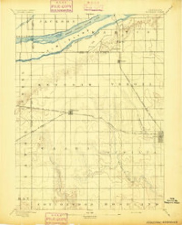
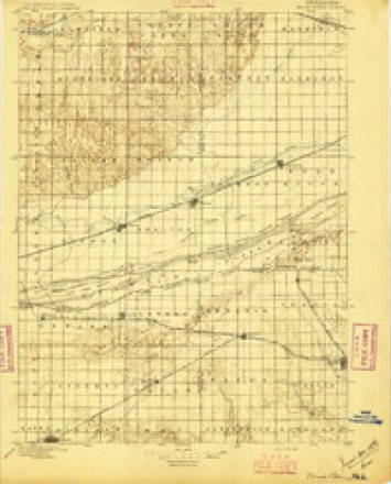
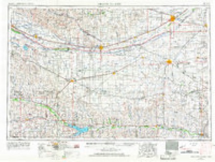
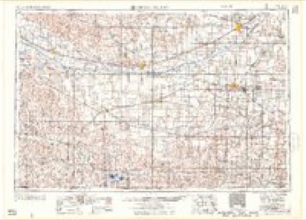
13 topographic sheets cover this place, the earliest surveyed in 1894 and the latest in 1985. It stands in Kenesaw Township. It lies in ZIP code area 68956. The Survey maps it on the Kenesaw quadrangle. 919 people lived here at the 2020 count. It stands 2,051 feet above sea level.
Population over time
2 figuresKenesaw grew from 880 to 919 between 2010 and 2020. These are the recorded population figures Wikidata holds for this place, reached through the Geographic Names Information System number this page is keyed on rather than by name, so they belong to this place and not to another of the same name. Most are census counts, but not all are: an early figure may be a founding or settlement estimate, and an estimate published within five years of a census is left out. The change column is computed, and is left blank where more than 20 years separate a figure from the one before it, because a gap that long is not a change between two counts.
| Year | People | Change |
|---|---|---|
| 2010 | 880 | |
| 2020 | 919 | +39 (+4%) |
Topographic sheets covering this place
7 surveys from 13 printed sheetsMatched by testing this settlement's coordinate against the published boundary of every sheet in the United States Geological Survey's historical collection. Each opens the scanned sheet at the Survey.
- 1894 USGS Kenesaw quadrangle1:62500
- 1896 USGS Wood River quadrangle1:125000, 4 printings
- 1955 USGS Grand Island quadrangle1:250000, 3 printings
- 1957 USGS Grand Island quadrangle1:250000
- 1958 USGS Grand Island quadrangle1:250000
- 1969 USGS Kenesaw quadrangle1:24000
- 1985 USGS Grand Island quadrangle1:100000, 2 printings
In the county-history sources
6,063 words on this townshipPast and Present of Adams County, Nebraska, published 1916 names this settlement in its chapter on Kenesaw Township. These are the passages that mention it, exactly as the scans read.
Tlie Kenesaw site was located June 9, 1871, l)y S. P. Howland, now living in Juniata, Milton F. Brown, Charles Colt and J. D. Butler, Jr. The foiu- original settlers preempted the fom* quarters of section 34, town 8, range 12. ^Recalling the circumstances ]Mr. Howland said: "I sent teams to Grand Island for lumber to build the shack and it was built that month, June. The first five nights I spent upon the site of Kenesaw it rained everj- night and I slept imder an inverted wagon box. Our drinking water at first had to be hauled from Lowell, ten miles to the west, b>it a ^^-eII was boi-ed about the third day after we arrived.
Passage source: Past and Present of Adams County, Nebraska, published 1916.
It is fortunate for the annals of Kenesaw that the first actual settler in that vicinity, Dr. A. D. Williams, was a man who wielded a facile pen and also had a penchant for making accurate records. "The i-ailroad was laid out across this section and finished," wrote Doctor A^'^illiams, "in June, 1872, through to Kearney. The Kenesaw townsite was laid out a little before but the depot was not built imtil along in the fall - I believe the latter part of October or the first of November.
Passage source: Past and Present of Adams County, Nebraska, published 1916.
The following quotation from Doctor AVilliams gives a detailed account of the earliest settlers in the vicinity of Kenesaw: "INIr. Fred Einst settled on the Platte River, nearly six miles north of Kenesaw. in the spring of 1872, and he and his sons became not only the oldest but among the most substantial citizens of that section of the country. The first permanent settler anywhere near Kenesaw was A. D. "Williams on the southwest quarter of section 26, 8, 12, August 16. 1872. He came thither in a 'prairie schooner,' and he with Mrs. "Williams, Katie and George lived three weeks in the covered wagon box, setting up the cook stove outside of it. in a kitchen bounded only by tlie liorizon.
Passage source: Past and Present of Adams County, Nebraska, published 1916.
Machine-read from a century-old scan, so expect the errors a machine makes: misspelled names, dropped words, stray characters.
Read the whole chapter on Kenesaw Township - it names this place 34 more 34 times.
Fires near this place
8 since 2000Regional context, not property-specific evidence. The federal wildfire occurrence database lists 8 fires within 5 miles of Kenesaw between 2000 and 2020, burning about 32 acres in total. None started naturally. None was recorded as arson. Distance is straight-line from the map coordinates, so a fire counted here may appear on a neighbouring settlement's page as well.
| Reported cause | Fires |
|---|---|
| Debris and open burning | 4 |
| Missing data/not specified/undetermined | 2 |
| Recreation and ceremony | 1 |
| Equipment and vehicle use | 1 |
The most recent of them, most recent first, with the day each was reported and the service that recorded it.
| Date | Cause | Size | Reported by | Name on the report |
|---|---|---|---|---|
| 14 May 2009 | Debris and open burning | under an acre | Nebraska Forest Service | not named |
| 6 April 2004 | Recreation and ceremony | 16 acres | Rainwater Basin Wetland Management District | KENESAW |
| 9 March 2011 | Missing data/not specified/undetermined | 2.0 acres | Rainwater Basin Wetland Management District | KENESAW |
| 7 March 2020 | Debris and open burning | 10 acres | Nebraska Forest Service | not named |
| 30 March 2014 | Missing data/not specified/undetermined | 2.0 acres | Rainwater Basin Wetland Management District | KENESAW |
| 2 November 2020 | Debris and open burning | under an acre | Nebraska Forest Service | not named |
| 17 November 2018 | Debris and open burning | 2.0 acres | Nebraska Forest Service | not named |
| 18 October 2000 | Equipment and vehicle use | under an acre | Nebraska Forest Service | not named |
Settlements close enough to share some of these fires:
Storms near this place
50 since 1994Regional context, not property-specific evidence. The National Weather Service names Kenesaw in 50 storm reports between 1994 and 2023: 31 hail, 13 thunderstorm wind, 4 flash flood, 2 tornado. No death or injury is recorded in these reports. Each account below is quoted exactly as the forecast office filed it, from the NOAA Storm Events Database, and each date opens the federal record of that event.
| When | Event | Place named | Harm | What the report says |
|---|---|---|---|---|
| July 2014 | Hail | Kenesaw | $1,000,000 | Quarter size hail was accompanied by wind gusts estimated to be near 60 MPH. |
| July 2014 | Thunderstorm Wind | Kenesaw | $1,000,000 | Wind gusts were estimated to be at least 60 MPH. |
| May 1999 | Tornado (F2) | Kenesaw | $300,000 | no account filed |
| July 2002 | Hail | Kenesaw | $200,000 | no account filed |
| May 1999 | Tornado (F1) | Kenesaw | $150,000 | no account filed |
| May 2020 | Flash Flood | Kenesaw | $100,000 | Radar estimates depicted an area of approximately 4 to 8 inches of rain fell in a very concentrated area across far southwestern portions of Hall County and far northwestern portions of Adams County. Numerous rural roads were covered in water and impassable for a period of time. A home just northwest of Kenesaw was flooded, and the residents had to be rescued. Due to road conditions, the rescue was not completed until daybreak on the 25th, and was done by airboat. |
| July 2002 | Hail | Kenesaw | $100,000 | no account filed |
| June 2015 | Thunderstorm Wind | Kenesaw | $75,000 | Wind gusts estimated to be near 70 MPH resulted in the derailment of seven BNSF freight train cars in extreme western Adams County (the train had a total of 72 cars). Hail up to the size of nickels was also reported in the area. |
| July 2008 | Thunderstorm Wind | Kenesaw | $60,000 | Damage reported included snapped power poles and power lines down as well as trees blown down onto cars. |
| May 2005 | Hail | Kenesaw | $50,000 | no account filed |
| August 1999 | Thunderstorm Wind | Kenesaw | $50,000 | no account filed |
| July 2008 | Flash Flood | Kenesaw | $40,000 | Highway 281 north of Hastings was closed due to water running across the highway. Numerous county roads were washed out across northern portions of Adams county. Street flooding was also reported in the city of Hastings. |
| June 2008 | Hail | Kenesaw | $25,000 | Penny to golfball size hail was reported. |
| July 1997 | Hail | Kenesaw | $25,000 | The large hail broke the windshield of a fire truck. |
| June 2008 | Flash Flood | Kenesaw | $20,000 | Water was running across several county roads over northern Adams County. |
| May 1998 | Hail | Kenesaw | $20,000 | no account filed |
| June 2000 | Hail | Kenesaw | $15,000 | no account filed |
| June 2009 | Hail | Kenesaw | $10,000 | no account filed |
| September 2006 | Hail | Kenesaw | $10,000 | no account filed |
| June 2008 | Hail | Kenesaw | $5,000 | no account filed |
| June 2008 | Hail | Kenesaw | $5,000 | no account filed |
| August 1999 | Thunderstorm Wind | Kenesaw | $5,000 | no account filed |
| June 2008 | Hail | Kenesaw | $2,000 | Nickel to quarter size hail was reported. |
| August 2007 | Thunderstorm Wind | Kenesaw | $1,000 | no account filed |
| May 2021 | Flash Flood | Kenesaw | - | Radar estimated that in general a corridor of 3 to 4 inches fell from northwestern Adams County into central portions of Kearney County, with isolated higher amounts. Measured totals included 4.40 inches from a CoCoRaHS observer located 2 miles northeast of Minden and 3.80 inches from the Cooperative Observer in Minden. A number of county roads were covered, including Primrose Avenue near Highway 6 southeast of Kenesaw, where at least one car left the roadway into the ditch. In Minden, the underpass was blocked off around 11 PM due to flooding, remaining that way through at least 3 AM. |
| July 2020 | Thunderstorm Wind | Kenesaw | - | Wind gusts were estimated to be near 60 MPH. |
| June 2019 | Thunderstorm Wind | Kenesaw | - | Wind gusts estimated to be near 60 MPH resulted in some tree damage in the area. A 58 MPH wind gusts was measured at 1:11 AM CDT by a mesonet station located 3 miles southwest of Prosser. |
| August 2017 | Thunderstorm Wind | Kenesaw | - | Wind gusts estimated to be near 60 MPH downed some tree limbs approximately 3 inches in diameter. |
| April 2014 | Hail | Kenesaw | - | Nickel size hail nearly covered the ground. This report was reported via TWITTER. |
| April 2014 | Hail | Kenesaw | - | This report along with a photo was received via TWITTER. |
| August 2010 | Thunderstorm Wind | Kenesaw | - | Wind gusts estimated at 60 MPH. |
| July 2010 | Thunderstorm Wind | Kenesaw | - | Wind gusts estimated at 60 MPH. |
| June 2009 | Hail | Kenesaw | - | Penny to golf ball size hail was reported. |
| June 1994 | Thunderstorm Wind | Kenesaw | - | Thunderstorm winds gusted up to 90 mph across the northern part of Adams County causing extensive power line damage. Tree and roof damage also occurred. A van was crushed by a falling tree. Three air conditioning units were blown off of a business causing a gas leak. A utility shed was blown into the side of a church, damaging the entrance and an air conditioning unit. Numerous grain bins were destroyed. |
| May 2023 | Hail | Kenesaw | - | no account filed |
| June 2022 | Hail | Kenesaw | - | no account filed |
| July 2022 | Hail | Kenesaw | - | no account filed |
| August 2017 | Hail | Kenesaw | - | no account filed |
| May 2016 | Hail | Kenesaw | - | no account filed |
| September 2015 | Hail | Kenesaw | - | no account filed |
| July 2009 | Hail | Kenesaw | - | no account filed |
| July 2007 | Thunderstorm Wind | Kenesaw | - | no account filed |
| March 2006 | Hail | Kenesaw | - | no account filed |
| June 2006 | Hail | Kenesaw | - | no account filed |
| March 2004 | Hail | Kenesaw | - | no account filed |
| May 2004 | Hail | Kenesaw | - | no account filed |
| June 1998 | Hail | Kenesaw | - | no account filed |
| June 1998 | Hail | Kenesaw | - | no account filed |
| July 1997 | Hail | Kenesaw | - | no account filed |
| March 1997 | Hail | Kenesaw | - | no account filed |
Nearest settlements
The eight closest, with where each one stands in the county. Distances are straight-line, computed from the Geographic Names Information System coordinates.
| Map | Place | Distance | Sheets |
|---|---|---|---|
| Hayland | 4.8 miles | 14 | |
| Prosser | 6.3 miles | 14 | |
| Juniata | 8.3 miles | 13 | |
| Assumption | 8.9 miles | 13 | |
| Holstein | 10.8 miles | 12 | |
| Roseland | 11.6 miles | 12 | |
| Ingleside | 11.7 miles | 14 | |
| Countryside Parks | 14.5 miles | 14 |
Elsewhere
Matched on this settlement's Geographic Names Information System number rather than its name, so it cannot be a different place of the same name in another state.
| Wikipedia article on Kenesaw | An encyclopaedic summary. Its text is share-alike, so it is linked here rather than copied. |
| Wikidata item Q3287854 | The structured record the population and elevation above come from. Public domain (CC0). |
Provenance
This settlement is recorded in the Geographic Names Information System as feature 830469. The sheet list is computed by point-in-boundary test against the United States Geological Survey's historical topographic inventory. Both are works of the United States government and carry no copyright under 17 U.S.C. 105.
Wildfire. Short, Karen C. 2022. Spatial wildfire occurrence data for the United States, 1992-2020 [FPA_FOD_20221014]. 6th Edition. Fort Collins, CO: Forest Service Research Data Archive. https://doi.org/10.2737/RDS-2013-0009.6 Collected with United States Government funding and usable without additional permissions or fees.
Storms. NOAA National Centers for Environmental Information, Storm Events Database https://www.ncei.noaa.gov/stormevents/ A work of the United States government, no copyright under 17 U.S.C. 105. Narratives are quoted verbatim from the National Weather Service report and are not edited or summarised.