 Block
Platte Center, Nebraska
8 topographic sheets cover this place, the earliest surveyed in 1955 and the latest in 1985. It stands in Lost Creek Township. It lies in ZIP code area 68653. It stands on Elm Creek. The Survey maps it on the Platte Center quadrangle. 333 people lived here at the 2020 count. It stands 1,526 feet above sea level.
Population over time
2 figuresPlatte Center fell from 336 to 333 between 2010 and 2020. These are the recorded population figures Wikidata holds for this place, reached through the Geographic Names Information System number this page is keyed on rather than by name, so they belong to this place and not to another of the same name. Most are census counts, but not all are: an early figure may be a founding or settlement estimate, and an estimate published within five years of a census is left out. The change column is computed, and is left blank where more than 20 years separate a figure from the one before it, because a gap that long is not a change between two counts.
| Year | People | Change |
|---|---|---|
| 2010 | 336 | |
| 2020 | 333 | -3 (-1%) |
Topographic sheets covering this place
5 surveys from 8 printed sheetsMatched by testing this settlement's coordinate against the published boundary of every sheet in the United States Geological Survey's historical collection. Each opens the scanned sheet at the Survey.
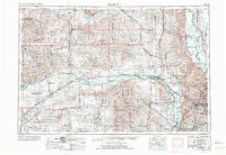
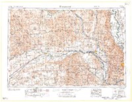
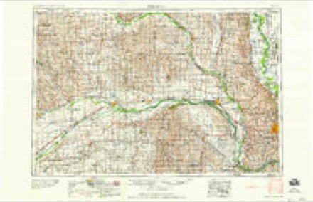
- 1955 USGS Fremont quadrangle1:250000, 3 printings
- 1957 USGS Fremont quadrangle1:250000
- 1958 USGS Fremont quadrangle1:250000
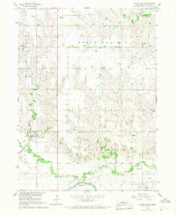
- 1966 USGS Platte Center quadrangle1:24000
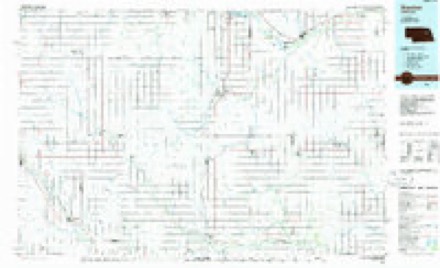
- 1985 USGS Stanton quadrangle1:100000, 2 printings
Fires near this place
12 since 2003Regional context, not property-specific evidence. The federal wildfire occurrence database lists 12 fires within 5 miles of Platte Center between 2003 and 2015, burning about 19 acres in total. None started naturally. None was recorded as arson. Distance is straight-line from the map coordinates, so a fire counted here may appear on a neighbouring settlement's page as well.
| Reported cause | Fires |
|---|---|
| Debris and open burning | 6 |
| Railroad operations and maintenance | 3 |
| Missing data/not specified/undetermined | 2 |
| Fireworks | 1 |
The most recent of them, most recent first, with the day each was reported and the service that recorded it.
| Date | Cause | Size | Reported by | Name on the report |
|---|---|---|---|---|
| 20 August 2003 | Debris and open burning | under an acre | Nebraska Forest Service | not named |
| 18 July 2009 | Debris and open burning | under an acre | Nebraska Forest Service | not named |
| 26 June 2010 | Fireworks | under an acre | Nebraska Forest Service | not named |
| 2 April 2010 | Railroad operations and maintenance | 2.0 acres | Nebraska Forest Service | not named |
| 7 March 2015 | Debris and open burning | 2.0 acres | Nebraska Forest Service | not named |
| 22 March 2015 | Debris and open burning | 2.0 acres | Nebraska Forest Service | not named |
| 16 March 2009 | Debris and open burning | 4.0 acres | Nebraska Forest Service | not named |
| 11 March 2015 | Railroad operations and maintenance | 5.0 acres | Nebraska Forest Service | not named |
Settlements close enough to share some of these fires:
Storms near this place
47 since 1996Regional context, not property-specific evidence. The National Weather Service names Platte Center in 47 storm reports between 1996 and 2024: 25 hail, 6 flash flood, 5 thunderstorm wind, 5 flood. The reports record 1 death. Each account below is quoted exactly as the forecast office filed it, from the NOAA Storm Events Database, and each date opens the federal record of that event.
| When | Event | Place named | Harm | What the report says |
|---|---|---|---|---|
| March 2019 | Flood | Platte Center | 1 killed | This is for flooding along the Shell Creek. The river gage near Columbus, operated by the USGS, peaked at 22.21 feet at 7:30 am on March 14th. Major flood stage is 22 feet. Preliminary data shows that this peak is the 2nd highest on record. US Highway 81 was flooded over from high waters from Shell Creek. Much rural property was inundated by flood waters. A bridges were taken out by flooding. A Columbus man drowned on the 14th while driving his tractor north on, 175th Avenue and over the Shell Creek Bridge. The bridge gave way and the man was swept away by flood waters. Dollar amounts for the county are included in the Loup River flood entry. |
| June 2010 | Flood | Platte Center | $2,000 | Rainfall of another 1 to 2 inches June 22 fell across parts of the Shell Creek basin near and north of Columbus. The rains fell on saturated soils due to the over 5 to 8 inches of rain that fell earlier in the month. This produced some lowland flooding along Shell Creek from near Platte Center to east of Highway 81. The high water closed county roads and Highway 81 for a while on the 23rd and 24th in addition to flooding farmland along the creek. |
| May 2008 | Flash Flood | Platte Center | $200 | Heavy rain caused water to flow over a few roads in the Platte Center area with mud and other debris on the road. The flooding was along Shell Creek tributaries and subsided after a short time. |
| May 2024 | Funnel Cloud | Platte Center | - | Emergency management reported a funnel cloud northwest of Platte Center. |
| April 2024 | Tornado (EF0) | Platte Center | - | This tornado track is based entirely on eyewitness reports as there was no damage indicated along the entirety of the intermittent track. Emergency management, storm spotters, and video evidence indicate that the tornado began approximately 3 miles southwest of Platte Center. it moved northeast where it crossed the Central Highway road a half mile east of 325th Avenue. From that point on, it became more intermittent, occasionally kicking up dust at the ground underneath the persistent funnel cloud. There were times, especially during the intermittent phase, when the ground-level circulation went through center pivot irrigation systems without tipping them over, which has stood as the basis for rating this as an EF-0 tornado. Video evidence suggests that it was approximately 50 yards wide at its maximum width. |
| July 2024 | Hail | Platte Center | - | The office received a public report of hail ranging from nickel to golf ball sized. It was also reported that crops were shredded from the hail in this area. |
| July 2023 | Hail | Platte Center | - | Trained spotter reported 1.25-inch hail. |
| May 2023 | Hail | Platte Center | - | Public reported 1.75-inch hail. |
| May 2023 | Hail | Platte Center | - | CoCoRaHS observer reported 1.75-inch hail. |
| May 2022 | Funnel Cloud | Platte Center | - | Public reported a funnel cloud spotted from Highway 81. |
| May 2022 | Thunderstorm Wind | Platte Center | - | Personal weather station measured a peak wind gust of 59 mph. |
| May 2022 | Thunderstorm Wind | Platte Center | - | Personal weather station measured a peak wind gust of 65 mph. |
| April 2022 | Hail | Platte Center | - | Emergency manager reported 1 inch hail. |
| April 2022 | Hail | Platte Center | - | Trained spotter reported 1.25 inch hail. |
| April 2022 | Hail | Platte Center | - | Emergency manager reported golf ball sized hail. |
| April 2022 | Flash Flood | Platte Center | - | Emergency manager reported numerous flooded county roads. |
| December 2021 | Tornado (EF1) | Platte Center | - | A tornado developed over an open field south of town and north of the creek where it tipped over two sections of an irrigation pivot. The tornado proceeded north northeast into Platte Center, causing damage to a garage and snapping several trees. The maximum damage occurred between 2nd and 4th streets where a large metal building with wood construction had the wind enter the doors, uplift the roof, and collapse the walls as the entire building shifted and collapsed to the northeast. Very large trees were blown down and one home lost much of its roof. The damage became less notable over the next block and dissipated near the elementary school. |
| May 2019 | Heavy Rain | Platte Center | - | Up to 6.5 inches of rain in Platte Center. |
| May 2019 | Flood | Platte Center | - | Closure of the south bound lane of Highway 81 due to flooding along Shell Creek. |
| June 2018 | Flash Flood | Platte Center | - | Heavy rainfall of 4 to 6 1/2 inches caused flash flooding in parts of Platte County. Flooding in Platte Center and nearby areas required sandbagging to occur to reduce the effects of flooding. Flooding started on the evening of the 24th and continued into the morning of the 25th. |
| June 2018 | Flood | Platte Center | - | Highway 81 was closed due to flooding of Shell Creek from 4 to 6 1/2 inch rainfall. |
| September 2016 | Flash Flood | Platte Center | - | The emergency manager reported that heavy rainfall in excess of 4 inches led to flooding of Central Highway. |
| August 2011 | Thunderstorm Wind | Platte Center | - | Thunderstorm wind gusts estimated at around 60 mph downed some large tree limbs near Platte Center. |
| June 2011 | Hail | Platte Center | - | From the same supercell thunderstorm that produced a tornado south of the area. |
| May 2011 | Flash Flood | Platte Center | - | Heavy rain cause brief flash-flooding of at least one road near Platte Center. Rainfall at the Loup Power Plant northeast of Columbus totaled over 3 inches from the storms this night, and some street flooding was also reported in Columbus. Any damage due to flooding was apparently minimal. |
| June 2008 | Flash Flood | Platte Center | - | Heavy rain caused flash flooding of county roads along Shell Creek from around Lindsay to Platte Center. Rainfall in the northwest part of the county was estimated at 2 to 3 inches. |
| February 2007 | Flood | Platte Center | - | Ice jams along Shell Creek from near Platte Center to northeast of Columbus flooded some lowland farmlands and a few county roads in the area. |
| July 2003 | Thunderstorm Wind | Platte Center | - | Thunderstorm wind gusts were estimated at over 60 mph by emergency management in Platte Center. The winds downed large tree branches in the Platte Center and Humphrey areas. |
| July 2003 | Tornado (F1) | Platte Center | - | This tornado was also caught on film and caused damage to buildings at 3 farmsteads and severely damaged at least 50 trees. Several center pivot irrigation systems were knocked over and a 500 gallon fuel barrel was tossed into an adjacent field. |
| May 2002 | Thunderstorm Wind | Platte Center | - | Emergency management of Platte county estimated thunderstorm wind gusts of around 65 mph. |
| April 2017 | Hail | Platte Center | - | no account filed |
| June 2017 | Hail | Platte Center | - | no account filed |
| May 2015 | Hail | Platte Center | - | no account filed |
| May 2013 | Hail | Platte Center | - | no account filed |
| June 2009 | Hail | Platte Center | - | no account filed |
| April 2006 | Hail | Platte Center | - | no account filed |
| July 2003 | Hail | Platte Center | - | no account filed |
| April 2003 | Hail | Platte Center | - | no account filed |
| May 2003 | Hail | Platte Center | - | no account filed |
| May 2003 | Hail | Platte Center | - | no account filed |
| April 2002 | Hail | Platte Center | - | no account filed |
| July 2002 | Hail | Platte Center | - | no account filed |
| June 2002 | Hail | Platte Center | - | no account filed |
| May 2002 | Hail | Platte Center | - | no account filed |
| August 2002 | Hail | Platte Center | - | no account filed |
| August 2000 | Hail | Platte Center | - | no account filed |
| July 1996 | Hail | Platte Center | - | no account filed |
Nearest settlements
The eight closest, with where each one stands in the county. Distances are straight-line, computed from the Geographic Names Information System coordinates.
| Map | Place | Distance | Sheets |
|---|---|---|---|
| Oconee | 4.9 miles | 14 | |
| Tarnov | 5.5 miles | 9 | |
| Sheldonville | 6.1 miles | 13 | |
| Monroe | 7.3 miles | 14 | |
| College View Park | 8.1 miles | 13 | |
| Countryview Estates | 8.1 miles | 13 | |
| Wagners Lake | 9.7 miles | 13 | |
| Columbus | 9.8 miles | 12 |
Elsewhere
Matched on this settlement's Geographic Names Information System number rather than its name, so it cannot be a different place of the same name in another state.
| Wikipedia article on Platte Center | An encyclopaedic summary. Its text is share-alike, so it is linked here rather than copied. |
| Wikidata item Q743052 | The structured record the population and elevation above come from. Public domain (CC0). |
Provenance
This settlement is recorded in the Geographic Names Information System as feature 832155. The sheet list is computed by point-in-boundary test against the United States Geological Survey's historical topographic inventory. Both are works of the United States government and carry no copyright under 17 U.S.C. 105.
Wildfire. Short, Karen C. 2022. Spatial wildfire occurrence data for the United States, 1992-2020 [FPA_FOD_20221014]. 6th Edition. Fort Collins, CO: Forest Service Research Data Archive. https://doi.org/10.2737/RDS-2013-0009.6 Collected with United States Government funding and usable without additional permissions or fees.
Storms. NOAA National Centers for Environmental Information, Storm Events Database https://www.ncei.noaa.gov/stormevents/ A work of the United States government, no copyright under 17 U.S.C. 105. Narratives are quoted verbatim from the National Weather Service report and are not edited or summarised.