 Block
Salem, Nebraska
11 topographic sheets cover this place, the earliest surveyed in 1915 and the latest in 1986. It stands in Salem precinct. It lies in ZIP code area 68433. It stands on North Fork Big Nemaha River. The Survey maps it on the Salem quadrangle. 83 people lived here at the 2020 count. It stands 971 feet above sea level.
Population over time
2 figuresSalem fell from 112 to 83 between 2010 and 2020. These are the recorded population figures Wikidata holds for this place, reached through the Geographic Names Information System number this page is keyed on rather than by name, so they belong to this place and not to another of the same name. Most are census counts, but not all are: an early figure may be a founding or settlement estimate, and an estimate published within five years of a census is left out. The change column is computed, and is left blank where more than 20 years separate a figure from the one before it, because a gap that long is not a change between two counts.
| Year | People | Change |
|---|---|---|
| 2010 | 112 | |
| 2020 | 83 | -29 (-26%) |
Topographic sheets covering this place
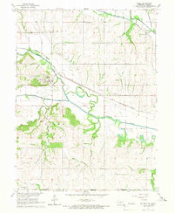
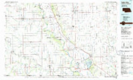
6 surveys from 11 printed sheetsMatched by testing this settlement's coordinate against the published boundary of every sheet in the United States Geological Survey's historical collection. Each opens the scanned sheet at the Survey.
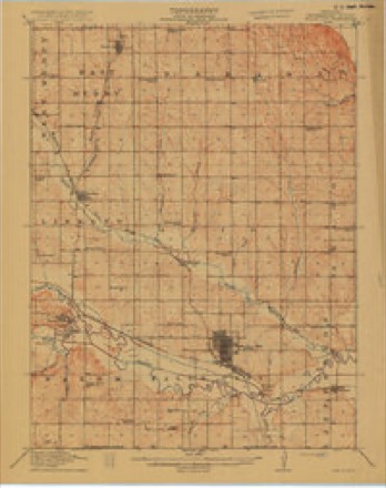
- 1915 USGS Falls City quadrangle1:62500, 3 printings
- 1955 USGS Nebraska City quadrangle1:250000, 3 printings
- 1957 USGS Nebraska City quadrangle1:250000
- 1958 USGS Nebraska City quadrangle1:250000
- 1965 USGS Salem quadrangle1:24000
- 1986 USGS Falls City quadrangle1:100000, 2 printings
In the county-history sources
1,683 words on this townshipHistory of Richardson County, Nebraska : Its People, Industries and Institutions, published 1917 names this settlement in its chapter on Salem Precinct. These are the passages that mention it, exactly as the scans read.
Salem precinct is composed of township No. i, range No. 15, and comprises some of the choicest lands and one of the oldest settlements of the county. The town of Salem is one of the first in the county. In the summer of 1857 there was already quite a village there with stores, postoffice and blacksmith shop. It is said that one son of Vulcan, who presided over a pioneer forge at this place, was often complained of by his customers wu'th having charged exorbitant prices for his work. Upon one occasion one of them remarked that he "ought to make a pretty good living at such prices for his work." With a fine blending of humor and impudence he replied: "I didn't come awa}- out here to make a living, but to make a raise."
Passage source: History of Richardson County, Nebraska : Its People, Industries and Institutions, published 1917.
The fair grounds of the old-time Richardson County Agricultural Society, were located near the town of Salem and the fairs which were held at this beautiful place annually from the very earliest times, were the best attended in the state and the meetings were looked forward to each year with the greatest interest. Those annual fairs had an educational value to an agricultural community such as ours, that has been wholly lacking in the modern meetings which have sought to take their places. Salem precinct with her manifold natural advantages and intelligent population, has always kept even with the development of our county and her place as one of our best precincts will always be secure.
Passage source: History of Richardson County, Nebraska : Its People, Industries and Institutions, published 1917.
The village is located about half way Ijetween Humboldt and Salem. The southwest portion of Grant precinct extends to and includes the south fork of the Nemaha in the vicinity of Miles' ranch. This ranch, or farm, embraces several thousand acres and was founded by Stephen B. Miles, Sr.. a wealthy man and one of the older citizens of the county, and is still owned intact by a .son, Joseph H. Miles, and his sons. Stephen and \\'arren. Mr. Miles has erected some of the best buildings of the county upon the ranch. The original owner, S. B. Miles, Sr., made his home nn this ranch for years and gave his personal attention to its development. There was for years in the earlier times a good store building containing an extensive stock of goods in this vicinity, the proprietor of which was Warren Cooper.
Passage source: History of Richardson County, Nebraska : Its People, Industries and Institutions, published 1917.
Machine-read from a century-old scan, so expect the errors a machine makes: misspelled names, dropped words, stray characters.
Read the whole chapter on Salem Precinct - it names this place 2 more 2 times.
Fires near this place
12 since 2005Regional context, not property-specific evidence. The federal wildfire occurrence database lists 12 fires within 5 miles of Salem between 2005 and 2020, burning about 1,152 acres in total. None started naturally. None was recorded as arson. Distance is straight-line from the map coordinates, so a fire counted here may appear on a neighbouring settlement's page as well.
| Reported cause | Fires |
|---|---|
| Debris and open burning | 6 |
| Missing data/not specified/undetermined | 5 |
| Power generation/transmission/distribution | 1 |
The most recent of them, most recent first, with the day each was reported and the service that recorded it.
| Date | Cause | Size | Reported by | Name on the report |
|---|---|---|---|---|
| 21 July 2018 | Debris and open burning | 1.0 acres | Nebraska Forest Service | not named |
| 18 April 2007 | Debris and open burning | 3.0 acres | Nebraska Forest Service | not named |
| 6 March 2009 | Debris and open burning | 3.0 acres | Nebraska Forest Service | not named |
| 5 March 2020 | Missing data/not specified/undetermined | 25 acres | Nebraska Forest Service | not named |
| 5 March 2005 | Missing data/not specified/undetermined | 1,020 acres | Nebraska Forest Service | not named |
| 28 March 2020 | Missing data/not specified/undetermined | 5.0 acres | Nebraska Forest Service | not named |
| 23 March 2009 | Power generation/transmission/distribution | 15 acres | Nebraska Forest Service | not named |
| 15 March 2009 | Missing data/not specified/undetermined | 1.0 acres | Nebraska Forest Service | not named |
Settlements close enough to share some of these fires:
Mines and quarries near this place
1 within 5 milesRegional context, not property-specific evidence. The federal mineral resources record lists 1 working within 5 miles of Salem: 1 producer. All of them still produce. What was taken out: Stone, Crushed/Broken. Distance is straight-line from the map coordinates, so a quarry counted here may appear on a neighbouring settlement's page as well.
| Where | Site | Commodity | Status | Recorded |
|---|---|---|---|---|
| Nemaha Valley Quarry & Mill | Stone, Crushed/Broken | Producer |
Storms near this place
18 since 1996Regional context, not property-specific evidence. The National Weather Service names Salem in 18 storm reports between 1996 and 2023: 8 hail, 3 thunderstorm wind, 3 flood, 2 flash flood. No death or injury is recorded in these reports. Each account below is quoted exactly as the forecast office filed it, from the NOAA Storm Events Database, and each date opens the federal record of that event.
| When | Event | Place named | Harm | What the report says |
|---|---|---|---|---|
| June 2015 | Flood | Salem | $125,000 | Significant flooding was observed along the Big Nemaha River near Falls City. The flooding including closing of many gravel and county roads, as well State Highway 8. The flooding also included agricultural low-lands along the river as well. |
| June 2009 | Flash Flood | Salem | $10,000 | Heavy rain for the second night in a row caused flash flooding along Rock Creek and another unnamed creek near Salem. The flooding crossed several county roads causing some gravel washout and culvert damage. |
| April 1999 | Tornado (F0) | Salem | $3,000 | Brief touchdown did some tree and outbuilding damage. |
| May 2023 | Thunderstorm Wind | Salem | - | A public personal weather station measured a peak wind gust of 73 mph. |
| June 2021 | Flash Flood | Salem | - | Law enforcement reported water over Highway 8. |
| August 2019 | Hail | Salem | - | The public reported golf ball size hail. Many windshields were damaged. Multiple total loss claims were reported for crops. |
| May 2019 | Heavy Rain | Salem | - | Measured 4.15 inches of rain in the previous 24 hours southwest of Salem. |
| August 2017 | Hail | Salem | - | Quarter size hail fell east of Salem. |
| March 2009 | Thunderstorm Wind | Salem | - | Thunderstorm wind gusts estimated at 60 to 70 mph downed trees and snapped at least one power pole causing a power outage south of Salem. |
| September 2007 | Flood | Salem | - | A brief period of flooding was observed along the Big Nemaha River in Richardson county due to heavy rain that fell the prior day. The river at Falls City crested at 25.1 feet around 9 pm CDT on 9/7, flood stage is 23 feet. The river at Falls City was above flood stage for about 5 1/2 hours beginning around 5 pm on the 7th. The flooding affected mainly agricultural lowlands. |
| May 2007 | Flood | Salem | - | Rainfall of 4 to 7 inches fell over the lower sections of the Big Nemaha River basin from Friday May 4th through Sunday May 6th. Falls City reported 7.15 inches during this time. The heavy rain caused the Big Nemaha River to flood, with the river at Falls City reaching a 30.3 foot crest around noon CDT on May 7th. Flood stage is 23 feet. The river at Falls City first crossed flood stage around 830 am on May 6th and didn't drop below flood stage until around 5 am on the 8th. Due to flood waters, an 8 mile stretch of old Highway 7 southeast of Rulo was closed. Flooding was also observed across some agricultural lowlands in the area. |
| June 2004 | Thunderstorm Wind | Salem | - | Thunderstorm wind gusts estimated to over 60 mph knocked down a tree in Salem. |
| June 2008 | Hail | Salem | - | no account filed |
| July 2008 | Hail | Salem | - | no account filed |
| June 2005 | Hail | Salem | - | no account filed |
| May 2004 | Hail | Salem | - | no account filed |
| February 2000 | Hail | Salem | - | no account filed |
| July 1996 | Hail | Salem | - | no account filed |
Nearest settlements
The eight closest, with where each one stands in the county. Distances are straight-line, computed from the Geographic Names Information System coordinates.
| Map | Place | Distance | Sheets |
|---|---|---|---|
| Verdon | 5.0 miles | 11 | |
| Straussville | 5.1 miles | 11 | |
| Falls City | 6.4 miles | 12 | |
| Dawson | 7.0 miles | 11 | |
| Nim City | 8.2 miles | 11 | |
| Archer (historical) | 8.2 miles | 12 | |
| Preston Census Designated Place | 11.1 miles | 12 | |
| Preston | 11.2 miles | 12 |
Elsewhere
Matched on this settlement's Geographic Names Information System number rather than its name, so it cannot be a different place of the same name in another state.
| Wikipedia article on Salem | An encyclopaedic summary. Its text is share-alike, so it is linked here rather than copied. |
| Wikidata item Q2785692 | The structured record the population and elevation above come from. Public domain (CC0). |
Provenance
This settlement is recorded in the Geographic Names Information System as feature 833121. The sheet list is computed by point-in-boundary test against the United States Geological Survey's historical topographic inventory. Both are works of the United States government and carry no copyright under 17 U.S.C. 105.
Wildfire. Short, Karen C. 2022. Spatial wildfire occurrence data for the United States, 1992-2020 [FPA_FOD_20221014]. 6th Edition. Fort Collins, CO: Forest Service Research Data Archive. https://doi.org/10.2737/RDS-2013-0009.6 Collected with United States Government funding and usable without additional permissions or fees.
Mines and quarries. USGS Mineral Resources Data System (MRDS) https://mrdata.usgs.gov/mrds/ A work of the United States government, no copyright under 17 U.S.C. 105.
Storms. NOAA National Centers for Environmental Information, Storm Events Database https://www.ncei.noaa.gov/stormevents/ A work of the United States government, no copyright under 17 U.S.C. 105. Narratives are quoted verbatim from the National Weather Service report and are not edited or summarised.