 Block
Silver Creek, Nebraska
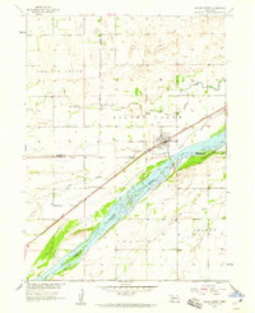
13 topographic sheets cover this place, the earliest surveyed in 1896 and the latest in 1985. It stands in Silver Creek Township. It lies in ZIP code area 68663. It stands on Silver Creek. The Survey maps it on the Silver Creek quadrangle. 320 people lived here at the 2020 count. It stands 1,542 feet above sea level.
Population over time
2 figuresSilver Creek fell from 362 to 320 between 2010 and 2020. These are the recorded population figures Wikidata holds for this place, reached through the Geographic Names Information System number this page is keyed on rather than by name, so they belong to this place and not to another of the same name. Most are census counts, but not all are: an early figure may be a founding or settlement estimate, and an estimate published within five years of a census is left out. The change column is computed, and is left blank where more than 20 years separate a figure from the one before it, because a gap that long is not a change between two counts.
| Year | People | Change |
|---|---|---|
| 2010 | 362 | |
| 2020 | 320 | -42 (-12%) |
Topographic sheets covering this place
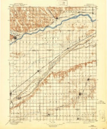
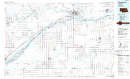
6 surveys from 13 printed sheetsMatched by testing this settlement's coordinate against the published boundary of every sheet in the United States Geological Survey's historical collection. Each opens the scanned sheet at the Survey.
- 1896 USGS Stromsburg quadrangle1:125000, 5 printings
- 1955 USGS Fremont quadrangle1:250000, 3 printings
- 1957 USGS Fremont quadrangle1:250000
- 1958 USGS Fremont quadrangle1:250000
- 1958 USGS Silver Creek quadrangle1:24000
- 1985 USGS David City quadrangle1:100000, 2 printings
In the county-history sources
255 words on this townshipA History of Merrick County, Nebraska: From "the Beginning" to 1895, published 1898 names this settlement in its chapter on Silver Creek Township. These are the passages that mention it, exactly as the scans read.
Silver Creek was platted by the Union Pacific in November, 1866. With the exception of the section house, the first building erected at the new station appears to have been built by Mr. B. F. Hobart. In September, 1870, Mr. Cyrus Lee erected a hotel called the "Lee House," which was the first semi-public building of which the little village boasted. Among the earliest settlers in and around Silver Creek were the Shaw brothers, Mr. Lathrop (who kept a ranch two miles below the town), J. and Ed Howland (who located a mile and a half north) and James Brown. During the year 1870, Rev. H. C. Shaw, one of the pioneer Episcopalian ministers, organized the society which still holds its regular sessions there. A district school was organized in 1871. In 1874 the Congregational church was organized and has grown in numbers and strength since that day.
Passage source: A History of Merrick County, Nebraska: From "the Beginning" to 1895, published 1898.
Silver Creek's newspaper history, so far as we are able to learn, is contaired in the record of the life of the Silver Creek Times, originally a Republican paper, but at the present time, under the editorship of the lion. Chas. Wooster, a representative of the Fusionists.
Passage source: A History of Merrick County, Nebraska: From "the Beginning" to 1895, published 1898.
Silver Creek derived its name from the clearness, sparkle and color of the little stream which meanders over the prairie near the town. Its growth in the twenty-one years since it was platted has not yet brought it into serious competition with the other towns of the county, but has none the less made it a substantial little country settlement.
Passage source: A History of Merrick County, Nebraska: From "the Beginning" to 1895, published 1898.
Machine-read from a century-old scan, so expect the errors a machine makes: misspelled names, dropped words, stray characters.
Fires near this place
11 since 2003Regional context, not property-specific evidence. The federal wildfire occurrence database lists 11 fires within 5 miles of Silver Creek between 2003 and 2014, burning about 72 acres in total. 1 started naturally. None was recorded as arson. Distance is straight-line from the map coordinates, so a fire counted here may appear on a neighbouring settlement's page as well.
| Reported cause | Fires |
|---|---|
| Railroad operations and maintenance | 3 |
| Debris and open burning | 2 |
| Missing data/not specified/undetermined | 2 |
| Smoking | 2 |
| Equipment and vehicle use | 1 |
| Natural | 1 |
The most recent of them, most recent first, with the day each was reported and the service that recorded it.
| Date | Cause | Size | Reported by | Name on the report |
|---|---|---|---|---|
| 30 September 2004 | Missing data/not specified/undetermined | 1.0 acres | Nebraska Forest Service | not named |
| 3 September 2003 | Missing data/not specified/undetermined | 1.0 acres | Nebraska Forest Service | not named |
| 22 May 2007 | Natural | under an acre | Nebraska Forest Service | not named |
| 26 April 2013 | Smoking | 3.0 acres | Nebraska Forest Service | not named |
| 21 April 2009 | Debris and open burning | under an acre | Nebraska Forest Service | not named |
| 2 April 2009 | Railroad operations and maintenance | 1.0 acres | Nebraska Forest Service | not named |
| 9 March 2007 | Equipment and vehicle use | 1.0 acres | Nebraska Forest Service | not named |
| 12 March 2014 | Debris and open burning | 60 acres | Nebraska Forest Service | not named |
Storms near this place
27 since 1999Regional context, not property-specific evidence. The National Weather Service names Silver Creek in 27 storm reports between 1999 and 2023: 14 hail, 9 thunderstorm wind, 2 tornado, 1 flood. No death or injury is recorded in these reports. Each account below is quoted exactly as the forecast office filed it, from the NOAA Storm Events Database, and each date opens the federal record of that event.
| When | Event | Place named | Harm | What the report says |
|---|---|---|---|---|
| July 2020 | Tornado (EF0) | Silver Creek | $200,000 | Region 44 Emergency Management assisted with this survey. A brief tornado touched down north of Silver Creek, with a path length of approximately 4 miles and maximum wind gusts estimated to be 85 MPH. Damage was primarily confined to trees, with downed large branches and some uprooted trees. Irrigation pivots along and near the path were overturned. Two farmsteads were affected, one sustained minor damage to a small outbuilding and the other sustained tree damage. |
| August 2015 | Thunderstorm Wind | Silver Creek | $100,000 | Wind gusts estimated near 70 MPH blew over an irrigation pivot and resulted in significant crop damage within a localized area. |
| October 2001 | Tornado (F1) | Silver Creek | $100,000 | Tornado entered Merrick County from Polk County. |
| May 2003 | Hail | Silver Creek | $50,000 | no account filed |
| May 2003 | Hail | Silver Creek | $50,000 | no account filed |
| May 2002 | Hail | Silver Creek | $50,000 | no account filed |
| July 2011 | Thunderstorm Wind | Silver Creek | $25,000 | A few tree limbs up to 6 inches in diameter and power lines were knocked down. |
| June 2013 | Hail | Silver Creek | $25,000 | no account filed |
| June 2011 | Hail | Silver Creek | $25,000 | no account filed |
| July 2003 | Thunderstorm Wind | Silver Creek | $25,000 | no account filed |
| June 1999 | Thunderstorm Wind | Silver Creek | $25,000 | no account filed |
| July 2006 | Hail | Silver Creek | $10,000 | no account filed |
| July 2006 | Flood | Silver Creek | $10,000 | no account filed |
| May 2004 | Thunderstorm Wind | Silver Creek | $10,000 | no account filed |
| June 2008 | Hail | Silver Creek | $5,000 | no account filed |
| June 2007 | Flash Flood | Silver Creek | $5,000 | no account filed |
| December 2021 | Thunderstorm Wind | Silver Creek | - | A wind gust of 59 MPH was measured by a mesonet station located approximately 5 miles southwest of Silver Creek. |
| June 2020 | Hail | Silver Creek | - | Observer reported mainly pea to nickel size hail, with occasional larger stones. Size of largest hail is unknown. |
| June 2014 | Hail | Silver Creek | - | Winds were estimated to be 35 to 45 mph. |
| July 2011 | Thunderstorm Wind | Silver Creek | - | Wind gusts were estimated at 60 MPH. |
| July 2023 | Hail | Silver Creek | - | no account filed |
| June 2010 | Hail | Silver Creek | - | no account filed |
| July 2008 | Hail | Silver Creek | - | no account filed |
| August 2007 | Thunderstorm Wind | Silver Creek | - | no account filed |
| April 2006 | Hail | Silver Creek | - | no account filed |
| June 2005 | Hail | Silver Creek | - | no account filed |
| April 1999 | Thunderstorm Wind | Silver Creek | - | no account filed |
Nearest settlements
The eight closest, with where each one stands in the county. Distances are straight-line, computed from the Geographic Names Information System coordinates.
| Map | Place | Distance | Sheets |
|---|---|---|---|
| Havens | 5.7 miles | 13 | |
| Clarks | 11.4 miles | 13 | |
| Heber | 21.7 miles | 14 | |
| Riverside Park | 22.2 miles | 14 | |
| Central City | 22.6 miles | 14 | |
| Hord | 24.3 miles | 14 | |
| Paddock | 26.5 miles | 14 | |
| Archer | 27.2 miles | 13 |
Elsewhere
Matched on this settlement's Geographic Names Information System number rather than its name, so it cannot be a different place of the same name in another state.
| Wikipedia article on Silver Creek | An encyclopaedic summary. Its text is share-alike, so it is linked here rather than copied. |
| Wikidata item Q1993680 | The structured record the population and elevation above come from. Public domain (CC0). |
Provenance
This settlement is recorded in the Geographic Names Information System as feature 833434. The sheet list is computed by point-in-boundary test against the United States Geological Survey's historical topographic inventory. Both are works of the United States government and carry no copyright under 17 U.S.C. 105.
Wildfire. Short, Karen C. 2022. Spatial wildfire occurrence data for the United States, 1992-2020 [FPA_FOD_20221014]. 6th Edition. Fort Collins, CO: Forest Service Research Data Archive. https://doi.org/10.2737/RDS-2013-0009.6 Collected with United States Government funding and usable without additional permissions or fees.
Storms. NOAA National Centers for Environmental Information, Storm Events Database https://www.ncei.noaa.gov/stormevents/ A work of the United States government, no copyright under 17 U.S.C. 105. Narratives are quoted verbatim from the National Weather Service report and are not edited or summarised.