 Block
From the record
8 National Register listings published here.
Sources: the county history on the Internet Archive · the National Register database, National Park Service
48 topographic sheets cover 13 settlements here, and 8 properties are on the National Register of Historic Places.
8 National Register listings published here.
Sources: the county history on the Internet Archive · the National Register database, National Park Service
Every property in this county listed on the National Register of Historic Places, with the year it was listed and the federal nomination document.
| Photograph | Property | Type | Listed | Reference |
|---|---|---|---|---|
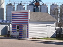 | Cahow Barber Shop | building | 1984 | 84002493 |
| Clarksville Township Carnegie Library | building | 2021 | 100006194 | |
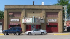 | Martha Ellen Auditorium | building | 1988 | 88000944 |
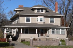 | Heber Hord House | building | 1987 | 87002096 |
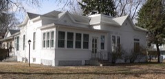 | Wright Morris Boyhood House | building | 1980 | 80002457 |
 | Nelson Farm | district | 2009 | 09000650 |
 | Patterson Law Office | building | 1979 | 79001451 |
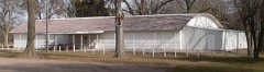 | Riverside Park Dance Pavillion | building | 1998 | 98001564 |
Every wildfire the federal occurrence database records inside this county: 86 of them, burning about 218 acres. 5 started naturally and 4 were recorded as arson. Each settlement page carries the fires within five miles of it.
| Reported cause | Fires |
|---|---|
| Debris and open burning | 26 |
| Railroad operations and maintenance | 21 |
| Equipment and vehicle use | 15 |
| Missing data/not specified/undetermined | 9 |
| Natural | 5 |
| Arson/incendiarism | 4 |
| Smoking | 4 |
| Fireworks | 2 |
The five largest, by the area the report gives. None of them was recorded as arson.
| Date | Cause | Size | Reported by | Name on the report |
|---|---|---|---|---|
| 29 November 2020 | Debris and open burning | 48 acres | Nebraska Forest Service | not named |
| 30 October 2008 | Natural | 41 acres | Nebraska Forest Service | not named |
| 5 March 2012 | Debris and open burning | 10 acres | Nebraska Forest Service | not named |
| 16 March 2011 | Debris and open burning | 10 acres | Nebraska Forest Service | not named |
| 25 July 2017 | Equipment and vehicle use | 10 acres | Nebraska Forest Service | not named |
| 1 March 2011 | Equipment and vehicle use | 6.0 acres | Nebraska Forest Service | not named |
| 26 March 2014 | Equipment and vehicle use | 5.0 acres | Nebraska Forest Service | not named |
| 18 March 2011 | Railroad operations and maintenance | 5.0 acres | Nebraska Forest Service | not named |
Every settlement page carries the fires within five miles of it - see the settlement index below.
The NOAA Storm Events Database holds 374 reports for this county, causing no deaths, no injuries and about $22,013,000 in recorded property damage. Each settlement page carries the reports that name it.
| Kind of event | Reports |
|---|---|
| Hail | 194 |
| Thunderstorm Wind | 126 |
| Tornado | 25 |
| Flood | 10 |
| Flash Flood | 8 |
| Heavy Rain | 8 |
| Lightning | 2 |
| Funnel Cloud | 1 |
The most serious of them, by death, then injury, then recorded damage. The accounts are quoted exactly as the forecast office filed them.
| When | Event | Place named | Harm | What the report says |
|---|---|---|---|---|
| May 2005 | Flash Flood | Countywide | $3,000,000 | no account filed |
| March 1990 | Tornado (F3) | not stated | $2,500,000 | no account filed |
| March 1990 | Tornado (F2) | not stated | $2,500,000 | no account filed |
| March 2019 | Flood | Palmer | $2,000,000 | no account filed |
| June 2024 | Thunderstorm Wind | Archer | $1,000,000 | Wind gusts estimated to be near 75 MPH resulted in tree and crop damage in the area, as well as flipped irrigation pivots. Power outages were reported in the area, and trees were reported down in Clarks. A wind gust of 70 MPH was measured by a mesonet station located four miles west-southwest of Clarks, and a wind gust of 60 MPH was measured by a mesonet station four miles northeast of Clarks. |
| June 2011 | Thunderstorm Wind | Clarks | $1,000,000 | Wind gusts were estimated to be as high as 80 MPH. Along this path, an old grain elevator was destroyed, large trees branches were blown down, irrigation pivots were overturned, and a couple of power poles were broken. |
| May 2025 | Hail | Central City | $1,000,000 | no account filed |
| June 2020 | Thunderstorm Wind | Chapman | $500,000 | Emergency management reported several pivots were flipped over and mangled north of Chapman. At a convenience store in Chapman, a metal light pole was blown down, and a large metal ice chest was moved away from the main building into the parking lot. |
| April 1994 | Tornado (F1) | Central City | $500,000 | A tornado touched down near the Platte River three miles south of Central City and then moved north to the east edge of town where it lifted back into the clouds. Outbuildings were damaged and tree tops were twisted off at three separate farms. The tornado blew the roof off of an auto body shop on the east edge of town. |
| May 2005 | Thunderstorm Wind | Central City | $500,000 | no account filed |
| June 2023 | Tornado (EF0) | Central City | $400,000 | A tornado touched down in rural portions of Merrick County a few miles northwest of Central City, with a maximum estimated wind speed of 80 MPH along a 4-mile path. The most noteworthy damage occurred at a large cattle company feedlot, where a large portion of a roof was blown off of a confinement barn, several outdoor pens and livestock shades were destroyed, and a few head of cattle were injured and had to be euthanized. In addition, several irrigation pivots were overturned. Some tree damage was also noted along the path of the tornado. At one farmstead, the home suffered gutter damage and an unoccupied tractor parked nearby had its windows blown out. There was also some hail damage to crops in roughly a 2x2 mile area. |
| June 2024 | Flash Flood | Worms | $300,000 | Based on radar estimation and various measured totals from NWS/NeRAIN/CoCoRaHS observers, widespread rainfall of 2-6 inches fell across mainly the northern half of the county (highest totals far north) mainly between 7:30 p.m. CDT on the 21st and 1 a.m. CDT on the 22nd. |
| October 2001 | Tornado (F2) | Central City | $300,000 | Tornado crossed from Merrick County into Nance County. |
| June 2023 | Thunderstorm Wind | Archer | $250,000 | Wind gusts were estimated to be near 80 MPH along this path. Several irrigation pivots were overturned and trees were damaged, including at least one that was uprooted. At one farmstead, a barn and nearby vehicle sustained minor damage. |
| July 2022 | Tornado (EF1) | Chapman | $250,000 | This EF1 tornado tracked nearly 10 miles through rural portions of far east central Hall and far southwestern Merrick counties during the very early morning hours of Monday, July 4th. The maximum wind speed was estimated to be 110 MPH, based on the combination of damage to trees, some buildings and homes, and power poles. The tornado was estimated to be 200 yards wide at its widest point.||This tornado first touched down in a rural area four miles south of downtown Grand Island and quickly gained strength. It entered Merrick County around 12:56 a.m. CDT near the intersection of Gunbarrel and Stolley Park Roads, persisting for nearly six more miles before lifting at 1:10 a.m. CDT approximately five miles southwest of Chapman (near the intersection of 5th and D Roads). Along its total path, it damaged over a half-dozen homes, including blown out windows, shingle and siding damage, and at least one home had part of its roof decking torn off (fortunately no injuries were reported). Other outbuildings and grain bins were damaged or destroyed, including a barn in Merrick County that was over 100 years old. Several power poles were snapped, along with trees and damage to crops. The damage pattern evident in corn fields had a distinct herringbone pattern...consistent with a tornadic wind field. ||This tornado formed in a trailing area of stratiform rainfall not usually conducive for tornadic development. The combination of a very moist, unstable airmass and very favorable wind shear for the time of day were key in the formation of the low-topped supercell which spawned the tornado. |
| May 2016 | Thunderstorm Wind | Chapman | $250,000 | Wind gusts estimated to be near 70 MPH resulted in some irrigation pivot damage in the area. Wind was accompanied by half dollar size hail. |
| August 2007 | Hail | Central City | $250,000 | Hail ranged in size from 1.75 to 2.75 inches in diameter. |
| July 2004 | Thunderstorm Wind | Central City | $250,000 | no account filed |
| May 2002 | Hail | Central City | $250,000 | no account filed |
| May 1982 | Tornado (F2) | not stated | $250,000 | no account filed |
| August 1974 | Tornado (F0) | not stated | $250,000 | no account filed |
| July 2020 | Tornado (EF0) | Silver Creek | $200,000 | Region 44 Emergency Management assisted with this survey. A brief tornado touched down north of Silver Creek, with a path length of approximately 4 miles and maximum wind gusts estimated to be 85 MPH. Damage was primarily confined to trees, with downed large branches and some uprooted trees. Irrigation pivots along and near the path were overturned. Two farmsteads were affected, one sustained minor damage to a small outbuilding and the other sustained tree damage. |
| May 2008 | Flash Flood | Palmer | $200,000 | Thunderstorms rolled across Merrick County during the evening and nighttime hours and dumped several inches of rain. This caused roads and small creeks to quickly flood. |
| April 1999 | Tornado (F1) | Clarks | $200,000 | no account filed |
| May 2003 | Hail | Chapman | $150,000 | no account filed |
| June 2003 | Thunderstorm Wind | Palmer | $150,000 | no account filed |
| May 2002 | Hail | Central City | $150,000 | no account filed |
| July 2001 | Thunderstorm Wind | Countywide | $150,000 | no account filed |
| August 2020 | Hail | Chapman | $125,000 | no account filed |
| May 2019 | Flood | Clarks | $100,000 | Heavy rainfall resulted in widespread flooding of area creeks across Merrick County, including the Prairie and Silver Creeks. Numerous rural roads and bridges were under water. Due to the flooding of the Silver Creek, there were voluntary home evacuations on the west-southwest side of the town of Silver Creek. Prairie Creek crested at 9.52 feet in the mid-morning hours of May 29th, and that was the 4th highest crest on record. Silver Creek crested at 9.65 feet the morning of May 29th, and that was a new record crest. |
| August 2015 | Thunderstorm Wind | Silver Creek | $100,000 | Wind gusts estimated near 70 MPH blew over an irrigation pivot and resulted in significant crop damage within a localized area. |
| June 2011 | Hail | Clarks | $100,000 | Hail up to the size of ping pong balls fell for 10 minutes. |
| August 2011 | Thunderstorm Wind | Central City | $100,000 | Wind gusts estimated at 70 MPH resulted in tree damage in Central City as well as in the Willow Bend Lake area. The main tree damage occurred in the Willow Bend Lake area, where large tree limbs were knocked down and a 90 foot tree was uprooted, clipping the corner of the roof of a nearby home. Boats were also pulled loose from structures on the shore. |
| June 2008 | Flash Flood | Chapman | $100,000 | A pickup was swept off of worms road in western Merrick County. Most of the residents in Archer woke to significant flooding around 0300CST June 8th and began sandbagging. Cars were floating in Archer. Numerous roads were washed out across western Merrick County. |
| June 2005 | Hail | Clarks | $100,000 | Not only did large hail fall, but 60 mph winds were noted as well. Six inch diameter tree limbs were broken. |
| October 2001 | Tornado (F1) | Silver Creek | $100,000 | Tornado entered Merrick County from Polk County. |
| April 2005 | Hail | Chapman | $100,000 | no account filed |
| May 2005 | Hail | Palmer | $100,000 | no account filed |
| May 2000 | Lightning | Central City | $100,000 | no account filed |
| May 1998 | Hail | Palmer | $80,000 | no account filed |
| May 2012 | Hail | Palmer | $75,000 | no account filed |
| July 2003 | Hail | Archer | $75,000 | no account filed |
| August 1998 | Thunderstorm Wind | Central City | $75,000 | no account filed |
| June 1997 | Hail | Palmer | $60,000 | no account filed |
| May 2024 | Thunderstorm Wind | Worms | $50,000 | Wind gusts estimated to be near 65 MPH resulted in some power pole damage four miles west of Archer. Power outages were also reported in the Central City and Palmer areas. |
| June 2011 | Hail | Clarks | $50,000 | Golf ball size hail was accompanied by wind gusts estimated at 50 MPH. |
| June 2022 | Hail | Chapman | $50,000 | no account filed |
| July 2014 | Hail | Chapman | $50,000 | no account filed |
| June 2014 | Hail | Chapman | $50,000 | no account filed |
| April 2006 | Thunderstorm Wind | Palmer | $50,000 | no account filed |
| May 2003 | Hail | Silver Creek | $50,000 | no account filed |
| May 2003 | Hail | Silver Creek | $50,000 | no account filed |
| June 2003 | Hail | Central City | $50,000 | no account filed |
| June 2002 | Hail | Clarks | $50,000 | no account filed |
| May 2002 | Hail | Silver Creek | $50,000 | no account filed |
| June 2002 | Hail | Clarks | $50,000 | no account filed |
| July 1997 | Hail | Palmer | $50,000 | no account filed |
| May 1998 | Hail | Central City | $45,000 | no account filed |
| June 2008 | Hail | Chapman | $30,000 | no account filed |
| October 2000 | Tornado (F0) | Clarks | $30,000 | no account filed |
A History of Merrick County, Nebraska: From "the Beginning" to 1895 devotes a chapter to each township: its boundaries and streams, who settled it and when, the mills, the schools and the churches. All 2 are reproduced here in full. Each row shows the township's own shape and where it lies in the county, drawn from the Census Bureau's boundary. Which settlements belong to which township is computed from that same boundary, not taken from the book.
| Shape and position in the county | Township | Settlements in it | Length | Sections |
|---|---|---|---|---|
| Chapman Township | Chapman | 1,425 words | 1 | |
| Silver Creek Township | Havens, Silver Creek | 255 words | 0 |
One book written about this county, cut here where the book itself is cut, at its printed chapters: 22 chapters in all. Every chapter is public domain, machine-read from the scan and reproduced complete. A chapter already given under one of the county's towns is not repeated in this list.
Named settlements recorded in the Geographic Names Information System, each with the topographic sheets covering it. Villages, hamlets and abandoned places alike. Each is shown with the nearest named watercourse or landform and the survey quadrangle it falls on.
Lone Tree township · 68826 · Near Parker Island · Central City East quadrangle
14 sheets, 1896 to 1985
Prairie Island township · 68826 · Near Island Number 7 · Central City East quadrangle
14 sheets, 1896 to 1985
Silver Creek township · 68663 · On Silver Creek · Silver Creek quadrangle
13 sheets, 1896 to 1985