 Block
Verdel, Nebraska
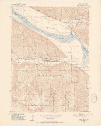
12 topographic sheets cover this place, the earliest surveyed in 1950 and the latest in 1989. It stands in Raymond Township. It lies in ZIP code area 68760. It stands on Dewey Creek. The Survey maps it on the Verdel quadrangle. 38 people lived here at the 2020 count. It stands 1,266 feet above sea level.
Population over time
2 figuresVerdel grew from 30 to 38 between 2010 and 2020. These are the recorded population figures Wikidata holds for this place, reached through the Geographic Names Information System number this page is keyed on rather than by name, so they belong to this place and not to another of the same name. Most are census counts, but not all are: an early figure may be a founding or settlement estimate, and an estimate published within five years of a census is left out. The change column is computed, and is left blank where more than 20 years separate a figure from the one before it, because a gap that long is not a change between two counts.
| Year | People | Change |
|---|---|---|
| 2010 | 30 | |
| 2020 | 38 | +8 (+27%) |
Topographic sheets covering this place
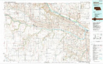
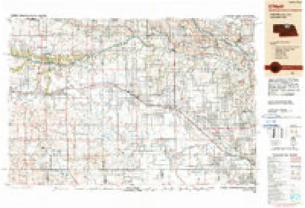
6 surveys from 12 printed sheetsMatched by testing this settlement's coordinate against the published boundary of every sheet in the United States Geological Survey's historical collection. Each opens the scanned sheet at the Survey.
- 1950 USGS Verdel quadrangle1:24000, 4 printings
- 1955 USGS O'Neill quadrangle1:250000, 2 printings
- 1959 USGS O'Neill quadrangle1:250000, 2 printings
- 1969 USGS O'Neill quadrangle1:250000
- 1986 USGS Atkinson quadrangle1:100000, 2 printings
- 1989 USGS O'Neill quadrangle1:250000
Fires near this place
5 since 2018Regional context, not property-specific evidence. The federal wildfire occurrence database lists 5 fires within 5 miles of Verdel between 2018 and 2020, burning about 32 acres in total. 1 started naturally. None was recorded as arson. Distance is straight-line from the map coordinates, so a fire counted here may appear on a neighbouring settlement's page as well.
| Reported cause | Fires |
|---|---|
| Missing data/not specified/undetermined | 2 |
| Equipment and vehicle use | 1 |
| Debris and open burning | 1 |
| Natural | 1 |
The most recent of them, most recent first, with the day each was reported and the service that recorded it.
| Date | Cause | Size | Reported by | Name on the report |
|---|---|---|---|---|
| 7 August 2019 | Natural | 2.0 acres | Nebraska Forest Service | not named |
| 28 April 2018 | Equipment and vehicle use | 2.0 acres | Nebraska Forest Service | not named |
| 11 March 2020 | Debris and open burning | 25 acres | Nebraska Forest Service | not named |
| 6 November 2020 | Missing data/not specified/undetermined | 2.0 acres | Nebraska Forest Service | not named |
| 30 January 2018 | Missing data/not specified/undetermined | 1.0 acres | Nebraska Forest Service | not named |
Storms near this place
50 since 1996Regional context, not property-specific evidence. The National Weather Service names Verdel in 50 storm reports between 1996 and 2024: 22 hail, 14 flood, 10 thunderstorm wind, 2 flash flood. No death or injury is recorded in these reports. Each account below is quoted exactly as the forecast office filed it, from the NOAA Storm Events Database, and each date opens the federal record of that event.
| When | Event | Place named | Harm | What the report says |
|---|---|---|---|---|
| March 2019 | Flood | Verdel | $1,200,000 | This is for flooding along the Niobrara River. The river gauge at Verdel, operated by the USGS, peaked at 19.38 feet at 6 pm on March 13th. Major flood stage is 10 feet. This peak is the highest on record. This gauge was destroyed by ice and floodwaters during the event. The high water value was obtained post-flood by the USGS. This historic flooding along the Niobrara River was the result of rain, snowmelt and the failure of the upstream Spencer Dam. The dam failed due to overtopping with some estimates of 3 to 5 feet of water going over the dam. The resulting wave of water from this dam failure caused substantial damage in low-lying areas of the town of Niobrara. Damage was somewhat isolated in regards to the whole town, but what was affected was absolutely devastated. Major damage sustained to the Country Cafe, and farm buildings next door. Thick river ice slabs 2-3 ft thick also contributed to damage, with the Country Cafe having most of its walls lost due to ice. The owner said when they arrived, the ice piles left behind from the flood were close to 10 ft high and completely surrounded the Cafe up to the roof. Measured a 6.4 ft high water mark in the cafe. The Highway 12 bridge was washed out in two sections on the west side of the river channels. Property damage amounts are for the entire county. |
| June 2011 | Flood | Verdel | $150,000 | Flooding along the Missouri River gradually worsened over the area during June as record releases from Ft. Randal Dam brought widespread flooding along the river. In Knox county the flooding closed Highway 12 between Verdel and Niobrara and east of Niobrara and also closed Highway 14/37 north of Niobrara. The flooding also forced the evacuation of 50 to 60 residences including the Lazy River Acres area in between Niobrara and Verdel. The flooding carried over into July. |
| August 2011 | Flood | Verdel | $50,000 | Flooding along the Missouri River gradually worsened over the area during June and July and persisted into August as record releases due to heavy rain and mountain snow melt above Ft. Randal Dam brought widespread flooding along the River. In Knox county the flooding closed Highway 12 between Verdel and Niobrara and the highway east of Niobrara and also closed Highway 14/37 north of Niobrara. The flooding also forced the evacuation of 50 to 60 residences including the Lazy River Acres area between Niobrara and Verdel. The flooding carried over into September. |
| July 2011 | Flood | Verdel | $50,000 | Flooding along the Missouri River gradually worsened over the area during June and persisted through July as record releases from Ft. Randal Dam brought widespread flooding along the River. In Knox county the flooding closed Highway 12 between Verdel and Niobrara and east of Niobrara and also closed Highway 14/37 north of Niobrara. The flooding also forced the evacuation of 50 to 60 residences including the Lazy River Acres area in between Niobrara and Verdel. The flooding carried over into August. |
| May 2011 | Flood | Verdel | $25,000 | Heavy rain on the upper Missouri River basin and then high releases from Missouri River Reservoirs brought prolonged flooding along the Missouri River. In Knox county the flooding closed Highway 12 east of Verdel and east of Niobrara and also closed Highway 14/37 north of Niobrara. The flooding also forced the evacuation of Lazy River Acres which was in between Niobrara and Verdel. The flooding carried over into and got progressively worse in June. |
| July 2010 | Flash Flood | Verdel | $20,000 | Rainfall of 5 to 6 inches fell south of Verdel causing flash flooding along small creeks in the area. According to the cooperative observer south of Verdel the flooding washed out 6 to 7 small earth dams as water around a quarter mile wide flooded out trees, fences and other objects in its path in the area. |
| June 2010 | Flood | Verdel | $15,000 | Heavy rain from June 8th through the morning of the 11th caused Ponca Creek to flood along sections of Highway 12 near Verdel. Additional heavy rain the next few nights caused it to remain above its 12 foot flood stage until the early evening hours of June 15th. The creek crested at 14.8 feet during the late afternoon of June 12th. The flooding mainly affected agricultural lowlands along the stream, but a few county roads were flooded and a bridge south of Highway 12 on a county road was washed out. |
| July 2010 | Flood | Verdel | $15,000 | Rainfall of at least 4 to 8 inches fell across the lower Niobrara River basin late in the evening of the 21st into the early morning hours of the 22nd. This caused the Niobrara River to flood across the Jct of Highways 12 and 14 near Niobrara swamping at least one vehicle. A few other roads in the area also flooded. At its peak almost 20,000 cfs of water was flowing down the Niobrara, compared to normal flows of 1,000 cfs. According to NPPD records, spillway gates from an upstream reservoir were opened for the first time since 1966 to relieve water pressure against the dam. The high water also flooded a local golf course and surrounding agricultural land. |
| July 2010 | Flash Flood | Verdel | $15,000 | Rainfall of 4 to 6 inches fell in about a 4 to 6 hour period along the Ponca Creek basin. The heavy rain caused a rapid rise of Ponca Creek which flooded areas along the creek east and west of Verdel. Some county roads and Highway 12 near the creek were flooded along with agricultural lowlands. Several washouts of county roads occurred. |
| June 2024 | Flood | Verdel | $10,000 | Slow-moving training thunderstorms across north-central Nebraska dropped a large swath of 3 to 6 inches of rain in the Ponca Creek drainage basin the 20th into the 21st. This resulted in moderate flooding along Ponca Creek near Verdel. The creek crested at 15.71 feet at 0000 CDT on the 23rd. Flood stage at this river gauge site is 13.5 feet. Reports were received from North Platte of water approaching the bottoms of rural bridges over the stream with significant tree debris in the water. The county in response to the flooding sandbagged around vulnerable homes and buildings along the creek bank. |
| September 2011 | Flood | Verdel | $5,000 | Flooding along the Missouri River, which worsened over the area during June and July, persisted into August before moderating late in that month and in September. Record releases due to heavy rain and mountain snow melt above Ft. Randal Dam brought the widespread flooding along the river. In Knox county at its height the flooding closed Highway 12 between Verdel and Niobrara and the highway east of Niobrara and also closed Highway 14/37 north of Niobrara. However, the highways had reopened by early September. Earlier the flooding had forced the evacuation of 50 to 60 residences including the Lazy River Acres area between Niobrara and Verdel. |
| August 1996 | Lightning | Verdel | $500 | no account filed |
| June 2023 | Hail | Verdel | - | Law enforcement reported nickel to quarter size hail. |
| May 2022 | Hail | Verdel | - | Public report hail stones up to quarter size. |
| July 2022 | Thunderstorm Wind | Verdel | - | COOP Observer reported broken 4-inch diameter tree branches. |
| March 2019 | Flood | Verdel | - | This is for flooding along the Ponca Creek. The river gage at Verdel, operated by the USGS, peaked at 18.2 feet at 4 am on March 14th. Major flood stage is 17 feet. Preliminarily this peak is the highest on record. Water damaged 3 homes on the outskirts of Verdel and there were some people that had to be evacuated via tractor. Property damage amounts for the county are included in the Niobrara River entry. |
| February 2017 | Flood | Verdel | - | Flooding was reported to the National Weather Service along Ponca Creek in Knox County. This flooding occurred when ice moved downstream creating an ice jam below and above the USGS gage at Verdel. The flooding was mostly contained to lowland areas. One paved road was flooded just east of Ponca, called Rayder Swanson Road. |
| June 2015 | Thunderstorm Wind | Verdel | - | Trees were downed along State Highway 12 and near the town of Verdel on some county roads. |
| September 2015 | Thunderstorm Wind | Verdel | - | The spotter reported a tree next to the house was uprooted in the strong winds. |
| May 2013 | Hail | Verdel | - | Wind gusts up to 60 mph were also reported. |
| May 2013 | Thunderstorm Wind | Verdel | - | Thunderstorm wind gusts estimated up to 60 mph were accompanied by quarter-size hail. |
| March 2011 | Flood | Verdel | - | Melting snow helped break loose ice which formed an ice jam near Verdel which caused minor flooding along Ponca Creek in the area. The creek near Verdel crested at a little over 15 feet around noon on March 12, flood stage is 12 feet. The flooding affected mainly agricultural lowlands and apparently caused little damage. |
| July 2010 | Heavy Rain | Verdel | - | Twenty-four hour rainfall of a little over 6 inches was measured by the cooperative observer south of Verdel, although most fell in about a 4 to 6 hour period. |
| August 2010 | Thunderstorm Wind | Verdel | - | A spotter estimated thunderstorm winds gusted to nearly 70 mph. The strong winds downed large tree branches in the area. |
| June 2009 | Thunderstorm Wind | Verdel | - | A spotter estimated thunderstorm wind gusts around 60 mph. |
| August 2009 | Hail | Verdel | - | Hail at least nickel-size was reported near Verdel. |
| June 2009 | Thunderstorm Wind | Verdel | - | Thunderstorm wind gusts estimated at over 60 mph knocked down several trees in the Verdel area which damaged a few vehicles. |
| June 2008 | Flood | Verdel | - | Heavy rain fell across the Ponca Creek basin on Wednesday June 4, with an additional 2 to 4 inches reported across the upper sections of the basin on Thursday June 5. The rain caused Ponca Creek to flood along Highway 12 in the Verdel area on Friday and Saturday June 6 and 7th. Farm fields and county roads in the area were also flooded. |
| February 2007 | Flood | Verdel | - | Ice jam flooding was reported on Ponca Creek near Verdel, on Bazile Creek east southeast of Niobrara, Bow Creek near Wynot and Verdigre Creek north of Verdigre. The jams on Bazile and Ponca Creeks were each at least a mile long at one time, and caused flooding which closed several county roads and flooded farmland in the area. The jam east of Niobrara also closed Highway 12 from 2 am on 2/22 until 430 am 2/23. |
| June 2006 | Thunderstorm Wind | Verdel | - | Thunderstorm winds estimated at 60 to 70 mph blew down a few small trees and knocked large limbs off of larger trees. |
| August 2006 | Thunderstorm Wind | Verdel | - | Thunderstorm winds that were estimated to gust around 60 mph downed some large branches west of Verdel. |
| August 1997 | Thunderstorm Wind | Verdel | - | Tree limbs downed. |
| September 2015 | Hail | Verdel | - | no account filed |
| September 2010 | Hail | Verdel | - | no account filed |
| September 2008 | Hail | Verdel | - | no account filed |
| May 2008 | Hail | Verdel | - | no account filed |
| August 2007 | Hail | Verdel | - | no account filed |
| May 2007 | Hail | Verdel | - | no account filed |
| August 2007 | Hail | Verdel | - | no account filed |
| August 2007 | Hail | Verdel | - | no account filed |
| August 2007 | Hail | Verdel | - | no account filed |
| August 2006 | Hail | Verdel | - | no account filed |
| April 2005 | Hail | Verdel | - | no account filed |
| July 2005 | Hail | Verdel | - | no account filed |
| June 2002 | Hail | Verdel | - | no account filed |
| June 2000 | Hail | Verdel | - | no account filed |
| August 2000 | Hail | Verdel | - | no account filed |
| July 1999 | Hail | Verdel | - | no account filed |
| June 1998 | Hail | Verdel | - | no account filed |
| August 1997 | Hail | Verdel | - | no account filed |
Nearest settlements
The eight closest, with where each one stands in the county. Distances are straight-line, computed from the Geographic Names Information System coordinates.
Elsewhere
Matched on this settlement's Geographic Names Information System number rather than its name, so it cannot be a different place of the same name in another state.
| Wikipedia article on Verdel | An encyclopaedic summary. Its text is share-alike, so it is linked here rather than copied. |
| Wikidata item Q3288865 | The structured record the population and elevation above come from. Public domain (CC0). |
Provenance
This settlement is recorded in the Geographic Names Information System as feature 834363. The sheet list is computed by point-in-boundary test against the United States Geological Survey's historical topographic inventory. Both are works of the United States government and carry no copyright under 17 U.S.C. 105.
Wildfire. Short, Karen C. 2022. Spatial wildfire occurrence data for the United States, 1992-2020 [FPA_FOD_20221014]. 6th Edition. Fort Collins, CO: Forest Service Research Data Archive. https://doi.org/10.2737/RDS-2013-0009.6 Collected with United States Government funding and usable without additional permissions or fees.
Storms. NOAA National Centers for Environmental Information, Storm Events Database https://www.ncei.noaa.gov/stormevents/ A work of the United States government, no copyright under 17 U.S.C. 105. Narratives are quoted verbatim from the National Weather Service report and are not edited or summarised.