 Block
From the record
One of 26 National Register listings published here for Cass County · listed in 2023 · category: Building.
Sources: the National Register database, National Park Service
Listed on the National Register of Historic Places in 2023.
One of 26 National Register listings published here for Cass County · listed in 2023 · category: Building.
Sources: the National Register database, National Park Service
Regional context, not property-specific evidence. The federal wildfire occurrence database lists 5 fires within 5 miles of Agricultural Society Building (Auditorium) between 2006 and 2018, burning about 3 acres in total. None started naturally. None was recorded as arson. Distance is straight-line from the map coordinates, so a fire counted here may appear on a neighbouring settlement's page as well.
| Reported cause | Fires |
|---|---|
| Debris and open burning | 2 |
| Fireworks | 1 |
| Power generation/transmission/distribution | 1 |
| Equipment and vehicle use | 1 |
The most recent of them, most recent first, with the day each was reported and the service that recorded it.
| Date | Cause | Size | Reported by | Name on the report |
|---|---|---|---|---|
| 10 August 2006 | Power generation/transmission/distribution | under an acre | Nebraska Forest Service | not named |
| 17 May 2007 | Debris and open burning | under an acre | Nebraska Forest Service | not named |
| 11 April 2018 | Equipment and vehicle use | 2.0 acres | Nebraska Forest Service | not named |
| 3 March 2007 | Debris and open burning | under an acre | Nebraska Forest Service | not named |
| 1 March 2007 | Fireworks | under an acre | Nebraska Forest Service | not named |
Regional context, not property-specific evidence. The federal mineral resources record lists 5 workings within 5 miles of Agricultural Society Building (Auditorium): 4 producers, 1 past producer. 4 still produce. What was taken out: Stone, Crushed/Broken, Sand and Gravel, Construction, Stone, Crushed/Broken, Sand and Gravel, Construction. Distance is straight-line from the map coordinates, so a quarry counted here may appear on a neighbouring settlement's page as well.
| Where | Site | Commodity | Status | Recorded |
|---|---|---|---|---|
| Texasgulf Inc. | Sand and Gravel, Construction, Stone, Crushed/Broken | Producer | ||
| Weeping W Mine & Mill | Sand and Gravel, Construction | Producer | ||
| Hopper Bros. Weeping Water Quarry | Stone, Crushed/Broken | Producer | ||
| Weeping Water Mine & Mill | Stone, Crushed/Broken | Past Producer | ||
| Weeping Water Mine & Mill | Stone, Crushed/Broken | Producer |
Regional context, not property-specific evidence. The National Weather Service names Weeping Water, the town this property stands in, in 33 storm reports between 1995 and 2025: 15 hail, 9 thunderstorm wind, 4 flood, 3 tornado. No death or injury is recorded in these reports. Each account below is quoted exactly as the forecast office filed it, from the NOAA Storm Events Database, and each date opens the federal record of that event.
| When | Event | Place named | Harm | What the report says |
|---|---|---|---|---|
| June 2010 | Flash Flood | Weeping Water | $40,000 | Rainfall of 2 to 4 inches fell in several hours during the evening of 6/20 produced flash flooding across numerous county roads including State Spur 13 into Weeping Water and Highway 50 near the spur. Some water also flowed across Highway 75 near Reike Road. Flood waters also spilled into a few homes in the Weeping Water area, and two people were almost trapped when flood waters poured into a basement putting them in neck-deep water before they escaped through a window. |
| September 2010 | Flood | Weeping Water | $20,000 | Rainfall of 3 to 5 inches fell across much of the Weeping Water Creek basin from the evening of 9/1 until the early morning hours of 9/2. This caused Weeping Water Creek to flood from near Weeping Water downstream to Union. The creek at Union crested a little over its 25 foot flood stage during the early afternoon hours of 9/2. In Weeping Water the creek crested about 3 feet lower than the highest crest that was reached in June of 2010. Numerous county roads along the creek flooded. |
| May 2007 | Flood | Weeping Water | $10,000 | Rainfall of 4 to 5 inches fell over much of the Weeping Water Creek basin from Friday May 4th through Sunday May 6th, with 4.88 inches reported in Plattsmouth. The heavy rain caused Weeping Water Creek to flood for two days, with a double crest observed on May 6th and 7th. The creek at Union first crossed it's 25 foot flood stage around 730 am CDT on May 6th, reached it's first crest of around 26.3 feet just before noon that day, fell below flood stage around 330 pm and then moved back over flood stage around 245 am CDT on May 7th. The creek at Union then reached a second crest, peaking close to 30 feet around 8 am on May 7th before falling back below flood stage for good around 1145 am CDT that morning. Besides flooding farmland, the high water also caused damage to a few county roads. |
| June 1996 | Thunderstorm Wind | Weeping Water | $5,000 | no account filed |
| April 2025 | Hail | Weeping Water | - | Public report of hail measured up to 1.25 in diameter. |
| July 2023 | Thunderstorm Wind | Weeping Water | - | Public reported a carport destroyed. |
| June 2023 | Thunderstorm Wind | Weeping Water | - | Emergency Manager reported trees as large as a foot in diameter downed. |
| September 2018 | Heavy Rain | Weeping Water | - | The Emergency Manager reported 2.44 inches of rain. |
| September 2018 | Flood | Weeping Water | - | Minor flooding was reported on the lower level at the Weeping Water Campground. |
| May 2017 | Hail | Weeping Water | - | Hail up to golf ball size was reported. |
| September 2015 | Thunderstorm Wind | Weeping Water | - | The spotter estimated winds to near 60 mph, and there were tree branches blown down. |
| September 2010 | Thunderstorm Wind | Weeping Water | - | Thunderstorm winds that were estimated at over 70 mph snapped power poles and caused significant tree damage in the Weeping Water area. The fallen trees/limbs caused some structural and vehicle damage in the area. |
| June 2008 | Flood | Weeping Water | - | Heavy rain on June 4th caused Weeping Water Creek to flood from near Weeping Water through the Union area. The creek at Union reached a 26 foot crest around 315pm CDT on June 5th, flood stage is 25 feet. The flooding affected mainly agricultural lowlands but also flooded a few county roads and properties of several residences. Some equipment in Weeping Water that was being used to build a sidewalk at the community basketball court was also flooded. |
| August 2005 | Thunderstorm Wind | Weeping Water | - | Thunderstorm wind gusts estimated at 60 mph destroyed a hay shed by lifting it up and throwing it to the ground. |
| February 2004 | Thunderstorm Wind | Weeping Water | - | Estimated thunderstorm wind gusts of between 60 and 70 mph were reported from 4 miles southwest of Weeping Water into Weeping Water. The winds uprooted a few trees in town. |
| July 2004 | Thunderstorm Wind | Weeping Water | - | A NWS Cooperative Observer reported that thunderstorm wind gusts estimated at least 60 mph downed some 6 inch diameter tree limbs in town. |
| November 2003 | Tornado (F0) | Weeping Water | - | A storm chaser reported a brief F0 tornado touchdown 5 to 10 miles southwest of Weeping Water. The tornado touched down in an open field and caused no apparent damage. |
| May 1995 | Tornado (F0) | Weeping Water | - | Cass County Emergency Services had 40 to 50 spotters throughout the county with several reports of brief tornado touchdowns, but no damage. |
| May 1995 | Tornado (F0) | Weeping Water | - | Cass County Emergency Services had 40 to 50 spotters throughout the county with several reports of brief tornado touchdowns, but no damage. |
| June 2016 | Hail | Weeping Water | - | no account filed |
| June 2014 | Hail | Weeping Water | - | no account filed |
| May 2009 | Hail | Weeping Water | - | no account filed |
| March 2006 | Hail | Weeping Water | - | no account filed |
| June 2006 | Hail | Weeping Water | - | no account filed |
| May 2006 | Hail | Weeping Water | - | no account filed |
| April 2005 | Hail | Weeping Water | - | no account filed |
| April 2005 | Hail | Weeping Water | - | no account filed |
| April 2001 | Hail | Weeping Water | - | no account filed |
| June 2000 | Hail | Weeping Water | - | no account filed |
| July 1998 | Hail | Weeping Water | - | no account filed |
| April 1998 | Hail | Weeping Water | - | no account filed |
| June 1997 | Thunderstorm Wind | Weeping Water | - | no account filed |
| May 1996 | Hail | Weeping Water | - | no account filed |
No historic map-sheet match is published for this property yet. That does not mean no map exists. This record needs a coordinate-quality review before it can be joined to a sheet boundary. Browse the county's mapped places while that work is pending.
Other National Register properties close enough to walk or drive between, ordered by distance from this one. Both positions come from the same geocoding pass that matched these properties to their map sheets.
| Photograph | Property | Distance | Listed |
|---|---|---|---|
| Weeping Water Historic District | 0.1 miles | 1972 | |
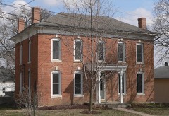 | Gibson House | 0.2 miles | 1986 |
 | Manley School | 3.8 miles | 2004 |
 | Bridge | 7.7 miles | 1992 |
| National Archives record | The nomination case file for reference 100008673 in Record Group 79. |
| Cass County | All 26 listed properties in this county. |