 Block
From the record
26 National Register listings published here.
Sources: the National Register database, National Park Service
79 topographic sheets cover 25 settlements here, and 26 properties are on the National Register of Historic Places.
26 National Register listings published here.
Sources: the National Register database, National Park Service
Every property in this county listed on the National Register of Historic Places, with the year it was listed and the federal nomination document.
| Photograph | Property | Type | Listed | Reference |
|---|---|---|---|---|
| Agricultural Society Building (Auditorium) | building | 2023 | 100008673 | |
 | Bridge | structure | 1992 | 92000707 |
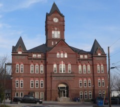 | Cass County Courthouse | building | 1990 | 89002248 |
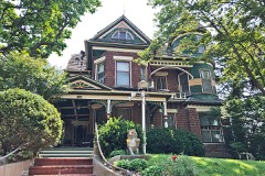 | George E. Dovey House | building | 2018 | 100003091 |
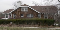 | Paul Fitzgerald House | building | 2006 | 06000100 |
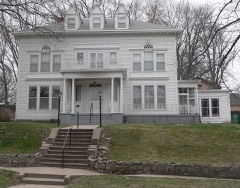 | Paul Gering House | building | 2006 | 06000604 |
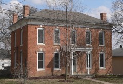 | Gibson House | building | 1986 | 86000471 |
| James and Margaret Greer Farmstead | district | 2011 | 11000103 | |
 | Christian Kupke Farmstead | building | 2012 | 12001073 |
 | Velosco V. Leonard House | building | 2018 | 100003092 |
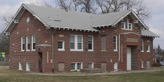 | Manley School | building | 2004 | 04001414 |
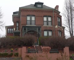 | McLaughlin-Waugh-Dovey House | building | 1980 | 80002443 |
| Morgan-Fricke House | building | 2021 | 100006790 | |
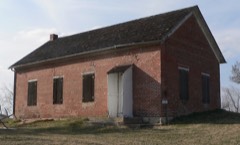 | Naomi Institute | building | 1977 | 77000825 |
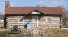 | Nehawka Public Library | building | 2002 | 02001481 |
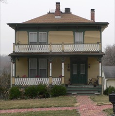 | Capt. John O'Rourke House | building | 2006 | 06000102 |
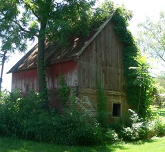 | Gottfried Gustav Pitz Barn | building | 2012 | 12000564 |
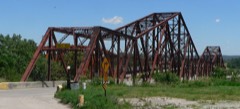 | Plattsmouth Bridge | structure | 1993 | 92000755 |
| Plattsmouth High School | building | 2020 | 100005052 | |
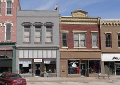 | Plattsmouth Main Street Historic District | district | 1985 | 85002585 |
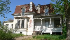 | Peter E. Ruffner House | building | 2016 | 16000105 |
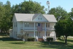 | Snoke Farmstead | building | 1998 | 98000189 |
 | The Elms | building | 1977 | 77000824 |
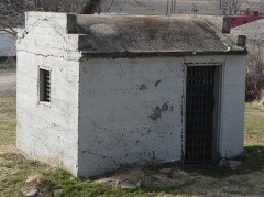 | Union Jail | building | 2006 | 06000605 |
| Weeping Water Historic District | district | 1972 | 72000744 | |
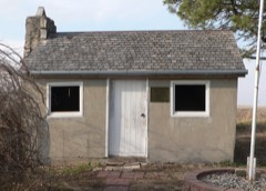 | Young Cemetery Cabin | building | 2004 | 04001408 |
Every wildfire the federal occurrence database records inside this county: 165 of them, burning about 614 acres. 2 started naturally and none was recorded as arson. Each settlement page carries the fires within five miles of it.
| Reported cause | Fires |
|---|---|
| Debris and open burning | 83 |
| Missing data/not specified/undetermined | 50 |
| Equipment and vehicle use | 11 |
| Recreation and ceremony | 4 |
| Fireworks | 4 |
| Power generation/transmission/distribution | 3 |
| Smoking | 3 |
| Railroad operations and maintenance | 3 |
| Natural | 2 |
| Misuse of fire by a minor | 2 |
The five largest, by the area the report gives. None of them was recorded as arson.
| Date | Cause | Size | Reported by | Name on the report |
|---|---|---|---|---|
| 13 April 2016 | Debris and open burning | 200 acres | Nebraska Forest Service | not named |
| 26 March 2014 | Debris and open burning | 60 acres | Nebraska Forest Service | not named |
| 21 March 2017 | Debris and open burning | 50 acres | Nebraska Forest Service | not named |
| 11 April 2017 | Debris and open burning | 40 acres | Nebraska Forest Service | not named |
| 8 May 2006 | Equipment and vehicle use | 25 acres | Nebraska Forest Service | not named |
| 17 November 2019 | Debris and open burning | 20 acres | Nebraska Forest Service | not named |
| 10 April 2016 | Missing data/not specified/undetermined | 20 acres | Nebraska Forest Service | not named |
| 15 March 2014 | Debris and open burning | 15 acres | Nebraska Forest Service | not named |
Every settlement page carries the fires within five miles of it - see the settlement index below.
The NOAA Storm Events Database holds 571 reports for this county, causing 1 death, 19 injuries and about $23,512,500 in recorded property damage. Each settlement page carries the reports that name it.
| Kind of event | Reports |
|---|---|
| Hail | 253 |
| Thunderstorm Wind | 186 |
| Tornado | 47 |
| Flood | 44 |
| Flash Flood | 24 |
| Funnel Cloud | 8 |
| Heavy Rain | 7 |
| Lightning | 2 |
The most serious of them, by death, then injury, then recorded damage. The accounts are quoted exactly as the forecast office filed them.
| When | Event | Place named | Harm | What the report says |
|---|---|---|---|---|
| July 1994 | Thunderstorm Wind | Louisville State Park | 1 killed, 1 hurt | Strong winds blew down a 100 foot tall cottonwood tree. The two to three feet diameter upper limbs hit a tent that two people were camping in. A 58 year old male was killed and a 31 year old female was injured. (M58O) |
| March 2009 | Tornado (EF1) | Eagle | 5 hurt | This is the third and longest tracked of 5 cyclic tornadoes that a low-topped supercell thunderstorm produced at it tracked southeast through east of the Lincoln area. This tornado touched down around 2.5 miles west of Bennet, in Lancaster county, tracked northeast clipping the far northwest corner of Otoe county and then lifted around 1.5 miles into the southwest corner of Cass county. In Cass county the tornado destroyed a garage and tossed the debris into a occupied car injuring 5 people. Other tree and farm outbuilding damage was noted. The total path length was around 11 miles. |
| July 1985 | Thunderstorm Wind | not stated | 5 hurt | no account filed |
| June 2017 | Thunderstorm Wind | Plattsmouth | 3 hurt | Substantial wind damage was reported in Plattsmouth. Trees down on most roads. |Power lines were blown down, with no power between Louisville, Plattsmouth, and Weeping Water. Maintenance building was destroyed. Several farmsteads on Highway 66 had buildings destroyed. There were 3 people injured in Plattsmouth. |
| March 2009 | Tornado (EF1) | Eagle | 3 hurt | This is the fourth of 5 cyclic tornadoes that a low-topped supercell thunderstorm produced at it tracked southeast through east of the Lincoln area. This tornado touched down on the southwest side of Eagle and caused tree and some building damage along its path before lifting around 1 mile south of Alvo. Three people sustained minor injures near Alvo when a tree fell onto a truck they were in. |
| June 2022 | Thunderstorm Wind | Greenwood | 1 hurt | Emergency manager reported campers flipped over at a campground. |
| June 1989 | Thunderstorm Wind | not stated | 1 hurt | no account filed |
| March 2019 | Flood | Oreapolis | $15,000,000 | This is for flooding along the Missouri River. The river gage at Plattsmouth, operated by the Army Corps of Engineers, peaked at 40.62 feet at 6 am on March 16th. Minor flood stage is 26 feet, moderate flood stage is 32 feet while major flood stage is 35 feet. Preliminary this peak is a record crest. This record flooding caused substantial damages to the water treatment plant for the city of Plattsmouth. Flooding continued into the next month. |
| June 1984 | Tornado (F2) | not stated | $2,500,000 | no account filed |
| March 2009 | Tornado (EF1) | Alvo | $1,000,000 | This is the fifth and last of 5 cyclic tornadoes that a low-topped supercell thunderstorm produced at it tracked southeast through east of the Lincoln area. This tornado touched down in Alvo and tracked a little over 10 miles north northeast before lifting just west of South Bend. The tornado knocked down power poles and transmission lines, snapped trees and damaged houses and destroyed farm out buildings along its path. One of the downed power lines fell on a car trapping its occupant for several hours. Several cars were crushed by fallen trees in the Alvo area. From the 3 confirmed tornadoes that hit the county, plus any associated wind damage, emergency management estimated that 30 homes had minor damage with 4 sustaining major damage and 60 to 80 farm outbuildings were damaged with the total damage approaching $1 million. |
| July 1996 | Hail | Plattsmouth | $1,000,000 | no account filed |
| March 2010 | Flood | Plattsmouth | $625,000 | Melting snow and periods of rain brought a prolonged period of flooding along the Missouri River. The river stage at Plattsmouth remained about its 26 foot flood stage for around 9 days in mid to late March, cresting at a little over 29 feet around midnight on the 22nd. The flooding mainly affected agricultural lowlands, but several roads near the river flooded, including the road that led to Plattsmouth's public boat dock and water treatment plant. Plant workers had to use a small boat to reach the plant. Damage included silt/debris clean-up and gravel washed off of county roads, which was estimated to be between $250,000 and $1 million according to emergency management. |
| June 2010 | Flood | Elmwood | $500,000 | Rainfall of 2 to over 4 inches that fell during the evening of 6/20 caused flooding along Weeping Water Creek and most likely many of its tributaries. The flooding caused the evacuations of Weeping Water, Union and Nehawka and shelters were established in each of those towns. Weeping Water Creek at Union crested at a record, almost 33 feet, during the morning of 6/21. Flood stage is 25 feet. The creek at Union was above flood stage from the early morning until early evening hours of 6/21. Many county roads and bridges were flooded in the area as were farmlands near the creek. |
| August 2006 | Thunderstorm Wind | Greenwood | $500,000 | A microburst from a thunderstorm caused extensive damage to a small area from near Greenwood to the Ashland County Club southwest of Asland (which is near the border of Saunders and Cass counties). The winds were estimated at around 100 mph by a damage survey compiled by a NWS storm survey team. The most extensive damage was at the Nebraska Raceway Park near Greenwood. Damage there included an overturned mobile home, camper, 4 empty semi trailers and a 2 ton storage trailer. Two ticket booths were destroyed and significant damage was done to a set of bleachers and a crash fence. Damage was estimated at nearly 1/2 million dollars at the track. The winds also downed numerous limbs at the Ashland Country Club. |
| July 1994 | Thunderstorm Wind | Louisville | $500,000 | Thunderstorm winds caused considerable damage at a farmstead. A dairy barn and other outbuildings were destroyed or heavily damaged. There was also some damage to crops. |
| June 2011 | Flood | Plattsmouth | $250,000 | Flooding along the Missouri River gradually worsened during June as record releases from Gavins Point Dam brought widespread flooding along the river. The river at Plattsmouth started the month around 30 feet, flood stage is 26 feet. The river then gradually rose through June reaching a little over 36 feet by the end of the month. The river remained in major flood stage into July. The high water initially flooded marshy areas and farmland along the river along with a few roads and recreation areas, including a road to the Plattsmouth water treatment plant. By the middle of the month some businesses and homes began to flood and most of 210 dwellings around Lake Waconda in the area were evacuated. |
| May 1983 | Tornado (F1) | not stated | $250,000 | no account filed |
| August 1952 | Tornado (F4) | not stated | $250,000 | no account filed |
| September 1996 | Lightning | Plattsmouth | $200,000 | no account filed |
| July 1995 | Hail | Plattsmouth | $110,000 | A small section of Cass County received significant crop damage due to hail. Marble to golf ball-size hail completely destroyed 500 to 1,000 acres of corn and soybeans, and partially destroyed another 1,000 acres. The Buccaneer Bay golf course received $10,000 damage to its greens and there was considerable damage to area roofs. |
| June 2010 | Flood | Plattsmouth | $100,000 | Heavy rain over much of eastern Nebraska and western Iowa during most of June caused a prolonged period of flooding along the Missouri River, especially downstream of Omaha through Rulo. The flood damage was increased near the confluence of the Platte River where flood waters from the Platte added to the flow. In Plattsmouth the Missouri River crested a little over 33 feet in the late afternoon of June 22nd, flood stage is 26 feet. The river climbed above flood stage in the afternoon of June 11 and remained above flood stage into early July. Some roads on the east end of Plattsmouth were closed due to flood waters which also submerged the land around a waste-water treatment plant which prompted sandbagging. A recreation area in the region was also partially submerged in flood waters along with the Plattsmouth boat house. |
| June 2010 | Flood | South Bend | $100,000 | Rainfall of at least 3 to 5 inches fell over much central Nebraska the week ending 7am 6/12, with additional heavy rains the following several days. All of this water eventually worked into the Platte River causing it to rise above flood stage from around North Bend downstream to its confluence with the Missouri River. At Louisville the river was above its 9 foot flood stage for most of the period from the afternoon of 6/11 until the afternoon of 6/16. The river crested at a little under 10.5 feet around noon on the 14th. The river gauge near Ashland was above its 20 foot flood stage for much of the period from 6/12 until the morning of the 20th. Although some lowlands were flooded all along the Platte River in Cass county, most of the more significant flooding was restricted to the area near confluence of the Missouri River around Plattsmouth. County roads and some recreation areas in that vicinity sustained flood damage. |
| July 1997 | Lightning | Eagle | $100,000 | Lightning struck a radio station transmitter tower causing significant damage. |
| June 2024 | Flood | Plattsmouth | $75,000 | Excessive rainfall across much of eastern South Dakota resulted in river flooding along the Missouri River at the end of June. Moderate flood stage was observed along the Missouri, with the river gauge in Plattsmouth cresting at 31.75 feet on 6/29. Flood stage for this river gauge is 26.0 feet. At 8:26 pm on the 23rd, emergency management reported the first instances of flooding showing several photos of lowland flooding in multiple spots along the river east of Plattsmouth. At 12:32 pm CDT on 6/25, Cass County emergency management sent photos of flooding at the Plattsmouth boat dock. Lowland flooding persisted into 6/26, with emergency management sending the office pictures of flooded fields from Sullivan Drive and Lake Waconda. At 5:56 PM on the 27th, emergency management reported flooding at the Plattsmouth sewer lift station on the south side of Main Street. |
| July 2024 | Flash Flood | Greenwood | $50,000 | Water was reported running over the road at the intersection of Rock Creek Road and Highway 6 by emergency management. Emergency management relayed reports of multiple people trapped in homes from quickly rising water in the Horseshoe Lake area. Rock creek also remained above flood stage from the excessive rain that fell this night until 11 am CST. |
| August 2011 | Flood | Plattsmouth | $50,000 | Flooding along the Missouri River in Cass county gradually worsened during June as record releases from Gavins Point Dam brought widespread flooding along the river. At Plattsmouth the Missouri River gradually rose through June reaching a little over 36 feet by the end of that month. Flood stage is 26 feet. The river remained in major flood stage into early July then slowly dropped into the moderate category by mid July and continued in that category through mid August before dropping by the end of the month to around 30 feet. However, minor flooding persisted through much of September. The high water flooded farmland along the river along with a few roads and recreation areas, including a road to the Plattsmouth water treatment plant. Some businesses and homes were also flooded, and most of the 210 dwellings around Lake Waconda in the area were evacuated. |
| September 2011 | Flood | Plattsmouth | $50,000 | Flooding along the Missouri River in Cass county which had gradually worsened during June and remained in a major or moderate flood category until late August, finally started letting up from late August into September as record releases from Gavins Point Dam were greatly reduced after mid August. At Plattsmouth the Missouri River reached a crest a little over 36 feet by the end of June, flood stage is 26 feet, remained at very high levels in July and August before dropping to around 30 feet by the first of September. Stepped decreases in reservoir releases allowed the river to finally fall below flood stage at Plattsmouth late in September. At its worst, the high water flooded farmland along with a few roads and recreation areas, including a road to the Plattsmouth water treatment plant. Some businesses and homes were also flooded, and most of the 210 dwellings around Lake Waconda in the area were evacuated. |
| July 2011 | Flood | Plattsmouth | $50,000 | Flooding along the Missouri River gradually worsened during June as record releases from Gavins Point Dam brought widespread flooding along the River. The river at Plattsmouth gradually rose through June reaching a little over 36 feet by the end of the month. The river remained in major flood stage into early July slowly dropped into the moderate category by the middle of the month. The high water flooded farmland along the river along with a few roads and recreation areas, including a road to the Plattsmouth water treatment plant. Some businesses and homes were also flooded, and most of the 210 dwellings around Lake Waconda in the area were evacuated. |
| June 2010 | Flash Flood | Weeping Water | $40,000 | Rainfall of 2 to 4 inches fell in several hours during the evening of 6/20 produced flash flooding across numerous county roads including State Spur 13 into Weeping Water and Highway 50 near the spur. Some water also flowed across Highway 75 near Reike Road. Flood waters also spilled into a few homes in the Weeping Water area, and two people were almost trapped when flood waters poured into a basement putting them in neck-deep water before they escaped through a window. |
| May 2015 | Flood | Greenwood | $30,000 | Rainfall of 4 to 9 inches fell along the Salt Creek River basin leading to record river levels around the Greenwood area. Although the river reached record levels, most of the flood waters were confined to within the levy system and to low-lined areas along the creek. |
| August 1958 | Tornado (F1) | not stated | $25,000 | no account filed |
| April 2010 | Thunderstorm Wind | Greenwood | $20,000 | Thunderstorm wind gusts estimated at over 60 mph damaged a few signs along Interstate 80 and blew a semi truck over near mile marker 422. The storm also did some damage to a race track bleacher section near the area. This same cell caused some damage in the Waverly area a few minutes earlier. |
| September 2010 | Flood | Weeping Water | $20,000 | Rainfall of 3 to 5 inches fell across much of the Weeping Water Creek basin from the evening of 9/1 until the early morning hours of 9/2. This caused Weeping Water Creek to flood from near Weeping Water downstream to Union. The creek at Union crested a little over its 25 foot flood stage during the early afternoon hours of 9/2. In Weeping Water the creek crested about 3 feet lower than the highest crest that was reached in June of 2010. Numerous county roads along the creek flooded. |
| July 1997 | Flash Flood | Plattsmouth | $12,000 | Thunderstorms produced nearly two inches of rain in a short time. This caused the side of an oil company building to collapse. |
| June 2014 | Flood | Plattsmouth | $10,000 | Several episodes of heavy rain caused the Missouri River to flood for an extended period downstream of it's confluence with the Platte River. At Plattsmouth the river crested around 30 feet during the morning of June 22, flood stage is 26 feet. The flooding impacted a few local roads and farmland near the river. |
| May 2011 | Flood | Plattsmouth | $10,000 | High releases from upstream reservoirs and periods of rain brought a prolonged flooding episode along the Missouri River. The river at Plattsmouth started the month a little above it's 26 foot flood stage, fell briefly below it from the 5th through the 11th, then steadily rose to a little over 30 feet by the end of the month. The flooding carried over into June. Although the high water mainly flooded marshy areas and farmland along the river, by the end of the month a few roads, recreational areas and cabins/houses were either flooded or threatened by flood waters. |
| September 2010 | Flash Flood | Alvo | $10,000 | Rainfall of 3 to 5 inches fell across the upper reaches of the Weeping Water Creek basin including 4.47 inches in Weeping Water. The heavy rain caused flash flooding along Weeping Water Creek and some of its tributaries from around Alvo to downstream of Weeping Water. In Weeping Water, water crossed a few roads and flooded into the city park. Numerous county roads between Alvo and Weeping Water were flooded. |
| May 2007 | Flood | Weeping Water | $10,000 | Rainfall of 4 to 5 inches fell over much of the Weeping Water Creek basin from Friday May 4th through Sunday May 6th, with 4.88 inches reported in Plattsmouth. The heavy rain caused Weeping Water Creek to flood for two days, with a double crest observed on May 6th and 7th. The creek at Union first crossed it's 25 foot flood stage around 730 am CDT on May 6th, reached it's first crest of around 26.3 feet just before noon that day, fell below flood stage around 330 pm and then moved back over flood stage around 245 am CDT on May 7th. The creek at Union then reached a second crest, peaking close to 30 feet around 8 am on May 7th before falling back below flood stage for good around 1145 am CDT that morning. Besides flooding farmland, the high water also caused damage to a few county roads. |
| June 2000 | Thunderstorm Wind | Louisville | $10,000 | Farm buildings were damaged east of Louisville by thunderstorm winds estimated at over 60 mph. |
| April 2011 | Flood | Plattsmouth | $5,000 | Several episodes of heavy rain combined with snow melt and rain upstream and caused a prolonged high flow of the Missouri River. The river at Plattsmouth started climbing significantly on 4/19 and went a little over it's 26 foot flood stage late in the evening on 4/22 and remained close to or above flood stage through May. Although the high water mainly flooded marshy areas and farmland along the river, it also flooded a few roads and recreational areas by the river. |
| August 2010 | Flood | Plattsmouth | $5,000 | This flooding carried over from June and July when heavy rain over much of eastern Nebraska and western Iowa during those months causing a prolonged period of flooding along the Missouri River, especially downstream of Omaha through Rulo. Although the river at Plattsmouth dropped below flood stage on July 8th, it remained high all of July climbing back above flood stage in the middle of the month and again several times late in the month into August. In Plattsmouth, the Missouri River crested a little over 33 feet in the late afternoon of June 22nd, flood stage is 26 feet. A July crest of around 29.5 feet was observed on the first with a crest of around 29 feet in August was seen on the 4th. Some roads on the east end of Plattsmouth were closed due to flood waters which also submerged the land around a waste-water treatment plant which prompted sandbagging. A recreation area in the region was also partially submerged in flood waters. Most of the damage and more significant flooding was observed in June and July. |
| July 2010 | Flood | Plattsmouth | $5,000 | This flooding carried over from June when heavy rain over much of eastern Nebraska and western Iowa during that month and also in July caused a prolonged period of flooding along the Missouri River, especially downstream of Omaha through Rulo. Although the river at Plattsmouth dropped below flood stage on July 8th, it remained high all of July climbing back above flood stage in the middle of the month and again several times late in the month into August. The flood damage was increased near the confluence of the Platte River early in the month where flood waters from the Platte added to the flow. In Plattsmouth the Missouri River crested a little over 33 feet in the late afternoon of June 22nd, flood stage is 26 feet. The July crest was about 29.5 feet on the first. Some roads on the east end of Plattsmouth were closed due to flood waters which also submerged the land around a waste-water treatment plant which prompted sandbagging. A recreation area in the region was also partially submerged in flood waters. |
| June 2010 | Flood | South Bend | $5,000 | Rainfall of 3 to 5 inches on June 20 and 21 combined with additional heavy rains the days following pushed the Platte River at Louisville above its 9 foot flood stage for much of the time period from the morning of the 21st until the evening of 6/23. The river crested around 9.5 feet during the afternoon of 6/21. Mainly bottom lands along the river were affected, although a few county roads and recreation areas were flooded. |
| June 2010 | Flood | Greenwood | $5,000 | Heavy rain on June 21st and 22nd caused flooding along Salt Creek from northeast of Lincoln to its confluence with the Platte River northeast of Greenwood. At Greenwood the creek crested at 23.3 feet around noon on the 21st, flood stage is 20 feet. The creek was above flood stage at Greenwood from the morning of the 21st until the late evening of the 21st. Farm fields and county roads near the creek were flooded. |
| April 2001 | Thunderstorm Wind | Eagle | $5,000 | Thunderstorm wind gusts estimated at 70-80 mph blew down numerous billboards at Eagle Raceway. |
| May 1999 | Tornado (F0) | Plattsmouth | $5,000 | Some shingle and tree damage was caused near the Beaver Lake area before the tornado crossed the Missouri River near Pacific Junction. |
| June 1996 | Thunderstorm Wind | Weeping Water | $5,000 | no account filed |
| June 2010 | Tornado (EF1) | Cedar Creek | $4,000 | A brief tornado touchdown caused damage to a pole barn before lifting near Highway 66. |
| June 1997 | Thunderstorm Wind | Louisville | $3,000 | Large tree fell on a car and crushed it. |
| June 1984 | Tornado (F2) | not stated | $2,500 | no account filed |
| September 1958 | Tornado | not stated | $2,500 | no account filed |
| July 1956 | Tornado (F1) | not stated | $2,500 | no account filed |
| June 1997 | Thunderstorm Wind | Murdock | $1,000 | Very large tree downed. |
| March 2025 | Thunderstorm Wind | Cole Arpt | - | Emergency manager report of a tree down, blocking the southbound lanes at the intersection of Highway 66 and 42nd street. Report also included blown signage along Highway 66. Estimated wind gust of 65 mph. |
| March 2025 | Thunderstorm Wind | Oreapolis | - | Mesonet measured wind gust of 61 mph. |
| April 2025 | Hail | Greenwood | - | Emergency manager report of hail measured up to 1.75 in diameter. |
| April 2025 | Hail | Greenwood | - | Emergency manager report of hail measured up to 2.75 in diameter. |
| April 2025 | Thunderstorm Wind | Alvo | - | Personal weather station measured wind gust of 71 mph. |
| April 2025 | Hail | Louisville | - | Public report of hail estimated up to 1 in diameter. |
| April 2025 | Hail | South Bend | - | Trained spotter report of hail estimated up to 1 in diameter. |
The Survey's mineral resources record lists 14 workings inside this county. 13 still produce and 1 is closed or unrecorded. Each settlement page carries the workings within five miles of it.
| Commodity | Workings |
|---|---|
| Stone, Crushed/Broken | 7 |
| Sand and Gravel, Construction | 4 |
| Sand and Gravel, Construction, Stone, Crushed/Broken | 1 |
| Clay | 1 |
| Calcium | 1 |
The least common of them first, because a county's hundredth gravel pit says nothing its first ten did not.
| Where | Site | Commodity | Status | Recorded |
|---|---|---|---|---|
| Ash Grove Quarry & Crusher | Calcium | Producer | ||
| Louisville Clay Pit & Crusher | Clay | Producer | ||
| Texasgulf Inc. | Sand and Gravel, Construction, Stone, Crushed/Broken | Producer | ||
| Plant #5,Cullom | Sand and Gravel, Construction | Producer | ||
| South Bend Pit and Plant | Sand and Gravel, Construction | Producer | ||
| United Rock Construction | Sand and Gravel, Construction | Producer | ||
| Weeping W Mine & Mill | Sand and Gravel, Construction | Producer | ||
| Ash Grove Cement Plant | Stone, Crushed/Broken | Producer | ||
| Becker Quarry | Stone, Crushed/Broken | Producer | ||
| Hopper Bros. Weeping Water Quarry | Stone, Crushed/Broken | Producer | ||
| Louisville Plant Quarry & Mill | Stone, Crushed/Broken | Producer | ||
| Nehawka Quarry & Mill | Stone, Crushed/Broken | Producer | ||
| Weeping Water Mine & Mill | Stone, Crushed/Broken | Past Producer | ||
| Weeping Water Mine & Mill | Stone, Crushed/Broken | Producer |
Named settlements recorded in the Geographic Names Information System, each with the topographic sheets covering it. Villages, hamlets and abandoned places alike. Each is shown with the nearest named watercourse or landform and the survey quadrangle it falls on.
Plattsmouth precinct · 68048 · On Fourmile Creek · Plattsmouth quadrangle
14 sheets, 1954 to 1994
Eight Mile Grove precinct · 68016 · On Cedar Creek · Cedar Creek quadrangle
18 sheets, 1893 to 1982
Eight Mile Grove precinct · 68048 · On Glendale Creek · Cedar Creek quadrangle
18 sheets, 1893 to 1982
East Rock Bluff precinct · 68048 · On Kenosha Creek · Rock Bluff quadrangle
15 sheets, 1935 to 1993
No longer a settlement
Nehawka precinct · 68413 · On North Branch Weeping Water Creek · Nehawka quadrangle
13 sheets, 1935 to 1993
Plattsmouth precinct · 68048 · On Fourmile Creek · Plattsmouth quadrangle
14 sheets, 1954 to 1994
East Rock Bluff precinct · 68048 · By Rock Bluff · Rock Bluff quadrangle
15 sheets, 1935 to 1993
No longer a settlement
The vanished settlements of Cass County: the places named above that are no longer on the map.