 Block
From the record
One of 20 National Register listings published here for Platte County · listed in 2013 · category: Building.
Sources: the National Register database, National Park Service
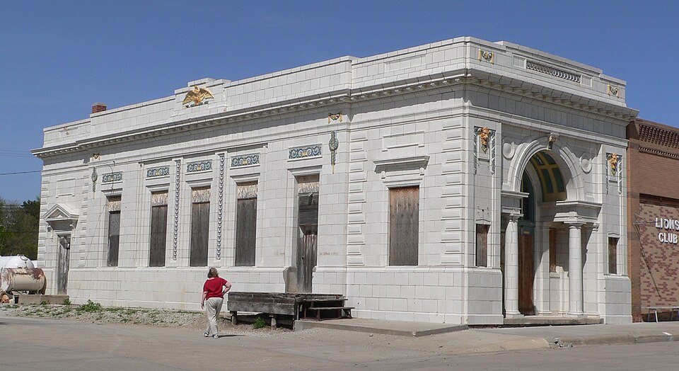
Listed on the National Register of Historic Places in 2013.
One of 20 National Register listings published here for Platte County · listed in 2013 · category: Building.
Sources: the National Register database, National Park Service
Regional context, not property-specific evidence. The federal wildfire occurrence database lists 1 fire within 5 miles of Citizens State Bank in 2007, burning under an acre in total. None started naturally. None was recorded as arson. Distance is straight-line from the map coordinates, so a fire counted here may appear on a neighbouring settlement's page as well.
| Reported cause | Fires |
|---|---|
| Power generation/transmission/distribution | 1 |
The most recent of them, most recent first, with the day each was reported and the service that recorded it.
| Date | Cause | Size | Reported by | Name on the report |
|---|---|---|---|---|
| 3 March 2007 | Power generation/transmission/distribution | under an acre | Nebraska Forest Service | not named |
Regional context, not property-specific evidence. The National Weather Service names Creston, the town this property stands in, in 47 storm reports between 1996 and 2025: 20 hail, 19 thunderstorm wind, 3 tornado, 2 flood. No death or injury is recorded in these reports. Each account below is quoted exactly as the forecast office filed it, from the NOAA Storm Events Database, and each date opens the federal record of that event.
| When | Event | Place named | Harm | What the report says |
|---|---|---|---|---|
| May 2024 | Flash Flood | Creston | $50,000 | The office received a public report of water and debris flowing over Monastery Road in northeast Platte County. About an hour after this report, the office received another public report that a bridge near Monroe was closed due to water flowing over the top of it and over the hood of a full-sized pickup truck. |
| June 2024 | Flash Flood | Creston | $10,000 | A trained spotter reported flood waters over county roads from overnight thunderstorms. |
| June 2024 | Flood | Creston | $5,000 | The office received a public report of water still over the southbound lane of Highway 81 in northeastern Platte County. This is a continuation of flash flooding that occurred from overnight thunderstorms the night prior. |
| July 1996 | Thunderstorm Wind | Creston | $5,000 | no account filed |
| March 2025 | Thunderstorm Wind | Creston | - | Personal weather station measured 59 mph wind gust. |
| September 2025 | Hail | Creston | - | Public report of hail estimated up to 0.75 inches in diameter. Report received via mPING. |
| April 2024 | Funnel Cloud | Creston | - | The Platte County EM reported numerous funnel clouds extending nearly to the ground. No debris was reported on the ground. These funnels lasted for several minutes. |
| April 2024 | Tornado (EF0) | Creston | - | A tornado began just west of 190th Avenue and about a half mile north of 445th Street where it flipped a cattle shed. The tornado then tracked toward the northwest, where it impacted another farm, flipping over a small outbuilding and removing roofing material of another outbuilding. A large cedar tree was also split down the middle. From this point, the tornado tracked north and then eventually east. Another farm was impacted near 190th Avenue and 475th Street where a detached garage had the roof removed and walls collapsed. Another cattle shed was overturned near the endpoint of the tornado near 475th Street and 182nd Avenue. There were several videos of this tornado which indicate an interesting evolution. It seemed to begin as the parent storm ingested rotation from a weak frontal boundary extending southeast of the storm, then pulled the tornado northwest closer to the storm updraft, and then eventually it turned to move northeast in the same direction as the storm and eventually pushed a bit more toward the east as a cool gust pushed out and dissipated the tornado. While the funnel cloud was rather wide at times, the actual contact with the ground was quite narrow, as evidenced by the narrow damage track. |
| April 2024 | Tornado (EF1) | Creston | - | Trained spotters reported that the tornado initially touched down just northwest of the intersection of 370th Street and 175th Avenue. It tracked north-northeast where it flipped a center pivot irrigation system. The tornado was intermittent as it tracked across 175th Avenue and toward Loseke Creek, becoming more persistent again as it reached and crossed Loseke Creek. At this point, it impacted a homestead where it snapped trees, blew windows out of a home, and caused significant damage to a barn roof. The tornado continued north where there was minor damage to fencing and an electrical pole at a feedlot, and continued to weaken and become intermittent to where the trained spotters reported that the ground circulation ended, just southwest of 160th Avenue and 445th Street. Peak winds in this tornado were estimated to be 100 miles per hour, with an average width of 35 yards. |
| June 2024 | Thunderstorm Wind | Creston | - | The office received a report of a measured 60 miles per hour wind gust from the public. |
| July 2023 | Hail | Creston | - | Public reported 1.25-inch hail. |
| May 2023 | Hail | Creston | - | Trained spotter reported 1.75-inch hail. |
| October 2023 | Thunderstorm Wind | Creston | - | Received a public report of the top of a tree broken off. The time of the report was estimated by radar. |
| May 2022 | Thunderstorm Wind | Creston | - | Public estimated wind gusts near 80 mph and reported several large tree branches down. |
| July 2022 | Thunderstorm Wind | Creston | - | Personal weather station measured a peak wind gust of 64 mph. |
| July 2022 | Thunderstorm Wind | Creston | - | Personal weather station measured a peak wind gust of 68 mph. |
| July 2022 | Thunderstorm Wind | Creston | - | Trained spotter estimated peak wind gusts at 60 mph. |
| October 2020 | Hail | Creston | - | Public reported 1.25 inch hail. |
| May 2020 | Thunderstorm Wind | Creston | - | Public personal weather station reported winds of 68 MPH. |
| June 2018 | Thunderstorm Wind | Creston | - | A person estimated 70 mph winds 5 miles south southeast of Creston. |
| June 2018 | Flood | Creston | - | Heavy rainfall of 4 to 6 1/2 inches caused the fork of Loseke Creek to go over its banks in Platte County. |
| June 2018 | Thunderstorm Wind | Creston | - | A storm spotter estimated 60 mph winds about 4 miles southeast of Creston. |
| June 2018 | Thunderstorm Wind | Creston | - | A person estimated 70 mph winds 5 miles south southeast of Creston. |
| June 2018 | Thunderstorm Wind | Creston | - | Large tree limbs were broken about 4 miles southeast of Creston. |
| August 2017 | Thunderstorm Wind | Creston | - | A few trees were snapped by damaging winds. |
| June 2017 | Thunderstorm Wind | Creston | - | Roof of a building was damaged by damaging winds. |
| August 2015 | Hail | Creston | - | Mostly smaller hail, but a few stones up to golf ball size. |
| August 2015 | Hail | Creston | - | The COOP Observer reported hail around 1 inch in diameter, but the public reported hail up to golf ball size. |
| June 2013 | Thunderstorm Wind | Creston | - | In the city of Creston there was tree and power line damage, including at least one tree that fell on a house. |
| February 2009 | Hail | Creston | - | Hail up to penny size was reported. |
| May 2008 | Thunderstorm Wind | Creston | - | Thunderstorm wind gusts of 70 mph were estimated by the public south of Creston. The winds were accompanied by 3/4 inch hail. |
| April 2007 | Hail | Creston | - | The hail was accompanied by thunderstorm wind gusts estimated at 60 mph. |
| April 2007 | Thunderstorm Wind | Creston | - | The wind was accompanied by dime size hail. |
| May 2000 | Tornado (F0) | Creston | - | Brief touchdown of a tornado was observed by law enforcement official near Creston. The official noted that the tornado then lifted with a funnel observed after that for around 10 to 20 minutes longer. |
| June 2018 | Hail | Creston | - | no account filed |
| August 2015 | Hail | Creston | - | no account filed |
| July 2014 | Hail | Creston | - | no account filed |
| June 2010 | Hail | Creston | - | no account filed |
| May 2008 | Hail | Creston | - | no account filed |
| August 2007 | Hail | Creston | - | no account filed |
| September 2005 | Hail | Creston | - | no account filed |
| August 2004 | Hail | Creston | - | no account filed |
| July 2003 | Hail | Creston | - | no account filed |
| July 2003 | Hail | Creston | - | no account filed |
| June 1999 | Hail | Creston | - | no account filed |
| May 1998 | Hail | Creston | - | no account filed |
| July 1998 | Thunderstorm Wind | Creston | - | no account filed |
No historic map-sheet match is published for this property yet. That does not mean no map exists. This record needs a coordinate-quality review before it can be joined to a sheet boundary. Browse the county's mapped places while that work is pending.
Other National Register properties close enough to walk or drive between, ordered by distance from this one. Both positions come from the same geocoding pass that matched these properties to their map sheets.
| Photograph | Property | Distance | Listed |
|---|---|---|---|
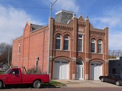 | Humphrey City Hall | 6.4 miles | 1996 |
| National Archives record | The nomination case file for reference 13000200 in Record Group 79. |
| Platte County | All 20 listed properties in this county. |