 Block
From the record
One of 9 National Register listings published here for Keith County · listed in 2015 · category: Building.
Sources: the National Register database, National Park Service

Listed on the National Register of Historic Places in 2015.
One of 9 National Register listings published here for Keith County · listed in 2015 · category: Building.
Sources: the National Register database, National Park Service
Regional context, not property-specific evidence. The federal wildfire occurrence database lists 11 fires within 5 miles of Front Street between 2003 and 2011, burning about 24 acres in total. 1 started naturally. None was recorded as arson. Distance is straight-line from the map coordinates, so a fire counted here may appear on a neighbouring settlement's page as well.
| Reported cause | Fires |
|---|---|
| Fireworks | 3 |
| Equipment and vehicle use | 2 |
| Missing data/not specified/undetermined | 2 |
| Debris and open burning | 1 |
| Smoking | 1 |
| Power generation/transmission/distribution | 1 |
| Natural | 1 |
The most recent of them, most recent first, with the day each was reported and the service that recorded it.
| Date | Cause | Size | Reported by | Name on the report |
|---|---|---|---|---|
| 12 September 2011 | Equipment and vehicle use | 20 acres | Nebraska Forest Service | not named |
| 4 July 2011 | Fireworks | under an acre | Nebraska Forest Service | not named |
| 4 July 2011 | Fireworks | under an acre | Nebraska Forest Service | not named |
| 29 July 2011 | Missing data/not specified/undetermined | under an acre | Nebraska Forest Service | not named |
| 29 June 2011 | Natural | under an acre | Nebraska Forest Service | not named |
| 15 May 2011 | Fireworks | 1.0 acres | Nebraska Forest Service | not named |
| 1 May 2011 | Power generation/transmission/distribution | under an acre | Nebraska Forest Service | not named |
| 29 March 2003 | Equipment and vehicle use | under an acre | Nebraska Forest Service | not named |
Regional context, not property-specific evidence. The federal mineral resources record lists 3 workings within 5 miles of Front Street: 3 producers. All of them still produce. What was taken out: Sand and Gravel, Construction. Distance is straight-line from the map coordinates, so a quarry counted here may appear on a neighbouring settlement's page as well.
| Where | Site | Commodity | Status | Recorded |
|---|---|---|---|---|
| Brown Sand & Gravel Pit & Plant | Sand and Gravel, Construction | Producer | ||
| East Pits & Plants No. 1 & 2 | Sand and Gravel, Construction | Producer | ||
| River Pit & Plant | Sand and Gravel, Construction | Producer |
Regional context, not property-specific evidence. The National Weather Service names Ogallala, the town this property stands in, in 169 storm reports between 1993 and 2025: 92 hail, 59 thunderstorm wind, 10 tornado, 6 flash flood. The reports record 1 injury. Each account below is quoted exactly as the forecast office filed it, from the NOAA Storm Events Database, and each date opens the federal record of that event.
| When | Event | Place named | Harm | What the report says |
|---|---|---|---|---|
| July 2001 | Lightning | Ogallala | 1 hurt | Lightning struck a woman as she walked past a utility pole during a thunderstorm. The woman was knocked to the ground. She was taken to the hospital but then released with no serious injuries. |
| July 2024 | Hail | Ogallala | $1,000,000 | Golf ball to tennis ball sized hail reported on the west side of Ogallala. |
| July 2003 | Hail | Ogallala | $1,000,000 | Hail initially struck the west side of Ogallala and then moved southeast across the town with numerous cars and boats sustaining severe body damage and broken windshields. Vinyl siding on homes were also damaged and windows broken. |
| May 2019 | Hail | Ogallala | $500,000 | Multiple reports of 2 inch diameter hail reported in Ogallala with numerous reports of damaged windows and car windows. |
| July 1999 | Tornado (F1) | Ogallala | $500,000 | The tornado touched down briefly 4 miles southwest of Ogallala where its intensity was F0. The tornado then lifted and touched down again in the southeast part of Ogallala as an F1 and travelled northwest through a mobile home park destroying two trailers and damaging ten others. It then crossed Highway 61 and struck Indian Hills Manor breaking all the windows on the east side of the building and taking the roof off WEL-Life, a senior residence near Indian Hills. It then hit two homes, taking the roof off one and removing the garage from the other. |
| August 1993 | Thunderstorm Wind | Ogallala | $500,000 | Thunderstorm winds estimated at over 70 mph uprooted trees, demolished a building at the grain elevator, and blew out a plate glass window at a business. Two of the trees fell onto cars. The debris from the demolished building blocked the neighboring railroad tracks for 2 hours and tore out a power line. |
| June 1998 | Hail | Ogallala | $250,000 | Hail, accumulating several inches deep, produced widespread damage to roofs, cars, and crops in and around Ogallala. Hail was accompanied by extensive street flooding. |
| June 1996 | Tornado (F1) | Ogallala | $250,000 | no account filed |
| July 2003 | Thunderstorm Wind | Ogallala | $240,000 | Thunderstorm outflow winds snapped off large tree limbs, broke off the top 150 feet of a 247 ft tower for KOGA radio, and destroyed six campers and extensively damaged seven other campers at a business one half mile south of Kingsley Dam. Nearby farmsteads received extensive damage to garages, barns, and outbuildings. Most doors on a storage facility near Kingsley Dam were damaged. Power poles and trees were also snapped off. |
| March 2007 | Tornado (EF1) | Ogallala | $100,000 | A tornado touched down along the Union Pacific railroad tracks near Highway 30 on the far west side of Ogallala and moved north-northeast. In the path, the tornado destroyed a garage, broke off power poles, destroyed outbuildings, lifted and moved vehicles, broke off trees, damaged roofs, and overturned horse trailers at a small farm and a veterinary hospital before lifting. |
| October 1994 | Tornado (F1) | Ogallala | $100,000 | A tornado moved along a narrowrow path from southwest to northeast for about nine city blocks on the west edge of Ogallala. The tornado touched down by the Union Pacific tracks south of West United States Highway 30; uprooting a tree there. The tornado moved across United States Highway 30 and felled a tree on a home, causing extensive damage to the roof. The tornado then ripped a 24 foot by 96 foot roof from a storage building. The roof was scattered across the Keith County fairgrounds and into an electrical feeder station, causing power outages to 25 homes. Tops were taken out of trees along the entire path and tree limbs ripped electrical services off numerous homes. Several trees were also uprooted along the path. Fifty feet of edging was blown off the elementary school's roof and three windows were broken. A tree fell on the roof of a home and a vehicle near the home. Hayes County 15NE Hayes Center,05,2250CST,,,0,0,?,?,Thunderstorm Winds (G60) Thunderstorm winds moved a double-wide trailer off of its foundation. Two storage sheds were destroyed and a solar panel from the roof of the trailer. Crops were destroyed in an adjacent cornfield. |
| August 1993 | Hail | Ogallala | $50,000 | A line of severe thunderstorms pushed through Keith county. Dime-size hail covered the ground and formed drifts north of Roscoe. A hail drift 6 inches deep remained there during the early afternoon. Hail up to golfball-size fell at Roscoe, south of Ogallala and at Brule. The hail damaged 1,000 acres of corn, 300 acres of sunflowers, 250 acres of beans, along with some hay. There was also some structural damage to buildings, windows were broken , and cars were dented. |
| June 2009 | Hail | Ogallala | $35,000 | Golf ball size hail was reported covering Interstate 80 near mile marker 122 west of Ogallala. |
| June 1999 | Hail | Ogallala | $30,000 | A severe thunderstorm that developed in western Keith County produced tennis ball sized hail which destroyed approximately 10000 acres of wheat. Corn and sugar beets were also damaged; but, those crops were not as sensitive to hail damage because of the early developmental stage of the corn and the underground growth of beets.. |
| July 2003 | Hail | Ogallala | $30,000 | no account filed |
| June 2024 | Thunderstorm Wind | Ogallala | $25,000 | Thunderstorm wind gusts measured at 68 MPH reported with several 6 inch diameter tree limbs down in Ogallala. |
| July 2009 | Hail | Ogallala | $25,000 | The hail hit the golf course southeast of Ogallala. |
| June 1999 | Hail | Ogallala | $20,000 | The thunderstorm became severe in south central Garden County just southeast of Oshkosh and crossed the county line in western Keith County and travelled to near Brule in southwest Keith County. The swath of the hail storm was approximately 4 miles wide and 25 miles long, and it brushed the northeast corner of Deuel county. The wheat on about 64,000 acres was destroyed. |
| June 2025 | Thunderstorm Wind | Ogallala | $15,000 | Law enforcement reports wind damage to a home in Ogallala. |
| July 2001 | Thunderstorm Wind | Ogallala | $15,000 | Strong winds overturned several boats on Lake McConaughy. |
| July 2020 | Flash Flood | Ogallala | $10,000 | A high water rescue was performed in downtown Ogallala where a mother and child were stranded in a car. The water was up to a police officer's belt line. |
| July 2010 | Thunderstorm Wind | Ogallala | $10,000 | The emergency manager reported four empty mobile homes damaged. |
| June 1998 | Hail | Ogallala | $10,000 | no account filed |
| June 2009 | Hail | Ogallala | $8,000 | no account filed |
| July 2009 | Hail | Ogallala | $8,000 | no account filed |
| August 2007 | Hail | Ogallala | $8,000 | no account filed |
| June 2025 | Thunderstorm Wind | Ogallala | $5,000 | Power lines reported down just to the southwest of Ogallala. |
| June 2016 | Thunderstorm Wind | Ogallala | $5,000 | Numerous trees down and windows blown out. |
| June 2009 | Hail | Ogallala | $5,000 | Penny to quarter size hail occurred for approximately 10 minutes. |
| March 2007 | Tornado (EF0) | Ogallala | $5,000 | A supercell thunderstorm spawned a brief tornado that produced minor roof damage to homes and broke off some tree limbs. |
| June 2004 | Hail | Ogallala | $3,000 | no account filed |
| June 2024 | Thunderstorm Wind | Ogallala | $2,000 | Thunderstorm wind gusts estimated at 70 MPH brought down a large healthy tree at this location. |
| July 2024 | Hail | Ogallala | $1,000 | Broken Wind shield on a police cruiser, west side of Ogallala. |
| May 2025 | Thunderstorm Wind | Ogallala | - | Multiple 4 inch tree limbs down from thunderstorm winds estimated at 60 MPH. |
| July 2025 | Hail | Ogallala | - | Hail up to 1.5 inches in diameter along with heavy rain reported in Ogallala. |
| July 2025 | Flash Flood | Ogallala | - | Public reports 2 to 4 feet of water on some roadways in Ogallala. |
| July 2024 | Hail | Ogallala | - | Report via social media. Hail fell at the Keith County Fairgrounds. |
| July 2024 | Hail | Ogallala | - | Report via social media at Interstate 80, mile marker 123. |
| July 2024 | Hail | Ogallala | - | Report via social media. Time estimated from radar. |
| April 2022 | Thunderstorm Wind | Ogallala | - | Thunderstorm wind gusts, estimated at 60 MPH, reported at this location. |
| June 2022 | Thunderstorm Wind | Ogallala | - | Damage to sheet steel storage building. |
| June 2022 | Thunderstorm Wind | Ogallala | - | Large tree snapped and damaged deck. |
| June 2022 | Thunderstorm Wind | Ogallala | - | Thunderstorm wind gust. |
| July 2022 | Thunderstorm Wind | Ogallala | - | Ogallala Airport AWOS measured a 61 mph wind gust. |
| July 2022 | Hail | Ogallala | - | A storm chaser reported ping pong ball size hail east of Ogallala. |
| September 2021 | Thunderstorm Wind | Ogallala | - | Wind gusts estimated at 60 MPH resulted in 3 inch diameter limbs down at this location. |
| August 2021 | Flash Flood | Ogallala | - | Numerous streets flooded in the town of Ogallala. |
| July 2019 | Thunderstorm Wind | Ogallala | - | Ogallala Airport AWOS measured 63 mph wind gusts. |
| August 2019 | Thunderstorm Wind | Ogallala | - | Measured wind gust from a Mesonet site. |
| June 2019 | Thunderstorm Wind | Ogallala | - | Wind speed estimated at 60 to 70 MPH at this location. |
| June 2018 | Thunderstorm Wind | Ogallala | - | Measured at the Ogallala Airport. |
| June 2018 | Thunderstorm Wind | Ogallala | - | Wind gust estimated at 60 MPH at this location. |
| June 2016 | Thunderstorm Wind | Ogallala | - | No significant damage reported from this wind gust. |
| June 2016 | Thunderstorm Wind | Ogallala | - | No significant damage reported from this wind gust. |
| June 2016 | Thunderstorm Wind | Ogallala | - | Trees down from the wind. |
| August 2016 | Thunderstorm Wind | Ogallala | - | Thunderstorm wind gusts measured 64 mph. |
| June 2015 | Flash Flood | Ogallala | - | A trained spotter reported Highway 61 was half covered with water, with some locations being 6 to 8 inches deep. |
| May 2015 | Thunderstorm Wind | Ogallala | - | Winds estimated to 70 mph. |
| May 2015 | Thunderstorm Wind | Ogallala | - | Wind gust estimated at 60 mph. |
| August 2014 | Thunderstorm Wind | Ogallala | - | Thunderstorm wind gusts to 60 MPH reported at KOGA Radio Station. |
No historic map-sheet match is published for this property yet. That does not mean no map exists. This record needs a coordinate-quality review before it can be joined to a sheet boundary. Browse the county's mapped places while that work is pending.
Other National Register properties close enough to walk or drive between, ordered by distance from this one. Both positions come from the same geocoding pass that matched these properties to their map sheets.
| Photograph | Property | Distance | Listed |
|---|---|---|---|
 | US Post Office-Ogallala | 0.3 miles | 1992 |
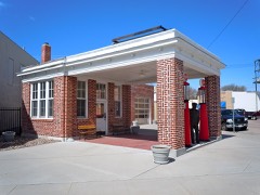 | Standard Oil Red Crown Service Station | 0.3 miles | 2004 |
 | Leonidas A. Brandhoefer Mansion | 0.7 miles | 1973 |
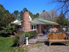 | Dr. Burdette and Myrna Gainsforth House | 0.8 miles | 2002 |
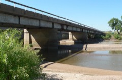 | Roscoe State Aid Bridge | 7.1 miles | 1992 |
| National Archives record | The nomination case file for reference 14001128 in Record Group 79. |
| Keith County | All 9 listed properties in this county. |