 Block
From the record
One of 27 National Register listings published here for Otoe County · listed in 1976 · category: District.
Sources: the case file at the National Archives · the National Register database, National Park Service
Listed on the National Register of Historic Places in 1976.
One of 27 National Register listings published here for Otoe County · listed in 1976 · category: District.
Sources: the case file at the National Archives · the National Register database, National Park Service
Regional context, not property-specific evidence. The federal wildfire occurrence database lists 57 fires within 5 miles of South 13th Street Historic District between 2007 and 2020, burning about 204 acres in total. None started naturally. 4 were recorded as arson. Distance is straight-line from the map coordinates, so a fire counted here may appear on a neighbouring settlement's page as well.
| Reported cause | Fires |
|---|---|
| Debris and open burning | 28 |
| Missing data/not specified/undetermined | 13 |
| Smoking | 7 |
| Arson/incendiarism | 4 |
| Fireworks | 2 |
| Equipment and vehicle use | 2 |
| Recreation and ceremony | 1 |
The most recent of them, most recent first, with the day each was reported and the service that recorded it.
| Date | Cause | Size | Reported by | Name on the report |
|---|---|---|---|---|
| 30 September 2017 | Debris and open burning | 15 acres | Nebraska Forest Service | not named |
| 9 July 2007 | Equipment and vehicle use | 1.0 acres | Nebraska Forest Service | not named |
| 4 July 2012 | Fireworks | 1.0 acres | Nebraska Forest Service | not named |
| 4 July 2007 | Debris and open burning | under an acre | Nebraska Forest Service | not named |
| 4 July 2007 | Arson/incendiarism | under an acre | Nebraska Forest Service | not named |
| 2 July 2012 | Fireworks | 1.0 acres | Nebraska Forest Service | not named |
| 27 June 2008 | Missing data/not specified/undetermined | under an acre | Nebraska Forest Service | not named |
| 11 June 2019 | Missing data/not specified/undetermined | 1.0 acres | Nebraska Forest Service | not named |
Regional context, not property-specific evidence. The federal mineral resources record lists 2 workings within 5 miles of South 13th Street Historic District: 2 past producers. None of them still produces. What was taken out: Sand and Gravel, Construction. Distance is straight-line from the map coordinates, so a quarry counted here may appear on a neighbouring settlement's page as well.
| Where | Site | Commodity | Status | Recorded |
|---|---|---|---|---|
| Payne Junction Pit | Sand and Gravel, Construction | Past Producer | ||
| Unknown | Sand and Gravel, Construction | Past Producer |
Regional context, not property-specific evidence. The National Weather Service names Nebraska City, the town this property stands in, in 72 storm reports between 1993 and 2025: 28 thunderstorm wind, 28 hail, 4 tornado, 4 flash flood. No death or injury is recorded in these reports. Each account below is quoted exactly as the forecast office filed it, from the NOAA Storm Events Database, and each date opens the federal record of that event.
| When | Event | Place named | Harm | What the report says |
|---|---|---|---|---|
| April 2001 | Thunderstorm Wind | Nebraska City | $250,000 | Thunderstorm winds estimated at over 60 mph damaged numerous locations in town including several trees that were were split with large sections falling onto houses causing roof damage, damage to garages and to windows. According to the Nebraska City News Press, the damage was primarily along a line from Pendleton Woolen Mills and W&H Manufacturers along Industrial Road to North Table Creek across the parking lot of Norman's. |
| May 2008 | Lightning | Nebraska City | $80,000 | A lightning strike started a fire that caused an estimated $80,000 damage to a home in Nebraska City. |
| April 2006 | Tornado (F1) | Nebraska City | $75,000 | This tornado touched down in far southern Otoe county around 11 miles south of Nebraska City, or around 1 mile east northeast of Julian. Julian is in Nemaha county and just south of the Otoe county line. The touchdown was near County Road S and Highway 75. The tornado caused f1 damage to a house in this vicinity and then tracked around 2.5 miles before lifting around 9 miles south of Nebraska City or about 2 to 3 miles northeast of Julian near county road Q and Highway 75. The tornado also caused f1 damage to houses near County Road R and Highway 75 and County Road S and Highway 75. Several trees were also toppled onto vehicles destroying them or causing extensive damage. The total path length was about 2.5 miles with an average damage width of 100 yards. |
| August 2009 | Lightning | Nebraska City | $35,000 | Lightning struck a 50-year-old tree causing it topple onto a house and car causing extensive damage to each. |
| July 1995 | Thunderstorm Wind | Nebraska City | $9,000 | Thunderstorm winds damaged a barn roof, a camper, and a club house. |
| June 2000 | Lightning | Nebraska City | $3,000 | Lightning strike caused roof damage to a house in Nebraska City. |
| July 1995 | Thunderstorm Wind | Nebraska City | $1,000 | no account filed |
| April 2025 | Thunderstorm Wind | Nebraska City | - | Measured wind gust of 59 mph from Nebraska City AWOS KAFK. |
| May 2024 | Thunderstorm Wind | Nebraska City | - | The Otoe County Emergency Manager reported a 60 miles per hour wind gust 5 miles to the south of Nebraska City. |
| June 2023 | Thunderstorm Wind | Nebraska City | - | Public reported via social media a field of corn flattened by wind south of Nebraska City. Many reported were received from in Nebraska City of power outages, power poles broken, and widespread tree damage. |
| April 2023 | Hail | Nebraska City | - | Public reported 1-inch hail. |
| April 2023 | Hail | Nebraska City | - | Trained spotter reported 1.75-inch hail. |
| June 2021 | Hail | Nebraska City | - | Public report from Mping for 1 inch hail. |
| May 2016 | Flood | Nebraska City | - | Widespread lowland flooding of mainly agricultural land was observed along the river with a crest of 19.83 feet on the 12th. |
| December 2015 | Flood | Nebraska City | - | Heavy rainfall over a two-day period in mid December brought the Missouri River to rise above flood stage. The crest reached 19.01 feet in the morning hours of December 15th. This was 1.01 feet above flood stage. Flooding was confined to low agricultural areas along the river. |
| August 2014 | Thunderstorm Wind | Nebraska City | - | Pictures from local law enforcement from Nebraska City indicate numerous tree branches broken and a few trees uprooted. |
| April 2012 | Tornado (EF1) | Nebraska City | - | A tornado touched down 3 miles northwest of Nebraska City destroying a machine shed and peeling the roof off of a vineyard building causing its partial collapse. Metal from that building was blown several hundred yards away. A home near there had window and siding damage and a home north of County Road 60 experienced a garage failure and outbuilding damage. Broken and uprooted trees marked the damage path east-northeast until the tornado lifted near the Missouri River. In total at least 7 homes were damaged from this tornado. |
| July 2010 | Thunderstorm Wind | Nebraska City | - | Thunderstorm wind gusts estimated at close to 60 mph downed at least one tree along with many branches in the Nebraska City area. |
| August 2009 | Hail | Nebraska City | - | A few hailstones up to golf ball-size fell in town. |
| May 2008 | Hail | Nebraska City | - | Reported near the intersection of 70th and P Streets. |
| August 2007 | Heavy Rain | Nebraska City | - | A thunderstorm dumped 4.20 inches of rain in one hour at county Hwy 69 and Q near the Nemaha county line just northeast of Julian. |
| May 2007 | Flood | Nebraska City | - | Heavy rainfall over the weekend of May 4th through the 6th caused a prolonged flood along the Missouri River in southeast Nebraska. At Nebraska City the Missouri River crested just under 21.5 feet for around 8 hours from late morning until early evening on the 7th. Flood stage at Nebraska City is 18 feet. The river at Nebraska City first crossed flood stage around 915 am cdt on the 6th and didn't drop below flood stage until a little after 200 pm cdt on the 9th.|The flooding affected mainly agricultural low lands, but some county roads, including one that led to a local marina, were closed due to the flood waters. |
| March 2006 | Thunderstorm Wind | Nebraska City | - | Thunderstorm wind gusts estimated at over 60 mph blew down a barn, snapped a power pole and broke numerous large tree limbs just south of Nebraska City. |
| May 2006 | Thunderstorm Wind | Nebraska City | - | Thunderstorm winds estimated at over 60 mph downed large tree branches along Highway 75. |
| April 2005 | Hail | Nebraska City | - | Hail up to walnut size caused damage to vehicles and trees in Nebraska City and several miles west through south of town. The hail was accompanied by heavy rain that caused some street flooding in town. |
| April 2005 | Flash Flood | Nebraska City | - | Heavy rain that fell in less than 1 hour caused extensive street flooding in Nebraska City. |
| June 2005 | Thunderstorm Wind | Nebraska City | - | Thunderstorm wind gusts estimated at 60 mph overturned a semi-truck in Nebraska City. |
| August 2005 | Thunderstorm Wind | Nebraska City | - | A thunderstorm wind gust of 59 mph was recorded by the Nebraska City AWOS. |
| February 2004 | Thunderstorm Wind | Nebraska City | - | Thunderstorm wind gusts estimated at around 60 mph severely damaged a gazebo in the city park. |
| May 2004 | Funnel Cloud | Nebraska City | - | An Amatuer radio operator reported a funnel cloud just north of Nebraska City. |
| May 2004 | Thunderstorm Wind | Nebraska City | - | Thunderstorm wind gusts of around 60 mph downed a large walnut tree in town which damaged a house as it fell. |
| August 2004 | Thunderstorm Wind | Nebraska City | - | Thunderstorm wind gusts estimated at over 60 mph blew a semi truck over near Nebraska City. The winds could have been the rear flank downdraft of a developing tornado that eventually touched down about 20 miles to the east. |
| July 2004 | Thunderstorm Wind | Nebraska City | - | Thunderstorm wind gusts estimated at around 60 mph downed a utility pole in town. |
| August 2002 | Thunderstorm Wind | Nebraska City | - | For the second night in a row, thunderstorm wind gusts knocked large tree limbs down in town. A tree was also uprooted causing minor roof damage to two homes. |
| August 2002 | Thunderstorm Wind | Nebraska City | - | Thunderstorm wind gusts knocked numerous large tree limbs and branches onto power lines throughout town. |
| August 2002 | Flash Flood | Nebraska City | - | Slow moving thunderstorms dropped very heavy rainfall over Otoe county, especially north of Nebraska City where one report of 5.5 inches was received. In fact the gage that recorded the 5.5 inches had overflowed so the amount was an estimate. The heavy rains caused Goose Creek north of Nebraska City to flood a county road. |
| June 2001 | Thunderstorm Wind | Nebraska City | - | Thunderstorm winds downed large tree limbs and power lines in Nebraska City. Again the damage was to the north of the storms. |
| June 2000 | Flash Flood | Nebraska City | - | Five to 6 inches of rain over Otoe county Friday evening the 23rd flooded numerous county roads south of Nebraska City. It also washed out a bridge near Paul, which is about 6 or 7 miles south southwest ofNebraska City. |
| June 2000 | Thunderstorm Wind | Nebraska City | - | Thunderstorm winds estimated at 65 mph downed power lines and knocked the power out for a while south of Nebraska City. |
| June 2000 | Tornado (F0) | Nebraska City | - | Brief touchdown of a tornado south of Nebraska City. The tornado touched down in open country and did no damage. |
| July 2000 | Thunderstorm Wind | Nebraska City | - | Thunderstorm winds estimated at close to 80 mph uprooted trees northwest of Nebraska City. |
| July 1999 | Thunderstorm Wind | Nebraska City | - | Thunderstorm gust downed two trees. |
| June 1998 | Flash Flood | Nebraska City | - | Significant street flooding. |
| June 1998 | Thunderstorm Wind | Nebraska City | - | Tree limbs downed. |
| May 1995 | Tornado (F0) | Nebraska City | - | A brief touchdown was reported in a field. |
| July 1995 | Hail | Nebraska City | - | Thunderstorm winds damaged a barn roof, a camper, and a club house. |
| August 1993 | Thunderstorm Wind | Nebraska City | - | Winds estimated at up to 60 mph blew a ventilator off of a roof. |
| August 1993 | Thunderstorm Wind | Nebraska City | - | Thunderstorm winds blew down numerous tree limbs. |
| May 2015 | Hail | Nebraska City | - | no account filed |
| March 2012 | Hail | Nebraska City | - | no account filed |
| May 2007 | Hail | Nebraska City | - | no account filed |
| August 2007 | Hail | Nebraska City | - | no account filed |
| April 2006 | Hail | Nebraska City | - | no account filed |
| April 2005 | Hail | Nebraska City | - | no account filed |
| June 2005 | Hail | Nebraska City | - | no account filed |
| June 2005 | Hail | Nebraska City | - | no account filed |
| May 2004 | Hail | Nebraska City | - | no account filed |
| August 2004 | Hail | Nebraska City | - | no account filed |
| May 2001 | Hail | Nebraska City | - | no account filed |
| June 2000 | Hail | Nebraska City | - | no account filed |
No historic map-sheet match is published for this property yet. That does not mean no map exists. This record needs a coordinate-quality review before it can be joined to a sheet boundary. Browse the county's mapped places while that work is pending.
Other National Register properties close enough to walk or drive between, ordered by distance from this one. Both positions come from the same geocoding pass that matched these properties to their map sheets.
| Photograph | Property | Distance | Listed |
|---|---|---|---|
 | Morton-James Public Library | 0.3 miles | 1976 |
 | Otoe County Courthouse | 0.3 miles | 1976 |
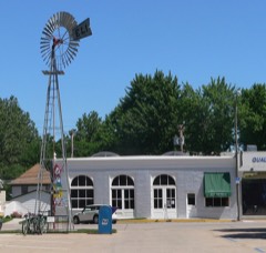 | Kregel Wind Mill Company | 0.3 miles | |
 | Grand Army of the Republic (G.A.R.) Memorial Hall | 0.3 miles | 1994 |
 | U.S. Post Office | 0.4 miles | 1971 |
 | Memorial Building | 0.4 miles | 2016 |
| National Archives record | The nomination case file for reference 76001137 in Record Group 79. |
| Otoe County | All 27 listed properties in this county. |