Block
From the record
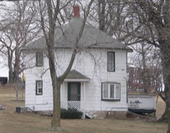
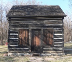
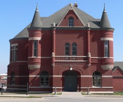
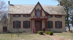
27 National Register listings published here, 2 of them National Historic Landmarks.
Sources: the National Register database, National Park Service
35 topographic sheets cover 17 settlements here, and 27 properties are on the National Register of Historic Places.
27 National Register listings published here, 2 of them National Historic Landmarks.
Sources: the National Register database, National Park Service
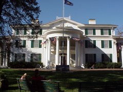
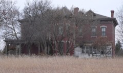
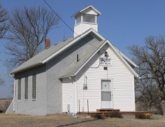
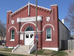
Every property in this county listed on the National Register of Historic Places, with the year it was listed and the federal nomination document.
Every wildfire the federal occurrence database records inside this county: 235 of them, burning about 2,245 acres. 2 started naturally and 9 were recorded as arson. Each settlement page carries the fires within five miles of it.
| Reported cause | Fires |
|---|---|
| Debris and open burning | 130 |
| Missing data/not specified/undetermined | 47 |
| Equipment and vehicle use | 23 |
| Smoking | 11 |
| Arson/incendiarism | 9 |
| Power generation/transmission/distribution | 5 |
| Recreation and ceremony | 4 |
| Fireworks | 3 |
| Natural | 2 |
| Railroad operations and maintenance | 1 |
The five largest, by the area the report gives. None of them was recorded as arson.
| Date | Cause | Size | Reported by | Name on the report |
|---|---|---|---|---|
| 4 October 2005 | Equipment and vehicle use | 443 acres | Nebraska Forest Service | not named |
| 29 March 2014 | Missing data/not specified/undetermined | 200 acres | Nebraska Forest Service | not named |
| 10 March 2011 | Missing data/not specified/undetermined | 160 acres | Nebraska Forest Service | not named |
| 14 March 2015 | Debris and open burning | 100 acres | Nebraska Forest Service | not named |
| 26 January 2014 | Missing data/not specified/undetermined | 100 acres | Nebraska Forest Service | not named |
| 4 March 2015 | Debris and open burning | 80 acres | Nebraska Forest Service | not named |
| 9 March 2014 | Power generation/transmission/distribution | 79 acres | Nebraska Forest Service | not named |
| 4 March 2020 | Debris and open burning | 75 acres | Nebraska Forest Service | not named |
Every settlement page carries the fires within five miles of it - see the settlement index below.
The NOAA Storm Events Database holds 473 reports for this county, causing no deaths, 4 injuries and about $25,190,500 in recorded property damage. Each settlement page carries the reports that name it.
| Kind of event | Reports |
|---|---|
| Hail | 216 |
| Thunderstorm Wind | 161 |
| Tornado | 31 |
| Flood | 29 |
| Flash Flood | 27 |
| Lightning | 4 |
| Funnel Cloud | 3 |
| Heavy Rain | 2 |
The most serious of them, by death, then injury, then recorded damage. The accounts are quoted exactly as the forecast office filed them.
| When | Event | Place named | Harm | What the report says |
|---|---|---|---|---|
| April 1991 | Tornado (F3) | not stated | 2 hurt, $2,500,000 | no account filed |
| July 1965 | Tornado (F3) | not stated | 1 hurt, $250,000 | no account filed |
| May 2005 | Flash Flood | Countywide | 1 hurt | Heavy rain caused flash flooding across parts of Otoe county...mainly rural county roads around the Dunbar...Syracuse...Unadilla and Douglas areas. A Weeping Water man driving a pickup truck was swept off of county road 62 in extreme southern Otoe county by flood waters. He managed to free himself and swim to safety suffering only minor injuries. Part of highway 67 just north of Dunbar was washed out and water was reported over a bridge near minimum maintenance County Road F and County Road 36. Rainfall of 2 to 6 inches was reported across the county, with much of it falling between 4 and 5 pm. |
| May 2004 | Tornado (F1) | Palmyra | $20,000,000 | no account filed |
| May 1996 | Flash Flood | Unadilla | $620,000 | no account filed |
| June 2010 | Flood | Elberon | $250,000 | Heavy rain over much of eastern Nebraska and western Iowa during most of June caused a prolonged period of flooding along the Missouri River, especially downstream of Omaha through Rulo. The river near Nebraska City climbed above flood stage early in the afternoon on June 11th and remained above flood stage into July. The river at Nebraska City crested around or a little over 25 feet during the afternoon of June 16th and June 21st. Flood stage is 18 feet. Industrial roads near the river were flooded along with some cabins, boat ramps and recreation areas. |
| April 2001 | Thunderstorm Wind | Nebraska City | $250,000 | Thunderstorm winds estimated at over 60 mph damaged numerous locations in town including several trees that were were split with large sections falling onto houses causing roof damage, damage to garages and to windows. According to the Nebraska City News Press, the damage was primarily along a line from Pendleton Woolen Mills and W&H Manufacturers along Industrial Road to North Table Creek across the parking lot of Norman's. |
| April 1982 | Tornado (F2) | not stated | $250,000 | no account filed |
| August 1958 | Tornado (F1) | not stated | $250,000 | no account filed |
| May 1998 | Thunderstorm Wind | Douglas | $85,000 | Semi truck overturned. 7000 square foot pole barn destroyed west of Syracuse. Hay sheds flattened. Most damage confined to an area between Douglas/Syracuse/and Unadilla. |
| May 2008 | Lightning | Nebraska City | $80,000 | A lightning strike started a fire that caused an estimated $80,000 damage to a home in Nebraska City. |
| June 2024 | Flood | Nebraska City Arpt | $75,000 | Excessive rainfall across much of eastern South Dakota resulted in river flooding along the Missouri River at the end of June. Moderate flood stage was observed along the Missouri, with the river gauge in Nebraska City cresting at 24.35 feet on 6/30. Flood stage at this river gauge is 18.0 feet. At 10:20 am CDT, emergency management sent photos of minor flooding in industrial areas right along the riverbank. Additional photos showed lowland flooding that had advances approximately half a mile outside of the normal riverbank. At 10:36 am on the 29th, additional photos were submitted by emergency management showing water levels had risen considerable, inundating multiple industrial buildings on the riverbank with several feet of water. Water levels were also approaching the bottom of a railroad bridge and low marshland adjacent to the river had also begun to flood. |
| June 2011 | Flood | Nebraska City Arpt | $75,000 | Flooding along the Missouri River gradually worsened during June as record releases from Gavins Point Dam brought widespread flooding along the river. The river at Nebraska City, which climbed above its 18 foot flood stage in mid April, started June around 23 feet and then began rising by the 10th eventually reaching a record crest of around 28 feet by the end of the month. The river stayed well above flood stage through July. In Otoe county farmland, roads and recreation areas near the river flooded as did some cabins and a grain elevator near Nebraska City. Flood waters crossed Highway 2 in Fremont county Iowa prompting its closure on both sides of the river. |
| April 2006 | Tornado (F1) | Nebraska City | $75,000 | This tornado touched down in far southern Otoe county around 11 miles south of Nebraska City, or around 1 mile east northeast of Julian. Julian is in Nemaha county and just south of the Otoe county line. The touchdown was near County Road S and Highway 75. The tornado caused f1 damage to a house in this vicinity and then tracked around 2.5 miles before lifting around 9 miles south of Nebraska City or about 2 to 3 miles northeast of Julian near county road Q and Highway 75. The tornado also caused f1 damage to houses near County Road R and Highway 75 and County Road S and Highway 75. Several trees were also toppled onto vehicles destroying them or causing extensive damage. The total path length was about 2.5 miles with an average damage width of 100 yards. |
| September 2014 | Tornado (EF1) | Elberon | $50,000 | The tornado developed from a slow moving supercell across rural Otoe County. The tornado initially developed near County Road 50, and between County Road M and L. Initial damage was mainly to crops and snapped tree limbs. The slow-moving tornado traveled generally east southeast exhibiting a slightly erratic path through rural Otoe County. The tornado impacted a couple of farmsteads along County Road 56, and also along County Road M. At these locations outbuildings were damaged or destroyed, as well as considerable tree damage. The tornado cross U.S. Highway 75 at the intersection of Nebraska Highway 128 where tree and power line damage occurred. The tornado continued east along Highway 128 continuing to do tree and crop damage for 1 mile before dissipating. |
| September 2011 | Flood | Nebraska City Arpt | $50,000 | Flooding along the Missouri River gradually worsened during June and early July as record releases from Gavins Point Dam brought widespread flooding along the river. The river at Nebraska City, which climbed above its 18 foot flood stage in mid April, eventually reached a record crest of around 28 feet by the end of June before falling several feet in July as downstream levees were breached and widened. River values steadily dropped during September as upstream releases were lowered substantially and by the end of the month the river had fallen below flood stage at Nebraska City. During the height of the flooding in Otoe county, farmland, roads and recreation areas near the river flooded as did some cabins and a grain elevator near Nebraska City. Flood waters crossed Highway 2 in Fremont county Iowa prompting its closure on both sides of the river. Highway 2 remained closed into late October due to damage that occurred earlier in the summer even though river levels fell enough so that they no longer covered the road. |
| August 2007 | Lightning | Syracuse | $50,000 | Lightning struck a house in Syracuse sparking a fire which caused extensive damage to the roof and attic. |
| August 2009 | Lightning | Nebraska City | $35,000 | Lightning struck a 50-year-old tree causing it topple onto a house and car causing extensive damage to each. |
| March 2010 | Flood | Nebraska City Arpt | $25,000 | Melting snow, along with several rain events, brought a prolonged period of lowland flooding along the Missouri River, especially downstream of its confluence with the Platte River near Plattsmouth. The river at Nebraska City first crossed flood stage, 18 feet, early in the afternoon on 3/16 and remained above flood stage until the morning of the 28th. The river at Nebraska City crested at around 21.5 feet during the evening of the 22nd. Agricultural lowlands and a few county roads near the river flooded in Otoe county as did some recreational areas near Nebraska City. |
| June 1967 | Tornado (F2) | not stated | $25,000 | no account filed |
| May 1957 | Tornado (F2) | not stated | $25,000 | no account filed |
| July 2011 | Flood | Madison | $20,000 | Flooding along the Missouri River gradually worsened during June and early July as record releases from Gavins Point Dam brought widespread flooding along the River. The river at Nebraska City, which climbed above its 18 foot flood stage in mid April, eventually reached a record crest of around 28 feet by the end of June before falling several feet in July as downstream levees were breached and widened. However, the flooding continued into August. In Otoe county farmland, roads and recreation areas near the river flooded as did some cabins and a grain elevator near in the area. Flood waters crossed Highway 2 in Fremont county Iowa prompting its closure on both sides of the river. |
| July 2010 | Flood | Nebraska City Arpt | $20,000 | Heavy rain over much of eastern Nebraska and western Iowa during most of June caused a prolonged period of flooding along the Missouri River, especially downstream of Omaha through Rulo. The river near Nebraska City climbed above flood stage early in the afternoon on June 11th and remained above flood stage for most of July and into August. The flooding was aided by additional rains in July and increased releases from upstream reservoirs. The river at Nebraska City crested around or a little over 25 feet during the afternoon of June 16th and June 21st and started July out a little under 22 feet. Flood stage is 18 feet. Industrial roads near the river were flooded along with some cabins, boat ramps and recreation areas. |
| June 2014 | Flood | Nebraska City Arpt | $15,000 | Several episodes of heavy rain caused prolonged flooding along the Missouri River near Nebraska City. The river crested at around 21.85 feet midday on June 23rd, flood stage in Nebraska City is 18 feet. After briefly falling below flood stage on the 27th, the river reached a second crest a little over flood stage on June 28th and 29th. The flooding impacted a few roads, farm fields and cabins near the river. |
| June 2010 | Flash Flood | Syracuse | $15,000 | Heavy rain caused flash flooding across streets in the Syracuse area and also flooded near a trailer park in town causing it to be evacuated when a creek rose 10 feet in a half an hour. The flood waters reached at least one trailer and flooded some vehicles. |
| October 2000 | Tornado (F0) | Syracuse | $15,000 | The first tornado in a cyclic storm that eventually produced 3 tornadoes. This one touched 2 miles southwest of Syracuse and blew some hog farm sheds around, caused a metal garage to collapse and did some tree damage before lifting 2 miles west of town. |
| March 2011 | Thunderstorm Wind | Lorton | $10,000 | Thunderstorm wind gusts estimated at over 60 mph ripped all of the vinyl siding off the side of a house southeast of Syracuse and two large sliding doors on a shed were blown off of their tracks. The winds were also accompanied by hail up to dime-size. |
| August 2011 | Flood | Nebraska City Arpt | $10,000 | Flooding along the Missouri River gradually worsened during June and early July as record releases from Gavins Point Dam brought widespread flooding along the River. The river at Nebraska City, which climbed above its 18 foot flood stage in mid April, eventually reached a record crest of around 28 feet by the end of June before falling several feet in July as downstream levees were breached and widened. At least minor flooding continued through August and September although river values steadily dropped even more from late August into September as upstream releases were lowered substantially. In Otoe county farmland, roads and recreation areas near the river flooded as did some cabins and a grain elevator near Nebraska City. Flood waters crossed Highway 2 in Fremont county Iowa prompting its closure until late October. |
| May 2007 | Flash Flood | Talmage | $10,000 | Heavy rainfall of 1 to 3 inches produced flash flooding which briefly crossed some county roads near Talmage and Lorton including Highways 128 and 67. The flooding also caused the temporary loss of telephone service in Talmage due to a washout. |
| July 1995 | Thunderstorm Wind | Nebraska City | $9,000 | Thunderstorm winds damaged a barn roof, a camper, and a club house. |
| October 2014 | Flood | Nebraska City Arpt | $5,000 | Heavy rainfall at the end of September caused the Missouri River to go into flood. The river rose above flood stage in the afternoon on the 1st, crested and fell below flood stage that evening. The river flooding was minor and mainly confined to low-lying areas along the river. |
| April 2011 | Flood | Nebraska City Arpt | $5,000 | Several periods of moderate to heavy rain combined with upstream inflows due to snow melt and rain caused the Missouri River to flood from around Nebraska City downstream through Rulo. The flooding began a little after the middle of the month and persisted into May. In Otoe county the flooding mainly affected marshy lowlands and low-lying farm fields along the river although a few recreational areas were flooded as well. The river at Nebraska City climbed above its 18 foot flood stage in the evening of 4/19 and continued above flood stage into May. The river had a prolonged crest of around and just under 19.5 feet over the last week or so of April. The crest and flooding carried over into May. |
| May 2011 | Flood | Nebraska City Arpt | $5,000 | This flooding carried over from April when several episodes of heavy rain combined with high releases from upstream reservoirs due to snow melt and rain caused a prolonged flood along the Missouri River. The river at Nebraska City, which climbed above its 18 foot flood stage in mid April, dipped slightly toward flood stage by the 10th but then steadily rose in stages through the rest of May reaching around 23 feet by the end of the month. The flooding carried into June. In May the flooding affected farmland and marshy areas along the river, and also flooded a few roads and recreational areas by the river. |
| August 2010 | Flood | Nebraska City Arpt | $5,000 | Heavy rain over much of eastern Nebraska and western Iowa during most of June caused a prolonged period of flooding along the Missouri River, especially downstream of Omaha through Rulo. The river near Nebraska City climbed above flood stage early in the afternoon on June 11th and remained above flood stage for most of July into August. The flooding was aided by additional rains in July and increased releases from upstream reservoirs. The river at Nebraska City crested around or a little over 25 feet during the afternoon of June 16th and June 21st and started July out a little under 22 feet. The crest during August was almost 21.5 feet on the 5th. Flood stage is 18 feet. Industrial roads near the river were flooded along with some cabins, boat ramps and recreation areas, with most of the flooding damage observed in June and early July. |
| July 2010 | Flash Flood | Syracuse | $5,000 | Rainfall of 1.5 to 2.5 inches in less than an hour caused flash flooding of a few streets and the city park in Syracuse. Water also crossed Highway 50 south of town and created a washout near the highway and railroad tracks. |
| October 2000 | Tornado (F0) | Unadilla | $5,000 | The third and last cyclic tornado that formed from the apparent same thunderstorm touched down 1 mile south of Unadilla, tracked near town then lifted 1 mile north of Unadilla. The tornado took the roof off of a machine shed 1 mile north of town and damaged a roof of a garage by driving 2 boards through the roof. |
| June 2000 | Lightning | Nebraska City | $3,000 | Lightning strike caused roof damage to a house in Nebraska City. |
| April 1958 | Tornado (F1) | not stated | $2,500 | no account filed |
| May 1953 | Tornado (F0) | not stated | $2,500 | no account filed |
| June 2010 | Flood | Talmage | $2,000 | Rainfall of 2 to 4 inches that fell during the evening of 6/20 caused flooding along Little Nemaha River and the North Fork of the Little Nemaha River from around Dunbar southeast through the Auburn area. The Little Nemaha near Auburn, just downstream in Nemaha county, crested at almost 27 feet during the evening of 6/21, flood stage is 22 feet. The river near Auburn was above flood stage from the morning of 6/21 until the morning of 6/22. The flooding along the North Fork of the Little Nemaha caused the evacuation of the houses of 11 people in the Dunbar area. County roads and farmland also experienced flooding. |
| September 2010 | Flood | Nebraska City Arpt | $1,000 | High levels of the Missouri River were pushed back above flood stage in the Nebraska City area in late September 2010 by a few heavy rain events in mid to late September plus increased flows from rivers in western Iowa and southeast South Dakota from heavy rain earlier in the month there. The river at Nebraska City crossed it's 18 foot flood stage during the afternoon of Sept. 28th and remained above flood stage into October. The flooding mainly affected agricultural lowlands. |
| October 2010 | Flood | Nebraska City Arpt | $1,000 | This flooding carried over from September when periodic heavy rain events combined with increased releases from upstream reservoirs and high rivers in northwest Iowa. The Missouri River at Nebraska City began the month a little over 18.5 feet, flood stage is 18 feet. The river gradually rose to a little over 19 feet early on the 4th before slowly falling, eventually below flood stage by the morning of Oct. 8th. Mainly agricultural lowlands near the river were affected. |
| October 2000 | Tornado (F0) | Syracuse | $1,000 | This tornado was the 2nd of 3 in Otoe county this night. The tornado was only on the ground 1 mile but did take the roof off of a shed and downed a few power poles. |
| July 1995 | Thunderstorm Wind | not stated | $1,000 | Thunderstorm winds damaged a barn roof, a camper, and a club house. |
| July 1995 | Thunderstorm Wind | Palmyra | $1,000 | Large trees down on power lines. |
| July 1995 | Thunderstorm Wind | Nebraska City | $1,000 | no account filed |
| June 1992 | Tornado (F1) | not stated | $250 | no account filed |
| April 1982 | Tornado (F0) | not stated | $250 | no account filed |
| April 2026 | Hail | Talmage | - | Delayed public report of hail estimated up to 1 inch in diameter in Talmage, NE. Time estimated with radar. |
| March 2025 | Hail | Paul | - | Trained spotter report of pea sized hail with intermittent quarter (1) sized hail. |
| March 2025 | Thunderstorm Wind | Talmage | - | Trained spotter report of a tree and power lines down on 5th Street and Market in Talmage. Estimated wind gust of 60-70 mph, with the time of the damage estimated from radar. |
| March 2025 | Thunderstorm Wind | Dunbar | - | Emergency manager report of a tree down south of Highway 2 and 67 near Dunbar. Estimated wind speed of 60-70 mph, with the time of the damage estimated from radar. |
| August 2025 | Thunderstorm Wind | Elberon | - | Personal weather station measured wind gust of 61 mph. |
| August 2025 | Thunderstorm Wind | Paul | - | KAFK ASOS measured wind gust of 90 mph prior to going offline. Damage to sheds at airport. |
| August 2025 | Tornado (EF0) | Tilden | - | An aerial survey identified a narrow tornado track through crop fields just south of Lorton, NE. Radar data was used to estimate the start and end time of the tornado, beginning at approximately 01:49 AM CST and ending at 01:52 CST. The tornado had a maximum width of 10 yards and traveled 2.36 miles. |
| April 2025 | Thunderstorm Wind | Nebraska City | - | Measured wind gust of 59 mph from Nebraska City AWOS KAFK. |
| May 2024 | Thunderstorm Wind | Nebraska City | - | The Otoe County Emergency Manager reported a 60 miles per hour wind gust 5 miles to the south of Nebraska City. |
| April 2024 | Hail | Paul | - | The office received a public report of quarter sized hail. |
| May 2024 | Hail | Syracuse | - | A swath of severe hail fell in association with a supercell thunderstorm that tracked across Otoe County and into eastern Cass County. The first reports of hail came from Syracuse, Nebraska, where half-dollar sized hail fell. Severe hail continued to fall as the storm crossed the county line into Cass County. The Otoe County Emergency Manager reported golf ball sized hail just south of the County line. About a mile west of this, a 2 inch hailstone was reported by the public. |
| July 2024 | Flood | Nebraska City Arpt | - | This is a continuation of river flooding from the end of June. River levels crested along this stretch of the Missouri at the end of June, hence flood waters were receding by this time. As such, the greatest impacts were felt in June (and discussed in the June entry for StormData). For the first part of July while flood waters continued to recede, continued impacts were felt in the form of residual flooding in low-lying areas of roads, trails, and riverfront properties. Damage estimates can be found in June StormData. |
Named settlements recorded in the Geographic Names Information System, each with the topographic sheets covering it. Villages, hamlets and abandoned places alike. Each is shown with the nearest named watercourse or landform and the survey quadrangle it falls on.
McWilliams precinct · 68346 · Talmage quadrangle
13 sheets, 1903 to 1986
No longer a settlement
Nebraska City city · 68410 · On North Table Creek · Nebraska City quadrangle
12 sheets, 1907 to 1993
North Palmyra precinct · 68418 · On Silver Creek · Palmyra quadrangle
13 sheets, 1903 to 1986
McWilliams precinct · 68448 · On North Fork Little Nemaha River · Talmage quadrangle
13 sheets, 1903 to 1986
McWilliams precinct · 68448 · On South Fork Little Nemaha River · Talmage quadrangle
13 sheets, 1903 to 1986
South Russell precinct · 68454 · On Russell Creek · Unadilla quadrangle
13 sheets, 1903 to 1986
The vanished settlements of Otoe County: the places named above that are no longer on the map.