 Block
From the record
One of 15 National Register listings published here for Sarpy County · listed in 1978 · category: Building.
Sources: the case file at the National Archives · the National Register database, National Park Service
Listed on the National Register of Historic Places in 1978.
One of 15 National Register listings published here for Sarpy County · listed in 1978 · category: Building.
Sources: the case file at the National Archives · the National Register database, National Park Service
Regional context, not property-specific evidence. The federal wildfire occurrence database lists 106 fires within 5 miles of Blacksmith Shop between 2008 and 2020, burning about 624 acres in total. 1 started naturally. 3 were recorded as arson. Distance is straight-line from the map coordinates, so a fire counted here may appear on a neighbouring settlement's page as well.
| Reported cause | Fires |
|---|---|
| Missing data/not specified/undetermined | 64 |
| Debris and open burning | 14 |
| Recreation and ceremony | 7 |
| Equipment and vehicle use | 6 |
| Fireworks | 5 |
| Smoking | 3 |
| Arson/incendiarism | 3 |
| Power generation/transmission/distribution | 2 |
| Misuse of fire by a minor | 1 |
| Natural | 1 |
The most recent of them, most recent first, with the day each was reported and the service that recorded it.
| Date | Cause | Size | Reported by | Name on the report |
|---|---|---|---|---|
| 8 September 2012 | Equipment and vehicle use | under an acre | Nebraska Forest Service | not named |
| 7 September 2019 | Missing data/not specified/undetermined | under an acre | Nebraska Forest Service | not named |
| 4 September 2013 | Missing data/not specified/undetermined | under an acre | Nebraska Forest Service | not named |
| 29 September 2012 | Missing data/not specified/undetermined | under an acre | Nebraska Forest Service | not named |
| 28 September 2012 | Missing data/not specified/undetermined | under an acre | Nebraska Forest Service | not named |
| 23 September 2020 | Missing data/not specified/undetermined | under an acre | Nebraska Forest Service | not named |
| 18 September 2012 | Missing data/not specified/undetermined | under an acre | Nebraska Forest Service | not named |
| 8 August 2012 | Missing data/not specified/undetermined | under an acre | Nebraska Forest Service | not named |
Regional context, not property-specific evidence. The federal mineral resources record lists 2 workings within 5 miles of Blacksmith Shop: 2 producers. All of them still produce. What was taken out: Stone, Crushed/Broken, Sand and Gravel, Construction. Distance is straight-line from the map coordinates, so a quarry counted here may appear on a neighbouring settlement's page as well.
| Where | Site | Commodity | Status | Recorded |
|---|---|---|---|---|
| Amick Pit | Sand and Gravel, Construction | Producer | ||
| La Platt Quarry & Mill | Stone, Crushed/Broken | Producer |
Regional context, not property-specific evidence. The National Weather Service names Bellevue, the town this property stands in, in 55 storm reports between 1995 and 2024: 27 hail, 17 thunderstorm wind, 4 lightning, 4 flash flood. No death or injury is recorded in these reports. Each account below is quoted exactly as the forecast office filed it, from the NOAA Storm Events Database, and each date opens the federal record of that event.
| When | Event | Place named | Harm | What the report says |
|---|---|---|---|---|
| May 1995 | Hail | Bellevue | $20,000,000 | A lunchtime hailstorm pounded parts of the Omaha metropolitan area, resulting in at least 12,000 damage claims. One to three inch hail produced damage estimates to homes and cars close to $20 million. |
| August 2002 | Lightning | Bellevue | $125,000 | Lightning struck a house in Bellevue igniting a fire that caused about $75,000 in damage to the structure and $50,000 damage to its contents. |
| May 2000 | Thunderstorm Wind | Bellevue | $30,000 | Thunderstorm winds estimated at between 75 and 85 mph knocked down a wall of a movie theatre that was under construction. |
| May 2000 | Lightning | Bellevue | $2,500 | Lightning struck a house causing around $2,500 worth of damage to the roof, blasting a 10-foot-widehole. |
| July 2004 | Lightning | Bellevue | $1,000 | Lightning struck Christmas lights which were still up on a Bellevue home. The lightning then traveled along a gutter and ignited a gas meter on the side of the house which was leaking natural gas. The resulting fire did minimal exterior damage. |
| June 1997 | Thunderstorm Wind | Bellevue | $1,000 | no account filed |
| May 2024 | Thunderstorm Wind | Bellevue | - | The office received a public report of a tree that had snapped and fallen onto a home in Bellevue. |
| May 2024 | Thunderstorm Wind | Bellevue | - | The office received a public report of several large branches down. |
| April 2023 | Flash Flood | Bellevue | - | The Emergency manager reported street flooding in parts of Olde Towne near Harlan and Industrial Drive. No structures were impacted but there were several stalled vehicles. |
| June 2022 | Hail | Bellevue | - | Public reported nickel to quarter sized hail on the south size of Bellevue via social media. |
| December 2021 | Thunderstorm Wind | Bellevue | - | Public reported a peak measured wind gust of 81 mph. |
| March 2019 | Flood | Bellevue | - | East Mission and Mills County State Highway 10 toll road is impassable. |
| August 2018 | Flash Flood | Bellevue | - | Standing water was reported up to the side of homes in Green Acres mobile home park. |
| August 2018 | Flash Flood | Bellevue | - | Payne Drive into Hayworth Park was closed due to water over the roadway. |
| September 2013 | Thunderstorm Wind | Bellevue | - | Thunderstorm wind gusts estimated at close to 60 mph downed a large branch which blocked a road near 32nd and Modification. |
| May 2012 | Hail | Bellevue | - | Hail up to quarter-size was reported near 15th and Gaelic Streets and nickel-size along West 16th Avenue in Bellevue. |
| June 2010 | Thunderstorm Wind | Bellevue | - | Thunderstorm winds estimated at close to 60 mph downed trees and power lines forcing several streets to be barricaded by police. |
| July 2009 | Thunderstorm Wind | Bellevue | - | Thunderstorm winds estimated at close to 60 mph knocked down tree limbs in the Bellevue area causing some power outages. |
| June 2008 | Flood | Bellevue | - | Heavy rain over sections of the Missouri River basin on June 4th and 5th, that eventually brought significant flooding downstream of Sarpy county, caused high water and some flooding along sections of the river in Sarpy county. A camp ground and marina near the river in the southeast part of town was flooded for a while on Thursday June 5th into Friday the 6th. |
| June 2008 | Thunderstorm Wind | Bellevue | - | Thunderstorm winds estimated at over 60 mph downed several large trees in the Bellevue area. The fallen trees damaged several vehicles. |
| March 2007 | Hail | Bellevue | - | Hail up to nickel size was reported in and around the Bellevue area. The hail was reported by off-duty weather observers from Offutt and also amateur radio operators. One report was at 36th and Capehart. |
| May 2007 | Heavy Rain | Bellevue | - | Rainfall of around 7 to 7.5 inches fell from Friday May 4th through Sunday May 6th in the Bellevue area. The heavy rain caused considerable ponding of water on several city streets and Highways in the area, and left area golf courses submerged in water which shut them down for several days afterward. |
| August 2007 | Thunderstorm Wind | Bellevue | - | Thunderstorm winds estimated at 60 mph downed a few trees in town causing power outages. |
| May 2006 | Hail | Bellevue | - | Hail up to 1 inch in diameter was reported near 48th and Cornhusker. |
| July 2006 | Thunderstorm Wind | Bellevue | - | Thunderstorm winds estimated at 60 mph caused some tree damage at a golf course in town. |
| August 2006 | Thunderstorm Wind | Bellevue | - | A thunderstorm wind gust was measured at 53 knots at Offutt AFB. The winds caused isolated damage to lawn and playground equipment in the area and also knocked down several large tree limbs in Bellevue. |
| June 2005 | Hail | Bellevue | - | Hail up to around 1 inch in diameter fell from Bellevue toward Offutt AFB. This was from the cluster of storms that dropped a little larger hail just to the west in Papillion. |
| June 2005 | Hail | Bellevue | - | The hail was accompanied by 60 mph winds and was from the second cluster of thunderstorms that moved across Sarpy county this evening. |
| May 2005 | Thunderstorm Wind | Bellevue | - | Thunderstorm wind gusts were estimated at 60 mph by the public. |
| August 2005 | Hail | Bellevue | - | Near Bellevue West High School. |
| May 2004 | Thunderstorm Wind | Bellevue | - | Thunderstorm winds estimated at least 60 mph downed some large tree limbs in town. |
| August 2004 | Hail | Bellevue | - | Hail up to 1.25 inches in diameter was reported from Bellevue to near Offutt AFB. |
| July 2003 | Thunderstorm Wind | Bellevue | - | Thunderstorm wind gusts estimated at over 60 mph rolled through Sarpy county. The winds were from the same group of storms that brought the wind damage to Douglas county and locations to the northwest. The strong winds downed large tree branches and some trees. |
| August 2002 | Thunderstorm Wind | Bellevue | - | An off duty Offutt Afb employee reported thunderstorm winds downed numerous relatively large tree limbs. |
| April 2001 | Hail | Bellevue | - | See the narrative for Douglas county for roughly the same time period. |
| August 1999 | Flash Flood | Bellevue | - | Although not as heavy as locations to the north, rainfall of 2 to 7 inches in a 24 hour period was reported over Sarpy county. Flash flooding was confined to mainly farm fields, but several roads, including 36th Street and Highway 370, were flooded. |
| August 1998 | Lightning | Bellevue | - | Lightning struck 911 transmitter forcing sheriffs department to use cell phones for 20 minutes. |
| June 1997 | Thunderstorm Wind | Bellevue | - | Wind estimated at TRACON site. |
| April 2010 | Hail | Bellevue | - | no account filed |
| October 2007 | Hail | Bellevue | - | no account filed |
| March 2006 | Hail | Bellevue | - | no account filed |
| June 2005 | Hail | Bellevue | - | no account filed |
| July 2005 | Hail | Bellevue | - | no account filed |
| June 2004 | Hail | Bellevue | - | no account filed |
| April 2002 | Hail | Bellevue | - | no account filed |
| August 2002 | Hail | Bellevue | - | no account filed |
| August 2002 | Hail | Bellevue | - | no account filed |
| April 2001 | Hail | Bellevue | - | no account filed |
| April 2001 | Hail | Bellevue | - | no account filed |
| September 2001 | Hail | Bellevue | - | no account filed |
| May 1999 | Hail | Bellevue | - | no account filed |
| February 1998 | Hail | Bellevue | - | no account filed |
| April 1998 | Hail | Bellevue | - | no account filed |
| May 1997 | Hail | Bellevue | - | no account filed |
| June 1996 | Hail | Bellevue | - | no account filed |
No historic map-sheet match is published for this property yet. That does not mean no map exists. This record needs a coordinate-quality review before it can be joined to a sheet boundary. Browse the county's mapped places while that work is pending.
Other National Register properties close enough to walk or drive between, ordered by distance from this one. Both positions come from the same geocoding pass that matched these properties to their map sheets.
| Photograph | Property | Distance | Listed |
|---|---|---|---|
| Fort Crook Historic District | 0.2 miles | 1976 | |
| Bellevue College Dormitories | 1.9 miles | 2017 | |
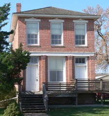 | Fontanelle Bank | 2.1 miles | 1969 |
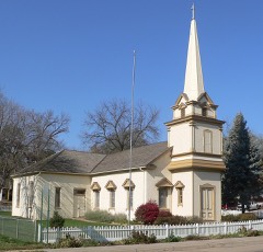 | Presbyterian Church | 2.1 miles | 1970 |
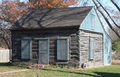 | Old Log Cabin | 2.2 miles | 1970 |
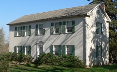 | William Hamilton House | 2.3 miles | 1969 |
| National Archives record | The nomination case file for reference 78001711 in Record Group 79. |
| Sarpy County | All 15 listed properties in this county. |