BlockBefore
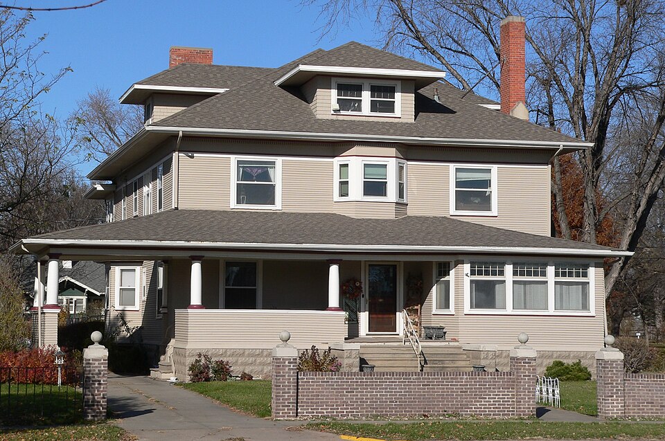
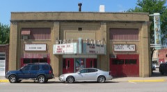
Photograph of Heber Hord House
Photograph by Ammodramus, Public domain. Via Wikimedia Commons.

Heber Hord House

Built in 1906. Listed on the National Register of Historic Places in 1987.

From the record

“The Heber Hord House is a two-story frame house in Central City, Nebraska. It was designed by Omaha architects Fisher & Lawrie, and built in 1906 by Heber Hord, the only son of Thomas Benton Hord, a prominent business man and cattle rancher in Nebraska during the late 19th and early 20th centuries.”

Wikipedia article Heber Hord House, CC BY-SA 4.0.

One of 8 National Register listings published here for Merrick County · listed in 1987 · category: Building · built in 1906, by Mendelssohn, Fisher and Lawrie.

Sources: the Wikipedia article · the case file at the National Archives · the National Register database, National Park Service
The listing

  • What is counted as historic. The nomination lists 2 buildingss as contributing to the listing.
  • Listed as. Hord, Heber, House - the National Register files a house under its owner's surname.
  • Address. 1505 Sixteenth St., Central City, 68826
  • When was it listed? December 1987
  • Category. building
  • Township. Lone Tree township
  • When was it built? 1906
  • Architect. Mendelssohn, Fisher and Lawrie
  • National Register reference number. 87002096 - the number the National Park Service assigned this property when it was listed, and the key its nomination file is catalogued under at the National Archives.

Fires near this property

14 since 2008

Regional context, not property-specific evidence. The federal wildfire occurrence database lists 14 fires within 5 miles of Heber Hord House between 2008 and 2017, burning about 68 acres in total. 2 started naturally. 2 were recorded as arson. Distance is straight-line from the map coordinates, so a fire counted here may appear on a neighbouring settlement's page as well.

Reported cause Fires
Debris and open burning6
Natural2
Equipment and vehicle use2
Arson/incendiarism2
Fireworks1
Railroad operations and maintenance1

The most recent of them, most recent first, with the day each was reported and the service that recorded it.

DateCause SizeReported by Name on the report
23 August 2008Arson/incendiarism1.0 acresNebraska Forest Servicenot named
3 July 2017Arson/incendiarism1.0 acresNebraska Forest Servicenot named
1 July 2017Fireworks1.0 acresNebraska Forest Servicenot named
23 May 2008Natural1.0 acresNebraska Forest Servicenot named
26 March 2014Equipment and vehicle useunder an acreNebraska Forest Servicenot named
19 March 2011Debris and open burning1.0 acresNebraska Forest Servicenot named
12 March 2011Debris and open burning2.0 acresNebraska Forest Servicenot named
11 March 2008Debris and open burning1.0 acresNebraska Forest Servicenot named

Every fire recorded in Merrick County

Storms near this property

60 of 74 shown

Regional context, not property-specific evidence. The National Weather Service names Central City, the town this property stands in, in 74 storm reports between 1994 and 2025: 43 hail, 19 thunderstorm wind, 5 heavy rain, 4 tornado. No death or injury is recorded in these reports. Each account below is quoted exactly as the forecast office filed it, from the NOAA Storm Events Database, and each date opens the federal record of that event.

WhenEvent Place namedHarm What the report says
May 2025HailCentral City$1,000,000no account filed
April 1994Tornado (F1)Central City$500,000A tornado touched down near the Platte River three miles south of Central City and then moved north to the east edge of town where it lifted back into the clouds. Outbuildings were damaged and tree tops were twisted off at three separate farms. The tornado blew the roof off of an auto body shop on the east edge of town.
May 2005Thunderstorm WindCentral City$500,000no account filed
June 2023Tornado (EF0)Central City$400,000A tornado touched down in rural portions of Merrick County a few miles northwest of Central City, with a maximum estimated wind speed of 80 MPH along a 4-mile path. The most noteworthy damage occurred at a large cattle company feedlot, where a large portion of a roof was blown off of a confinement barn, several outdoor pens and livestock shades were destroyed, and a few head of cattle were injured and had to be euthanized. In addition, several irrigation pivots were overturned. Some tree damage was also noted along the path of the tornado. At one farmstead, the home suffered gutter damage and an unoccupied tractor parked nearby had its windows blown out. There was also some hail damage to crops in roughly a 2x2 mile area.
October 2001Tornado (F2)Central City$300,000Tornado crossed from Merrick County into Nance County.
August 2007HailCentral City$250,000Hail ranged in size from 1.75 to 2.75 inches in diameter.
July 2004Thunderstorm WindCentral City$250,000no account filed
May 2002HailCentral City$250,000no account filed
May 2002HailCentral City$150,000no account filed
August 2011Thunderstorm WindCentral City$100,000Wind gusts estimated at 70 MPH resulted in tree damage in Central City as well as in the Willow Bend Lake area. The main tree damage occurred in the Willow Bend Lake area, where large tree limbs were knocked down and a 90 foot tree was uprooted, clipping the corner of the roof of a nearby home. Boats were also pulled loose from structures on the shore.
May 2000LightningCentral City$100,000no account filed
August 1998Thunderstorm WindCentral City$75,000no account filed
June 2003HailCentral City$50,000no account filed
May 1998HailCentral City$45,000no account filed
June 2024Thunderstorm WindCentral City$25,000A wind gust of 65 MPH was measured by a mesonet station located two miles south-southeast of Central City. Tree damage was reported in Central City, including a few larger downed branches.
July 2023Thunderstorm WindCentral City$25,000Tree damage was reported in the area, including downed limbs which damaged a home, and a power pole was also damaged.
September 2018Thunderstorm WindCentral City$25,000Tree limbs were downed in the area.
May 2018Thunderstorm WindCentral City$25,000Wind gusts estimated to be near 65 MPH resulted in tree damage in Central City.
July 2015Thunderstorm WindCentral City$25,000Wind gusts estimated near 60 MPH knocked down tree limbs up to 5 inches in diameter.
May 2005HailCentral City$25,000no account filed
May 2000Thunderstorm WindCentral City$25,000no account filed
May 2001HailCentral City$20,000no account filed
May 1998HailCentral City$20,000no account filed
August 1996LightningCentral City$12,000no account filed
August 2018Thunderstorm WindCentral City$10,000Wind gusts estimated to be near 60 MPH knocked down a few tree limbs in town.
June 2015Thunderstorm WindCentral City$10,000Wind gusts estimated to be near 65 MPH resulted in some tree damage in Central City, with power line and pole damage also reported.
July 2008Thunderstorm WindCentral City$10,000Winds knocked down large tree limbs and caused power outages across town.
June 2008HailCentral City$10,000no account filed
May 2007Flash FloodCentral City$10,000no account filed
May 2001HailCentral City$10,000no account filed
December 2021Thunderstorm WindCentral City-A wind gust of 58 MPH was measured by a mesonet station located four miles north of Central City.
August 2017Heavy RainCentral City-A 24-hour precipitation amount of 3.03 inches was recorded 2 miles northeast of Central City.
August 2017Heavy RainCentral City-A 24-hour precipitation amount of 3.03 inches was recorded 1 mile north-northeast of Central City.
June 2015HailCentral City-Quarter size hail occurred 2 miles southwest of Central City on Highway 30.
July 2014HailCentral City-Ground was almost completely covered by nickel size hail.
May 2013Heavy RainCentral City-A storm total rainfall of 3.03 inches was reported by a Nebraska Rainfall Assessment and Information Network Observer.
October 2013HailCentral City-Nickel size hail was ongoing at the time of the report.
October 2013HailCentral City-This report of nickel size hail was received via Facebook.
October 2013HailCentral City-This report of quarter size hail was received via an NERAIN (Nebraska Rainfall Assessment and Information Network) observer.
June 2011Thunderstorm WindCentral City-Wind gusts were estimated at 60 MPH.
July 2011Heavy RainCentral City-Total rainfall over the past 24 hours of 3.64 inches was reported by a Nebraska Rainfall Assessment and Information Network observer.
May 2001Tornado (F0)Central City-Brief touchdown with no damage.
April 2025HailCentral City-no account filed
June 2022HailCentral City-no account filed
August 2020HailCentral City-no account filed
June 2020Thunderstorm WindCentral City-no account filed
August 2018HailCentral City-no account filed
June 2015HailCentral City-no account filed
June 2014HailCentral City-no account filed
April 2013HailCentral City-no account filed
May 2013HailCentral City-no account filed
June 2010HailCentral City-no account filed
April 2007Heavy RainCentral City-no account filed
August 2007HailCentral City-no account filed
April 2006HailCentral City-no account filed
April 2006Thunderstorm WindCentral City-no account filed
April 2006HailCentral City-no account filed

Every storm recorded in Merrick County

Map coverage status

No historic map-sheet match is published for this property yet. That does not mean no map exists. This record needs a coordinate-quality review before it can be joined to a sheet boundary. Browse the county's mapped places while that work is pending.

Listed places nearby

5 within 8 miles

Other National Register properties close enough to walk or drive between, ordered by distance from this one. Both positions come from the same geocoding pass that matched these properties to their map sheets.

Photograph PropertyDistance Listed
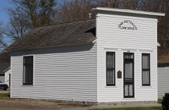
Patterson Law Office0.6 miles1979
Martha Ellen Auditorium0.7 miles1988
Riverside Park Dance Pavillion1.7 miles1998
Wright Morris Boyhood House2.0 miles1980
Nelson Farm5.3 miles2009

Sources for this property

National Archives recordThe nomination case file for reference 87002096 in Record Group 79.
Wikipedia articleCommunity-written account of this property, licensed CC BY-SA.
Merrick CountyAll 8 listed properties in this county.

Provenance

  • Listing record. National Park Service National Register of Historic Places, listed-properties dataset, current to 2026-05-22.
  • Map join. Address geocoded through the United States Census geocoder, then tested against the published boundary of every sheet in the USGS Historical Topographic Map Collection.
  • How this page is made. Listing fields come from federal records; map-sheet coverage is a labelled coordinate-to-boundary calculation, not a source-field claim.
  • Wildfire. Short, Karen C. 2022. Spatial wildfire occurrence data for the United States, 1992-2020 [FPA_FOD_20221014]. 6th Edition. Fort Collins, CO: Forest Service Research Data Archive. https://doi.org/10.2737/RDS-2013-0009.6 Collected with United States Government funding and usable without additional permissions or fees.
  • Storms. NOAA National Centers for Environmental Information, Storm Events Database https://www.ncei.noaa.gov/stormevents/ A work of the United States government, no copyright under 17 U.S.C. 105. Narratives are quoted verbatim from the National Weather Service report and are not edited or summarised.