 Block
From the record
One of 20 National Register listings published here for Platte County · listed in 1990 · category: District.
Sources: the case file at the National Archives · the National Register database, National Park Service
Listed on the National Register of Historic Places in 1990.
One of 20 National Register listings published here for Platte County · listed in 1990 · category: District.
Sources: the case file at the National Archives · the National Register database, National Park Service
Regional context, not property-specific evidence. The National Weather Service names Tarnov, the town this property stands in, in 14 storm reports between 1995 and 2025: 7 hail, 6 thunderstorm wind, 1 tornado. No death or injury is recorded in these reports. Each account below is quoted exactly as the forecast office filed it, from the NOAA Storm Events Database, and each date opens the federal record of that event.
| When | Event | Place named | Harm | What the report says |
|---|---|---|---|---|
| May 2025 | Thunderstorm Wind | Tarnov | - | Emergency management report of a semi truck blow over east of Tarnov. |
| May 2024 | Tornado (EF1) | Tarnov | - | This tornado developed about 3 miles east of Tarnov, knocking over center pivots and grain storage bins as it crossed agricultural fields. The tornado continued moving east across Platte County, damaging the outbuildings of a goat farm, and producing high-end EF-0 damage. The tornado moved east to damage the farmhouse, outbuildings and trees of another goat farm, producing EF-1 damage. The tornado then moved slightly north of east tracking into Colfax County. Peak winds during this segment of the tornado track were estimated to be 100 miles per hour. The maximum path width for this segment was measured to be 700 yards, with an average width estimated at 200 yards. |
| July 2023 | Thunderstorm Wind | Tarnov | - | Public reported an estimated 60 mph wind gusts. |
| July 2023 | Hail | Tarnov | - | Public reported via social media 2.5-inch hail. |
| July 2023 | Hail | Tarnov | - | Public reported hail lasting approximately 20 to 25 minutes. First started as pea size and got progressively larger. The largest stones were baseball sized. It destroyed crops and gardens. There were numerous downed branches. |
| May 2023 | Thunderstorm Wind | Tarnov | - | A public personal weather station recorded a peak wind gust of 59 mph. |
| June 2018 | Thunderstorm Wind | Tarnov | - | Power lines were blown down near Tarnov. |
| June 2015 | Thunderstorm Wind | Tarnov | - | A microburst caused a camper being pulled by a pickup truck to be blown over on Highway 81. Other damage included tree limbs down in Tarnov, a grain bin was blown off the foundation, and several center irrigation center pivots were blown over. |
| May 2011 | Thunderstorm Wind | Tarnov | - | Thunderstorm wind gusts estimated at over 70 mph damaged or destroyed farm outbuildings and overturned numerous center pivots near Tarnov. Trees were toppled in the area as well. |
| April 2017 | Hail | Tarnov | - | no account filed |
| May 2012 | Hail | Tarnov | - | no account filed |
| May 2012 | Hail | Tarnov | - | no account filed |
| August 2007 | Hail | Tarnov | - | no account filed |
| March 1995 | Hail | Tarnov | - | no account filed |
No historic map-sheet match is published for this property yet. That does not mean no map exists. This record needs a coordinate-quality review before it can be joined to a sheet boundary. Browse the county's mapped places while that work is pending.
Other National Register properties close enough to walk or drive between, ordered by distance from this one. Both positions come from the same geocoding pass that matched these properties to their map sheets.
| Photograph | Property | Distance | Listed |
|---|---|---|---|
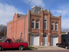 | Humphrey City Hall | 5.2 miles | 1996 |
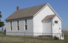 | First Welch Calvinistic Methodist Church and Cemetery | 6.1 miles | 1999 |
| National Archives record | The nomination case file for reference 90001766 in Record Group 79. |
| Platte County | All 20 listed properties in this county. |