 Block
Clayton, New Mexico
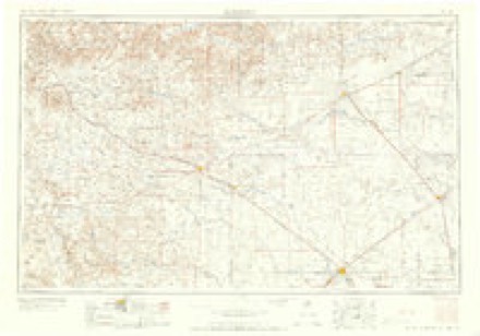
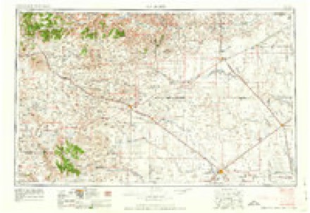
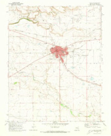
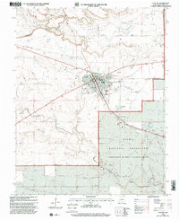
8 topographic sheets cover this place, the earliest surveyed in 1954 and the latest in 1998. It stands in the Clayton South census division. It lies in ZIP code area 88415. The Survey maps it on the Clayton quadrangle. 2,643 people lived here at the 2020 count. It stands 5,056 feet above sea level.
Research this city
On record in Clayton
Buildings and businesses the archive holds for this place. Each opens its own page, with the source record it came from.
On the National Register 7 records
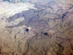 Rabbit EarsNational Historic Landmark · listed 1966
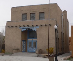 Clayton Public Librarylisted 2002
 Clayton Public Schools Historic Districtlisted 1996
 Eklund Hotellisted 2002
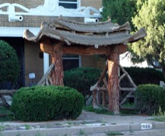 Gate, Fence and Hollow Tree Shelter Designed by Dionicio Rodriguezlisted 2008
 Luna Theaterlisted 2007
 Union County Courthouselisted 1987
Population over time
2 figuresClayton fell from 2,980 to 2,643 between 2010 and 2020. These are the recorded population figures Wikidata holds for this place, reached through the Geographic Names Information System number this page is keyed on rather than by name, so they belong to this place and not to another of the same name. Most are census counts, but not all are: an early figure may be a founding or settlement estimate, and an estimate published within five years of a census is left out. The change column is computed, and is left blank where more than 20 years separate a figure from the one before it, because a gap that long is not a change between two counts.
| Year | People | Change |
|---|---|---|
| 2010 | 2,980 | |
| 2020 | 2,643 | -337 (-11%) |
Topographic sheets covering this place
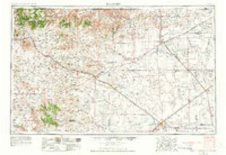
6 surveys from 8 printed sheetsMatched by testing this settlement's coordinate against the published boundary of every sheet in the United States Geological Survey's historical collection. Each opens the scanned sheet at the Survey.
- 1954 USGS Dalhart quadrangle1:250000, 2 printings
- 1958 USGS Dalhart quadrangle1:250000, 2 printings
- 1962 USGS Dalhart quadrangle1:250000
- 1970 USGS Clayton quadrangle1:24000
- 1982 USGS Clayton quadrangle1:100000
- 1998 USGS Clayton quadrangle1:24000
Photographs
1 photograph, 1931Taken for the Office of War Information and the Farm Security Administration, who photographed the country between 1935 and 1944. Works of United States government photographers, with no known restriction on use. Each opens its catalogue record.
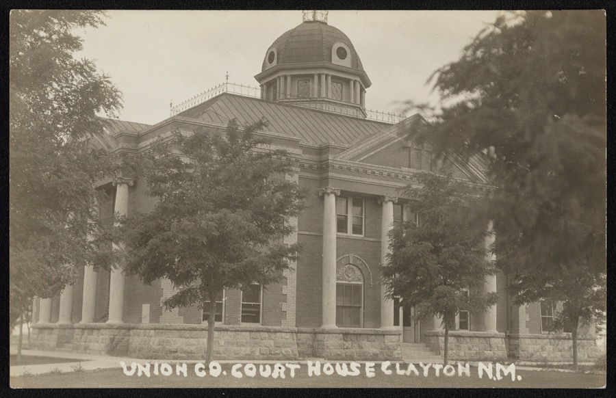
Photographer not recorded, 1931. Library of Congress
Fires near this place
18 since 1997Regional context, not property-specific evidence. The federal wildfire occurrence database lists 18 fires within 5 miles of Clayton between 1997 and 2020, burning about 24,758 acres in total. 2 started naturally. None was recorded as arson. Distance is straight-line from the map coordinates, so a fire counted here may appear on a neighbouring settlement's page as well.
| Reported cause | Fires |
|---|---|
| Equipment and vehicle use | 8 |
| Missing data/not specified/undetermined | 3 |
| Natural | 2 |
| Power generation/transmission/distribution | 2 |
| Fireworks | 1 |
| Debris and open burning | 1 |
| Smoking | 1 |
The most recent of them, most recent first, with the day each was reported and the service that recorded it.
| Date | Cause | Size | Reported by | Name on the report |
|---|---|---|---|---|
| 27 August 2010 | Equipment and vehicle use | 3.7 acres | Cibola National Forest | K-38 |
| 6 July 2017 | Fireworks | under an acre | Cimarron District | PODZEMNY |
| 4 July 2008 | Natural | 8.5 acres | Cibola National Forest | BIRTHDAY |
| 3 July 2019 | Equipment and vehicle use | 1.0 acres | Cimarron District | 20-20020018X |
| 28 July 2015 | Natural | 5.0 acres | New Mexico State Forestry Division | BELL |
| 21 July 2009 | Power generation/transmission/distribution | under an acre | Cibola National Forest | CLAYTON |
| 4 May 2020 | Equipment and vehicle use | 1.0 acres | Cimarron District | ROCKLEDGE |
| 21 May 2014 | Equipment and vehicle use | under an acre | Cibola National Forest | KITTS |
Settlements close enough to share some of these fires:
Mines and quarries near this place
10 of 12 shownRegional context, not property-specific evidence. The federal mineral resources record lists 12 workings within 5 miles of Clayton: 10 unknowns, 1 past producer, 1 producer. 1 still produces. What was taken out: Sand and Gravel, Construction. Distance is straight-line from the map coordinates, so a quarry counted here may appear on a neighbouring settlement's page as well.
| Where | Site | Commodity | Status | Recorded |
|---|---|---|---|---|
| Materials Pit | Sand and Gravel, Construction | Unknown | ||
| Materials Pit | Sand and Gravel, Construction | Past Producer | ||
| Materials Pit | Sand and Gravel, Construction | Unknown | ||
| Materials Pit | Sand and Gravel, Construction | Unknown | ||
| Materials Pit | Sand and Gravel, Construction | Unknown | ||
| Materials Pit | Sand and Gravel, Construction | Unknown | ||
| Materials Pit | Sand and Gravel, Construction | Unknown | ||
| Materials Pit | Sand and Gravel, Construction | Producer | ||
| Materials Pit | Sand and Gravel, Construction | Unknown | ||
| Pit #60 30 F | Sand and Gravel, Construction | Unknown |
Storms near this place
60 of 90 shownRegional context, not property-specific evidence. The National Weather Service names Clayton in 90 storm reports between 1993 and 2025: 67 hail, 13 thunderstorm wind, 6 flash flood, 3 funnel cloud. No death or injury is recorded in these reports. Each account below is quoted exactly as the forecast office filed it, from the NOAA Storm Events Database, and each date opens the federal record of that event.
| When | Event | Place named | Harm | What the report says |
|---|---|---|---|---|
| August 2023 | Thunderstorm Wind | Clayton | $30,000 | The Southwestern Electric Cooperative reported severe winds having knocked down six power poles along State Highway 56 between mile markers 13 and 14 southwest of Clayton. Power was lost for a few hours. Damage is an estimate. |
| August 2011 | Thunderstorm Wind | Clayton | $20,000 | Law enforcement official reported a roof blown off a home on the southwest side of Clayton. Numerous fences were also blown down in this area. |
| May 1996 | Flash Flood | Clayton | $20,000 | no account filed |
| August 2024 | Thunderstorm Wind | Clayton | $10,000 | Large live tree snapped and damaged utility power lines at 2nd and Main Street in Clayton, NM. |
| August 2007 | Hail | Clayton | $10,000 | The general public and law enforcement officials reported car windshields broken by golf ball-sized hail along Highway 56. A garden and greenhouse were damaged at a nursery and several homes suffered broken windows and skylights. The hail dented kitchen appliances inside one home as it fell through the skylight. |
| September 2024 | Thunderstorm Wind | Clayton | $5,000 | Severe wind gusts from a storm heading directly toward Texline, TX blew through Clayton, NM, knocking out power for to an estimated 15 hours. Three power poles were reported down by the Southwestern Electric Cooperative. |
| May 2024 | Hail | Clayton | $5,000 | Storm spotters reported quarter to golf ball size hail along U.S. Highway 56 near the Otto Cemetery southwest of Clayton. |
| May 2024 | Thunderstorm Wind | Clayton | $5,000 | Powerlines down along U.S. Highway 56 near Otto Cemetery southwest of Clayton from damaging thunderstorm wind gusts. |
| July 2010 | Flash Flood | Clayton | $4,000 | State Route 370 was impassable due to water covering much of the road between Clayton and Clayton Lake State Park, as several creeks overflowed their banks. Several motorists were stranded. |
| August 2007 | Hail | Clayton | $4,000 | Large hail damaged several vehicles at Clayton Lake State Park and cracked a window at the visitor center. |
| August 2015 | Thunderstorm Wind | Clayton | $3,000 | Fire chief reported a 68 mph wind gust at the fire station. This wind blew down 2 trees in a nearby alley as well as the personal weather station on site. |
| September 2025 | Hail | Clayton | - | Ping pong to golf ball size hail was observed from a severe thunderstorm along U.S. Highway 64 and 87 on the northwest outskirts of Clayton. |
| September 2025 | Hail | Clayton | - | A trained spotter between downtown Clayton and Clayton Municipal Airport observed half dollar size hail from a severe thunderstorm moving through the town. |
| May 2024 | Hail | Clayton | - | A severe thunderstorm produced penny to quarter sized hail in Clayton. |
| May 2024 | Hail | Clayton | - | Local law enforcement reported penny to quarter size hail a few miles north of downtown Clayton. |
| May 2024 | Hail | Clayton | - | A trained spotter in Clayton reported penny to quarter size hail at her residence. |
| May 2024 | Hail | Clayton | - | A trained spotter at the local radio station on the south side of town reported ping pong ball size hail. |
| June 2023 | Hail | Clayton | - | Spotter Network report of half dollar size hail on the northern outskirts of Clayton from second supercell. |
| June 2023 | Hail | Clayton | - | Trained spotter and local fire and rescue reported penny to nickel size hail in downtown Clayton from second supercell. |
| July 2023 | Hail | Clayton | - | Quarter sized hail fell in Clayton as a supercell moved southeast into the Texas and Oklahoma panhandles. |
| August 2023 | Hail | Clayton | - | Hail between penny to half dollar size diameter fell in the area. |
| June 2023 | Hail | Clayton | - | A supercell moving east dropped quarter sized hail in Clayton. |
| May 2022 | Hail | Clayton | - | A member of the public near Clayton estimated quarter size hail from a severe thunderstorm. |
| April 2022 | Thunderstorm Wind | Clayton | - | A trained spotter near Clayton estimated wind gusts of 60 mph with a severe thunderstorm. These winds dropped visibility briefly down to one quarter mile with blowing dust. |
| May 2019 | Hail | Clayton | - | Nickel size hail reported one mile west of Clayton. |
| May 2019 | Hail | Clayton | - | Giant hail was reported by several storm chasers as a tornadic supercell tracked northeast through the area along U.S. 56 southwest of Clayton. |
| June 2019 | Hail | Clayton | - | Penny size hail in Clayton. |
| June 2019 | Hail | Clayton | - | Hail up to the size of quarters in Clayton. |
| June 2019 | Hail | Clayton | - | Nickel to quarter size hail reported in Clayton. |
| June 2019 | Hail | Clayton | - | Nickel to quarter size hail reported in Clayton. |
| June 2018 | Thunderstorm Wind | Clayton | - | The Clayton airport reported a peak wind gust up to 64 mph. Wind damage was reported to roofs of outbuildings in Clayton. A large tree was toppled on the 200 block of Monroe. |
| August 2017 | Funnel Cloud | Clayton | - | Several folks spotted a dramatic funnel cloud with a highly sinuous shape northwest of Clayton, NM near U.S. Highway 87. Observers never witnessed the funnel touch down. |
| May 2017 | Thunderstorm Wind | Clayton | - | Outflow winds on the front side of an approaching thunderstorms downed several small tree limbs around Clayton. Pea size hail accumulated four inches deep. |
| April 2016 | Hail | Clayton | - | Penny size hail just to the northeast of Clayton. |
| August 2016 | Flash Flood | Clayton | - | Highway 56 flooded between 4th and 6th streets. One to two feet of water over the roadway in low spots. Road impassable. |
| August 2016 | Flash Flood | Clayton | - | Fairgrounds flooded. |
| September 2016 | Hail | Clayton | - | Penny size hail. |
| July 2013 | Funnel Cloud | Clayton | - | The Clayton Police Dept. relayed reports of a funnel cloud associated with a severe thunderstorm storm in the area. A large funnel cloud was accompanied by several smaller funnel clouds. Rotation was not observed or evident on radar. |
| June 2013 | Funnel Cloud | Clayton | - | Clayton police department relayed public report of possible funnel cloud south of Mount Dora near highways 67 and 84. |
| August 2009 | Hail | Clayton | - | KVII-TV in Amarillo relayed a view report of penny size hail. |
| July 2007 | Hail | Clayton | - | Most of the hail was 1.25 inches in diameter with a few stones ranging between 2.50 and 3 inches. |
| August 2006 | Flash Flood | Clayton | - | Rural roads reported flooded and unpassable around the Agricultural Research Station east of Clayton. |
| June 2004 | Thunderstorm Wind | Clayton | - | A tree was blown over onto a house. |
| August 1995 | Thunderstorm Wind | Clayton | - | Clayton Police Department reported winds estimated at 65 MPH northwest of Clayton. No reported damage occurred with these high winds. |
| August 1995 | Thunderstorm Wind | Clayton | - | Clayton Police Department reported winds estimated at 65 MPH northwest of Clayton. No reported damage with these high winds. |
| July 1994 | Hail | Clayton | - | Golf ball-size hail at Mt. Dora was reported by Clayton Police. |
| July 1994 | Hail | Clayton | - | A severe thunderstorm over Union County produced strong winds and hail up to golf ball-size. The 52 knot winds was from the Clayton SAO. A local spotter reported the hail in Sedan with KLMX radio station providing the other reports. |
| July 1994 | Hail | Clayton | - | A severe thunderstorm over Union County produced strong winds and hail up to golf ball-size. The 52 knot winds was from the Clayton SAO. A local spotter reported the hail in Sedan with KLMX radio station providing the other reports. |
| July 1994 | Thunderstorm Wind | Clayton | - | A severe thunderstorm over Union County produced strong winds and hail up to golf ball-size. The 52 knot winds was from the Clayton SAO. A local spotter reported the hail in Sedan with KLMX radio station providing the other reports. |
| June 1994 | Hail | Clayton | - | Dime-size hail reported west of Pasamonte by a storm spotter. |
| August 1993 | Hail | Clayton | - | Golfball-size hail was reported by the Clayton Police Department. |
| August 2013 | Hail | Clayton | - | no account filed |
| April 2012 | Hail | Clayton | - | no account filed |
| April 2010 | Hail | Clayton | - | no account filed |
| May 2010 | Hail | Clayton | - | no account filed |
| May 2010 | Hail | Clayton | - | no account filed |
| May 2010 | Hail | Clayton | - | no account filed |
| May 2010 | Hail | Clayton | - | no account filed |
| May 2010 | Hail | Clayton | - | no account filed |
| May 2010 | Hail | Clayton | - | no account filed |
Newspapers printed here
3,806 digitised pages3 papers published in this town, digitised by the Library of Congress and free to read: 476 issues, 3,806 pages. Every page is searchable, so a name or a street can be looked for directly in what the town printed about itself at the time.
| Newspaper | Published |
|---|---|
| Clayton Enterprise | 1888 to 1906 |
| The Clayton Citizen | 1906 to 19?? |
| The Clayton News | 19?? to 1954 |
What the paper printed
21,785 wordsFront pages of the local paper, read from the Library of Congress scans: 14 issues spread across its run from 1905 to 1922, 21,785 words in total. Each is reproduced on its own page, exactly as the recogniser returned it.
These pages read less well than anything else here, and the number is worth stating: about three words in four come through cleanly, against nine in ten for the building records. An 1896 broadsheet sets eight-point type in seven columns on microfilm, which is the hardest thing in this archive to read by machine. We tested our own recognisers against the Library's and they were not better, so the Library's text is what appears, with the wholly unreadable columns removed. Read it as a guide to what the paper covered, and follow the link to the scan before quoting anything.
| Issue | Paper | Length |
|---|---|---|
| 1906-10-05 | The Clayton Citizen | 742 words |
| 1906-11-02 | The Clayton Citizen | 1,617 words |
| 1906-11-23 | The Clayton Citizen | 489 words |
| 1906-12-28 | The Clayton Citizen | 1,752 words |
| 1915-02-27 | The Clayton News | 2,736 words |
| 1915-05-15 | The Clayton News | 3,321 words |
| 1915-08-14 | The Clayton News | 3,475 words |
| 1915-10-30 | The Clayton News | 2,755 words |
| 1922-12-15 | The Clayton News | 447 words |
| 1905-03-03 | Clayton Enterprise | 116 words |
| 1905-05-05 | Clayton Enterprise | 1,772 words |
| 1905-07-14 | Clayton Enterprise | 291 words |
| 1905-09-15 | Clayton Enterprise | 274 words |
| 1905-11-24 | Clayton Enterprise | 1,998 words |
Nearest settlements
The eight closest, with where each one stands in the county. Distances are straight-line, computed from the Geographic Names Information System coordinates.
| Map | Place | Distance | Sheets |
|---|---|---|---|
| Royce | 7.3 miles | 9 | |
| Bates | 10.8 miles | 8 | |
| Seneca | 12.6 miles | 9 | |
| Tate (historical) | 15.3 miles | 7 | |
| Thomas | 15.3 miles | 7 | |
| Mount Dora | 16.8 miles | 8 | |
| Old Moses | 17.0 miles | 9 | |
| McNees Crossing | 17.8 miles | 9 |
Elsewhere
Matched on this settlement's Geographic Names Information System number rather than its name, so it cannot be a different place of the same name in another state.
| Wikipedia article on Clayton | An encyclopaedic summary. Its text is share-alike, so it is linked here rather than copied. |
| Wikidata item Q1020722 | The structured record the population and elevation above come from. Public domain (CC0). |
Provenance
This settlement is recorded in the Geographic Names Information System as feature 905193. The sheet list is computed by point-in-boundary test against the United States Geological Survey's historical topographic inventory. Both are works of the United States government and carry no copyright under 17 U.S.C. 105.
Wildfire. Short, Karen C. 2022. Spatial wildfire occurrence data for the United States, 1992-2020 [FPA_FOD_20221014]. 6th Edition. Fort Collins, CO: Forest Service Research Data Archive. https://doi.org/10.2737/RDS-2013-0009.6 Collected with United States Government funding and usable without additional permissions or fees.
Mines and quarries. USGS Mineral Resources Data System (MRDS) https://mrdata.usgs.gov/mrds/ A work of the United States government, no copyright under 17 U.S.C. 105.
Storms. NOAA National Centers for Environmental Information, Storm Events Database https://www.ncei.noaa.gov/stormevents/ A work of the United States government, no copyright under 17 U.S.C. 105. Narratives are quoted verbatim from the National Weather Service report and are not edited or summarised.