 Block
Farmington, New Mexico
18 topographic sheets cover this place, the earliest surveyed in 1889 and the latest in 1980. It stands in the Farmington census division. It lies in ZIP code area 87401. It stands on Farmington Glade. The Survey maps it on the Farmington South quadrangle. 46,624 people lived here at the 2020 count. It stands 5,394 feet above sea level.
Research this city
On record in Farmington
Buildings and businesses the archive holds for this place. Each opens its own page, with the source record it came from.
On the National Register 1 record
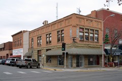
Population over time
2 figuresFarmington grew from 45,877 to 46,624 between 2010 and 2020. These are the recorded population figures Wikidata holds for this place, reached through the Geographic Names Information System number this page is keyed on rather than by name, so they belong to this place and not to another of the same name. Most are census counts, but not all are: an early figure may be a founding or settlement estimate, and an estimate published within five years of a census is left out. The change column is computed, and is left blank where more than 20 years separate a figure from the one before it, because a gap that long is not a change between two counts.
| Year | People | Change |
|---|---|---|
| 2010 | 45,877 | |
| 2020 | 46,624 | +747 (+2%) |
Topographic sheets covering this place
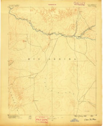
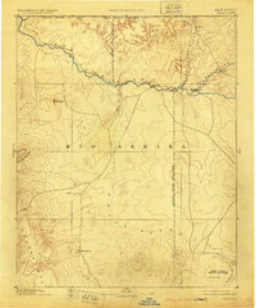
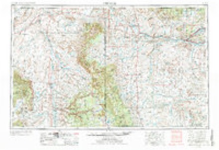
7 surveys from 18 printed sheetsMatched by testing this settlement's coordinate against the published boundary of every sheet in the United States Geological Survey's historical collection. Each opens the scanned sheet at the Survey.
- 1889 USGS Chaco quadrangle1:250000
- 1892 USGS Chaco quadrangle1:250000, 5 printings
- 1954 USGS Shiprock quadrangle1:250000, 5 printings
- 1958 USGS Shiprock quadrangle1:250000
- 1959 USGS Shiprock quadrangle1:250000
- 1965 USGS Farmington South quadrangle1:24000, 3 printings
- 1980 USGS Farmington quadrangle1:100000, 2 printings
Fires near this place
53 since 1994Regional context, not property-specific evidence. The federal wildfire occurrence database lists 53 fires within 5 miles of Farmington between 1994 and 2020, burning about 130 acres in total. 14 started naturally. 4 were recorded as arson. Distance is straight-line from the map coordinates, so a fire counted here may appear on a neighbouring settlement's page as well.
| Reported cause | Fires |
|---|---|
| Debris and open burning | 16 |
| Natural | 14 |
| Missing data/not specified/undetermined | 14 |
| Arson/incendiarism | 4 |
| Fireworks | 2 |
| Equipment and vehicle use | 1 |
| Misuse of fire by a minor | 1 |
| Smoking | 1 |
The most recent of them, most recent first, with the day each was reported and the service that recorded it.
| Date | Cause | Size | Reported by | Name on the report |
|---|---|---|---|---|
| 13 August 2003 | Natural | under an acre | Farmington Field Office | GLADE |
| 9 July 2001 | Natural | under an acre | Farmington Field Office | HOOD |
| 8 July 2017 | Debris and open burning | under an acre | Navajo Region Fire and Aviation Management | UPPER FRUITLAND 8 |
| 7 July 2002 | Natural | under an acre | Farmington Field Office | HEAD CANYO |
| 3 July 2019 | Fireworks | under an acre | Farmington Field Office | FARMINGTON FIREWORKS |
| 3 July 2018 | Missing data/not specified/undetermined | under an acre | Farmington Field Office | FIREWORK 1 |
| 3 July 2014 | Debris and open burning | under an acre | Navajo Region Fire and Aviation Management | UPPER FRUITLAND 2 |
| 3 July 2005 | Fireworks | under an acre | Farmington Field Office | GLADE |
Settlements close enough to share some of these fires:
Mines and quarries near this place
10 of 18 shownRegional context, not property-specific evidence. The federal mineral resources record lists 18 workings within 5 miles of Farmington: 11 unknowns, 6 producers, 1 past producer. 6 still produce. What was taken out: Sand and Gravel, Construction. Distance is straight-line from the map coordinates, so a quarry counted here may appear on a neighbouring settlement's page as well.
| Where | Site | Commodity | Status | Recorded |
|---|---|---|---|---|
| Acora Pit | Sand and Gravel, Construction | Unknown | ||
| Arco Pit | Sand and Gravel, Construction | Unknown | ||
| Bolack No 1 | Sand and Gravel, Construction | Past Producer | ||
| Eaton Pit | Sand and Gravel, Construction | Unknown | ||
| Farmington Sand and Gravel Co. Pit | Sand and Gravel, Construction | Producer | Sedimentary | |
| Hilltop Pit | Sand and Gravel, Construction | Producer | Sedimentary | |
| Materials Pit | Sand and Gravel, Construction | Unknown | ||
| Materials Pit | Sand and Gravel, Construction | Unknown | ||
| Materials Pit | Sand and Gravel, Construction | Unknown | ||
| Materials Pit | Sand and Gravel, Construction | Unknown |
Storms near this place
23 since 1997Regional context, not property-specific evidence. The National Weather Service names Farmington in 23 storm reports between 1997 and 2025: 8 hail, 6 thunderstorm wind, 4 flash flood, 2 lightning. The reports record 1 death and 1 injury. Each account below is quoted exactly as the forecast office filed it, from the NOAA Storm Events Database, and each date opens the federal record of that event.
| When | Event | Place named | Harm | What the report says |
|---|---|---|---|---|
| November 1998 | Heat | Farmington | 1 killed | A 37 year old man was found dead in an open field near Farmington. Overnight low temperature was near 18 degrees. |
| October 2000 | Thunderstorm Wind | Farmington | 1 hurt, $20,000 | no account filed |
| August 2010 | Flash Flood | Farmington | $2,000,000 | Significant flooding plagued the Farmington area during the evening hours of August 1st. More than 2.5 inches of rain fell in 3 hours, but most of the rain fell in about a 30 minute time frame. Some of the hardest hit areas are described in the following paragraphs. ||The Webb Chevrolet-Toyota dealership and neighboring businesses along East Main Street between Gila St. and Hannon Dr. was described as a swamp. Weeds and shrubs were wrapped around the tires of each truck as water, mud and debris flooded into the lot. The force of the water moved one truck about six feet, and moved a nearby dumpster approximately 100 yards. Also in this area, a man whose car got stuck at the intersection of Cliffside Dr. and East Main got trapped in shallow, quick moving water. The man was rescued by firefighters and was unharmed.||Near the intersection of Largo St. and Railroad St., water was estimated to be 6 to 12 inches deep at the height of the event. Water damage was evident to at least two residences. ||An arroyo that crosses Hubbard St. near Peace Valley Road was flowing over the roadway. A high school senior attempted to drive through the waters, when her car was washed away. Her car traveled approximately 80 yards down the arroyo before she was rescued. She was unharmed, but her car was destroyed. After the waters receded, it became evident that Peace Valley Road was partially eroded away beneath the pavement.||Due to a holding pond that overflowed, five homes around the Country Club suffered significant damage, including one basement that was completely filled with water. Most of these homes were filled with no less than 6 inches of water on the ground level, resulting in damage of carpet, tile and other objects or furniture that was on the floor. Landscaping was completely eroded away, and fence lines were downed.||A mudslide was also reported on County Road 3000 at mile marker 9.5. The road was impassible until the mud was cleaned off the road. |
| June 2024 | Thunderstorm Wind | Farmington | $150,000 | A trained spotter measured a 65 mph wind gust. A single wide mobile home was pushed off its blocks with minor damage to the structure. Other wind damage reports include a tree limb falling through a roof, a mangled metal car port, damaged horse sheds, and 15 power poles blown down. Damage is an estimate. |
| June 2024 | Thunderstorm Wind | Farmington | $50,000 | A single wide mobile home was pushed off its blocks with minor damage to the structure. Damage is an estimate. |
| July 2001 | Lightning | Farmington | $30,000 | A water and oil separator tank exploded, sending debris over a large area after being struck by lightning. |
| August 2003 | Lightning | Farmington | $30,000 | no account filed |
| June 2005 | Thunderstorm Wind | Farmington | $15,000 | Dry microburst winds estimated at near 60 MPH blew off part of the roof at the Farmington Police Station. Record wind gusts at the nearby Farmington Airport peaked at only 39 mph. |
| June 2025 | Hail | Farmington | - | A trained spotter in northeast Farmington observed quarter size hail from a severe thunderstorm. |
| August 2023 | Thunderstorm Wind | Farmington | - | Several trees were blown down in Kiwanis Park from a likely microburst. Individual heard a huge crack when trees fell. The microburst also came with a wall of sand and a possible dust devil. |
| June 2018 | Hail | Farmington | - | Nickel size hail in Farmington. |
| June 2018 | Hail | Farmington | - | Nickel size hail near San Juan College in Farmington. |
| September 2017 | Flash Flood | Farmington | - | Flash flooding along U.S. Highway 64 at Browning Street. |
| May 2015 | Thunderstorm Wind | Farmington | - | A total of 4 aspen trees blown over by an estimated 55 mph virga bomb north of Farmington. One tree was 16 feet tall and another was 20 feet tall. |
| June 2015 | Flood | Farmington | - | Animas River rose above bankful during the mid afternoon of the 11th and crested at minor flood stage briefly around 4pm before slowly falling through the overnight. Berg and Animas Parks experienced flooding along the riverwalk and many trails were inundated along the river for several hours. No damage to infrastructure was reported. |
| June 2015 | Hail | Farmington | - | Quarter size hail in Farmington. |
| June 2015 | Hail | Farmington | - | Photo from emergency manager showed ping pong ball size hail. |
| July 2006 | Flash Flood | Farmington | - | A flash flood on Cottonwood Wash overtopped the road, taking out the large culverts on Highway 170. |
| July 1997 | Funnel Cloud | Farmington | - | A brief funnel cloud was reported by sheriff deputies. |
| July 1997 | Flash Flood | Farmington | - | Heavy rain of 1/2 to 3/4 inch in about an hour produced considerable street and road flooding in the area of Farmington, Aztec and Bloomfield, with several homes flooded after mud and debris clogged drainage systems. Arroyos ran strong elsewhere across San Juan County with several areas of mud and rock slides which briefly blocked roads. |
| September 2009 | Hail | Farmington | - | no account filed |
| October 2006 | Hail | Farmington | - | no account filed |
| September 1998 | Hail | Farmington | - | no account filed |
Newspapers printed here
452 digitised pages1 paper published in this town, digitised by the Library of Congress and free to read: 83 issues, 452 pages. Every page is searchable, so a name or a street can be looked for directly in what the town printed about itself at the time.
| Newspaper | Published |
|---|---|
| The San Juan Times | 1891 to 1900 |
What the paper printed
1,096 wordsFront pages of the local paper, read from the Library of Congress scans: 1 issue from 1895, 1,096 words in total. Each is reproduced on its own page, exactly as the recogniser returned it.
These pages read less well than anything else here, and the number is worth stating: about three words in four come through cleanly, against nine in ten for the building records. An 1896 broadsheet sets eight-point type in seven columns on microfilm, which is the hardest thing in this archive to read by machine. We tested our own recognisers against the Library's and they were not better, so the Library's text is what appears, with the wholly unreadable columns removed. Read it as a guide to what the paper covered, and follow the link to the scan before quoting anything.
| Issue | Paper | Length |
|---|---|---|
| 1895-08-16 | The San Juan Times | 1,096 words |
Nearest settlements
The eight closest, with where each one stands in the county. Distances are straight-line, computed from the Geographic Names Information System coordinates.
| Map | Place | Distance | Sheets |
|---|---|---|---|
| Totah Vista | 1.5 miles | 18 | |
| Upper Fruitland | 5.1 miles | 20 | |
| Crouch Mesa | 7.3 miles | 17 | |
| Kirtland | 7.5 miles | 20 | |
| Ojo Amarillo | 8.3 miles | 20 | |
| Flora Vista | 8.6 miles | 19 | |
| Fruitland | 9.4 miles | 21 | |
| Lee Acres | 9.9 miles | 17 |
Elsewhere
Matched on this settlement's Geographic Names Information System number rather than its name, so it cannot be a different place of the same name in another state.
| Wikipedia article on Farmington | An encyclopaedic summary. Its text is share-alike, so it is linked here rather than copied. |
| Wikidata item Q1012695 | The structured record the population and elevation above come from. Public domain (CC0). |
Provenance
This settlement is recorded in the Geographic Names Information System as feature 902246. The sheet list is computed by point-in-boundary test against the United States Geological Survey's historical topographic inventory. Both are works of the United States government and carry no copyright under 17 U.S.C. 105.
Wildfire. Short, Karen C. 2022. Spatial wildfire occurrence data for the United States, 1992-2020 [FPA_FOD_20221014]. 6th Edition. Fort Collins, CO: Forest Service Research Data Archive. https://doi.org/10.2737/RDS-2013-0009.6 Collected with United States Government funding and usable without additional permissions or fees.
Mines and quarries. USGS Mineral Resources Data System (MRDS) https://mrdata.usgs.gov/mrds/ A work of the United States government, no copyright under 17 U.S.C. 105.
Storms. NOAA National Centers for Environmental Information, Storm Events Database https://www.ncei.noaa.gov/stormevents/ A work of the United States government, no copyright under 17 U.S.C. 105. Narratives are quoted verbatim from the National Weather Service report and are not edited or summarised.