 Block
Idlewild, New Mexico
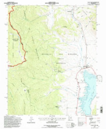
11 topographic sheets cover this place, the earliest surveyed in 1954 and the latest in 1995. It stands in the Cimarron census division. It lies in ZIP code area 87718. It stands on Probar Creek. The Survey maps it on the Eagle Nest quadrangle.
Topographic sheets covering this place
5 surveys from 11 printed sheetsMatched by testing this settlement's coordinate against the published boundary of every sheet in the United States Geological Survey's historical collection. Each opens the scanned sheet at the Survey.
- 1954 USGS Raton quadrangle1:250000, 3 printings
- 1958 USGS Raton quadrangle1:250000, 3 printings
- 1963 USGS Eagle Nest quadrangle1:24000, 3 printings
- 1982 USGS Wheeler Peak quadrangle1:100000
- 1995 USGS Eagle Nest quadrangle1:24000
Fires near this place
39 since 1993Regional context, not property-specific evidence. The federal wildfire occurrence database lists 39 fires within 5 miles of Idlewild between 1993 and 2020, burning about 60 acres in total. 26 started naturally. None was recorded as arson. Distance is straight-line from the map coordinates, so a fire counted here may appear on a neighbouring settlement's page as well.
| Reported cause | Fires |
|---|---|
| Natural | 26 |
| Missing data/not specified/undetermined | 6 |
| Debris and open burning | 3 |
| Equipment and vehicle use | 2 |
| Fireworks | 1 |
| Recreation and ceremony | 1 |
The most recent of them, most recent first, with the day each was reported and the service that recorded it.
| Date | Cause | Size | Reported by | Name on the report |
|---|---|---|---|---|
| 7 September 1993 | Missing data/not specified/undetermined | under an acre | New Mexico State Forestry Division | GORMAN |
| 13 September 2019 | Natural | under an acre | Cimarron District | 20-20480249X |
| 26 August 2010 | Natural | under an acre | Cimarron District | TOLBY |
| 22 August 1994 | Missing data/not specified/undetermined | under an acre | New Mexico State Forestry Division | GORMAN |
| 16 August 2020 | Natural | under an acre | Cimarron District | CABIN TOP |
| 3 July 2002 | Natural | under an acre | New Mexico State Forestry Division | LAKE VIEW |
| 3 July 2002 | Natural | under an acre | Northern Pueblos Agency | LAKEVIEW |
| 29 July 2015 | Natural | under an acre | New Mexico State Forestry Division | MORENO |
Settlements close enough to share some of these fires:
Mines and quarries near this place
10 of 11 shownRegional context, not property-specific evidence. The federal mineral resources record lists 11 workings within 5 miles of Idlewild: 7 unknowns, 3 past producers, 1 occurrence. None of them still produces. What was taken out: Gold, Sand and Gravel, Construction, Iron, Silver, Copper, Gold. Distance is straight-line from the map coordinates, so a quarry counted here may appear on a neighbouring settlement's page as well.
| Where | Site | Commodity | Status | Recorded |
|---|---|---|---|---|
| Iron Mountains Prospects | Gold, Copper, Iron | Past Producer | Contact Metasomatic | |
| Klondike Mine | Silver, Copper, Gold | Occurrence | Gold, Malachite | |
| Pay Ore | Copper, Gold | Unknown | ||
| Iron Mountain Prospect | Gold, Iron | Past Producer | ||
| Materials Pit | Sand and Gravel, Construction | Unknown | ||
| Materials Pit | Sand and Gravel, Construction | Unknown | ||
| Confidence | Gold | Unknown | ||
| Denver | Gold | Unknown | ||
| Elizabeth-Baldy | Gold | Past Producer | 1866 | |
| Klondike Mine | Gold | Unknown |
Storms near this place
1 since 2018Regional context, not property-specific evidence. The National Weather Service names Idlewild in 1 storm report in 2018: 1 tornado. No death or injury is recorded in these reports. Each account below is quoted exactly as the forecast office filed it, from the NOAA Storm Events Database, and each date opens the federal record of that event.
| When | Event | Place named | Harm | What the report says |
|---|---|---|---|---|
| August 2018 | Tornado (EF0) | Idlewild | $300,000 | A landspout tornado produced a narrow swath of damage near Eagle Nest. This is the first documented tornado in the Moreno Valley since at least 1950. The landspout tornado also exhibited anti-cyclonic rotation during its entire lifecycle. It had a classically narrow condensation funnel cloud and formed in a vast open area just|west of U.S. 64 between mile markers 283 and 284 near Pepper Sauce Camp. The landspout tornado crossed U.S. 64 very near Elk Lane Rd. tracking slightly north of due east until dissipating over the northeast portion of Eagle Nest Lake. Elevations along the track ranged from approximately 8350 feet to 8175 feet. Approximately 180 feet of barbed wire/picket fence was downed and damaged. Several steel t-posts were sheared or bent nearly 90-degrees. All 10 units that comprise the Pepper Sauce Camp property suffered damage. All but two of sixteen west-facing windows were partially or completely destroyed by flying debris. Windows and storm doors at the main building were partially or completely busted. A small car that was parked and facing east had|all but the front windshield busted out. The bed of an old truck used as a marketing sign was lifted and carried about 50 feet toward the southwest. The front windshield of an old Chevrolet C65 truck was struck no less than 75 times by flying debris but remained intact while both side windows were completely busted out. An old hay barn was collapsed and roofing material found 300 feet away. An unoccupied fifth wheel recreational vehicle with an estimated weight of 12,000 pounds was partially lifted, shifted and rolled on its side at the Eagle Nest Campground. Two other RVs sustained|damage to include busted windows, including a Class A diesel pusher (dry weight 32,000 pounds) that was oriented nearly perpendicular to the tornado`s path. Damage amounts have been estimated. |
Nearest settlements
The eight closest, with where each one stands in the county. Distances are straight-line, computed from the Geographic Names Information System coordinates.
| Map | Place | Distance | Sheets |
|---|---|---|---|
| Val Verde Ski Area | 0.9 miles | 11 | |
| Eagle Nest | 2.2 miles | 11 | |
| Lakeview Pines | 2.8 miles | 11 | |
| Virginia City | 4.0 miles | 13 | |
| Perryville (historical) | 4.2 miles | 13 | |
| Elizabethtown | 4.9 miles | 11 | |
| Moreno (historical) | 7.3 miles | 10 | |
| Hematite (historical) | 7.7 miles | 10 |
Provenance
This settlement is recorded in the Geographic Names Information System as feature 907182. The sheet list is computed by point-in-boundary test against the United States Geological Survey's historical topographic inventory. Both are works of the United States government and carry no copyright under 17 U.S.C. 105.
Wildfire. Short, Karen C. 2022. Spatial wildfire occurrence data for the United States, 1992-2020 [FPA_FOD_20221014]. 6th Edition. Fort Collins, CO: Forest Service Research Data Archive. https://doi.org/10.2737/RDS-2013-0009.6 Collected with United States Government funding and usable without additional permissions or fees.
Mines and quarries. USGS Mineral Resources Data System (MRDS) https://mrdata.usgs.gov/mrds/ A work of the United States government, no copyright under 17 U.S.C. 105.
Storms. NOAA National Centers for Environmental Information, Storm Events Database https://www.ncei.noaa.gov/stormevents/ A work of the United States government, no copyright under 17 U.S.C. 105. Narratives are quoted verbatim from the National Weather Service report and are not edited or summarised.