 Block
Logan, New Mexico
5 topographic sheets cover this place, the earliest surveyed in 1954 and the latest in 1989. It stands in the Logan-Nara Visa census division. It lies in ZIP code area 88426. The Survey maps it on the Logan South quadrangle. 970 people lived here at the 2020 count. It stands 3,819 feet above sea level.
Research this city
Population over time
3 figuresLogan fell from 1,094 to 970 between 2000 and 2020. These are the recorded population figures Wikidata holds for this place, reached through the Geographic Names Information System number this page is keyed on rather than by name, so they belong to this place and not to another of the same name. Most are census counts, but not all are: an early figure may be a founding or settlement estimate, and an estimate published within five years of a census is left out. The change column is computed, and is left blank where more than 20 years separate a figure from the one before it, because a gap that long is not a change between two counts.
| Year | People | Change |
|---|---|---|
| 2000 | 1,094 | |
| 2010 | 1,042 | -52 (-5%) |
| 2020 | 970 | -72 (-7%) |
Topographic sheets covering this place
4 surveys from 5 printed sheetsMatched by testing this settlement's coordinate against the published boundary of every sheet in the United States Geological Survey's historical collection. Each opens the scanned sheet at the Survey.
- 1954 USGS Tucumcari quadrangle1:250000, 2 printings
- 1958 USGS Tucumcari quadrangle1:250000
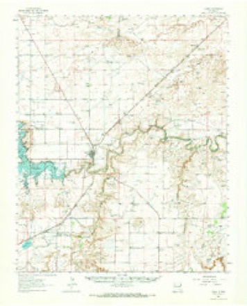
- 1962 USGS Logan quadrangle1:62500
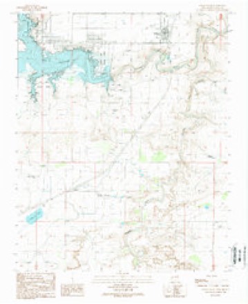
- 1989 USGS Logan South quadrangle1:24000
Fires near this place
16 since 1992Regional context, not property-specific evidence. The federal wildfire occurrence database lists 16 fires within 5 miles of Logan between 1992 and 2018, burning about 9,814 acres in total. 3 started naturally. None was recorded as arson. Distance is straight-line from the map coordinates, so a fire counted here may appear on a neighbouring settlement's page as well.
| Reported cause | Fires |
|---|---|
| Missing data/not specified/undetermined | 9 |
| Natural | 3 |
| Debris and open burning | 2 |
| Smoking | 1 |
| Equipment and vehicle use | 1 |
The most recent of them, most recent first, with the day each was reported and the service that recorded it.
| Date | Cause | Size | Reported by | Name on the report |
|---|---|---|---|---|
| 15 August 2014 | Natural | 25 acres | New Mexico State Forestry Division | DAVIS |
| 3 July 2005 | Missing data/not specified/undetermined | 15 acres | New Mexico State Forestry Division | BRUHM |
| 3 June 2011 | Natural | 238 acres | New Mexico State Forestry Division | SANTOS |
| 27 June 1998 | Missing data/not specified/undetermined | 300 acres | New Mexico State Forestry Division | REVETA |
| 22 May 2000 | Natural | under an acre | New Mexico State Forestry Division | LOGAN |
| 4 April 2006 | Debris and open burning | 250 acres | New Mexico State Forestry Division | not named |
| 7 March 1992 | Missing data/not specified/undetermined | 3,000 acres | New Mexico State Forestry Division | MEEKS |
| 30 March 2006 | Missing data/not specified/undetermined | 100 acres | New Mexico State Forestry Division | not named |
Settlements close enough to share some of these fires:
Mines and quarries near this place
10 of 16 shownRegional context, not property-specific evidence. The federal mineral resources record lists 16 workings within 5 miles of Logan: 15 unknowns, 1 producer. 1 still produces. What was taken out: Sand and Gravel, Construction, Stone. Distance is straight-line from the map coordinates, so a quarry counted here may appear on a neighbouring settlement's page as well.
| Where | Site | Commodity | Status | Recorded |
|---|---|---|---|---|
| Hare Pit | Stone | Unknown | ||
| Adams Pit | Sand and Gravel, Construction | Unknown | ||
| Materials Pit 71-15-S | Sand and Gravel, Construction | Unknown | ||
| Materials Pit 71-15-S | Sand and Gravel, Construction | Producer | ||
| Materials Pit 73-13-S | Sand and Gravel, Construction | Unknown | ||
| Unnamed Pit | Sand and Gravel, Construction | Unknown | ||
| Unnamed Pit | Sand and Gravel, Construction | Unknown | ||
| Unnamed Pit | Sand and Gravel, Construction | Unknown | ||
| Unnamed Pit | Sand and Gravel, Construction | Unknown | ||
| Unnamed Pit | Sand and Gravel, Construction | Unknown |
Storms near this place
60 of 72 shownRegional context, not property-specific evidence. The National Weather Service names Logan in 72 storm reports between 1993 and 2025: 42 hail, 22 thunderstorm wind, 4 flash flood, 3 tornado. The reports record 13 injuries. Each account below is quoted exactly as the forecast office filed it, from the NOAA Storm Events Database, and each date opens the federal record of that event.
| When | Event | Place named | Harm | What the report says |
|---|---|---|---|---|
| March 2007 | Tornado (EF1) | Logan | 12 hurt, $3,500,000 | A small and possibly elevated landspout type tornado developed on the far east end of a rear flank outflow that swung south through east over Logan as a storm centered about 5 miles to the west moved north over Ute Lake. Damage along the track as it moved over the west side of Logan was intermittent with damage indicators pointing to winds of general 80 to 90 mph with peak winds near the south and north ends of the track estimated at 105 mph. Average track width was around 100 yards. Logan had no tornado siren system but citizens reported nearly 30 to 50 minutes notice of an approaching severe thunderstorm. About a dozen injuries were reported with only two transported to Tucumcari for brief treatment in hospital. Heaviest damage was mainly confined to about 50 manufactured homes and recreational vehicles tossed and rolled mainly on the south end of the lake resort community. Damage to site constructed homes and buildings was limited to window, roof and soffit damage except for one 1910 era frame home that lost its roof. |
| July 1998 | Thunderstorm Wind | Logan | 1 hurt, $60,000 | no account filed |
| March 2007 | Hail | Logan | $200,000 | Storm passing mainly west of Logan dumped large hail over the west edge of Ute Lake. |
| June 2021 | Thunderstorm Wind | Logan | $80,000 | A member of the public in Logan estimated 70 mph wind gusts from a severe thunderstorm that tracked southeast through the area. The emergency manager also reported thunderstorm damage from these winds with siding and metal roofing torn from several mobile homes. A tractor trailer was also turned over on New Mexico State Highway 54, and several four feet tall mesquite bushes were snapped in half. Damages are estimated for the mobile home damage, overturned tractor trailers, and mesquite bush damage. |
| August 1993 | Thunderstorm Wind | Logan | $50,000 | A severe thunderstorm in Logan blew over trees and power poles and damaged a trailer. Reports were received by both the media and the sheriff's office in Tucumcari. |
| June 2021 | Hail | Logan | $40,000 | Trained spotters and law enforcement in Logan reported estimated quarter size hail from a severe thunderstorm tracking southeast through the area. The hail tore holes in mobile home siding. This thunderstorm also produced six to twelve inches of hail accumulation across Logan, including along New Mexico State Highway 54. Damages are estimated for the hail damage to the mobile homes. |
| July 2016 | Thunderstorm Wind | Logan | $10,000 | Strong thunderstorms winds flipped over a pop-up camper at Ute Lake State Park. |
| August 1999 | Thunderstorm Wind | Logan | $10,000 | Boat storage facilities and power lines were damaged by high winds at Ute Lake. |
| June 2013 | Hail | Logan | $5,000 | Golf ball size hail broke windows and damaged a tree and nearby barn about 6 miles north-northeast east of Logan. |
| July 2022 | Hail | Logan | $2,000 | A trained spotter near Logan reported quarter size hail. The hail did damage to tree leaves and destroyed their garden. Damages are estimated. |
| July 2010 | Thunderstorm Wind | Logan | $2,000 | A few portable buildings near Logan were overturned. |
| July 2010 | Thunderstorm Wind | Logan | $200 | A large three to four foot diameter tree trunk was split apart at a height of eight feet off the ground as seen via webcam. Wind gust recorded by SchoolNet site, and relayed by KVII in Amarillo. |
| July 2025 | Thunderstorm Wind | Logan | - | A trained spotter's personal weather station just northwest of Logan and north of Ute Lake measured a 60 mph wind gust as outflow winds ahead of a line of severe thunderstorms moved through. The spotter lost power shortly after. Additionally, a mesonet and UPR station very close by near Logan and Ute Lake each measured a 59 mph wind gust. |
| May 2024 | Hail | Logan | - | The Logan Fire Department reported quarter size hail from a severe thunderstorm. |
| May 2024 | Hail | Logan | - | Logan Fire Department reported quarter-size hail with a few stones slightly larger from a brief severe thunderstorm. |
| June 2023 | Hail | Logan | - | A trained spotter reported lots of lightning and gusty winds along with the half dollar size hail that lasted approximately 20 minutes. |
| April 2022 | Hail | Logan | - | An amateur radio user near Ute Lake State Park reported one inch hail with a severe thunderstorm. |
| April 2022 | Hail | Logan | - | A member of the public near Logan reported 1 inch hail from a severe thunderstorm. |
| June 2022 | Hail | Logan | - | A CoCoRaHS observer near Ute Lake State Park reported quarter size hail. |
| May 2021 | Thunderstorm Wind | Logan | - | A mesonet station near Logan measured a 60 mph wind gust from a decaying thunderstorm producing a strong downburst. |
| May 2021 | Hail | Logan | - | One inch hail was reported with a severe thunderstorm located near Logan. |
| July 2021 | Flash Flood | Logan | - | Heavy rain across eastern Quay County resulted in flash flooding along New Mexico State Road 469. Local law enforcement reported that the roadway became impassable and the road was closed. There are no known impacts. |
| May 2019 | Thunderstorm Wind | Logan | - | Peak wind gusts were estimated to be at least 58 mph in Logan. |
| May 2019 | Hail | Logan | - | A rapidly moving severe thunderstorm produced golf ball size hail in Logan. |
| May 2019 | Hail | Logan | - | Penny size hail was reported in Logan. |
| May 2018 | Hail | Logan | - | Hail up to the size of golf balls reported seven miles northeast of Logan. |
| August 2017 | Hail | Logan | - | Hail up to the size of pennies with torrential rainfall in Logan. |
| October 2017 | Flash Flood | Logan | - | Roads flooded and closed southwest of Logan. Several vehicles stranded in flood waters. |
| October 2017 | Flash Flood | Logan | - | Widespread street flooding in Logan. Water three to four inches deep running over state road 540 at eight different locations. No homes flooded. Two vehicles disabled. |
| July 2016 | Hail | Logan | - | Quarter size hail in Logan. |
| August 2015 | Hail | Logan | - | Quarter size hail reported near Logan. |
| May 2014 | Thunderstorm Wind | Logan | - | Anemometer on Ute Lake reported 64mph wind gust. Report relayed via HAM radio dispatcher. |
| June 2012 | Thunderstorm Wind | Logan | - | Power outages in the area. |
| June 2012 | Thunderstorm Wind | Logan | - | Several boats on Ute Lake were damaged due to strong winds. |
| August 2012 | Thunderstorm Wind | Logan | - | A SchoolNet site recorded a 60 mph thunderstorm wind gust, which was relayed by TV media. |
| May 2012 | Thunderstorm Wind | Logan | - | Estimated wind gust speed of 50 to 60 mph was reported from the public. |
| June 2011 | Thunderstorm Wind | Logan | - | The Logan SchoolNet Site recorded a thunderstorm wind gust of 61 mph. Report relayed by KVII Amarillo. |
| June 2011 | Thunderstorm Wind | Logan | - | A trained spotter estimated a 60 mph thunderstorm wind gust. |
| June 2010 | Flash Flood | Logan | - | The Logan Fire Department reported localized flooding with a couple of intersections impassable. |
| July 2010 | Thunderstorm Wind | Logan | - | A SchoolNet site in the Pueblo Point subdivision recorded a 59 mph wind gust. Report relayed by KVII in Amarillo. |
| August 2009 | Hail | Logan | - | Ping pong ball size hail was relayed via KVII in Amarillo from a viewer. |
| July 2009 | Thunderstorm Wind | Logan | - | A Schoolnet site reported high winds between 549 and 553 pm MST at Ute Lake. A peak wind gust of 60 mph was reported at 553 pm with sustained winds over 40 mph. |
| July 2001 | Hail | Logan | - | Marble to golfball hail covered the ground at Logan. |
| June 1999 | Hail | Logan | - | Dime to quarter size hail piled 4 inches deep in Logan. |
| May 1999 | Tornado (F0) | Logan | - | Deputies reported a brief, small tornado over the open rangeland northeast of Logan. |
| May 1994 | Hail | Logan | - | Severe thunderstorms produced dime- to quarter-size hail in Quay County. |
| May 1993 | Hail | Logan | - | A late afternoon thunderstorm produced dime-size hail. |
| May 2010 | Hail | Logan | - | no account filed |
| June 2010 | Hail | Logan | - | no account filed |
| July 2010 | Thunderstorm Wind | Logan | - | no account filed |
| May 2008 | Hail | Logan | - | no account filed |
| July 2005 | Hail | Logan | - | no account filed |
| June 2004 | Hail | Logan | - | no account filed |
| August 2004 | Hail | Logan | - | no account filed |
| August 2004 | Hail | Logan | - | no account filed |
| August 2004 | Hail | Logan | - | no account filed |
| April 2003 | Hail | Logan | - | no account filed |
| July 2003 | Thunderstorm Wind | Logan | - | no account filed |
| June 2002 | Funnel Cloud | Logan | - | no account filed |
| June 2002 | Hail | Logan | - | no account filed |
Nearest settlements
The eight closest, with where each one stands in the county. Distances are straight-line, computed from the Geographic Names Information System coordinates.
| Map | Place | Distance | Sheets |
|---|---|---|---|
| Anniston (historical) | 4.7 miles | 5 | |
| Canode (historical) | 6.3 miles | 5 | |
| Hudson | 9.5 miles | 6 | |
| Sand Springs | 10.0 miles | 5 | |
| Porter | 11.6 miles | 4 | |
| Frio (historical) | 15.2 miles | 6 | |
| Obar | 16.1 miles | 4 | |
| Lesbia | 16.6 miles | 6 |
Elsewhere
Matched on this settlement's Geographic Names Information System number rather than its name, so it cannot be a different place of the same name in another state.
| Wikipedia article on Logan | An encyclopaedic summary. Its text is share-alike, so it is linked here rather than copied. |
| Wikidata item Q2937686 | The structured record the population and elevation above come from. Public domain (CC0). |
Provenance
This settlement is recorded in the Geographic Names Information System as feature 898366. The sheet list is computed by point-in-boundary test against the United States Geological Survey's historical topographic inventory. Both are works of the United States government and carry no copyright under 17 U.S.C. 105.
Wildfire. Short, Karen C. 2022. Spatial wildfire occurrence data for the United States, 1992-2020 [FPA_FOD_20221014]. 6th Edition. Fort Collins, CO: Forest Service Research Data Archive. https://doi.org/10.2737/RDS-2013-0009.6 Collected with United States Government funding and usable without additional permissions or fees.
Mines and quarries. USGS Mineral Resources Data System (MRDS) https://mrdata.usgs.gov/mrds/ A work of the United States government, no copyright under 17 U.S.C. 105.
Storms. NOAA National Centers for Environmental Information, Storm Events Database https://www.ncei.noaa.gov/stormevents/ A work of the United States government, no copyright under 17 U.S.C. 105. Narratives are quoted verbatim from the National Weather Service report and are not edited or summarised.