 Block
Moriarty, New Mexico
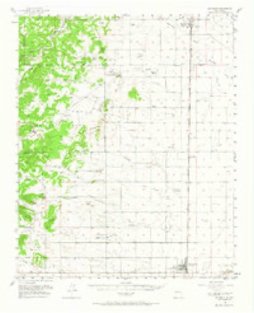
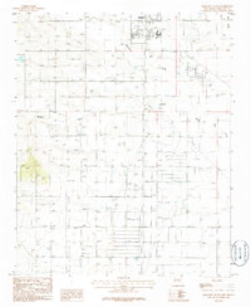
10 topographic sheets cover this place, the earliest surveyed in 1917 and the latest in 1986. It stands in the Estancia census division. It lies in ZIP code area 87035. The Survey maps it on the Moriarty South quadrangle. 1,946 people lived here at the 2020 count. It stands 6,220 feet above sea level.
Research this city
On record in Moriarty
Buildings and businesses the archive holds for this place. Each opens its own page, with the source record it came from.
On the National Register 2 records
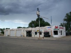 Greene Evans Garagelisted 1993
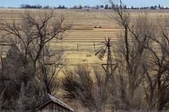 Moriarty Eclipse Windmilllisted 1979
Population over time
2 figuresMoriarty grew from 1,910 to 1,946 between 2010 and 2020. These are the recorded population figures Wikidata holds for this place, reached through the Geographic Names Information System number this page is keyed on rather than by name, so they belong to this place and not to another of the same name. Most are census counts, but not all are: an early figure may be a founding or settlement estimate, and an estimate published within five years of a census is left out. The change column is computed, and is left blank where more than 20 years separate a figure from the one before it, because a gap that long is not a change between two counts.
| Year | People | Change |
|---|---|---|
| 2010 | 1,910 | |
| 2020 | 1,946 | +36 (+2%) |
Topographic sheets covering this place
7 surveys from 10 printed sheetsMatched by testing this settlement's coordinate against the published boundary of every sheet in the United States Geological Survey's historical collection. Each opens the scanned sheet at the Survey.
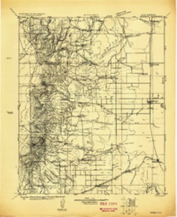
- 1917 USGS Estancia quadrangle1:125000
- 1954 USGS Socorro quadrangle1:250000, 2 printings
- 1956 USGS Estancia quadrangle1:62500, 2 printings
- 1958 USGS Socorro quadrangle1:250000
- 1962 USGS Socorro quadrangle1:250000
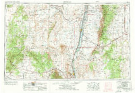
- 1979 USGS Belen quadrangle1:100000, 2 printings
- 1986 USGS Moriarty South quadrangle1:24000
Fires near this place
89 since 1992Regional context, not property-specific evidence. The federal wildfire occurrence database lists 89 fires within 5 miles of Moriarty between 1992 and 2020, burning about 3,218 acres in total. None started naturally. 1 was recorded as arson. Distance is straight-line from the map coordinates, so a fire counted here may appear on a neighbouring settlement's page as well.
| Reported cause | Fires |
|---|---|
| Missing data/not specified/undetermined | 67 |
| Smoking | 5 |
| Fireworks | 5 |
| Equipment and vehicle use | 4 |
| Debris and open burning | 3 |
| Misuse of fire by a minor | 3 |
| Power generation/transmission/distribution | 1 |
| Arson/incendiarism | 1 |
The most recent of them, most recent first, with the day each was reported and the service that recorded it.
| Date | Cause | Size | Reported by | Name on the report |
|---|---|---|---|---|
| 29 August 1993 | Missing data/not specified/undetermined | under an acre | New Mexico State Forestry Division | BURL |
| 25 August 1997 | Missing data/not specified/undetermined | 1.0 acres | New Mexico State Forestry Division | STUBBY |
| 13 August 2020 | Fireworks | under an acre | Bernalillo District | 21-60590203X |
| 11 August 1993 | Missing data/not specified/undetermined | 6.0 acres | New Mexico State Forestry Division | LIGHTNING 2 |
| 9 July 2020 | Missing data/not specified/undetermined | 1.0 acres | Bernalillo District | 21-60200055X |
| 9 July 2020 | Fireworks | under an acre | Bernalillo District | 21-60260085X |
| 9 July 2004 | Missing data/not specified/undetermined | under an acre | New Mexico State Forestry Division | HOUSE |
| 9 July 2004 | Missing data/not specified/undetermined | under an acre | New Mexico State Forestry Division | SIXTEEN |
Settlements close enough to share some of these fires:
Mines and quarries near this place
5 within 5 milesRegional context, not property-specific evidence. The federal mineral resources record lists 5 workings within 5 miles of Moriarty: 5 unknowns. None of them still produces. What was taken out: Sand and Gravel, Construction. Distance is straight-line from the map coordinates, so a quarry counted here may appear on a neighbouring settlement's page as well.
| Where | Site | Commodity | Status | Recorded |
|---|---|---|---|---|
| Materials Pit | Sand and Gravel, Construction | Unknown | ||
| Materials Pit | Sand and Gravel, Construction | Unknown | ||
| Materials Pit | Sand and Gravel, Construction | Unknown | ||
| Materials Pit | Sand and Gravel, Construction | Unknown | ||
| Materials Pit | Sand and Gravel, Construction | Unknown |
Storms near this place
44 since 1995Regional context, not property-specific evidence. The National Weather Service names Moriarty in 44 storm reports between 1995 and 2025: 23 hail, 11 thunderstorm wind, 4 funnel cloud, 3 flash flood. The reports record 3 injuries. Each account below is quoted exactly as the forecast office filed it, from the NOAA Storm Events Database, and each date opens the federal record of that event.
| When | Event | Place named | Harm | What the report says |
|---|---|---|---|---|
| July 2013 | Lightning | Moriarty | 2 hurt, $10,000 | A car traveling east bound on Interstate 40 three miles east of Moriarty at mile marker 199 with 4 occupants was struck by lightning. One child and one adult were injured and treated at the scene. Car's electronics were destroyed and vehicle towed from scene. |
| April 2014 | Lightning | Moriarty | 1 hurt | A man was grazed by a lightning strike 10 feet away while photographing a dust devil near Moriarty. The man survived the shock however no details on the extent of his injuries was reported. |
| September 2021 | Flash Flood | Moriarty | $250,000 | One to two inches of heavy rainfall caused flash flooding in Moriarty. Torrance County Dispatch reported torrential rainfall with a severe thunderstorm crossing Interstate 40 near Moriarty. Visibility was near zero which forced many travelers to pull off the road. Several Moriarty residents reported flood damage from the heavy rainfall. The water continued to flow southward through McIntosh and even caused Estancia Park Lake to overfill its banks. The extent of damages is unknown, therefore, damage amounts are a rough estimate. |
| September 2021 | Thunderstorm Wind | Moriarty | $100,000 | A severe thunderstorm tracking southeast across Interstate 40 near Moriarty caused thunderstorm wind damage with estimated 60 to 70 mph winds. A Moriarty resident reported that multiple trees were downed in the area with widespread power outages. Another resident's above ground cistern was also moved several feet by the strong winds. Schwebach Farms in Moriarty reported extensive damage to their entire farm crops which forced them to harvest the entire crop immediately. Damages are a rough estimate. |
| October 2008 | Thunderstorm Wind | Moriarty | $80,000 | A steel building was destroyed and blown onto Interstate 40, six power poles were snapped, at least three water tanks were damaged beyond repair and a pumpkin shooter was damaged from sustained winds estimated at 55 to 70 mph with gusts of 90-100 mph. Corn stalks were also damaged in a large corn maze. |
| July 2023 | Thunderstorm Wind | Moriarty | $20,000 | A thunderstorm downburst lifted a large solar panel unit and its concrete pillars out of the ground and tossed it several feet away. Many of the panels and the steel frame were damaged or destroyed. |
| May 1998 | Thunderstorm Wind | Moriarty | $10,000 | Dry microbursts with gusts of 50 to 60 mph were reported across Bernalillo and western Torrance counties. Roof damage was reported and a tractor trailor was turned on its side between Edgewood and Moriarty. |
| June 2025 | Hail | Moriarty | $5,000 | A CoCoRaHS observer reported golf ball size hail from a severe thunderstorm shattering the rain gauge and causing house and vehicle damage. |
| August 2016 | Hail | Moriarty | $5,000 | Slight hail damage to vehicle. |
| July 1998 | Thunderstorm Wind | Moriarty | $2,000 | Thunderstorm winds caused barn roof damage in Moriarty. |
| August 2013 | Hail | Moriarty | $1,000 | Broadcast media partner relayed report of hail ranging in size from marble to golf ball in association with a passing storm near Moriarty. One half an inch of rain was also reported. |
| June 2025 | Hail | Moriarty | - | Quarter to half dollar sized hail was observed a few miles south of I-40 at Edgewood from a severe thunderstorm. |
| June 2025 | Hail | Moriarty | - | Hail as large as tennis ball size was observed in Moriarty from a severe thunderstorm. |
| June 2025 | Hail | Moriarty | - | Penny size hail was observed from a strong thunderstorm along NM 41 south of Moriarty. |
| June 2024 | Thunderstorm Wind | Moriarty | - | A trained spotter a few miles south of Edgewood estimated a 60 mph wind gust from a severe thunderstorm. |
| August 2024 | Flash Flood | Moriarty | - | A driveway a few miles south of Edgewood became flooded and impassable. |
| June 2020 | Hail | Moriarty | - | Penny to quarter size hail was reported in the Edgewood area. |
| July 2018 | Thunderstorm Wind | Moriarty | - | A metal storage shed was destroyed by thunderstorm outflow winds. |
| May 2017 | Hail | Moriarty | - | Hail up to the size of quarters reported in Moriarty. |
| June 2016 | Funnel Cloud | Moriarty | - | Wall cloud and short-lived funnel cloud spotted near Moriarty. |
| April 2015 | Funnel Cloud | Moriarty | - | Public reported cold air funnel cloud hovering between Edgewood and Moriarty. |
| July 2015 | Hail | Moriarty | - | Dime to quarter size hail in Edgewood. |
| June 2014 | Tornado (EF0) | Moriarty | - | Landspout tornado just north of Interstate 40 near Moriarty on the ground for approximately 10 minutes. No damage reported. |
| June 2013 | Thunderstorm Wind | Moriarty | - | Several strong outflow wind gusts in Moriarty between 7pm and 8pm with strongest to 75mph at around 745pm. |
| May 2012 | Funnel Cloud | Moriarty | - | Funnel cloud reported 6 miles west southwest of Moriarty. |
| June 1999 | Thunderstorm Wind | Moriarty | - | Spotter estimated winds of at least 60 mph as gust front passed. |
| July 1997 | Hail | Moriarty | - | Dime size hail was reported by a Ham Radio SKYWARN spotter. |
| August 1997 | Funnel Cloud | Moriarty | - | Spotters reported a funnel cloud near Moriarty. |
| June 1995 | Hail | Moriarty | - | Golf ball-size hail was reported at Longhorn Estates. |
| May 2023 | Hail | Moriarty | - | no account filed |
| July 2014 | Hail | Moriarty | - | no account filed |
| October 2008 | Hail | Moriarty | - | no account filed |
| August 2004 | Hail | Moriarty | - | no account filed |
| April 2000 | Hail | Moriarty | - | no account filed |
| June 2000 | Hail | Moriarty | - | no account filed |
| June 2000 | Flash Flood | Moriarty | - | no account filed |
| June 2000 | Hail | Moriarty | - | no account filed |
| July 2000 | Hail | Moriarty | - | no account filed |
| July 2000 | Thunderstorm Wind | Moriarty | - | no account filed |
| July 2000 | Thunderstorm Wind | Moriarty | - | no account filed |
| September 1998 | Hail | Moriarty | - | no account filed |
| October 1998 | Hail | Moriarty | - | no account filed |
| May 1997 | Hail | Moriarty | - | no account filed |
| April 1997 | Hail | Moriarty | - | no account filed |
Nearest settlements
The eight closest, with where each one stands in the county. Distances are straight-line, computed from the Geographic Names Information System coordinates.
| Map | Place | Distance | Sheets |
|---|---|---|---|
| Otto | 6.1 miles | 17 | |
| Gallegos | 6.5 miles | 19 | |
| Estancia Ranchettes | 6.9 miles | 7 | |
| Martinez | 7.5 miles | 13 | |
| McIntosh | 8.6 miles | 10 | |
| Pine Springs | 9.9 miles | 13 | |
| Witt | 10.3 miles | 10 | |
| Antelope Springs | 10.9 miles | 10 |
Elsewhere
Matched on this settlement's Geographic Names Information System number rather than its name, so it cannot be a different place of the same name in another state.
| Wikipedia article on Moriarty | An encyclopaedic summary. Its text is share-alike, so it is linked here rather than copied. |
| Wikidata item Q1933126 | The structured record the population and elevation above come from. Public domain (CC0). |
Provenance
This settlement is recorded in the Geographic Names Information System as feature 892232. The sheet list is computed by point-in-boundary test against the United States Geological Survey's historical topographic inventory. Both are works of the United States government and carry no copyright under 17 U.S.C. 105.
Wildfire. Short, Karen C. 2022. Spatial wildfire occurrence data for the United States, 1992-2020 [FPA_FOD_20221014]. 6th Edition. Fort Collins, CO: Forest Service Research Data Archive. https://doi.org/10.2737/RDS-2013-0009.6 Collected with United States Government funding and usable without additional permissions or fees.
Mines and quarries. USGS Mineral Resources Data System (MRDS) https://mrdata.usgs.gov/mrds/ A work of the United States government, no copyright under 17 U.S.C. 105.
Storms. NOAA National Centers for Environmental Information, Storm Events Database https://www.ncei.noaa.gov/stormevents/ A work of the United States government, no copyright under 17 U.S.C. 105. Narratives are quoted verbatim from the National Weather Service report and are not edited or summarised.