 Block
Portales, New Mexico
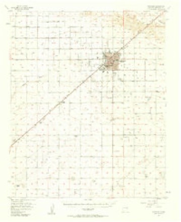
8 topographic sheets cover this place, the earliest surveyed in 1954 and the latest in 1985. It stands in the Portales census division. It lies in ZIP code area 88130. The Survey maps it on the Portales quadrangle. 12,137 people lived here at the 2020 count. It stands 4,006 feet above sea level.
Research this city
On record in Portales
Buildings and businesses the archive holds for this place. Each opens its own page, with the source record it came from.
On the National Register 4 records
 Administration Buildinglisted 1988
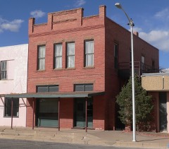 Bank of Portaleslisted 1984
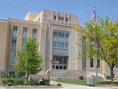 Roosevelt County Courthouselisted 2008
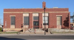 US Post Office-Portales Mainlisted 1990
Surveyed buildings and structures 1 record
- Eastern New Mexico State Park, Highway 70, 6 miles north of Portales, Portalesfederal building survey, 1 photograph
Population over time
2 figuresPortales fell from 12,280 to 12,137 between 2010 and 2020. These are the recorded population figures Wikidata holds for this place, reached through the Geographic Names Information System number this page is keyed on rather than by name, so they belong to this place and not to another of the same name. Most are census counts, but not all are: an early figure may be a founding or settlement estimate, and an estimate published within five years of a census is left out. The change column is computed, and is left blank where more than 20 years separate a figure from the one before it, because a gap that long is not a change between two counts.
| Year | People | Change |
|---|---|---|
| 2010 | 12,280 | |
| 2020 | 12,137 | -143 (-1%) |
Topographic sheets covering this place
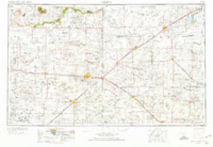
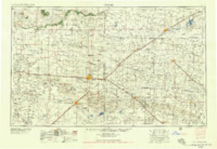
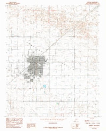
4 surveys from 8 printed sheetsMatched by testing this settlement's coordinate against the published boundary of every sheet in the United States Geological Survey's historical collection. Each opens the scanned sheet at the Survey.
- 1954 USGS Clovis quadrangle1:250000, 4 printings
- 1957 USGS Portales quadrangle1:62500, 2 printings
- 1958 USGS Clovis quadrangle1:250000
- 1985 USGS Portales quadrangle1:24000
Photographs
4 photographs, 1942Taken for the Office of War Information and the Farm Security Administration, who photographed the country between 1935 and 1944. Works of United States government photographers, with no known restriction on use. Each opens its catalogue record.
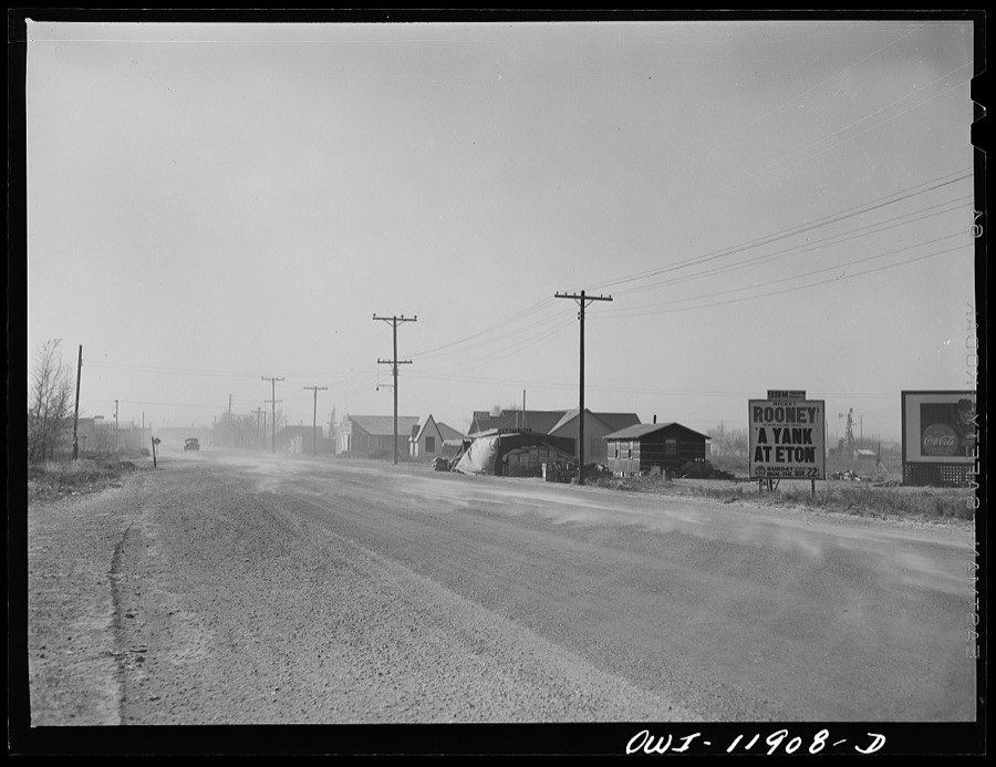
Vachon, John, 1942. Library of Congress
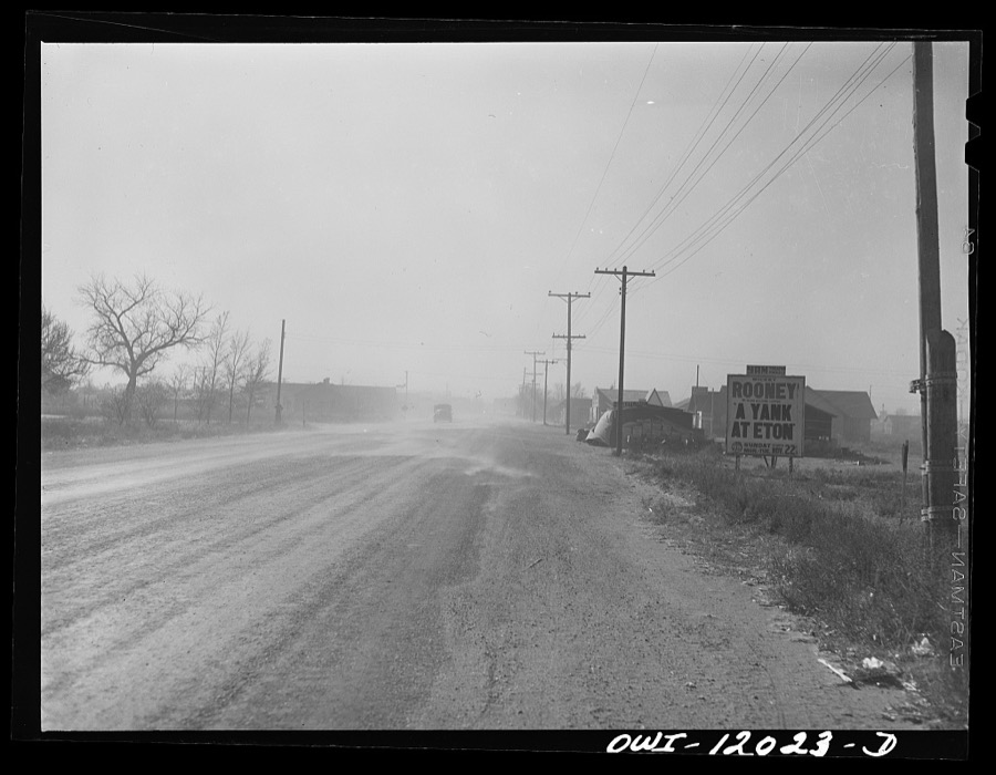
Vachon, John, 1942. Library of Congress
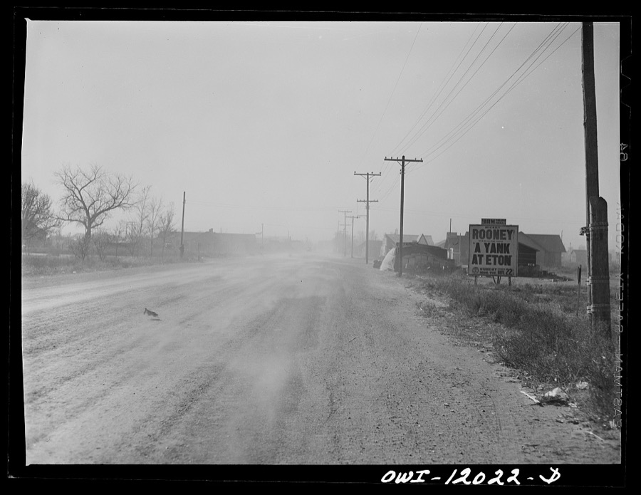
Vachon, John, 1942. Library of Congress
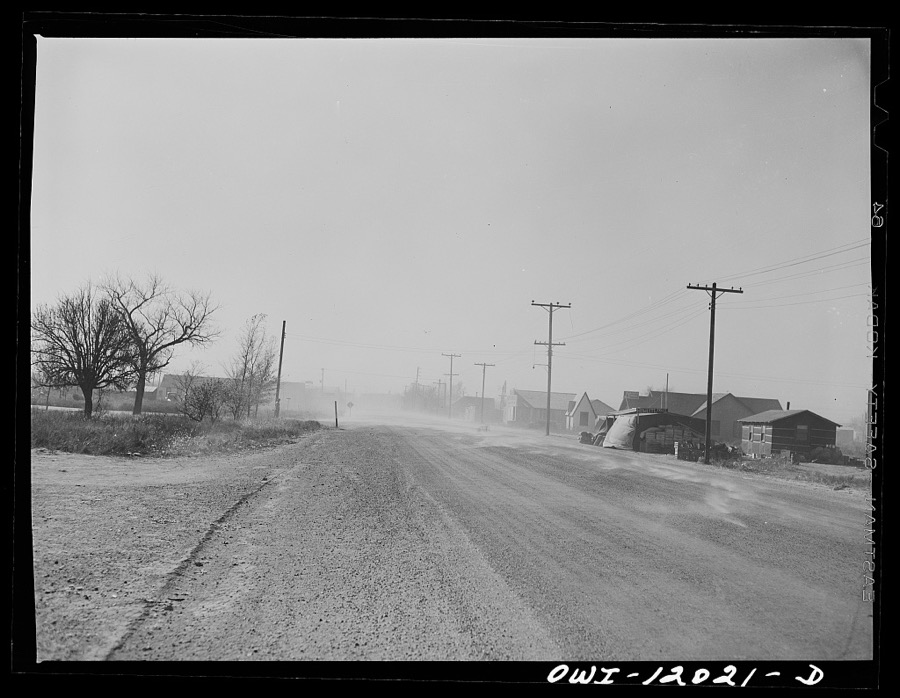
Vachon, John, 1942. Library of Congress
Fires near this place
119 since 1993Regional context, not property-specific evidence. The federal wildfire occurrence database lists 119 fires within 5 miles of Portales between 1993 and 2020, burning about 17,065 acres in total. 7 started naturally. 1 was recorded as arson. Distance is straight-line from the map coordinates, so a fire counted here may appear on a neighbouring settlement's page as well.
| Reported cause | Fires |
|---|---|
| Missing data/not specified/undetermined | 82 |
| Equipment and vehicle use | 10 |
| Debris and open burning | 10 |
| Natural | 7 |
| Power generation/transmission/distribution | 3 |
| Fireworks | 3 |
| Smoking | 3 |
| Arson/incendiarism | 1 |
The most recent of them, most recent first, with the day each was reported and the service that recorded it.
| Date | Cause | Size | Reported by | Name on the report |
|---|---|---|---|---|
| 27 September 2011 | Natural | 197 acres | New Mexico State Forestry Division | MULLINS |
| 19 September 2017 | Equipment and vehicle use | 2.0 acres | Capitan District | GAVIN |
| 9 August 2015 | Equipment and vehicle use | 9.0 acres | New Mexico State Forestry Division | 236 |
| 9 August 1997 | Missing data/not specified/undetermined | 1.0 acres | New Mexico State Forestry Division | VISAGE |
| 2 August 2015 | Natural | 5.0 acres | New Mexico State Forestry Division | HALL |
| 4 July 2020 | Fireworks | 5.5 acres | Capitan District | 21-50070037X |
| 4 July 2019 | Fireworks | 4.0 acres | Capitan District | 20-50060027X |
| 30 July 2001 | Equipment and vehicle use | 5.0 acres | New Mexico State Forestry Division | CORNER |
Settlements close enough to share some of these fires:
Mines and quarries near this place
6 within 5 milesRegional context, not property-specific evidence. The federal mineral resources record lists 6 workings within 5 miles of Portales: 6 unknowns. None of them still produces. What was taken out: Sand and Gravel, Construction. Distance is straight-line from the map coordinates, so a quarry counted here may appear on a neighbouring settlement's page as well.
| Where | Site | Commodity | Status | Recorded |
|---|---|---|---|---|
| Eastwood Pit | Sand and Gravel, Construction | Unknown | ||
| Materials Pit | Sand and Gravel, Construction | Unknown | ||
| Materials Pit | Sand and Gravel, Construction | Unknown | ||
| Materials Pit | Sand and Gravel, Construction | Unknown | ||
| Materials Pit | Sand and Gravel, Construction | Unknown | ||
| Russell Pit | Sand and Gravel, Construction | Unknown |
Storms near this place
60 of 123 shownRegional context, not property-specific evidence. The National Weather Service names Portales in 123 storm reports between 1993 and 2025: 74 hail, 27 thunderstorm wind, 17 flash flood, 2 tornado. The reports record 2 injuries. Each account below is quoted exactly as the forecast office filed it, from the NOAA Storm Events Database, and each date opens the federal record of that event.
| When | Event | Place named | Harm | What the report says |
|---|---|---|---|---|
| July 2004 | Lightning | Portales | 2 hurt | no account filed |
| May 1996 | Hail | Portales | $720,000 | no account filed |
| August 1996 | Thunderstorm Wind | Portales | $300,000 | no account filed |
| May 2021 | Flash Flood | Portales | $250,000 | Slow-moving thunderstorms in the Portales area produced three to four inches of rainfall in a short period of time. This led to flash flooding in the area where a trained spotter reported some roadways were under 2 feet of water. The Portales Fire Department had to perform a water rescue for a family of three which included two children after their car was swept into a drainage ditch. The family was traveling along 18th Street when their car was swept by the flooded waters and pushed into a culvert headed south along S Globe Street. Their car eventually came to a stop against a pipe that was across the culvert. The family was rescued about 45 minutes after the first 911 call, and no injuries were reported. Damages are estimated for the loss of the car as well as rough estimates for water damages to an unknown amount of structures. |
| June 2012 | Hail | Portales | $250,000 | Softball size hail reported in Portales. |
| June 2013 | Thunderstorm Wind | Portales | $50,000 | A CoCoRaHS observer estimated a thunderstorm wind gust near 60 mph from the northwest that resulted in a power outage for several hours. Additionally, over one and a half inches of rain was measured but no hail observed. Numerous downed power lines were reported across Roosevelt County. |
| August 1996 | Hail | Portales | $50,000 | no account filed |
| May 1999 | Thunderstorm Wind | Portales | $40,000 | High winds ripped across the southern Portales area deroofing several barns and downing power poles. |
| July 2009 | Thunderstorm Wind | Portales | $30,000 | A roof was blown off a building and one wall collapsed at 109 W. 2nd St. |
| June 1999 | Thunderstorm Wind | Portales | $30,000 | Strong winds destroyed several barns just west of Portales. |
| June 2021 | Thunderstorm Wind | Portales | $25,000 | A severe thunderstorm tracking southeast through Portales downed several power lines along Commercial Street and along U.S. Highway 70. Damages are estimated for the downed power lines. |
| June 2003 | Tornado (F0) | Portales | $20,000 | Damage from possible brief tornado reported east side of Portales. |
| July 2001 | Thunderstorm Wind | Portales | $20,000 | Several tin roofs were blown off and steel poles bent during a strong storm west of Portales on Highway 267. |
| July 2009 | Thunderstorm Wind | Portales | $15,000 | There were large tree branches and power lines downed from high winds. |
| September 1999 | Thunderstorm Wind | Portales | $15,000 | High winds downed power lines and ripped tim off several roofs in Portales. |
| May 2021 | Hail | Portales | $10,000 | Several trained spotters in Portales reported hail ranging from the size of quarters to the size of golf balls from a slow-moving severe thunderstorm. Hail accumulations of one to two inches in the area resulted in the collapse of a patio roof at one residence in Portales. Damages are estimated for the destruction of the roof. |
| August 2013 | Flash Flood | Portales | $10,000 | Flooding reported around Portales High School. Numerous sandbags and resources deployed to prevent significant residential flooding. |
| July 2011 | Thunderstorm Wind | Portales | $10,000 | Several trees and large limbs were downed by strong wind gusts in Portales, along U.S. Highway 70. |
| June 2007 | Thunderstorm Wind | Portales | $10,000 | The windows were blown out of a commercial building. Power lines and poles were blown down. |
| October 2000 | Flash Flood | Portales | $10,000 | no account filed |
| June 2012 | Thunderstorm Wind | Portales | $5,000 | Power pole snapped leading to power outages. |
| July 2010 | Flash Flood | Portales | $5,000 | There was 18 inches of standing water on 18th St. in the southern portion of Portales. |
| July 2009 | Thunderstorm Wind | Portales | $5,000 | Large tree branches were downed all along 18th street. |
| June 2003 | Thunderstorm Wind | Portales | $5,000 | no account filed |
| June 1994 | Hail | Portales | $5,000 | no account filed |
| July 2013 | Hail | Portales | $1,000 | A SKYWARN Spotter relayed a report of windows that had been broken out in the Portales area from a severe storm the evening of the 3rd. |
| May 2011 | Hail | Portales | $1,000 | State Police reported golf ball sized hail along Highway 70 at mile post 407. The hail broke the windshield of the police car. |
| May 2013 | Thunderstorm Wind | Portales | $750 | Powerlines down at intersection of Road 7 and T. |
| April 1993 | Thunderstorm Wind | Portales | $500 | An area of strong thunderstorms moved into Roosevelt County. Strong outflow winds picked up a steel horse corral and dropped it on a kennel about 50 feet away. |
| August 2025 | Hail | Portales | - | Nickel to half-dollar size hail southeast of Clovis. |
| August 2025 | Flash Flood | Portales | - | Flooded roadways around 18th Street and Kilgore Avenue from heavy rainfall. |
| August 2025 | Flash Flood | Portales | - | Heavy rainfall from thunderstorms resulted in flash flooding on numerous streets in Portales. This included 18th Street which was flooded with 6 to 8 inches of water over the road. |
| July 2024 | Flash Flood | Portales | - | Heavy rain from thunderstorms resulted in flash flooding with a depth of 6 inches across parts of Portales. Locations included U.S. 70 and Kilgore Road in northeast Portales and 18th Street near downtown Portales. No reports of any damage from flooding. |
| September 2024 | Thunderstorm Wind | Portales | - | Severe thunderstorm wind gusts blew down a large tree branch at NM Highway 206 and Moreland Road, while also knocking out power in the area south of Portales to include the towns of Dora, Pep and Causey. |
| August 2024 | Flash Flood | Portales | - | Intersection flooded and closed at East 3rd Street and Kilgore Avenue. |
| May 2024 | Hail | Portales | - | A severe thunderstorm produced golf ball size hail in Portales. Report was shared by a media outlet in Lubbock, Texas. |
| May 2024 | Hail | Portales | - | Tennis ball to teacup size hail was observed just in Portales from a supercell thunderstorm. |
| May 2023 | Hail | Portales | - | A trained spotter drove through penny sized hail with the first storm to hit the area. |
| May 2023 | Hail | Portales | - | There were three reports of severe hail ranging in size from 1.5 to 1.75 inches in Portales. |
| May 2021 | Hail | Portales | - | A trained spotter in Portales measured 1.25 inch hail from a severe thunderstorm. |
| May 2021 | Thunderstorm Wind | Portales | - | A weather station at the Portales airport measured a 74 mph wind gust from a severe thunderstorms. Other trained spotters in Portales estimated wind speeds of 60 to 65 mph. |
| May 2021 | Hail | Portales | - | A trained spotter reported penny size hail from a strong thunderstorm in Portales. |
| May 2021 | Hail | Portales | - | Numerous observers reported large hail ranging from 1 inch to 1.75 inches from a severe thunderstorm near Portales. The thunderstorm also produced torrential rainfall that caused minor street flooding in Portales. Damages are unknown. |
| May 2021 | Thunderstorm Wind | Portales | - | A member of the public in Portales estimated 65 mph wind gusts from a severe thunderstorm moving eastward through the area. |
| June 2020 | Hail | Portales | - | Trained spotters in Portales reported large hail in the area ranging from half-dollar to tennis ball sized hail. |
| March 2019 | Funnel Cloud | Portales | - | A funnel cloud was spotted for about five minutes west of Portales. |
| October 2019 | Flash Flood | Portales | - | A thunderstorm with torrential rainfall produced flash flooding around Portales. Most streets and intersections in town were under water with several stalled vehicles. An observer just northwest of Melrose reported a whopping 4.60 of rainfall in less than 24 hours. Fortunately, there were no injuries or rescues with this flooding event. |
| May 2018 | Hail | Portales | - | Nickel size hail in Portales. |
| September 2017 | Heavy Rain | Portales | - | Thunderstorms with torrential rainfall produced 24-hour rainfall amounts between 4 and 5 inches around Portales. An observer two miles southwest of Portales reported 4.04 inches and another spotter 8 miles south-southeast of Portales reported 5.42 inches. Mostly minor flooding occurred however this heavy rainfall set the stage for more significant flooding through early October. |
| August 2017 | Hail | Portales | - | Hail up to the size of quarters accumulated one inch deep. Dense fog developed in the area after the storm passed. |
| October 2017 | Flash Flood | Portales | - | State road 88 closed at Portales due to flooding. |
| May 2017 | Hail | Portales | - | Nickel size hail on the west side of Portales. |
| May 2016 | Hail | Portales | - | Very brief period of quarter size hail at home in Portales. |
| May 2016 | Hail | Portales | - | Quarter size hail near Portales. |
| May 2015 | Hail | Portales | - | Quarter size hail 2 miles northeast of Portales. |
| May 2015 | Hail | Portales | - | Ping pong ball size hail in Portales. |
| May 2015 | Hail | Portales | - | Golf ball size hail in Portales. |
| May 2015 | Hail | Portales | - | Ping pong size hail fell at home near Eastern New Mexico University in Portales. |
| June 2015 | Flash Flood | Portales | - | Intersection of 17th and 18th streets with 3rd and Kilgor flooding. No damage reported. |
| October 2015 | Hail | Portales | - | Pea to quarter size hail. |
Nearest settlements
The eight closest, with where each one stands in the county. Distances are straight-line, computed from the Geographic Names Information System coordinates.
| Map | Place | Distance | Sheets |
|---|---|---|---|
| Yerba | 3.1 miles | 8 | |
| Tinsley Crossing | 6.2 miles | 8 | |
| Midway | 6.8 miles | 9 | |
| Bethel | 8.0 miles | 8 | |
| Eiland (historical) | 8.9 miles | 9 | |
| Cameo | 9.1 miles | 9 | |
| Delphos | 11.3 miles | 8 | |
| Arch | 11.3 miles | 9 |
Elsewhere
Matched on this settlement's Geographic Names Information System number rather than its name, so it cannot be a different place of the same name in another state.
| Wikipedia article on Portales | An encyclopaedic summary. Its text is share-alike, so it is linked here rather than copied. |
| Wikidata item Q988821 | The structured record the population and elevation above come from. Public domain (CC0). |
Provenance
This settlement is recorded in the Geographic Names Information System as feature 893416. The sheet list is computed by point-in-boundary test against the United States Geological Survey's historical topographic inventory. Both are works of the United States government and carry no copyright under 17 U.S.C. 105.
Wildfire. Short, Karen C. 2022. Spatial wildfire occurrence data for the United States, 1992-2020 [FPA_FOD_20221014]. 6th Edition. Fort Collins, CO: Forest Service Research Data Archive. https://doi.org/10.2737/RDS-2013-0009.6 Collected with United States Government funding and usable without additional permissions or fees.
Mines and quarries. USGS Mineral Resources Data System (MRDS) https://mrdata.usgs.gov/mrds/ A work of the United States government, no copyright under 17 U.S.C. 105.
Storms. NOAA National Centers for Environmental Information, Storm Events Database https://www.ncei.noaa.gov/stormevents/ A work of the United States government, no copyright under 17 U.S.C. 105. Narratives are quoted verbatim from the National Weather Service report and are not edited or summarised.